CCN Weather Update for Saturday April 4, 2026.
This weather update is sponsored by Freedom Insurance of Whiteville. You can trust Freedom Insurance to give you clear blue skies when it comes to home, car, boat, or whatever insurance you need. Let Freedom provide customized coverage to keep you and your family safe. Contact Freedom today at 910-640-2828!
Here’s today’s Bottom Line:
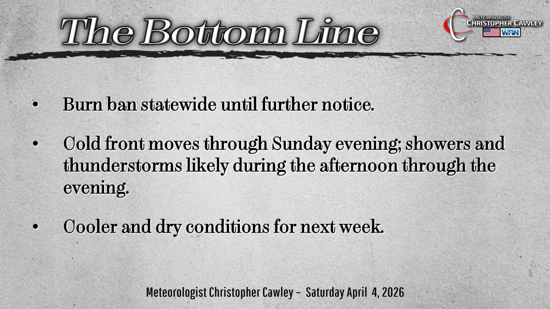
The burn ban remains in place for the time being, at least as of the time of this writing.
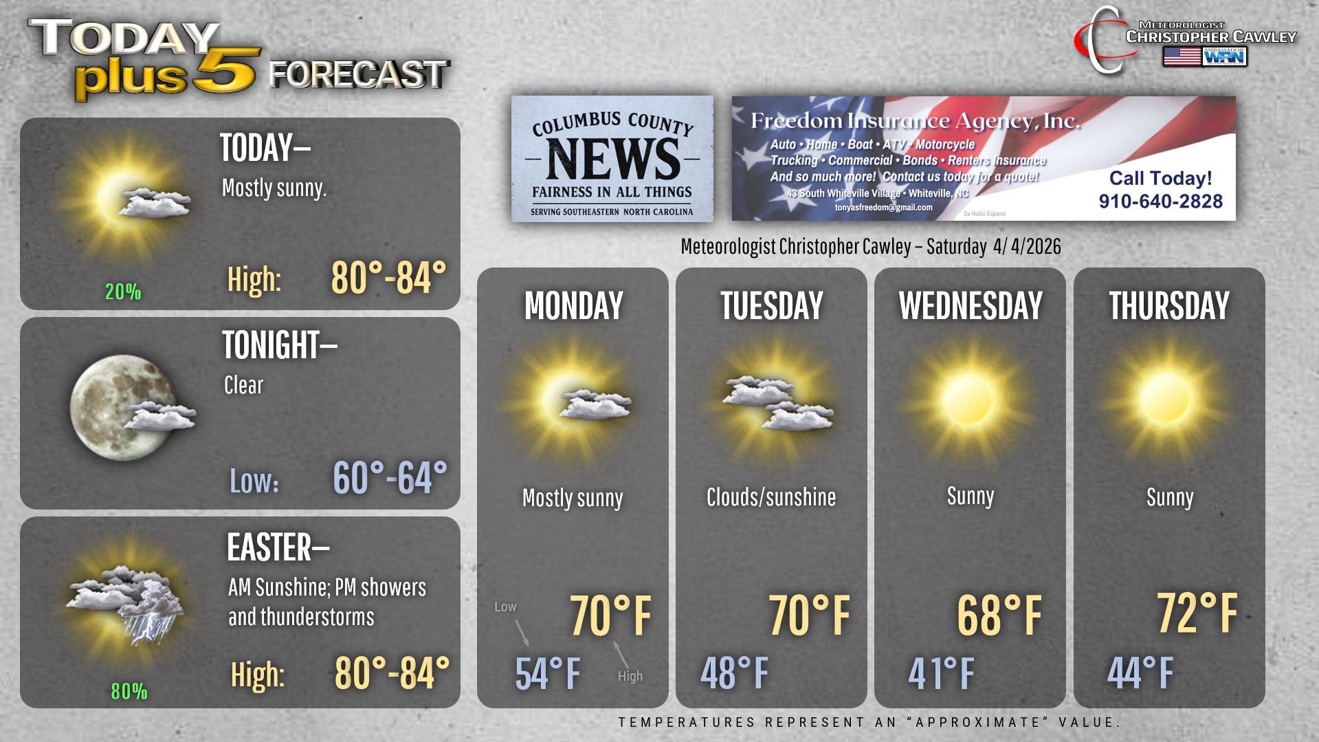
Today will be another warm, dry day across the area as high pressure clings to life. Actually the high will be just fine, just “shunted” a little to the east thanks to a strong cold front that will come through the area during the evening of Easter Sunday.
We have a low-level severe weather threat with this frontal passage.
The NWS Storm Prediction Center has placed central and eastern North Carolina, and extreme northeastern South Carolina, under a level 1 “marginal” risk for severe storms.
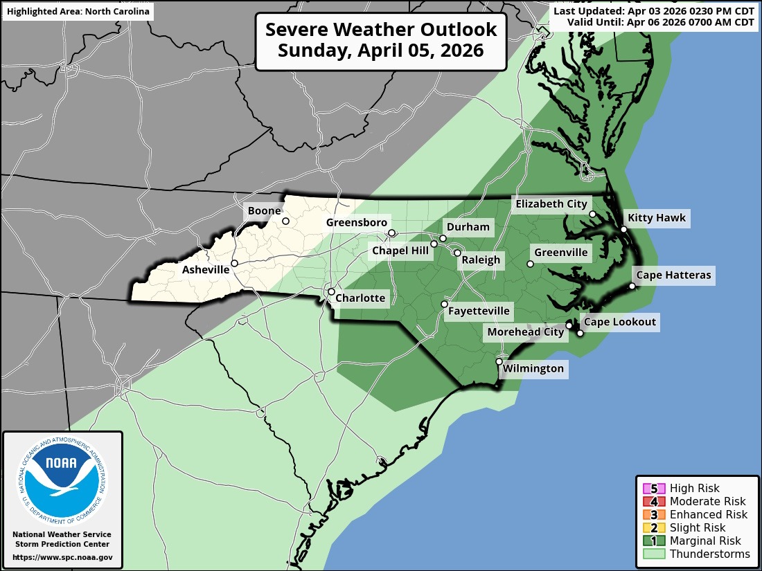
We’ll have plenty of daytime heating on Easter Sunday, which should allow for clusters of thunderstorms to develop. While there will be some instability sufficient to produce storms, the numbers right now just don’t add up to an organized severe threat.
Rainfall may be upwards of half an inch, which really isn’t much… but since we’ve had NONE for most of the area for several weeks now… that’s a good thing. It won’t be a drought-buster by any means, but every drop helps.
After the frontal passage, we return to bone-dry weather conditions for next week. A secondary cold front will cross the area Tuesday night with even cooler temps on Wednesday, but the frost threat–right now anyway–is zero.
Here’s your Freedom Insurance Today-plus-Five Forecast!
–Meteorologist Christopher Cawley