

CCN Weather Update for Tuesday June 23, 2026
This weather update is sponsored by Freedom Insurance of Whiteville. Trust Freedom Insurance to give you clear blue skies when it comes to home, car, boat, or whatever insurance you need. Let Freedom provide customized coverage to keep you and your family safe. Contact Freedom today at 910-640-2828!
Here’s today’s Bottom Line
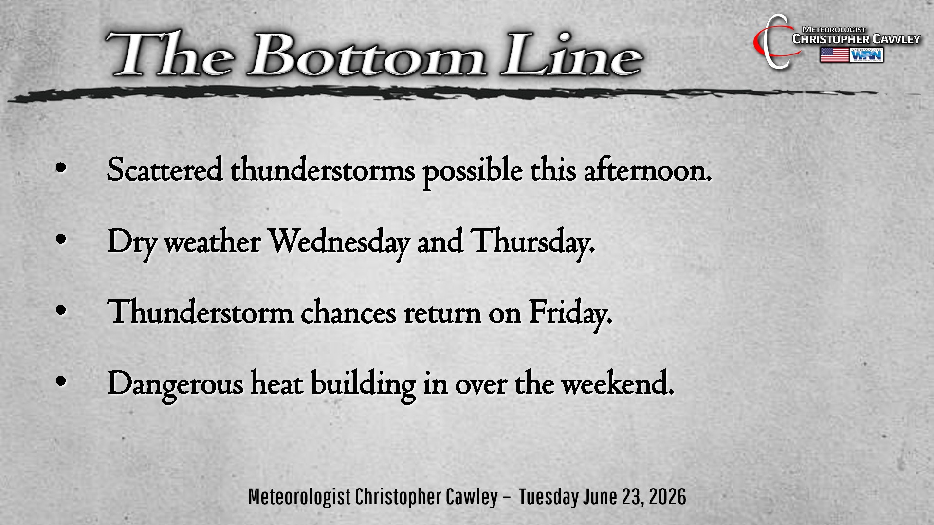
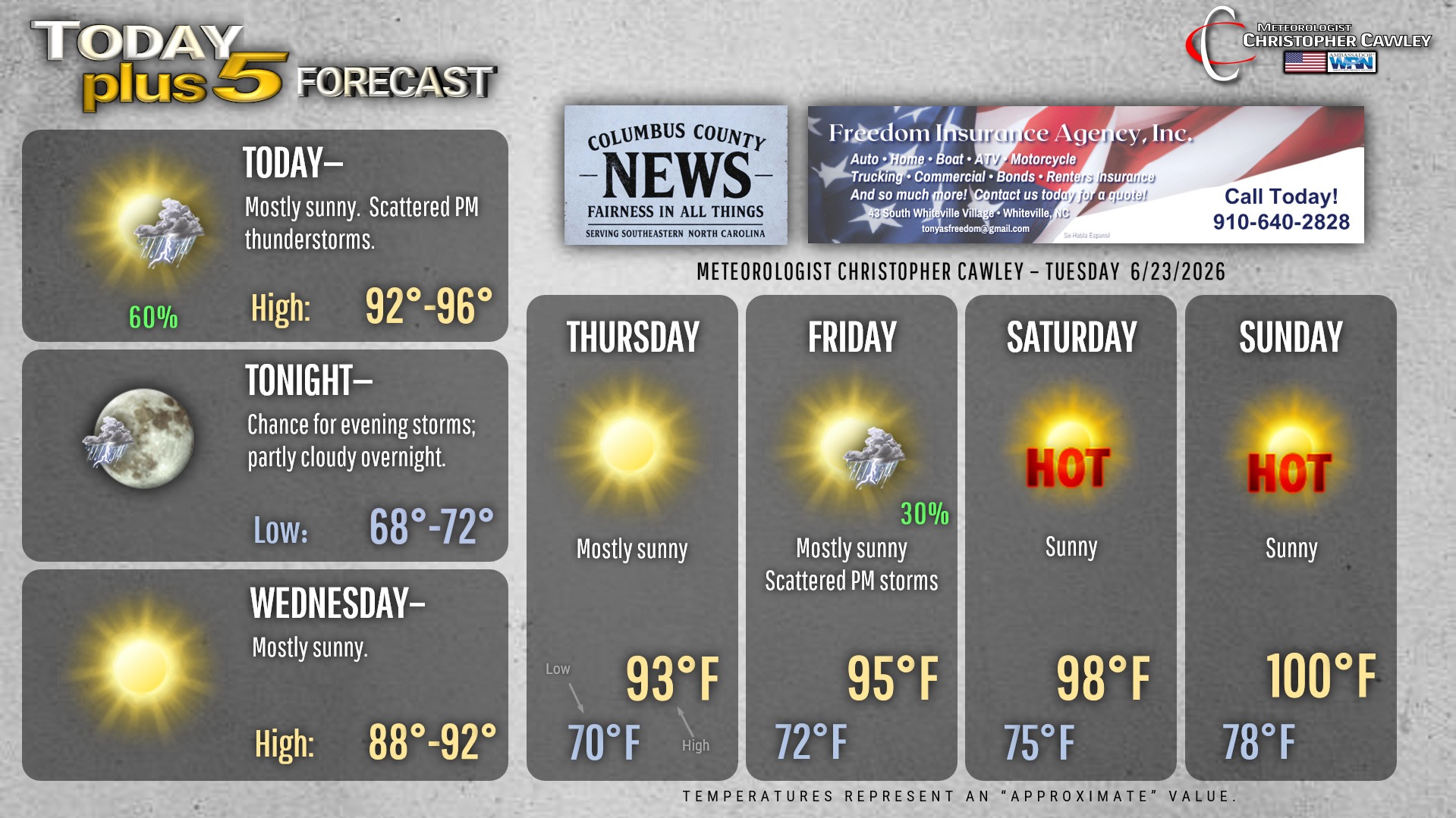
Strong thunderstorms possible this afternoon.
Dangerous heat building in for the weekend and beyond.
Let’s tackle these one at a time.
The “ghost” of a frontal boundary will be moving through later this afternoon. I’ve been talking about this for several days. This will be the focus and source of lift for thunderstorm development this afternoon, but the latest series of models suggests most of the interesting stuff will go off to our north. Still we’ll need to keep an eye and ear to the sky for this afternoon into early this evening.
Dry weather will be in place for Wednesday and Thursday. Humidity values will be in check for Wednesday but start to become more noticeable on Thursday as ridging starts to build offshore.
Another “ghost” front tries to drop into the ridge for Friday. This will bring additional shower and thunderstorm chances.
The high pressure ridge really gets locked in for the weekend. A westerly wind flow, downsloping off the Piedmont, along with compression, brings dangerous heat to the region for the weekend and into next week.
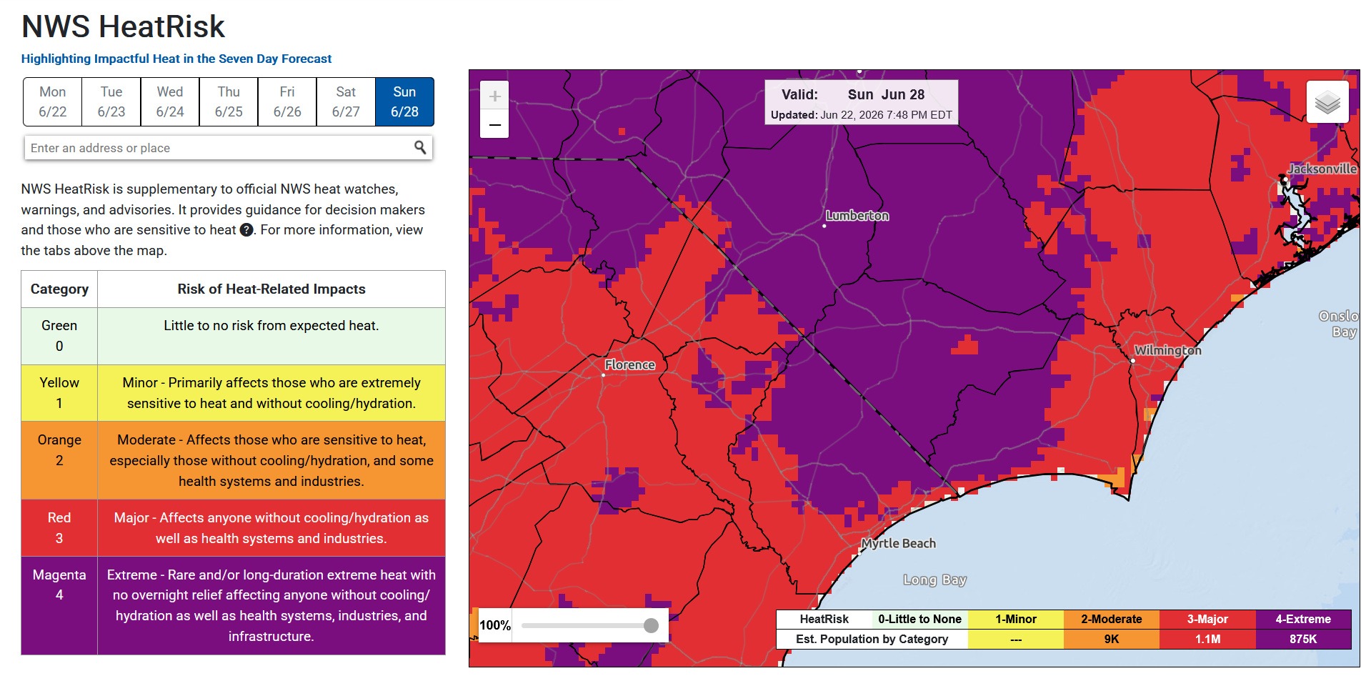
Triple-digit temperatures appear LIKELY for Sunday. Heat index values should crush advisory criteria Friday and Saturday, and possibly push into “extreme heat warning” criteria (heat index values 110+) by Sunday into next week. Thunderstorm chances will be little to none, outside of a renegade isolated cell.
NWS HeatRisk has the county under “Extreme Risk” for Sunday. This will likely be the same on Monday and Tuesday, possibly beyond.
Tropics remain quiet at this time.
Here is your Freedom Insurance Today-plus-Five Forecast:
–Meteorologist Christopher Cawley