
Columbus County NEWS Weather Update for Tuesday July 28, 2026.
This weather update is sponsored by Freedom Insurance of Whiteville. Trust Freedom Insurance to give you clear blue skies when it comes to home, car, boat, or whatever insurance you need. Let Freedom provide customized coverage to keep you and your family safe. Contact Freedom today at 910-640-2828!
Here’s today’s Bottom Line
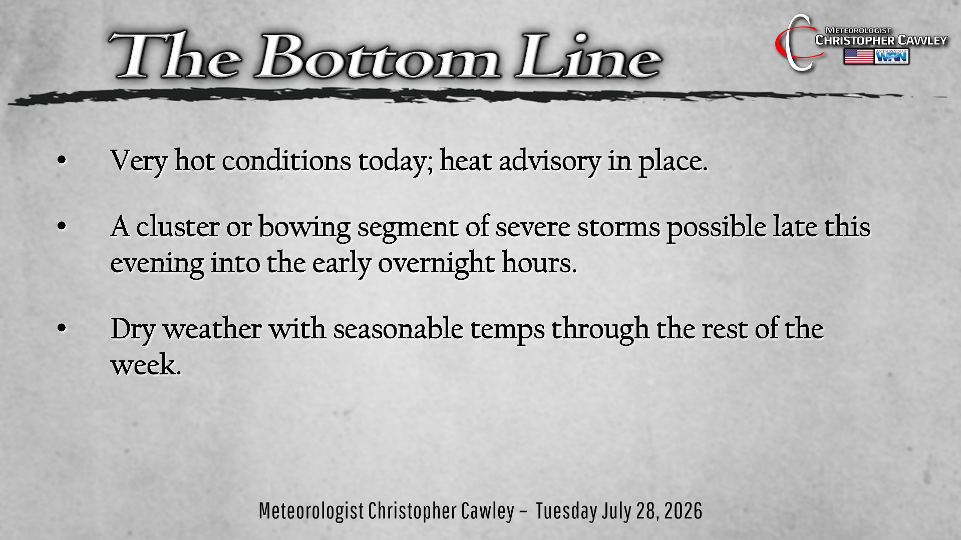
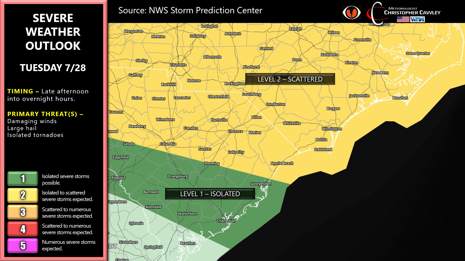
We have a full-throated severe weather risk later this evening into the overnight hours as a cold front crosses the area.
It’s going to be hot today, though, and a heat advisory is in place for Columbus County. Heat index values will be back up into that 105-109 territory once again… but just for today.
As we move through the evening, conditions become more favorable for strong storms to develop ahead of the cold front. Atmospheric profiles look very good for severe weather to the north and west, mainly west of a line from Whiteville through Elizabethtown, and north of a line from Whiteville through Fair Bluff to Hartsville. That being said, a damaging wind risk does exist farther to the south and east.
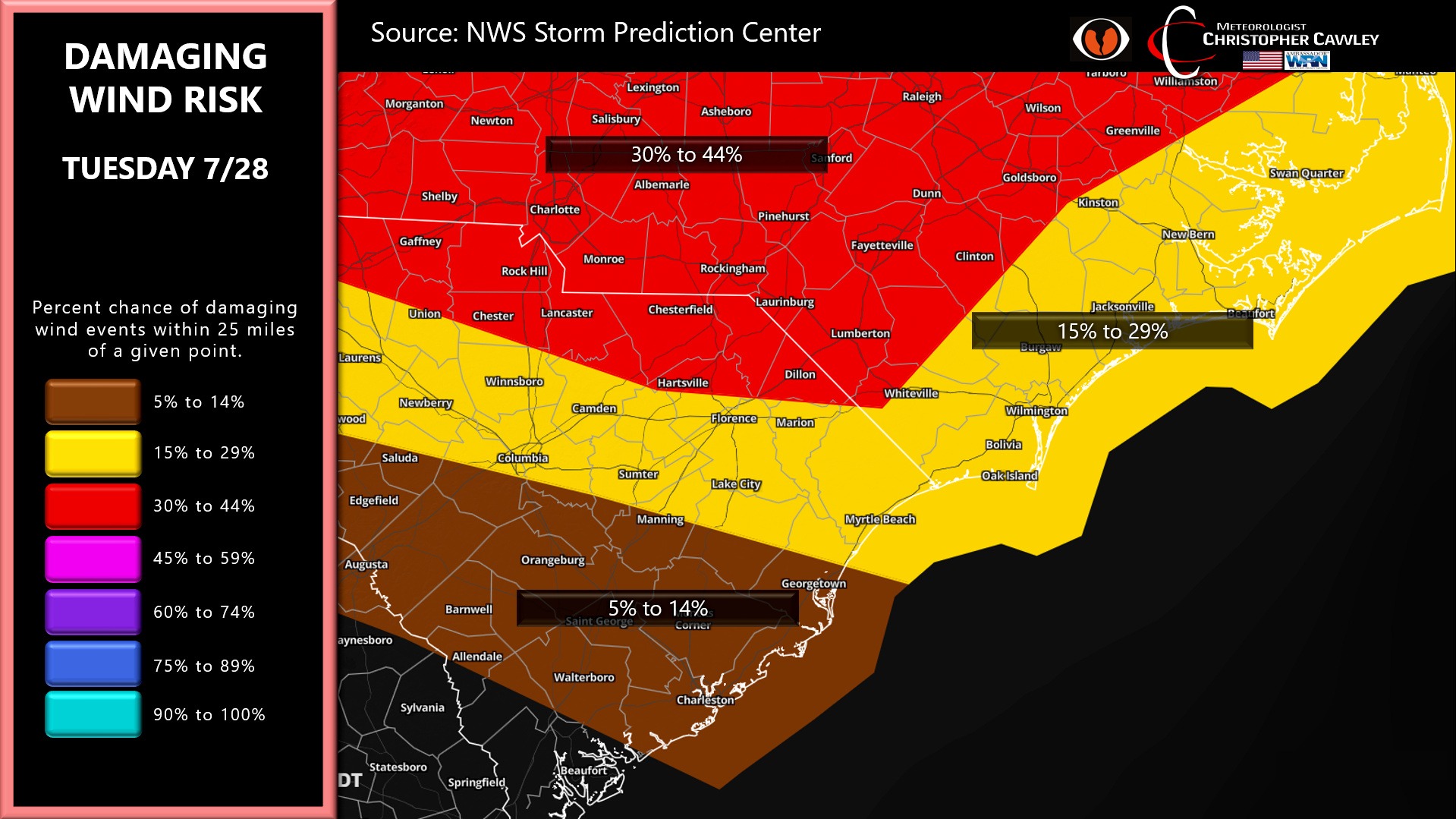
The window, as it stands right now, is between 8 PM and 2 AM from northwest to southeast. A cluster, or clusters of bowing-segment storms is likely to drop from NW to SE. These storms will have the potential to produce damaging winds and isolated tornadoes, as well as torrential rainfall and frequent lightning.
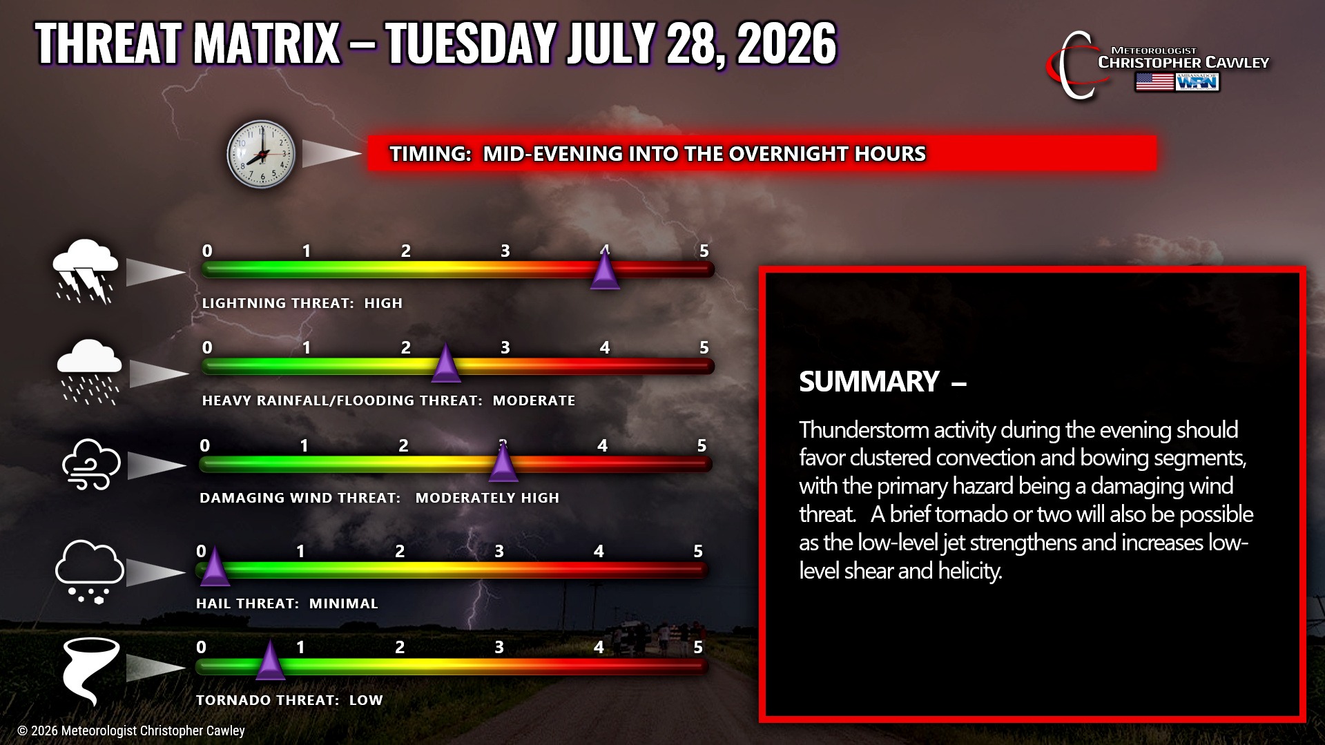
BUST POTENTIAL: There is a bust potential with this event. A couple of thunderstorm clusters may possibly dive south over the Appalachians into western and west-central NC today. “Debris cloudiness” from those storms may inhibit instability just enough to greatly reduce the severe potential.
I’ll be watching this storm potential through the evening hours and will update on my socials as needed.
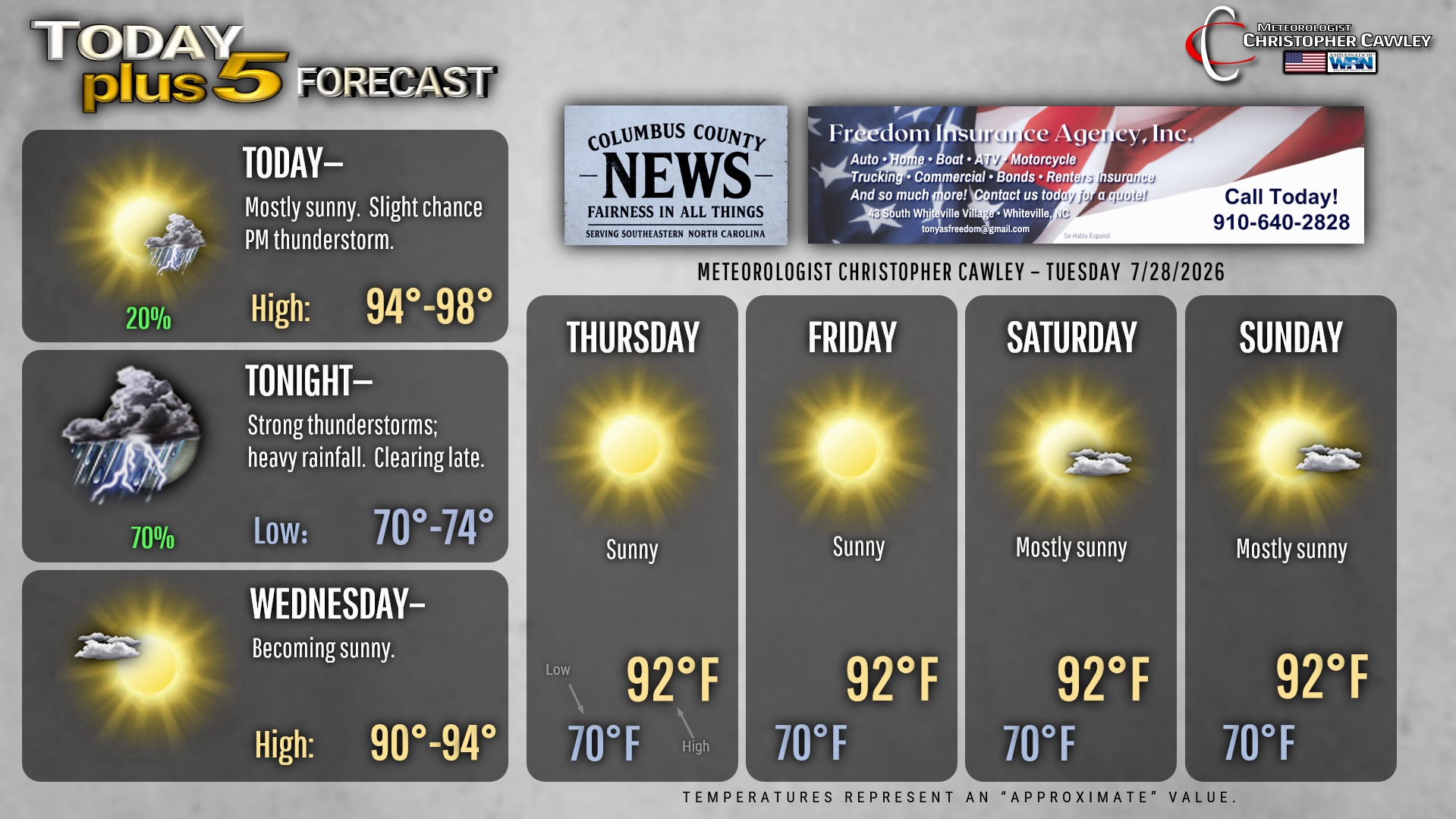
Dry high pressure builds in for Wednesday and lasts into the weekend with seasonably hot temps and dry weather.
Here is your Freedom Insurance Today-plus-Five Forecast:
–Meteorologist Christopher Cawley