Hey folks, welcome to the Monday edition of the CCN Weather Update!
Sponsoring the CCN Daily Weather Update is Freedom Insurance of Whiteville, NC. Freedom Insurance believes in providing peace of mind for you and your loved ones. Whether you’re looking to safeguard your home, car, health, or business, Freedom can offer tailored insurance solutions to meet your unique needs. Contact them today at 910-640-2828 or stop in at their office across from Lowe’s in Whiteville.
STATISTICS FOR WHITEVILLE – Sunday February 8, 2025.
High: 79.2°F at 3:51 AM (normal is 57)
Low: 52.9°F at 11:59 PM (normal is 33)
Precip: 0.00 in
View live, real-time weather data for Whiteville on my College Street Weather Station.
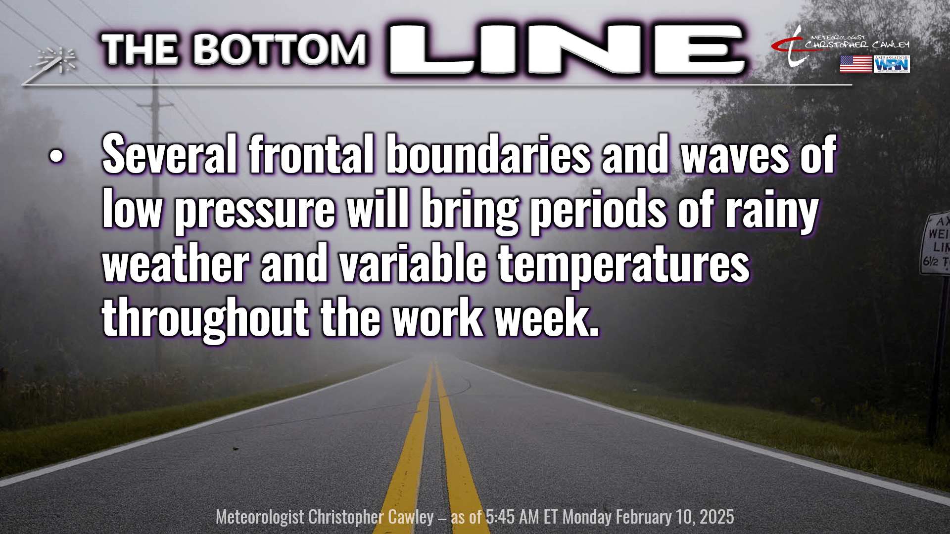
Here’s your Bottom Line for today…
On this day in 1973, the largest recorded snowfall in Whiteville’s history occurred, with an official measurement of 15 inches. Recorded data goes back to 1953.
I hope everyone was able to enjoy some time outside on Sunday. My forecast high was 80, our actual high was 79.2. I’ll call that a win.
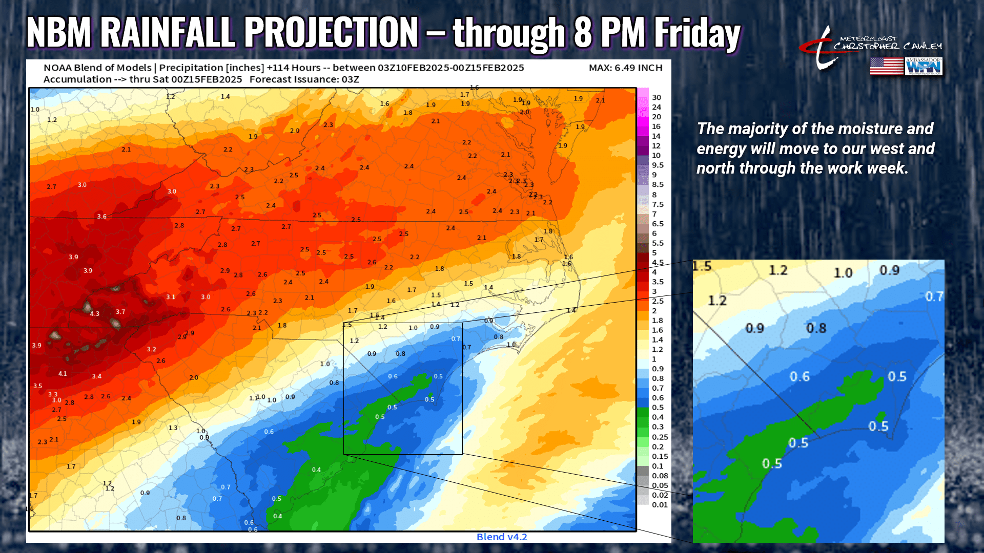
Anyway, that’s all a memory now. You’re going to need a jacket and an umbrella this week. As noted in the Bottom Line, multiple frontal boundaries and waves of low pressure will bring some rain to the area this week. Unfortunately, with the very latest guidance available, it seems that the drought-busting rains are going to go just off to our north and west… so the rain we do get won’t be a productive rain. Ugh. The National Blend of Models rainfall projection only shows a bit over half an inch of rain for the County this week, whereas if you travel north/west of I-95, rainfall totals of 1-4 inches are likely.
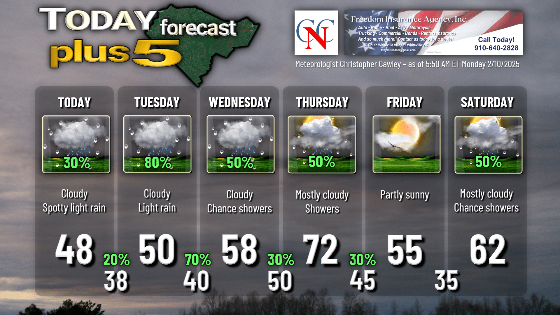
So for today, a frontal boundary will be far to our south as an area of high pressure stretches across New York and Pennsylvania. This sets the stage for the third distinct cold-air-damming event (“wedge”) across our area in the past week. This means that today we will experience lots of clouds, a northeasterly wind flow, and spotty light rain. Our temperatures will remain steady in the upper 40s throughout the day. The actual “high temperature” has likely already occurred — it was in the lower 50s at midnight and temps will, again, pretty much hold steady. Keep that jacket handy.
For tonight, the wedge only becomes more entrenched. Lots of clouds and some areas of fog will be around the area tonight, we’ll have a continued chance for light rain or mist, and our lows will drop into the upper 30s to around 40. On Tuesday, the wedge says, “gosh, I like it here,” and goes nowhere fast as a coastal trough becomes established. Colder, moist air trapped at the surface will continue while warmer, moist air aloft starts to lift “up and over” that cold air in place. This leads to perfect conditions for periods light rain on Tuesday. Heavier rainfall will occur farther west across central and western NC as a low pressure system starts to get it’s act together from Oklahoma to the Ohio Valley.
There’ll be just enough rain on Tuesday to make it a cold and miserable day, but not enough rain that it’s going to break any of the drought conditions. I expect only a few tenths of an inch at most. Periods of light rain continue Tuesday night with lows dropping to around 40.
Forecast confidence starts to drop as we go into Wednesday, particularly the temperature forecast. A frontal boundary is going to waver over the area. Periods of rain are likely to occur Wednesday and Wednesday night, but my confidence in the temperature forecast is not great. Why? There could be as much as a 10-15 degree difference on one side of a front vs the other. If the frontal boundary hovers around I-95 or west, our highs easily push deep into the 70s. If the front is farther to the south/east (off the coast), we’re in the 50s. I’m hedging my bets that the frontal boundary hangs around the coast or maybe just inland from the coast on Wednesday, so I put a 58 on the graphic. Ensemble ranges run from about 47 to 75, and the NBM says “63,” but … ultimately as of right now I think we’ll be in the 50s on Wednesday.
The frontal boundary lifts off to the north on Thursday and we bump into the warm sector for a few hours before a cold front arrives later in the day. A significant push of warm, southerly air from the Gulf brings our temps into the 70s. The cold front arrives in the afternoon with a round of showers and maybe some thunderstorm activity depending on the timing of the frontal passage. No severe weather.
A mysterious, very bright yellow-orange orb appears in the sky on Friday, bringing with it a brief opportunity to dry out. Temperatures behind the cold front should be in the mid to upper 50s, which is pretty close to normal for this time of year.
Don’t get used to dry, sunny weather. Another large, sprawling storm system looks to hit the east coast by the weekend. Warm front lifts over the area on Saturday with some showers. Sunday looks quite warm, breezy, and possibly stormy as yet another cold front crashes the party. Temps going into NEXT week look like they might average out just a touch below normal.
Speaking of next week, a quick look at longer-range trends indicates the potential for another significant frontal system during the mid-week period. Way too early to nail down any specifics on that. Along with that system, the European ensembles point to a “bubble” of Arctic air possibly slipping down the eastern seaboard……. let’s just not even think about what could happen with that.
Here’s your Freedom Insurance Today-Plus-5 forecast for Columbus County.
Well that will conclude another CCN Daily Weather Update! Despite the gloomy weather, I hope it’s “sunny and 75” wherever you go today. As always, take care.
~Meteorologist Christopher Cawley