Welcome to another work week and welcome to the Monday edition of the CCN Weather Update.
LOTS to talk about with regard to the potential for severe weather on Wednesday. Today’s update is part science lesson, as well.
This weather update is brought to you by our friends at Freedom Insurance in Whiteville. When severe weather strikes, have the peace of mind that your vehicles and property are well covered. Visit our office for comprehensive policy quote that will fit all of your needs. Call us at 910-640-2828 or stop in at the south end Hills shopping plaza.
STATISTICS FOR WHITEVILLE – Sunday March 2, 2025.
High: 60.2°F at 12:01 AM (normal is 62)
Low: 33.5°F at 11:59 PM (normal is 36)
Precip: 0.00 in
View live, real-time weather data for Whiteville on my College Street Weather Station.
Here’s your Bottom Line for today…
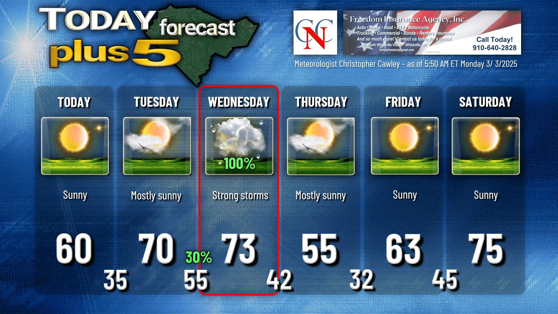
Quiet weather today through Tuesday. Today will be calm and clear, with low relative humidity levels once again this afternoon. The elevated fire risk continues. Tonight will be clear with temps back into the mid 30s. I don’t think there’s much frost concern given how dry the air is.
For Tuesday, we’re dramatically warmer as a very impressive low pressure system takes shape over the central Plains. Southerly flow becomes established and while I wrote “mostly sunny” on the graphic, clouds will be increasing during the afternoon.
A warm front lifts north over the county Tuesday night, and this may bring a shower or two, maybe a rumble of thunder. It becomes increasingly breezy Tuesday night as well.
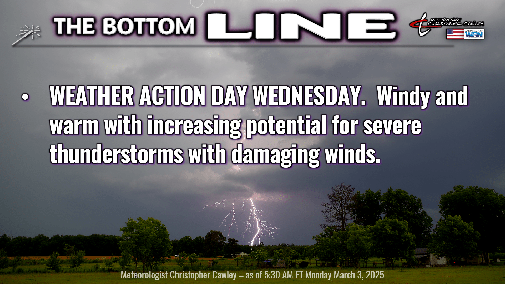
WEATHER ALERT DAY FOR WEDNESDAY – INCREASING POTENTIAL FOR SEVERE WEATHER
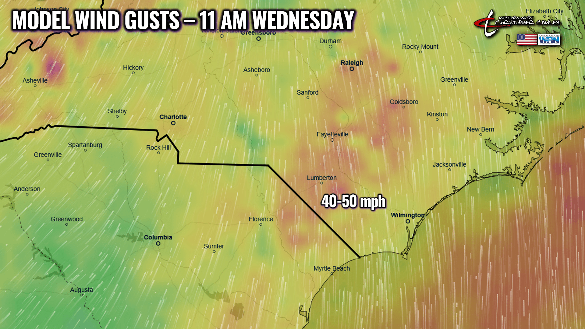
The center of the powerful low pressure system lifts across the lower Great lakes region into Quebec on Wednesday. This drags a significant cold front into our picture. Strong winds will develop ahead of the front; modeling shows potential wind gusts of 40-50 mph from late morning until the frontal passage. A convective line is likely to move across the state ahead of the cold front. It’s all in the timing at this point and I’m going to be watching this carefully… especially by tonight and for tomorrow morning’s post as we will be in the window for the short-term / high-resolution model guidance. Looking at things right now, the NAM12 brings the line through the County right after lunchtime on Wednesday, with potential atmospheric destabilization just ahead of this line.
SEVERE WEATHER PARAMETERS.
Moisture: Abundant to near-saturation in the atmospheric column. Precipitable water values will be somewhere in the 1- to 2-inch range. This means that if you took a section of the atmosphere and “rained out” all of the moisture, it would accumulate 1-2 inches of water. Doesn’t sound like much… but it’s actually a lot.
Shear: Wind shear is going to be jaw-dropping, as shown by the chart here. Wind shear of 78-111 mph is shown by the European model over our area just after lunch on Wednesday. No, we’re not going to see 78-111 mph winds at the surface. As the graphic explains, this means there will be a CHANGE in wind speed between vertical and horizontal levels. In thunderstorms, this shear can (will) cause a tilting in the storm’s updraft in such a manner that the updraft and downdraft remain separate from one another. This results in longer-lasting thunderstorms, increased severity, and a higher potential for damaging surface winds and/or tornadoes.
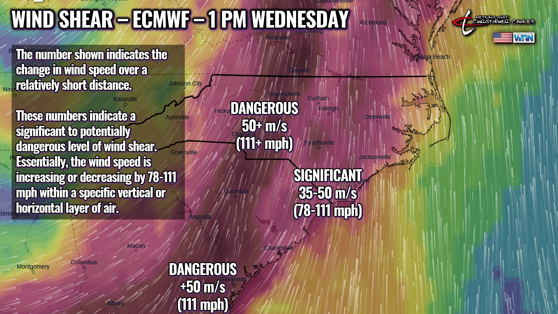
When wind shear varies in direction with height, it can cause rotation within the thunderstorm, leading to the formation of something called a “mesocyclone,” which is a rotating updraft (rapidly rising air) that can produce tornadoes.
Instability: This is still the biggest question-mark. Instability provides the energy for rising air that fuels thunderstorms. The higher the instability, the higher likelihood for severe weather including tornadoes. Higher levels of instability generally result in stronger updrafts. I did a little “model shopping” and found the one showing the highest level of instability as of the time of this writing.

We’re not looking at an all-day rainfall on Wednesday. As I mentioned earlier, there may be a shower or “gentle thunderstorm” late Tuesday night/early Wednesday as the warm front lifts north, and then the main line of convection moving through on Wednesday. Indications are that it will be a relatively quick hit. Variably cloudy skies and, again, quite windy. Winds should slowly die down after the front pushes off the coast.
The severe weather threat is HIGHLY DEPENDENT on the timing of the convective line. If things progress a little faster than expected, the line moves through during the late morning hours and the severe weather threat is less. If things slow down and our line doesn’t move through until closer to suppertime on Wednesday, once again that results in less severe weather threat (but still very gusty winds). Wind shear and moisture are going to be plentiful, as noted. It’s all going to depend on the level of instability.
This all clears out by Wednesday night. Thursday and Friday are going to be dry. Thursday’s highs will be cooler than normal, and there’s a frost/freeze threat Thursday night into early Friday. Seasonable highs Friday … then rising into the 70s again by Saturday. The next cold front with showers/storms arrives Saturday night.
Here’s your Freedom Insurance Today-Plus-5 forecast for Columbus County.
That’ll do it for today. Thanks for reading, and as always, take care!
~Meteorologist Christopher Cawley