CCN Weather Update for Wednesday June 4, 2025.
This weather update is sponsored by Freedom Insurance of Whiteville. When severe weather strikes, with Freedom Insurance you will always be prepared. For home, car, boat, or whatever you need, Freedom can provide customized coverage to keep you and your family safe. Contact Freedom today at 910-640-2828!
Here’s today’s Bottom Line
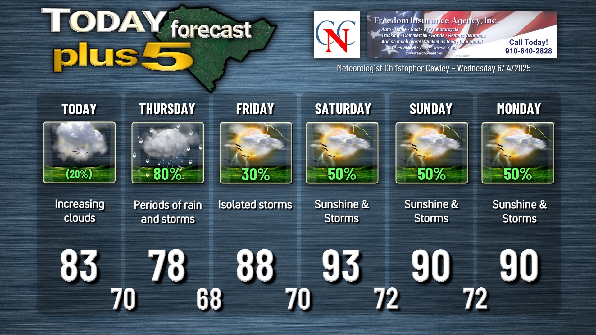
High pressure gives way to building moisture from the south today. This will result in an increase in cloudiness and even the possibility of some showers later this afternoon.
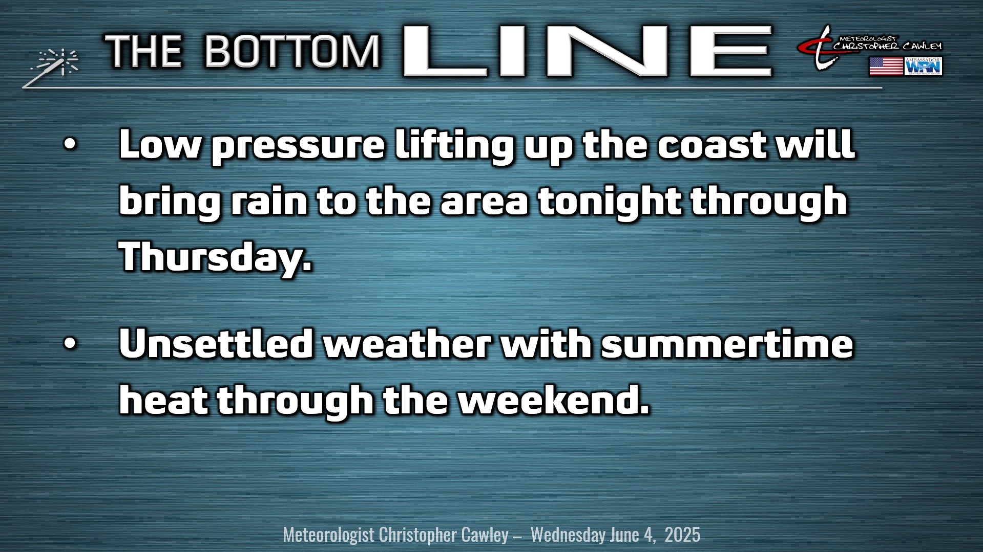
Low pressure lifting northeast along the coast will bring rainy conditions tonight through Thursday. This may or may not become a subtropical system by the time it gets here, see the “tropical” section below.
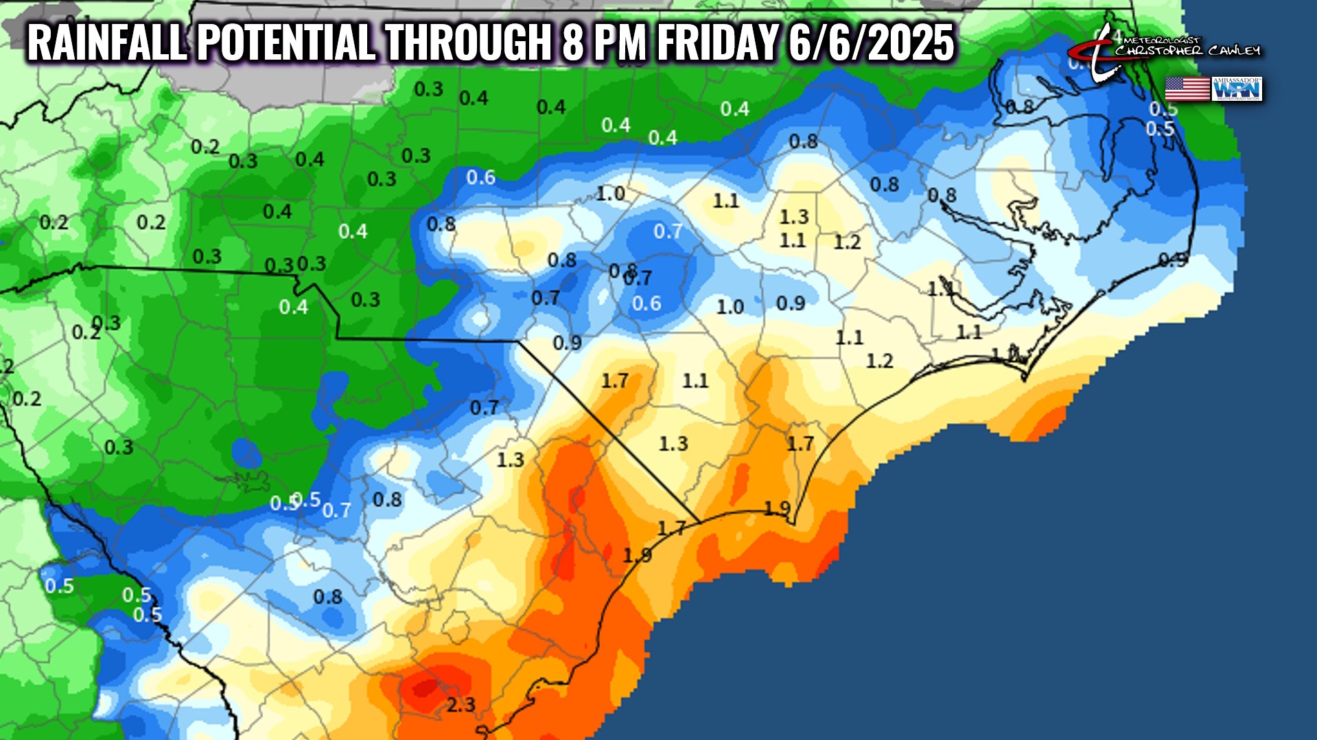
Rain may be heavy at times tonight and Thursday. Rainfall amounts over the county should be between 1 and 1.5 inches.
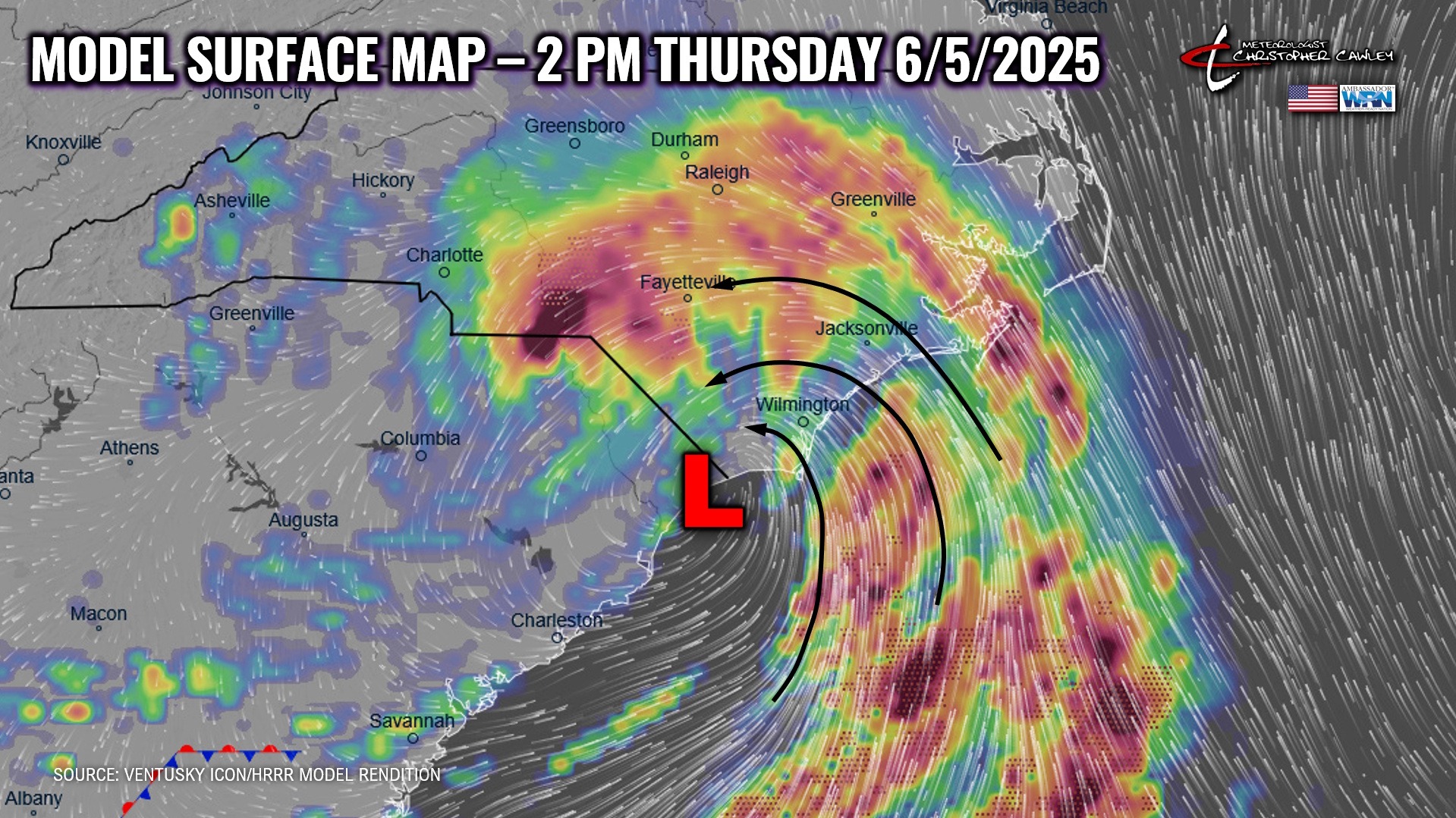
Dry air at the middle levels of the atmosphere will wrap around the west/southwest side of the low by Thursday night, resulting in a pretty quick cut-off to the rain… and skies becoming partly cloudy.
This low continues to move across the Outer Banks on Friday and then will get picked up by a stronger system over the northeast US on Saturday. Dry air continues to push in from the northwest, but I’m keeping low-end shower/storm chances in my forecast for Friday. It’ll probably be dry all day, but I can’t make that promise.
A weak boundary (called a shortwave) pinwheels over the area on Saturday. This, combined with all kinds of instability and the sea-breeze, along with temps in the lower 90s, will likely lead to the development of scattered storms Saturday afternoon and evening.
A cold front tries to push through the area late Saturday night or Sunday but I believe this will stall to our north. Unsettled weather, with thunderstorm chances and summertime heat, continue Sunday into Monday.
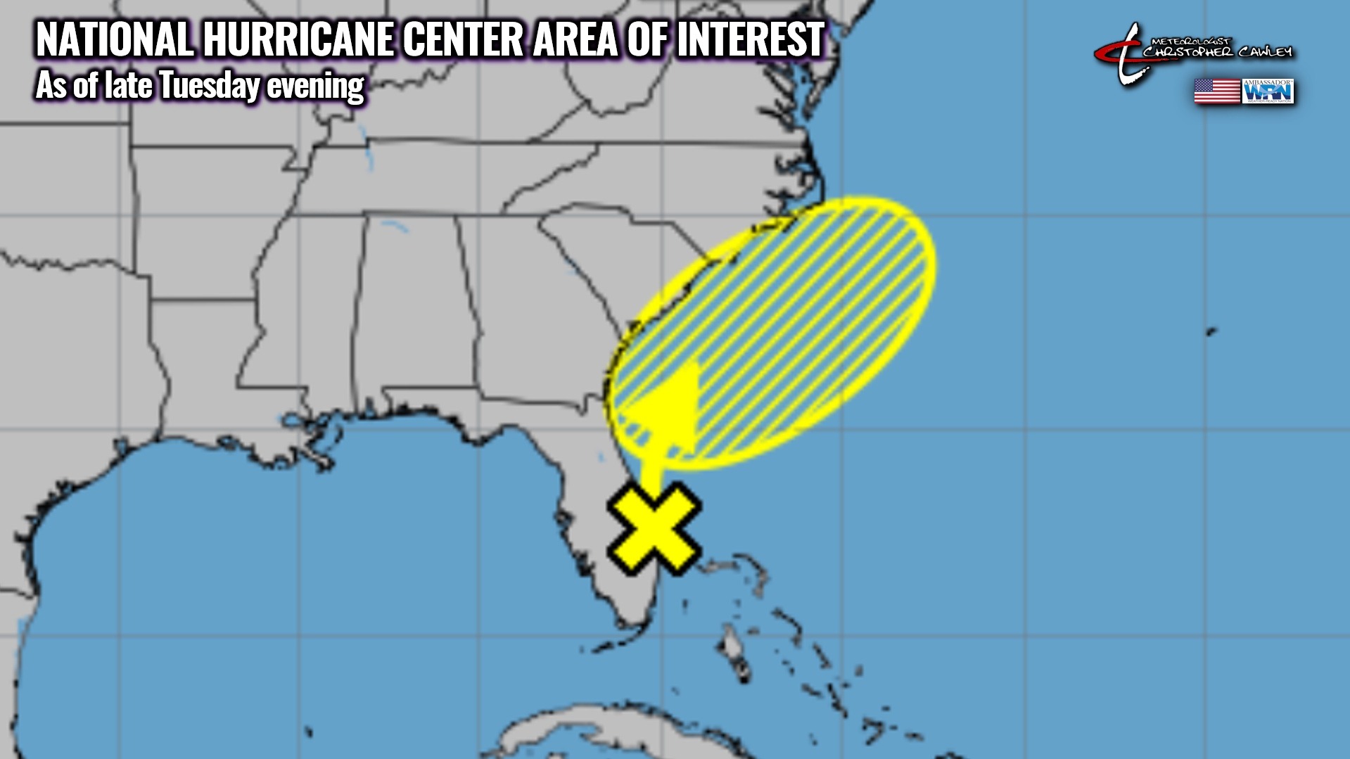
TROPICAL OUTLOOK: An area of low pressure lifting slowly northeast along the coast might develop into a subtropical system (maybe) by later today or early Thursday. Several of the global models suggest this may stay over land or ride directly on the coastline; if this is the case, it will likely not develop subtropical/tropical characteristics. If the low stays over the water, just offshore, then we have a 10% chance of the system taking on subtropical/tropical characteristics.
Subtropical systems have fronts attached to them and have the strongest winds away from the center. They are fueled by upper-air dynamics and warm water, whereas true tropical systems do not have frontal boundaries and are fueled exclusively by warm water.
Regardless of what happens, all this will be, for us, nothing more than a rainmaker on Thursday. Then it’s gone.
Beyond that, nothing further is expected in the next 5-7 days.
Here is your Freedom Insurance Today-plus-Five Forecast:
–Meteorologist Christopher Cawley