CCN Weather Update for Monday August 11, 2025.
This weather update is sponsored by Freedom Insurance of Whiteville. No weather worries with Freedom Insurance. For home, car, boat, or whatever you need, Freedom can provide customized coverage to keep you and your family safe. Contact Freedom today at 910-640-2828!
Here’s today’s Bottom Line
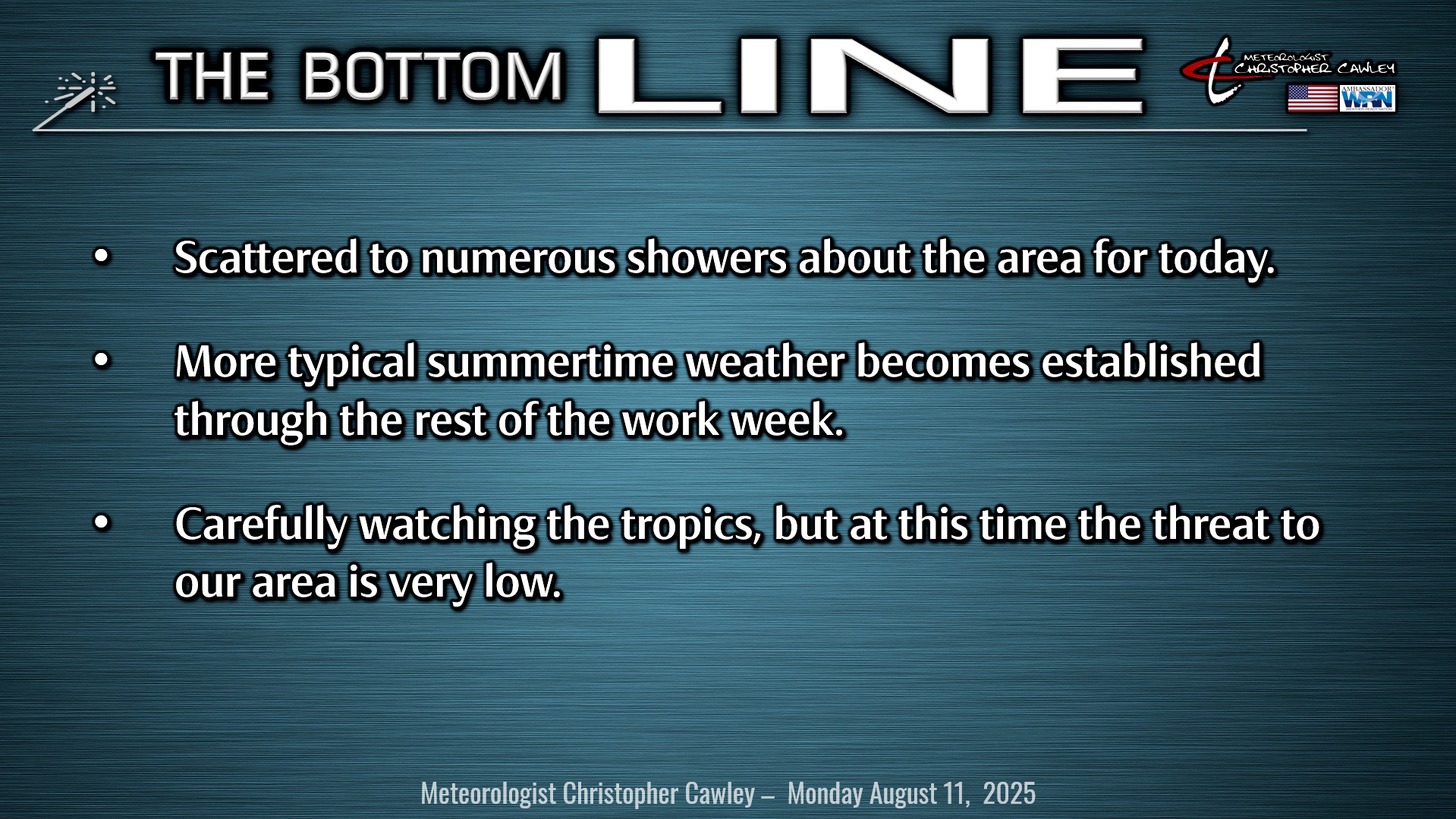
A weak coastal trough / warm front will remain in place today, and this will be the focus for scattered to numerous showers throughout the day under a cloudy sky. Despite the numerous nature of the showers, I don’t expect rainfall totals to be all that robust, generally less than a half an inch, although one or two places may pick up a little bit more. The showers continue tonight, tapering off by about midnight. Lots of clouds, drizzle, and patchy fog will dominate the overnight hours tonight.
For Tuesday, that coastal trough generally dissolves as high pressure starts to take hold. This high-pressure center will remain generally in control of our weather through the end of the work-week bringing more typical summertime weather to our area. This means partly to mostly sunny skies along with afternoon/evening thunderstorm chances. A few more showers/storms may occur on Wednesday as modeling hints at another coastal trough or shortwave wrapping through.
Like I said, the rest of the week features clouds, sun, and storms, and temps running a bit hotter than normal.
Now… what everyone really wants to talk about……
Tropics: Yes, we have a storm system off the coast of Africa, and it is likely to become Tropical Storm Erin, probably by the time you’re reading this. All indications are that Erin will become the season’s first hurricane, and it could strengthen into a major (cat-3) hurricane. Either way, it’s at least a week or more away from becoming a concern to the U.S., meaning it’s beyond range of “deterministic,” or specific, predictions.
There are two main sources of uncertainty regarding where it matures and “recurves” northwards – either toward land or out to sea.
1. Where the center forms. This should happen imminently as it treks westward across the central tropical Atlantic in the MDR, or “Main Development Region.” Projecting where a storm might go is futile until the storm’s center actually becomes established. Otherwise, it’s like playing “pin-the-tail on a donkey” without knowing where the donkey is.
2. How strong is the high pressure ridge off to the north? Think of it as a “forcefield” acting as a guardrail. If it’s stronger, we have a stronger forcefield, and we suppress the storm south and force it westward toward the Lesser Antilles. If the forcefield is weaker, then there’s a greater chance our system will slip northwards out to sea.
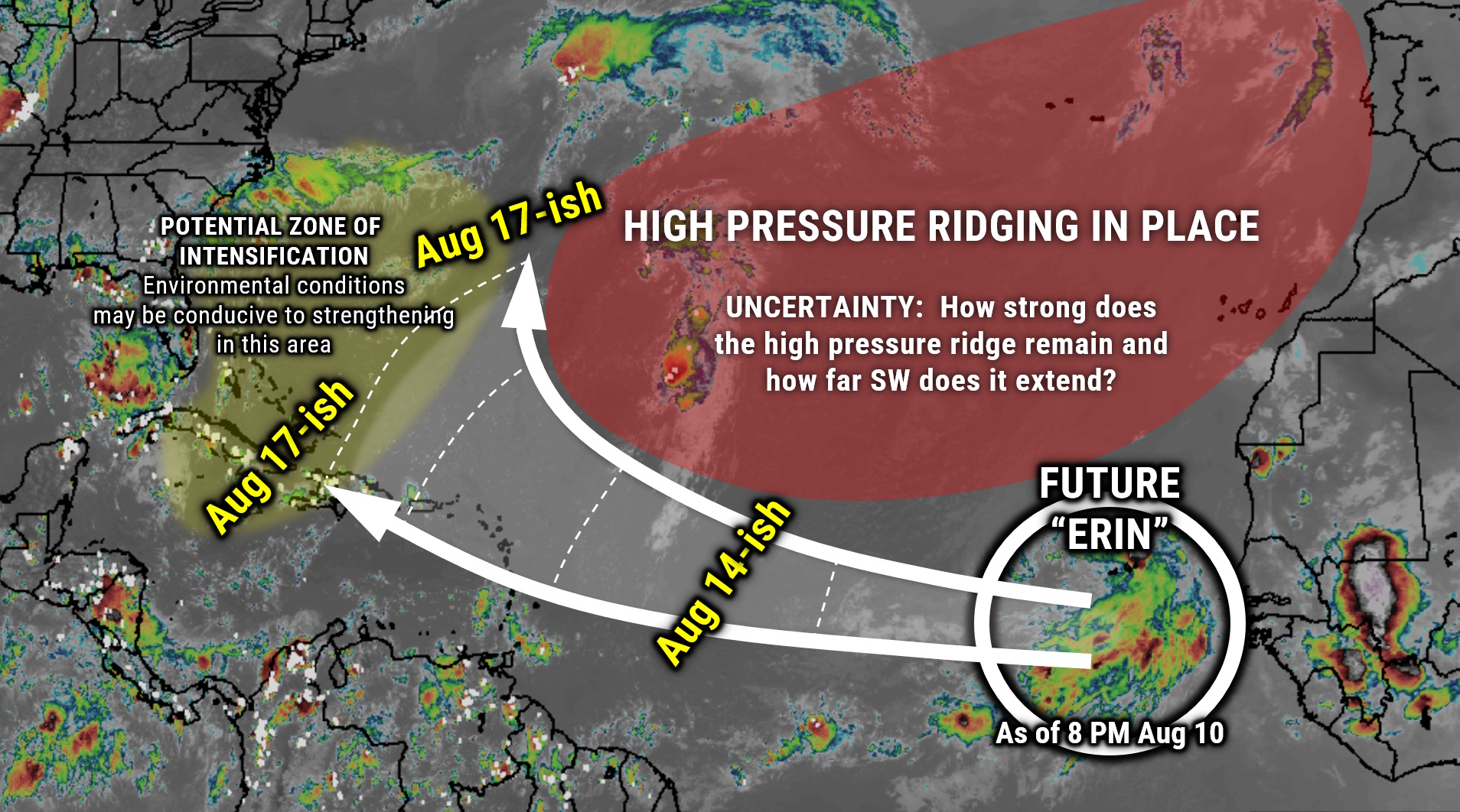
For now, know that we’re still over a week away from *anything* impacting *anywhere*. Bad actors on social media will always post cherrypicked scary-looking model runs. The science, however, tells us that we have very little skill beyond 5-7 days – especially before a system even forms.
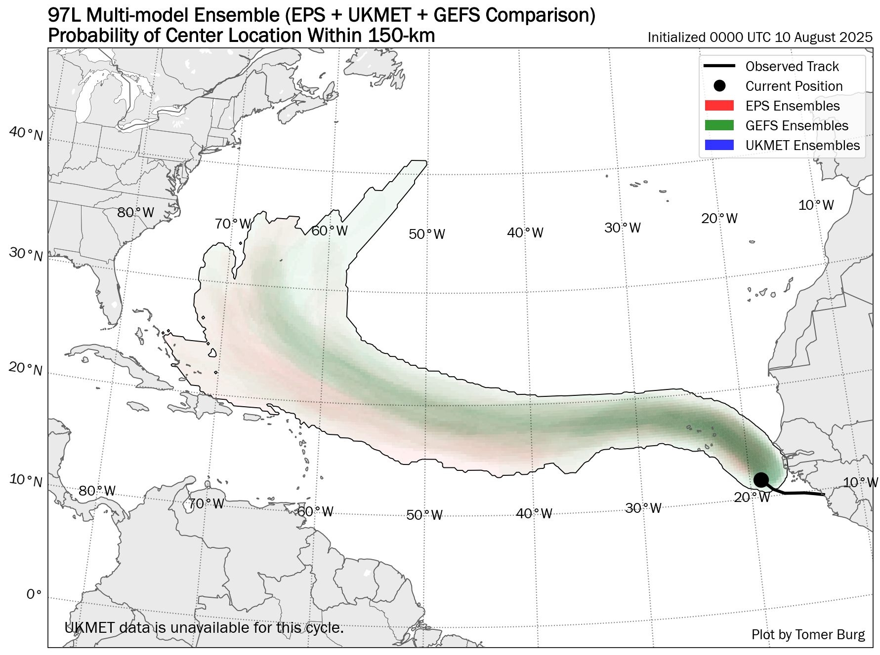
That all being said, the vast majority of the model guidance indicates a weaker high pressure to the north, and therefore a curve northward (as shown by the map below). That doesn’t rule out a southerly trek toward the islands and eventually Florida, but those chances are becoming much less with each model run. That also doesn’t rule in or out a strike along the Georgia/SC/NC coast. The likelihood is quite low, but not zero, and that really won’t be a “known” for at least another 3-5 days.
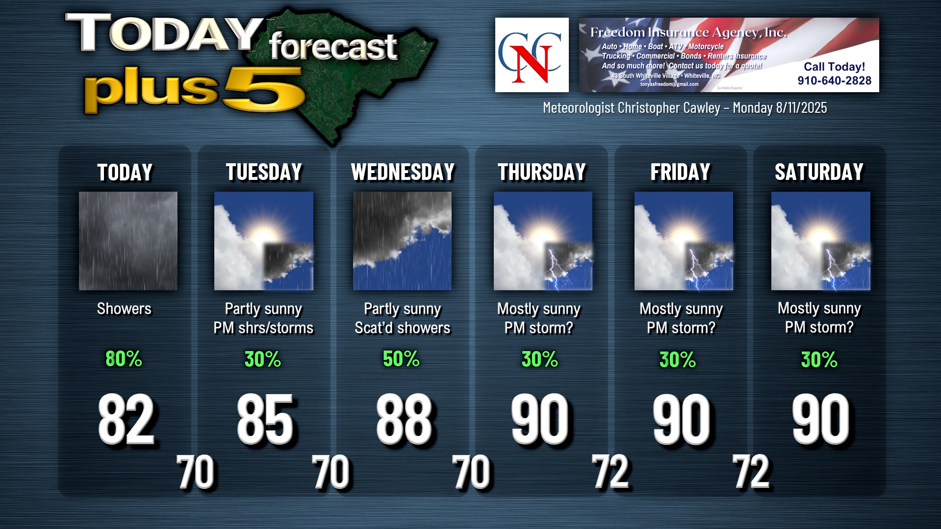
Here is your Freedom Insurance Today-plus-Five Forecast:
–Meteorologist Christopher Cawley