


CCN Weather Update for Tuesday August 12, 2025.
This weather update is sponsored by Freedom Insurance of Whiteville. No weather worries with Freedom Insurance. For home, car, boat, or whatever you need, Freedom can provide customized coverage to keep you and your family safe. Contact Freedom today at 910-640-2828!
Here’s Today’s Bottom Line
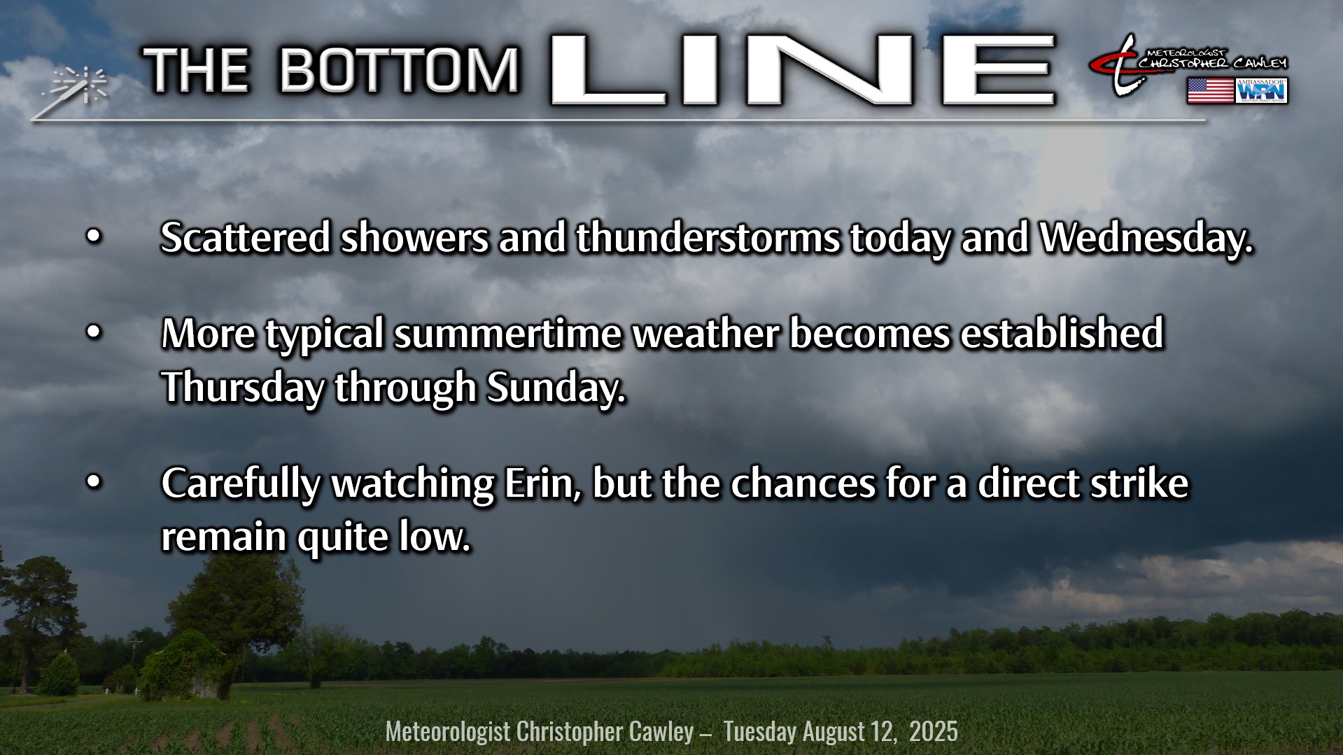
A weak coastal trough will hang tough today before giving way to building high pressure by Thursday. Shower and thunderstorm activity is expected this afternoon and this evening, and again Wednesday afternoon and evening, before a more typical summertime pattern becomes established.
“Yeah that’s great, Chris, what about the hurricane?” You’re interested in Erin. Here goes.
Tropics: Erin will become at least a category-3 hurricane later this week. Some modeling suggests she’ll become a strong cat-4, if not even a 5. The big question will be… where will she go?
We have a couple of factors that will influence where she goes. A couple of areas of high pressure… one over the south-central United States and one over the north-central Atlantic ocean… will act as “steering mechanisms” driving where Erin will go. As I said yesterday, high pressure acts as a “forcefield” of sorts, or you could say a roadblock. How strong a particular ridge of high pressure will determine the ultimate path of a storm, and Erin will be no different.
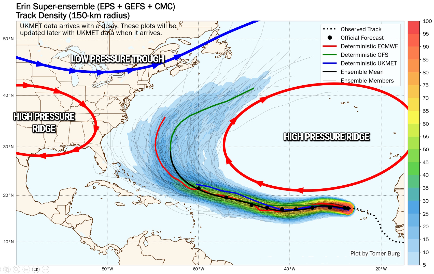
Between these two areas of high pressure is the path Erin will take. She has no choice, the laws of physics and science will prevail. The strength of the two highs will determine the ultimate path. As you can see by the map, the vast, vast majority of the latest modeling keeps this storm well out to sea. If you look carefully, yes, there are a handful of lines along the Carolina coast.
There’s a lot of anxiety that Erin is going to run slam into the Carolinas. This is fed by irresponsible social “mediaologists” cherrypicking model maps that they find online and posting them as if they’re some sort of fact.
Ultimately it is too early to really make any definitive black-and-white calls as to where Erin will go, and we’re a good 5 days or so away from knowing those exact details.
Don’t lose sleep worrying about Erin right now. If you feel that you wish to make hurricane preparations, by all means, do so… it’s good to have a level of preparedness.
But you need to understand that people sharing the scary-looking “end of the world” images on social media are only trying to get clicks, and they do so by exploiting fear. Don’t fall for it. Trust local degreed/trained meteorologists and the National Hurricane Center.
I have a moderate to high confidence that Erin will eventually take that northern track, that northern turn. Whether she brushes the Outer Banks with a glancing blow or stays hundreds of miles offshore is too soon to call right now… but the chance of a direct strike in our area right now remains extremely low.
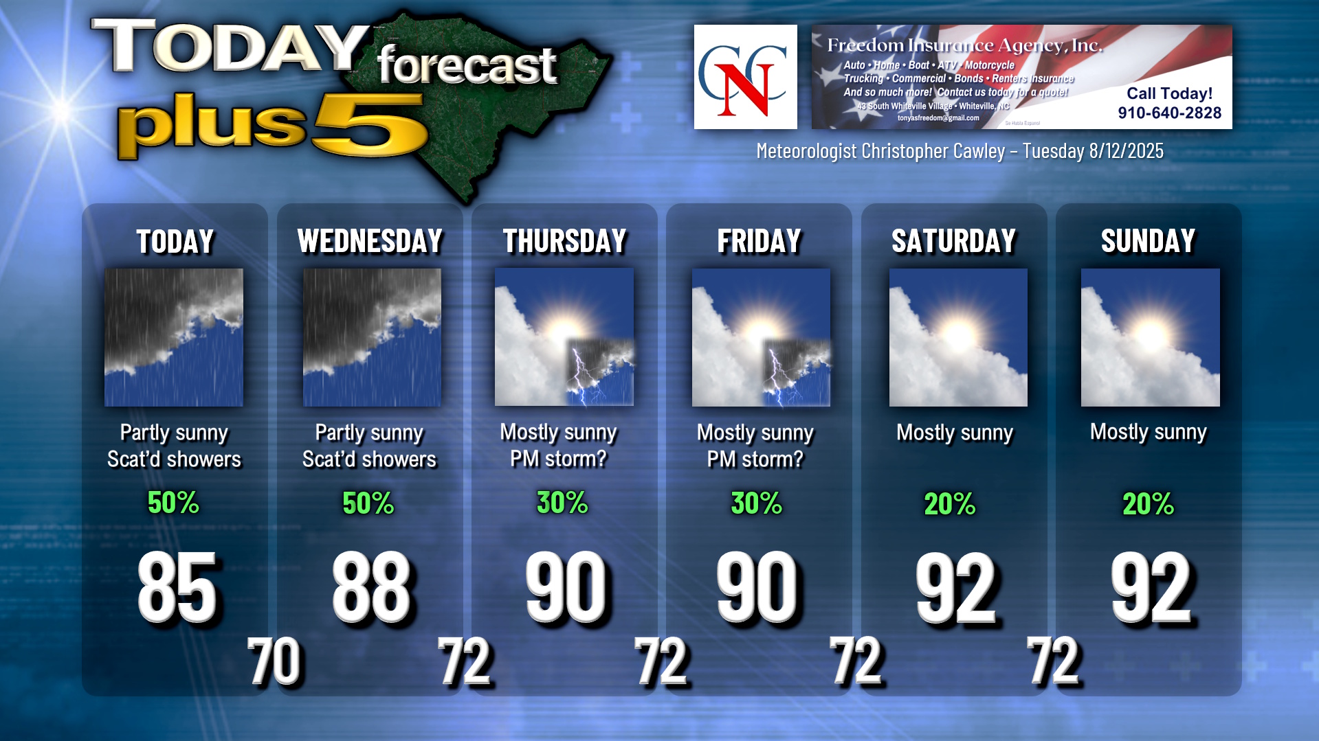
Here is your Freedom Insurance Today-plus-Five Forecast:
–Meteorologist Christopher Cawley


