CCN Weather Update for Wednesday August 13, 2025.
This weather update is sponsored by Freedom Insurance of Whiteville. No weather worries with Freedom Insurance. For home, car, boat, or whatever you need, Freedom can provide customized coverage to keep you and your family safe. Contact Freedom today at 910-640-2828!
Here’s Today’s Bottom Line
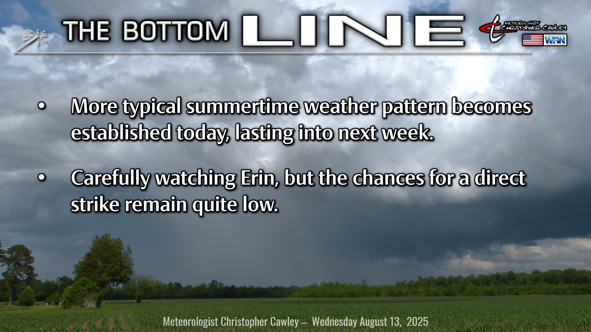
Typical summertime weather pattern becomes established today with intervals of clouds, sunshine, and a chance for afternoon and evening thunderstorms. This persists through Friday before high pressure brings hot temperatures and very low thunderstorm chances for the weekend well into next week.
But that’s not why you’re reading this. You’re interested in Erin.
Tropics: Tropical Storm Erin ran into some Sahara dust and dry air during the day Tuesday which impeded her development a little bit. That’s no longer expected to be the case as she gradually moves into an area far more friendly for development, and she is expected to become a hurricane by Friday morning, continuing a westward track in the central Atlantic ocean.
The official NHC projection has her continuing a general westward movement until getting just north of Puerto Rico, where she should start taking a swing to the northwest.
Since people read this blog at different times of the day, and since the NHC updates their maps every 6 hours or so, click HERE for the very latest maps from the National Hurricane Center.
Modeling, for the most part, from there has Erin curving generally northward and staying over open ocean.
There are lots of uncertainties and some science with this “turn.” There is a strong ridge of high pressure to the north and east of Erin. The strength of this “forcefield” will help steer Erin, and precisely where this northward turn begins. If the high continues to strengthen and moves westward, even just a bit, that pushes Erin closer to the coast before the northward turn.
Furthermore, the stronger Erin becomes, the more likely she will turn north due to laws of physics, including the Coriolis effect (which is a force that acts on objects moving in a rotating frame of reference, such as the Earth). Coriolis is caused by the planet’s rotation and influences the direction of moving objects, making them deflect to the right in the Northern Hemisphere. This means that Erin, moving in a straight trajectory, will eventually be forced to make a right-hand turn (which, in a westward moving system is a turn to the north). The stronger Erin becomes, the more likely she will make a hard right turn, whereas if she remains relatively “weak” (cat 2 or less), the more likely the northern turn is more gradual, perhaps bringing her closer to the coast.
Modeling, as you can see by the image here, is in universal agreement on a northern turn, but not in agreement on WHEN the northerly turn takes place. If you look carefully, you’ll see there are several lines and even some blue shading “brushing” the coastal areas of the Carolinas.
I need to stress that these “spaghetti model” plots are ***NOT*** OFFICIAL FORECASTS. Neither is the nonsense you see on social media. The only OFFICIAL forecasts are those issued by the National Hurricane Center.
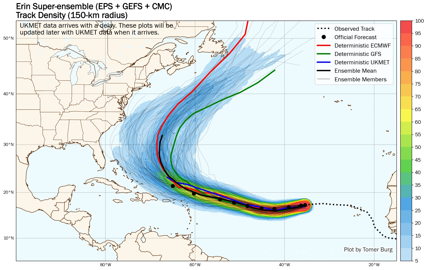
I can’t stress this enough: It’s too soon to make ANY definitive call on when and where the northerly turn takes place.
I remain quite confident that Erin will stay comfortably out at sea, bringing nothing more than dangerous rip currents and some high surf to the beaches. I remain quite confident that there will be little to no impacts in Columbus County.
Could that change? Absolutely.
Is it likely to change? No.
There is no reason to change your plans for next week, there is no reason for losing sleep or panic-shopping based on crazy colorful graphics you’re seeing shared by irresponsible individuals on social media. Trust your local degreed, trained, experienced meteorologists… we’ll let you know if there’s reason to worry. This daily blog, the local media outlets, the National Hurricane Center, and the National Weather Service in Wilmington — we’ve all got your back.
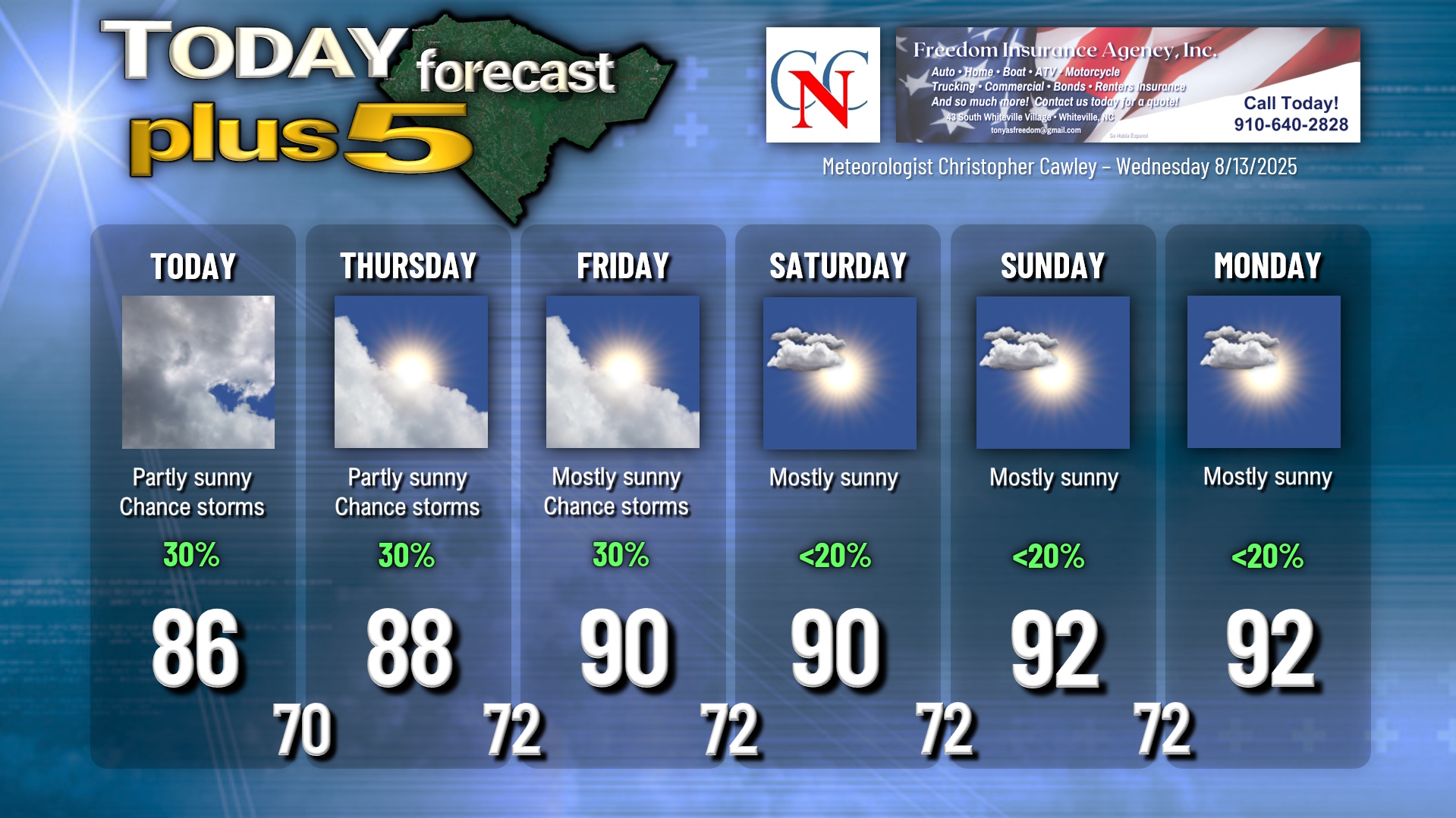
Here is your Freedom Insurance Today-plus-Five Forecast:
–Meteorologist Christopher Cawley