CCN Weather Update for Wednesday September 3, 2025.
This weather update is sponsored by Freedom Insurance of Whiteville. No weather worries with Freedom Insurance. For home, car, boat, or whatever you need, Freedom can provide customized coverage to keep you and your family safe. Contact Freedom today at 910-640-2828!
Here’s today’s Bottom Line
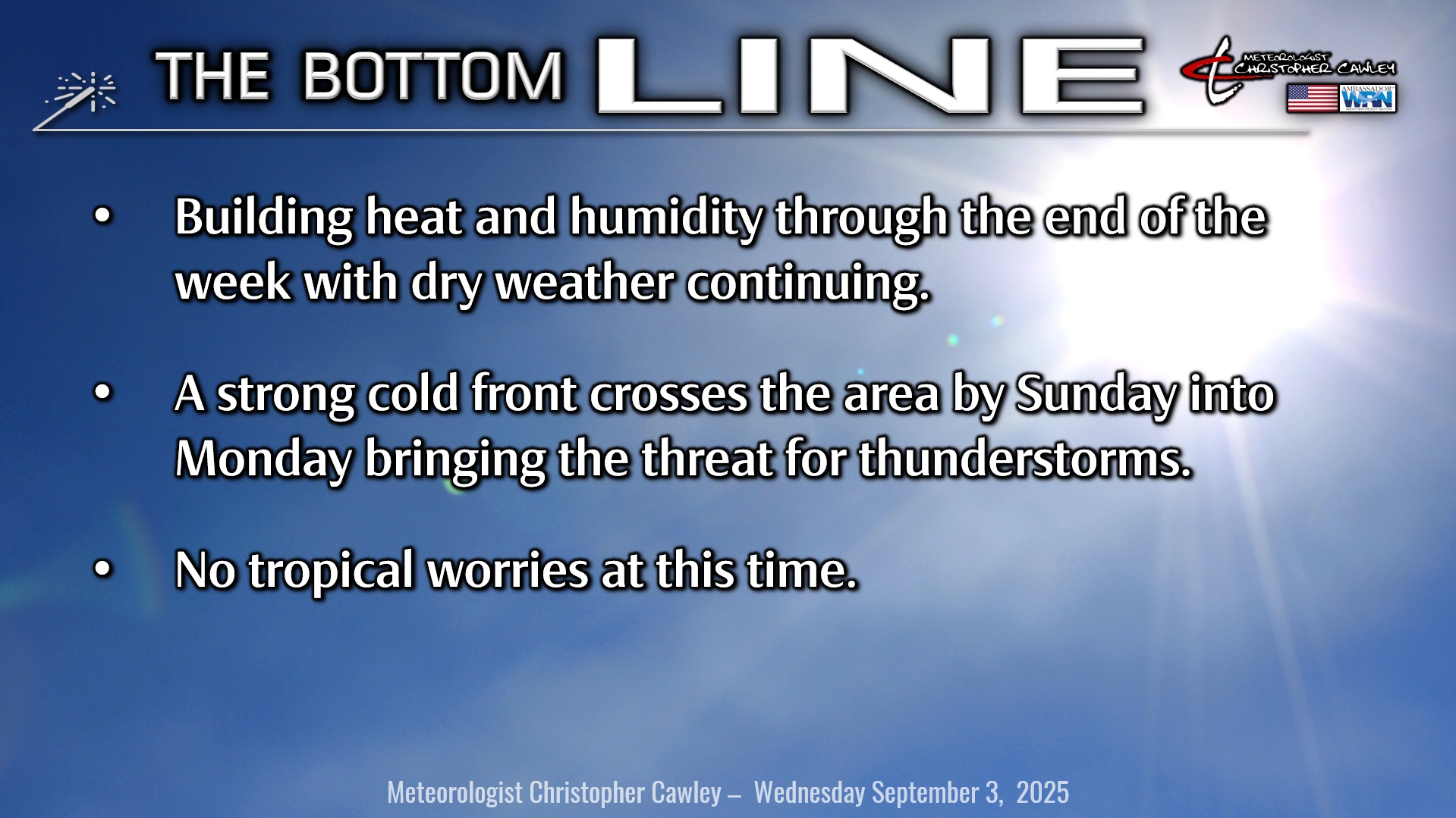
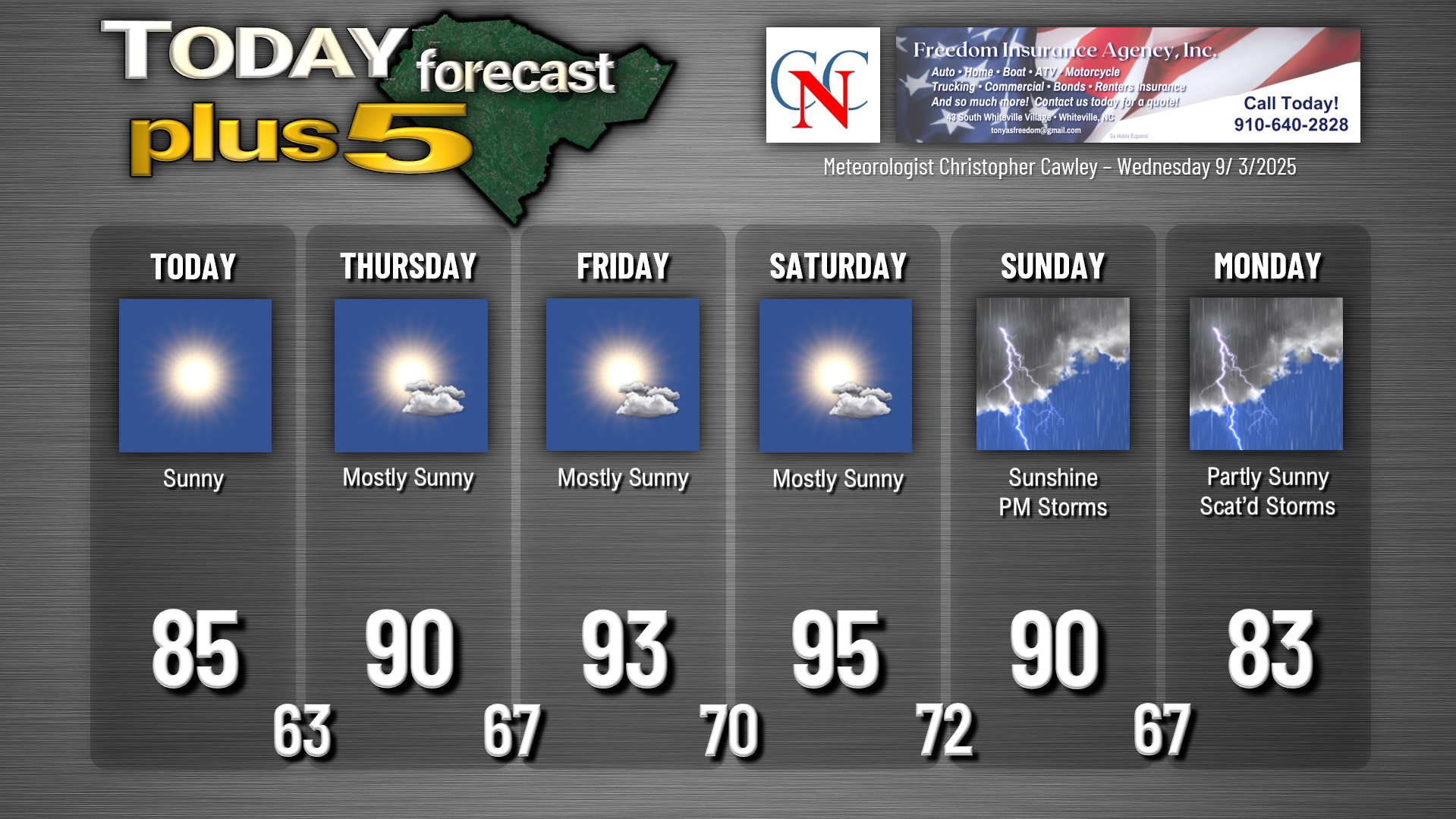
Well, folks, there really isn’t a whole lot to talk about in terms of weather. Strong high pressure will be the dominant weather factor through the end of the work week with building heat and humidity… progressively hotter temperatures each day today through Saturday.
A pair of cold fronts impacts the area this weekend. The first one will move through without much fanfare, and without much change in temperature… but it’s the second one that will mean business by Sunday afternoon/evening. Thunderstorms are possible Sunday afternoon, and especially Sunday night into Monday as the front slows down along the coast. Depending on the timing of things Sunday afternoon, we could be looking at a threat for strong storms.
The front will push farther offshore and then stall as strong high pressure builds in for next week. The placement of this frontal boundary could play a role in steering what will likely become Gabrielle in the tropics……
TROPICS: It’s becoming more and more likely that our next tropical system of the season (which will be named Gabrielle) will take shape in the south-central Atlantic over the next few days. A tropical wave off the Africa coast continues to become more organized and will move into an area very favorable for development. The NHC now gives this a 70% chance of becoming a tropical system over the next 7 days.
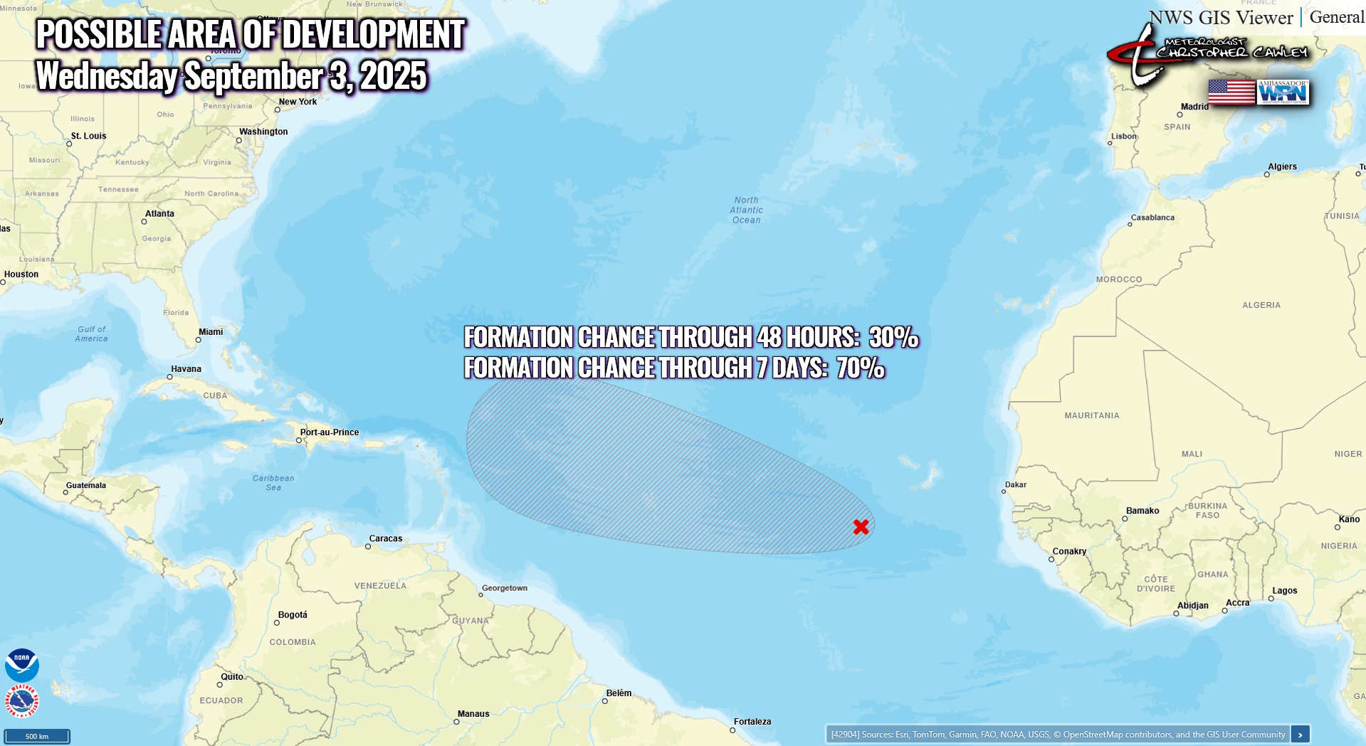
I believe this will be a storm that takes a similar flight path to Erin, in that it should move west-northwest and then likely curve to the north staying over the ocean. It’s too soon to make any call, though, and modeling is quite inconsistent because we’re talking about a system that hasn’t really come together yet. Once the system becomes organized, more data will be ingested into the model computers, and much better modeling will occur. Part of my reasoning for a northern curve will be the presence of a frontal boundary far offshore and dominant areas of high pressure over the eastern third of the country next week. Less likely is a journey more westward into the Caribbean but that can’t be ruled out either.
No matter what, there is no tropical weather threat to the Carolinas over the next week to ten days.
Here is your Freedom Insurance Today-plus-Five Forecast:
–Meteorologist Christopher Cawley