CCN Weather Update for Monday June 1, 2026
This weather update is sponsored by Freedom Insurance of Whiteville. Trust Freedom Insurance to give you clear blue skies when it comes to home, car, boat, or whatever insurance you need. Let Freedom provide customized coverage to keep you and your family safe. Contact Freedom today at 910-640-2828!
Here’s today’s Bottom Line
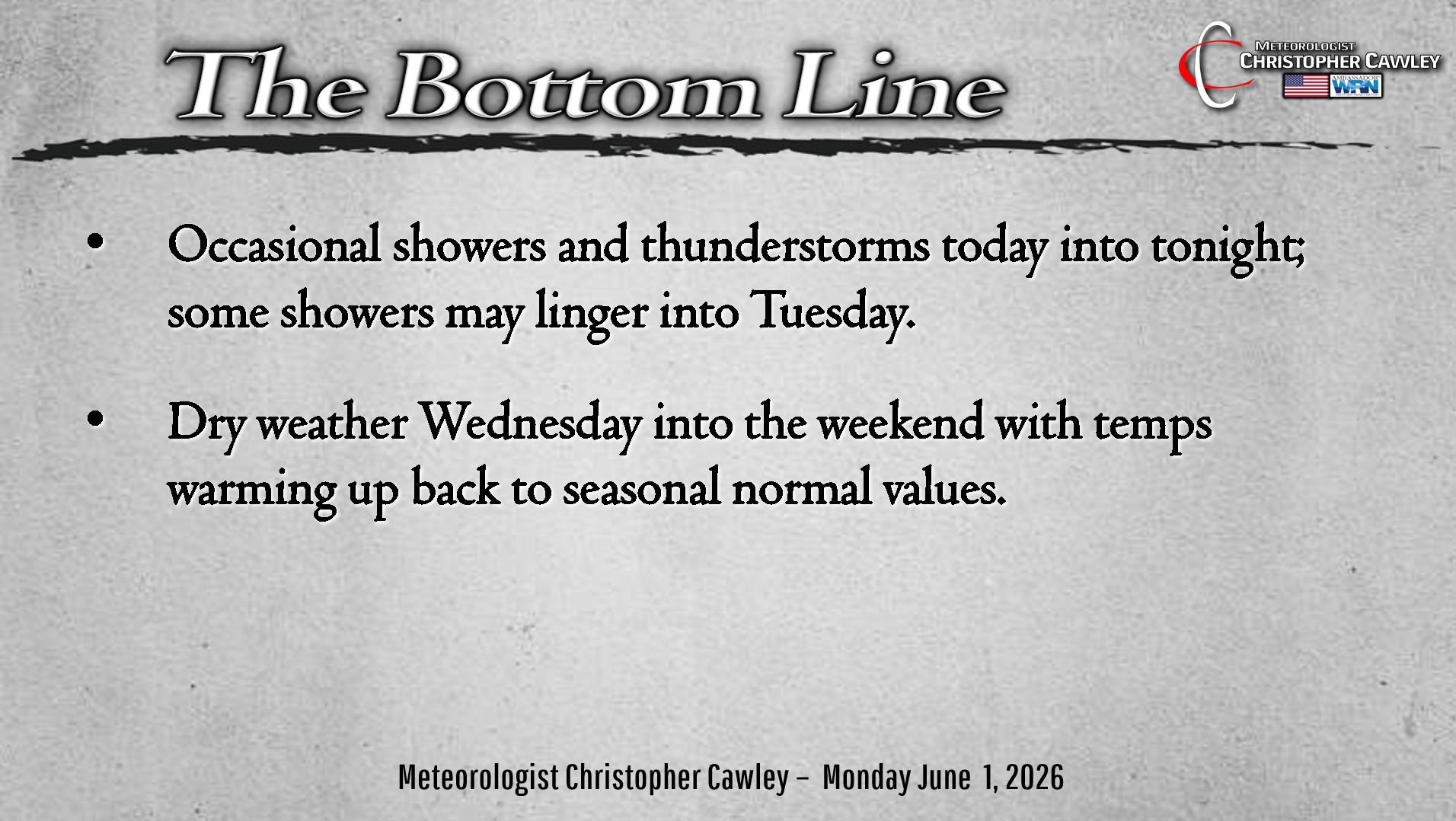
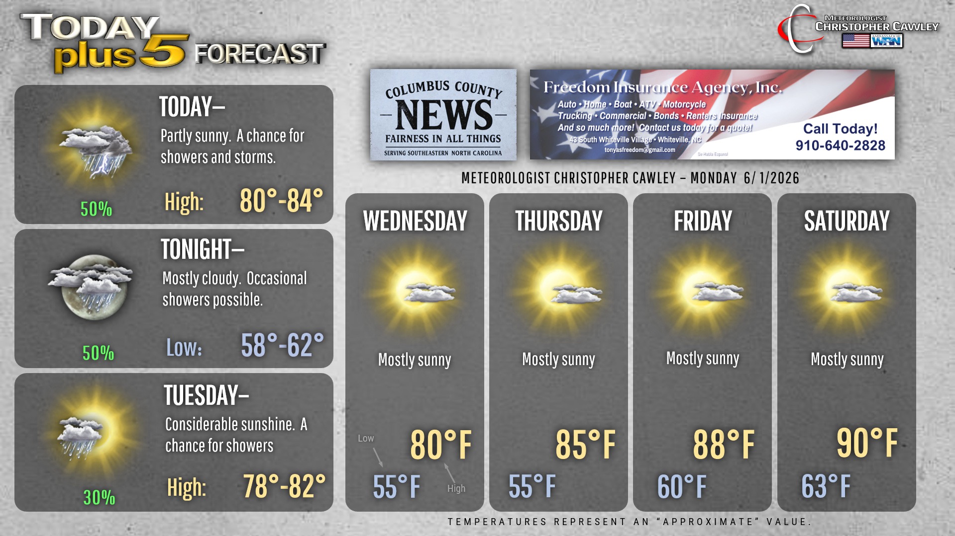
Welcome to the month of June and the official start of HURRICANE SEASON. Nothing of worry at this time in that regard, but we will have some unsettled weather about the area today through tonight.
A weak area of low pressure will lift northeast along the coast today. This could bring one round of showers to the area this morning. We should then see a lull in the action through the afternoon before a cold front moves through this evening. High-res modeling suggests this brings a broken line of showers and storms to the area this evening, with a few showers lingering overnight and possibly into Tuesday morning.
It’ll be cooler once again behind the front on Tuesday with highs in the upper 70s to around 80. Temps during the overnight into early Wednesday will be in the lower to middle 50s about the area, about 8-10 degrees below seasonal normal lows.
Strong high pressure then takes hold for the remainder of the week and into the weekend. Temperatures and humidity will start off a little cooler than seasonal normal values but will quickly rise as we go into the coming weekend.
TROPICAL UPDATE: As today is the start of the Atlantic hurricane season, I will be adding a “tropical update” to the daily weather update. The weak area of low pressure lifting up the coast is along a frontal boundary, and is of no threat. There are no other tropical threats at this time.
Here is your Freedom Insurance Today-plus-Five Forecast:
–Meteorologist Christopher Cawley