CCN Weather Update for Saturday June 13, 2026
This weather update is sponsored by Freedom Insurance of Whiteville. Trust Freedom Insurance to give you clear blue skies when it comes to home, car, boat, or whatever insurance you need. Let Freedom provide customized coverage to keep you and your family safe. Contact Freedom today at 910-640-2828!
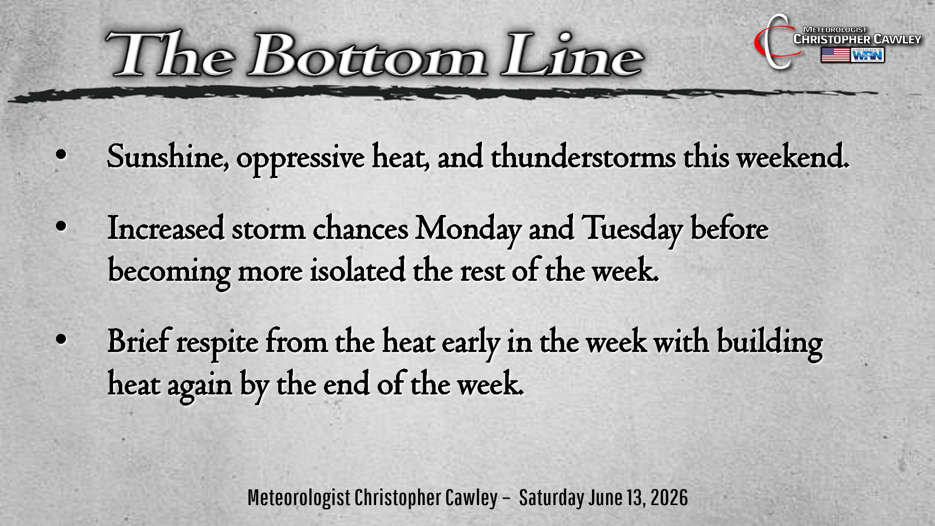
Here’s today’s Bottom Line
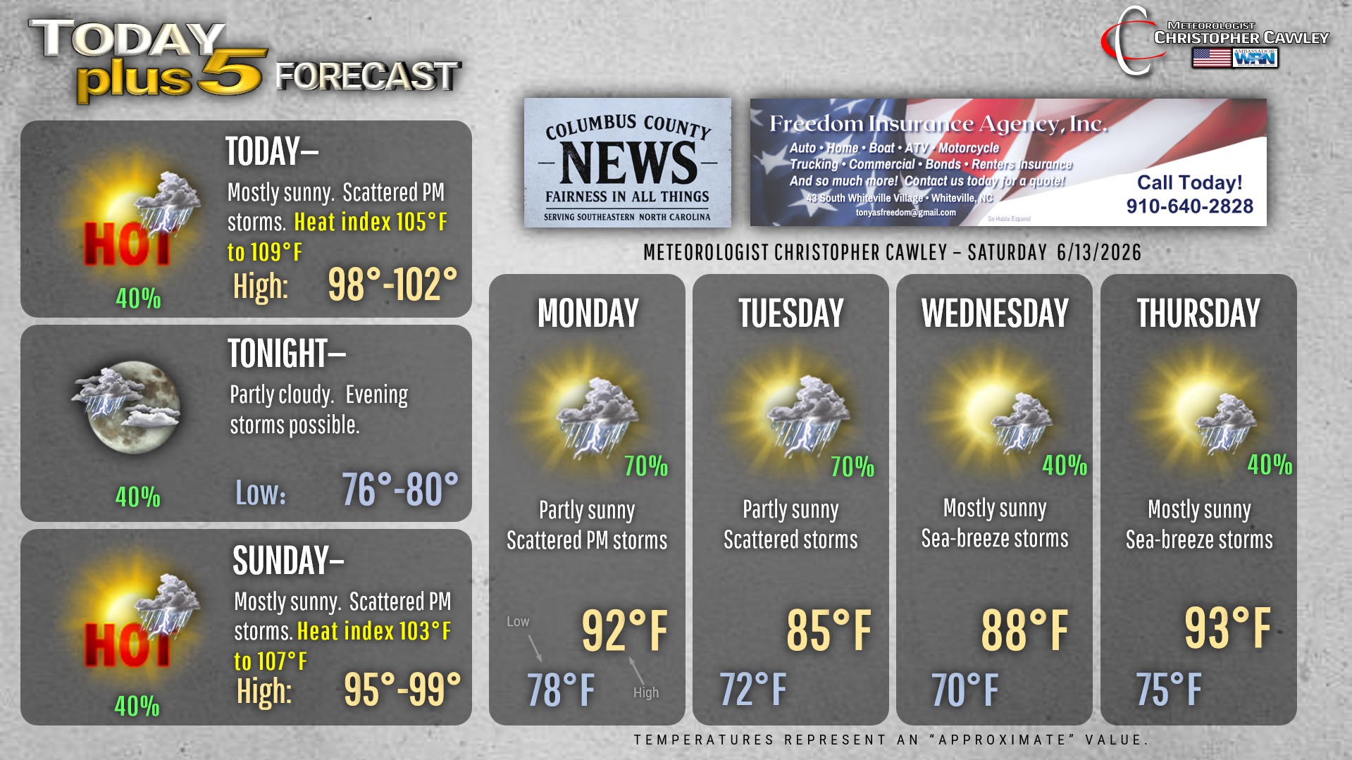
Strong high pressure ridging will slowly shift east and allow a weak frontal boundary (if you want to call it that) today. Very hot temperatures will continue this weekend but with the front in the area, thunderstorm chances will also be in place this afternoon and evening, and again Sunday afternoon and evening.
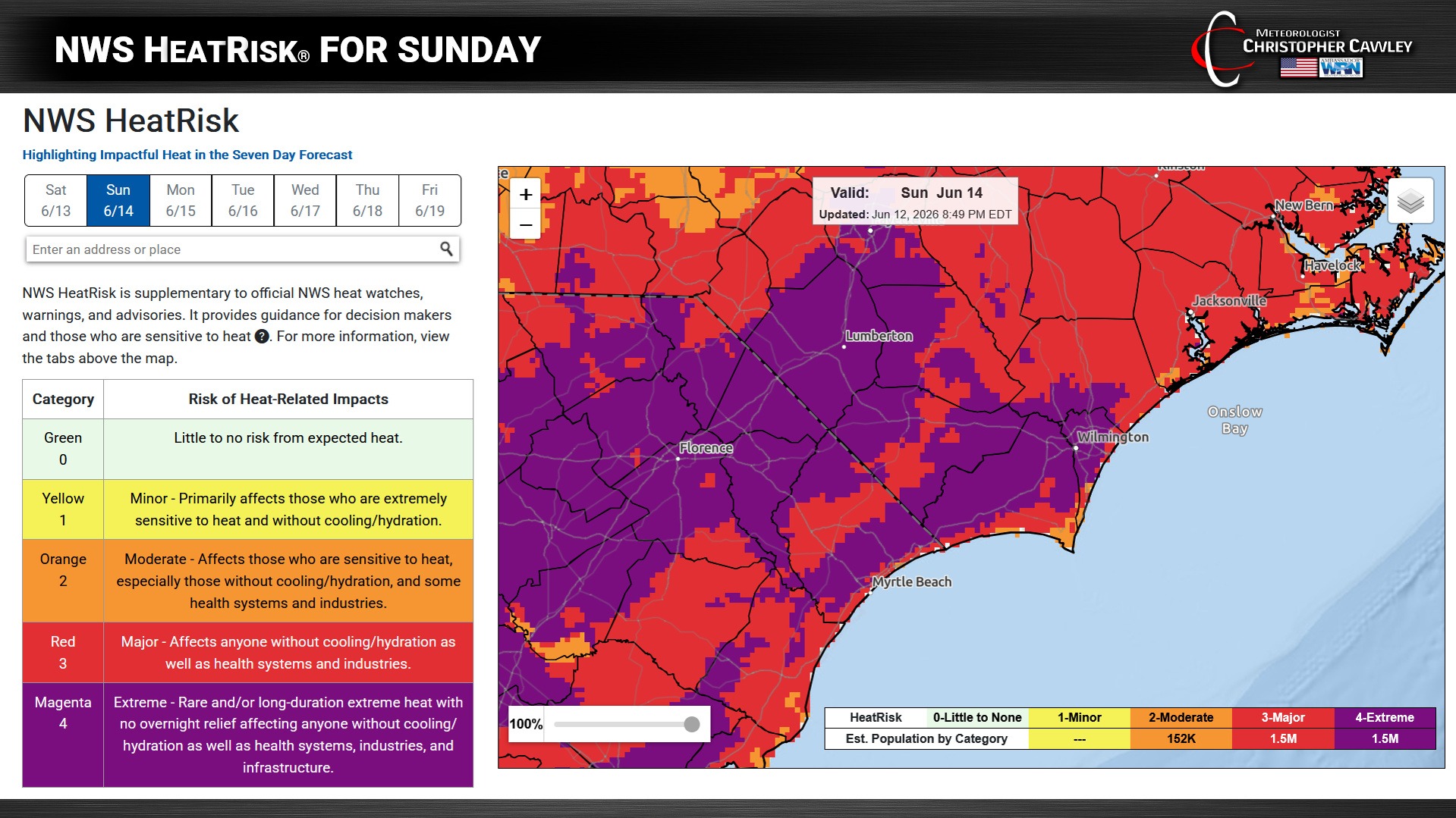
The heat will be impressive once again with heat index values likely north of 105 degrees, with actual air temps right around the Misery Mark. Slightly cooler on Sunday.
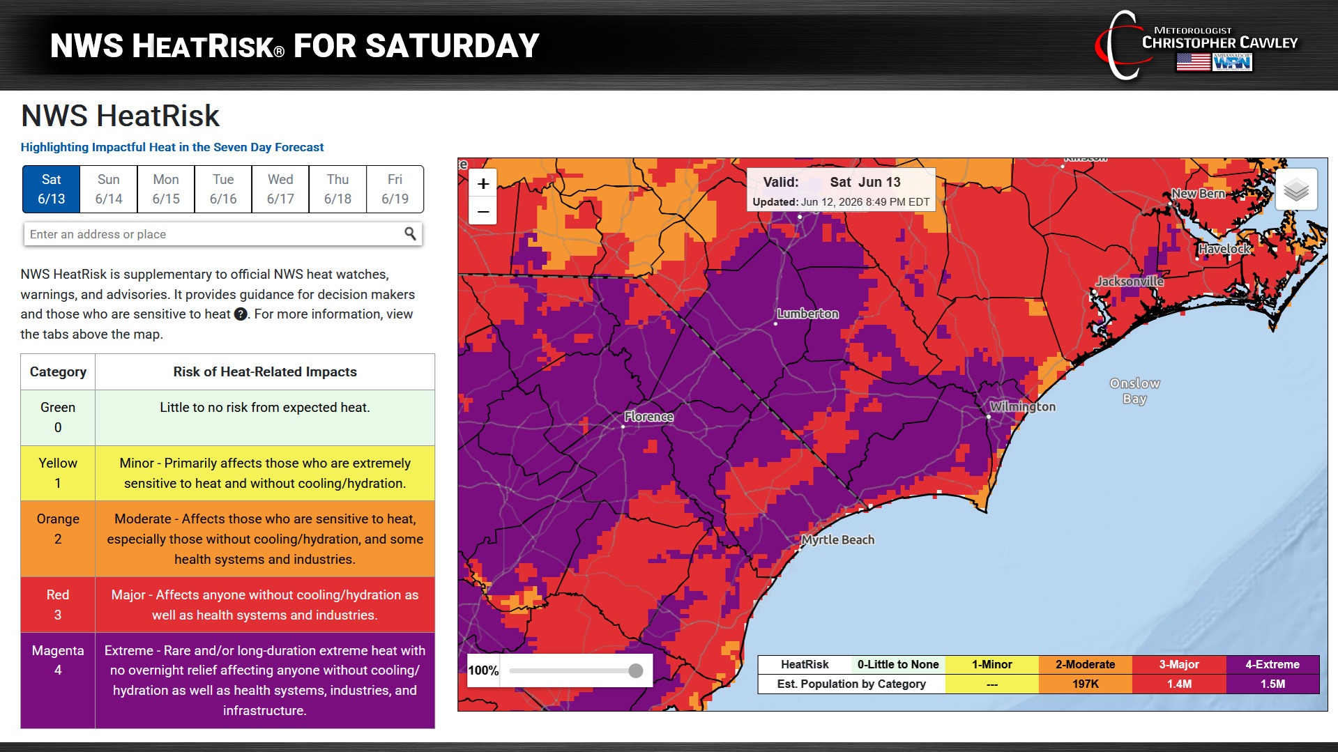
This afternoon’s storm threat develops along the sea-breeze after about 2 PM pushing inland from the coast. These will be the typical summertime thunderstorms that produce copious amounts of rainfall over isolated areas along with nearly constant lightning.
Short-term modeling suggests Sunday afternoon will feature another round of storms firing on the sea-breeze, followed by a broken line of storms late Sunday evening with the frontal boundary in place.
This front will likely cross the area before stalling and dissipating along or just off the coast. A general southerly flow of tropical moisture from the Gulf will bring scattered to numerous showers and storms Monday and Tuesday before another cold front crosses the area.
Temps start to rebound on Wednesday and Thursday as our wind flow becomes zonal (west-to-east) with building heat and reduced thunderstorm potential.
Here is your Freedom Insurance Today-plus-Five Forecast:
–Meteorologist Christopher Cawley