Hello friends and neighbors, welcome to the FRIDAY edition of the CCN Daily Weather Update! What a remarkable week this has been in the weather department, and I want to say THANK YOU for trusting us at Columbus County News in keeping you updated and informed.
Sponsoring this weather update is Freedom Insurance in Whiteville, NC. Freedom insurance can provide you with all of your insurance needs, from auto to boat to homeowners to life insurance. Their friendly and professional staff are laser-focused on customer service and will work with you to write the perfect policy for your needs. Contact Freedom today at 910-640-2828.
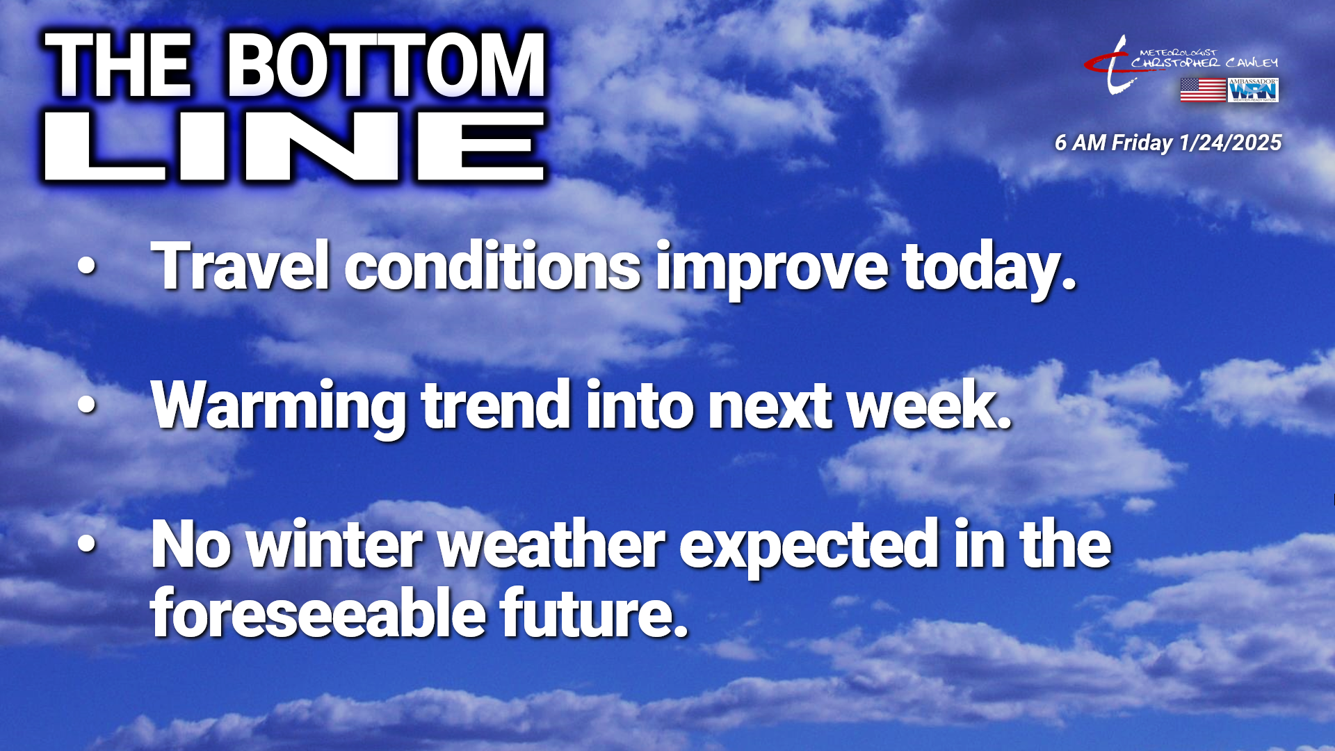
The Bottom Line —
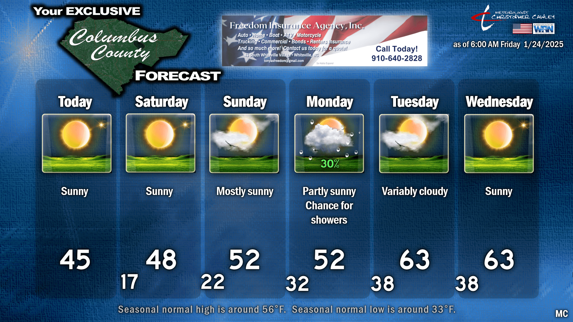
Travel conditions will greatly improve throughout the day as bright sunshine will provide radiating effects at the ground level, and our temperatures should push into the lower and middle 40s. There are some areas, however, on secondary and tertiary roads that are covered in thick, solid ice, so it’s going to take a few minutes for them to clear up. This is especially true in areas that are shaded and don’t receive a lot of sunlight. Many areas were clear and dry as of Thursday afternoon… clear and dry until you go around a corner and there’s that skating rink. So please use caution when traveling the secondaries today. Let nature do the work, the ice will melt, and all will return to normal by the end of the weekend.
Sprawling high pressure extending from Pennsylvania to the Gulf coast will slowly push overhead this weekend. Tonight will feature bitter cold temps once again; I’m going lower than the MOS guidance given the snow still on the ground, which acts as a refrigerator. So I’m going upper teens tonight. I’m just as sick of it as yall, but hang in there… I don’t think we’ll be in the teens anymore for the foreseeable future after tonight. Once again, anything still “wet” on our roads will freeze.
High pressure drifts offshore by Sunday and into Monday allowing a southerly flow to develop. Temperatures FINALLY break into the 50s by Sunday, but still run a touch below seasonal normal values. A frontal boundary approaches from the northwest on Monday. That southerly flow brings a chance for some showers (rain showers) Monday afternoon… but I’m still not convinced that it’s going to be anything more than enough to wet the ground.
The atmospheric wind flow becomes parallel to the frontal boundary and causes the front to stall over central NC. There’s such limited moisture with this that I think the only effects we will have on Tuesday will be some bright white cumulus clouds in the sky. Guidance shows our temperatures jump into the 60s (!!) Tuesday and Wednesday next week as the front stays to our north. There’s a bit of uncertainty with this; if the front drops south of us, knock about 10 degrees off those numbers.
Here’s my 6-day forecast chart for Whiteville.
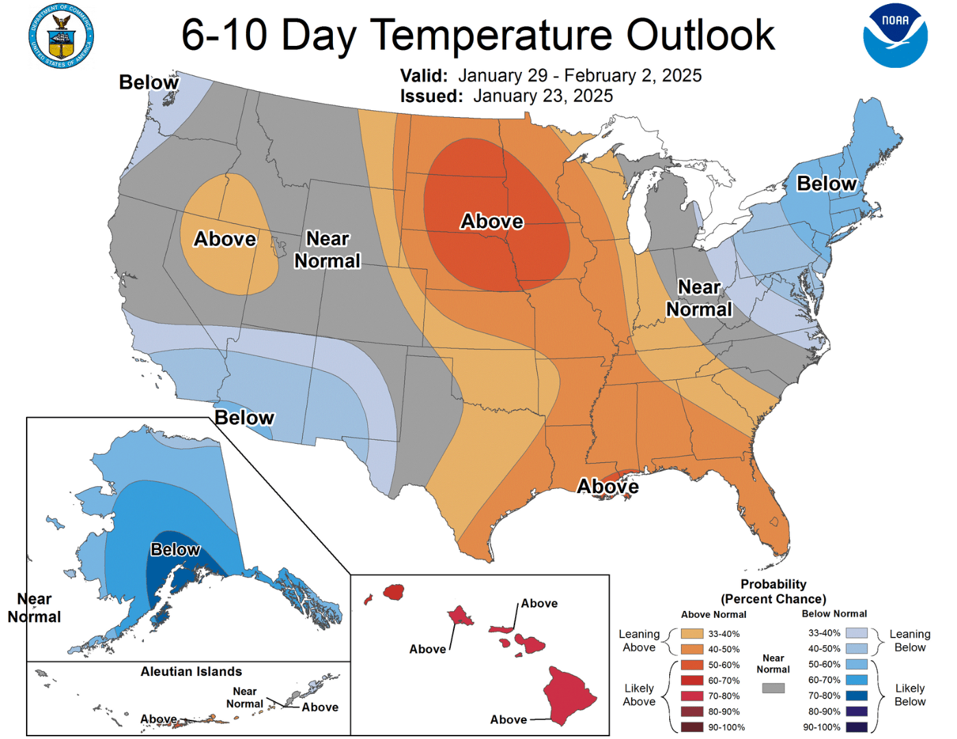
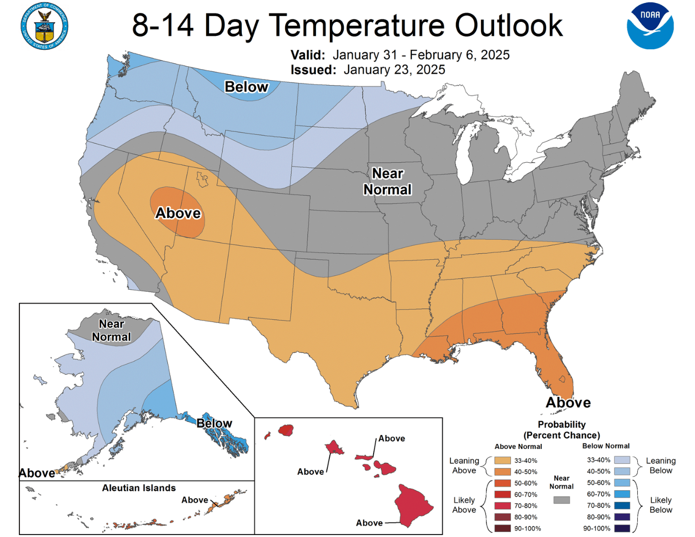
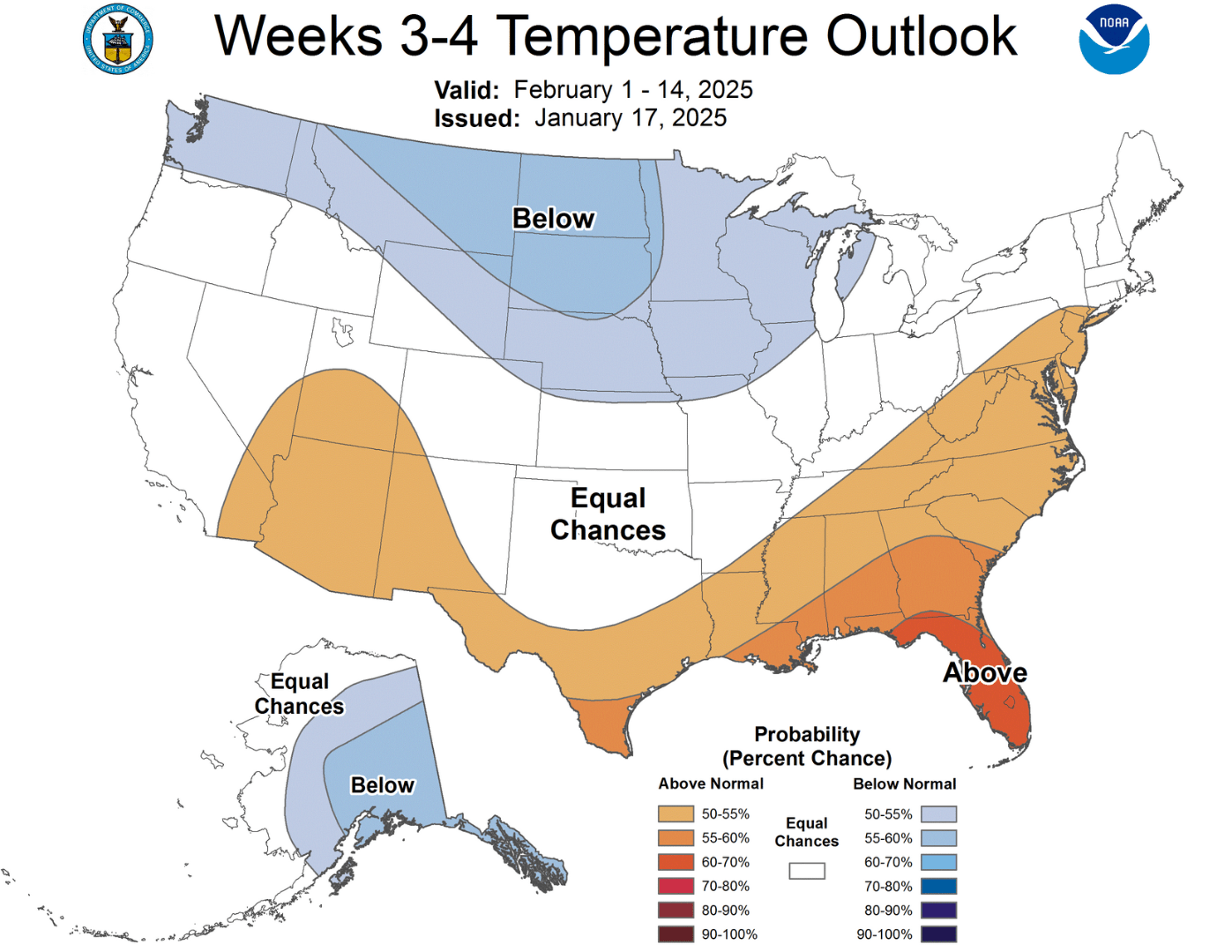
Looking farther ahead into the first part of February…. NO winter weather systems are visible on the horizon. The Climate Prediction Center is going with normal- to above-normal temperatures going into the first few weeks of February.
Normal high/low for Whiteville—
February 1st: Normal high 57, normal low 36.
February 10th: Normal high 59, normal low 38.
February 15th: Normal high 60, normal low 38.
CPC temperature outlook—
January 29-February 2
January 31-February 6
February 1-14
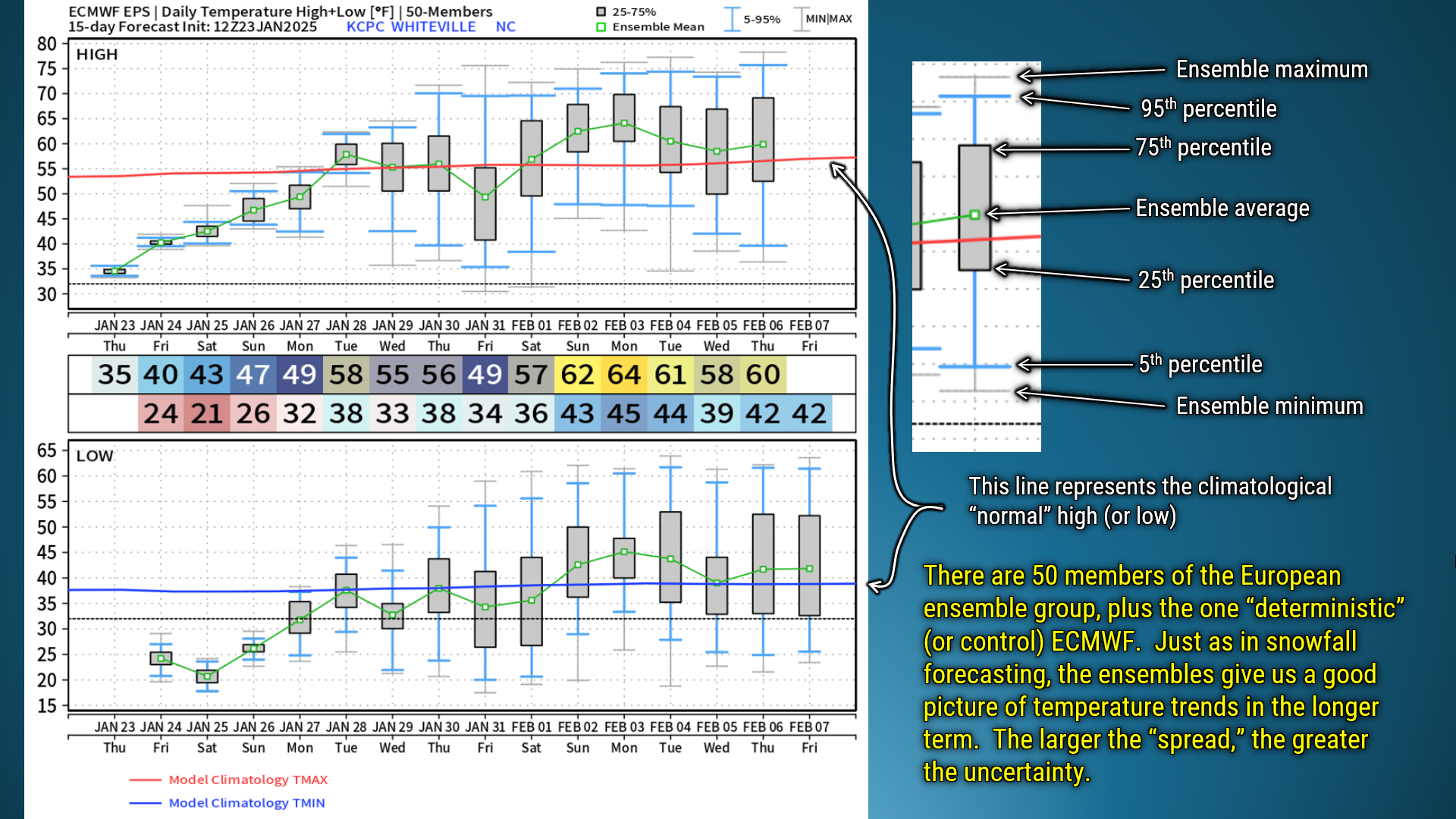
Going into the snowstorm, I spoke often about ensemble modeling. Meteorologists use the ensemble modeling to look at long-term TRENDS, to get a general picture of where we are going. We can use ensembles for temperature trends as well.
Here’s the European EPS (ensemble) data for temperatures through February 6:
On the slide I put a little bit of an explanation of what you’re looking at here. This is yet another “peek behind the curtain” at tools forecasters use. There is a LOT of model spread with our temperatures once we get to January 29th and beyond. THIS IS NORMAL. There’s going to be a wider spread the farther out in time you go. This is also reason 342 why phone weather apps that have “16 day” forecasts are a bit of a joke; those apps are giving you deterministic model data, likely GFS, that take no ensemble data into consideration.
So that’s just a brief little look at one more thing I take account of when doing forecasting. It’s not just putting numbers on a graphic and calling it a day.
That’ll wrap up today’s post. Thank you for reading and sharing, thank you for supporting Freedom Insurance, thank you for supporting Columbus County News, and as always, take care.
~Meteorologist Christopher Cawley

