CCN Weather Update for Saturday, the 19th of July, 2025.
This weather update is sponsored by Freedom Insurance of Whiteville. No weather worries with Freedom Insurance. For home, car, boat, or whatever you need, Freedom can provide customized coverage to keep you and your family safe. Contact Freedom today at 910-640-2828!
Yesterday’s numbers from my weather station in central Whiteville—

We also picked up half an inch of rainfall from the thunderstorm that rolled through during the afternoon. The heat index peaked at 111.5°F.
View real-time data from the weather station at College Street Weather Station.
Here’s today’s Bottom Line
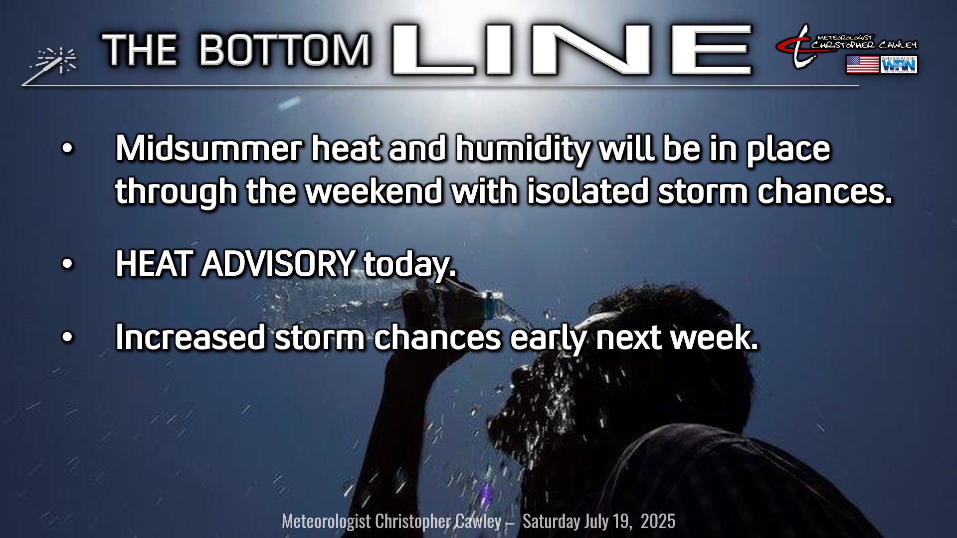
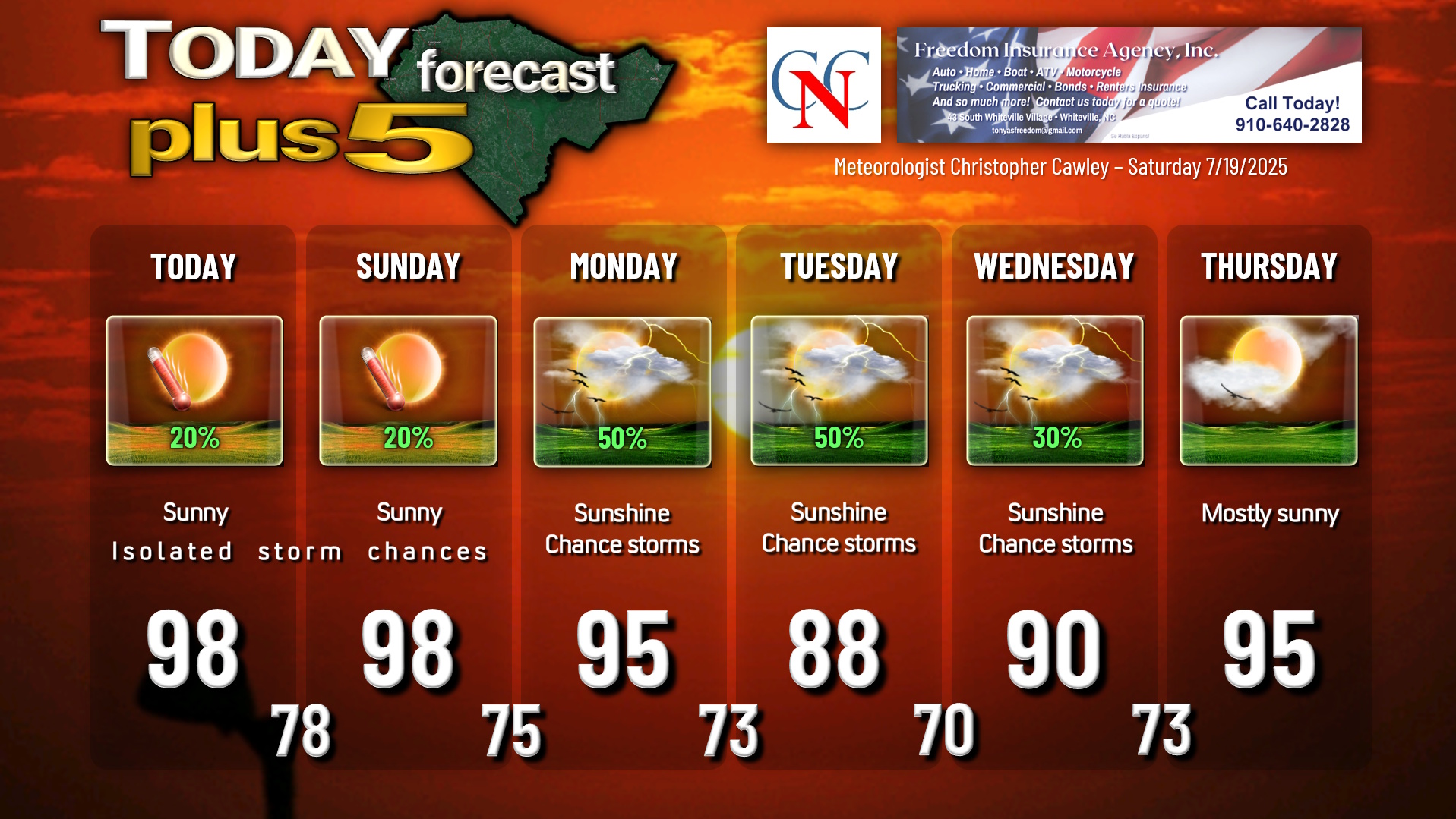
Essentially a cut-and-paste from yesterday’s report as nothing has changed. The weather we had yesterday, we’re likely to experience once again today and once again on Sunday. Bermuda high pressure ridge will remain in place through the weekend, with a dangerous combination of heat and humidity. Widely scattered thunderstorms are possible.
An impressive thunderstorm cluster impacted much of central Columbus County yesterday. I didn’t see any reports of wind or lightning damage, but there was a considerable amount of lightning. Any storm that forms today will be similar in nature: A torrential downpour and nearly continuous cloud-to-ground lightning.
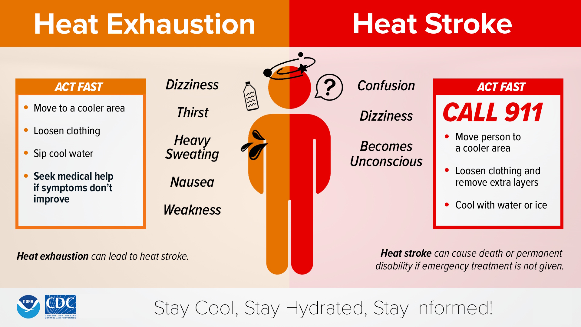
A HEAT ADVISORY is up for today, as airport heat index values reach between 105°F and 109°F. Heat index values downtown, where people actually live and work, will be higher this afternoon. Actual high temperatures, like yesterday, will be in the 96°F to 100°F range.
Heat advisories are probable for Sunday as well. Remember, heat stroke symptoms are a medical emergency.
Thunderstorm chances increase early next week as a cold front drops south over the area on Tuesday. Slightly cooler temps Tuesday and Wednesday won’t last long as Bermuda high pressure regains full control toward the end of next week… with additional above-normal temperatures and probable heat advisory conditions.
TROPICAL OUTLOOK: An area of low pressure / tropical wave about 800 miles southwest of the Cabo Verde Islands could develop into a tropical system in the south-central Atlantic over the next 7 days. No impacts to the Carolinas.
Here is your Freedom Insurance Today-plus-Five Forecast:
–Meteorologist Christopher Cawley