

CCN Weather Update for Saturday September 27, 2025.
This may be the longest blog post since I’ve been writing them. Please stay with it and read all the way through.
This weather update is sponsored by Freedom Insurance of Whiteville. No weather worries with Freedom Insurance. For home, car, boat, or whatever you need, Freedom can provide customized coverage to keep you and your family safe. Contact Freedom today at 910-640-2828!
Preparations should continue for a POTENTIAL land-falling tropical cyclone early next week.
Here’s today’s Bottom Line
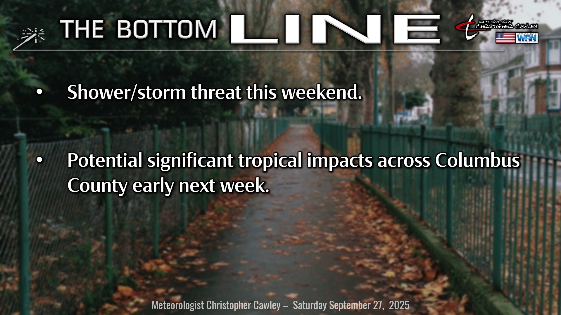
SHORT TERM: A frontal system crosses the area between today and tomorrow with scattered to numerous showers and thunderstorms.
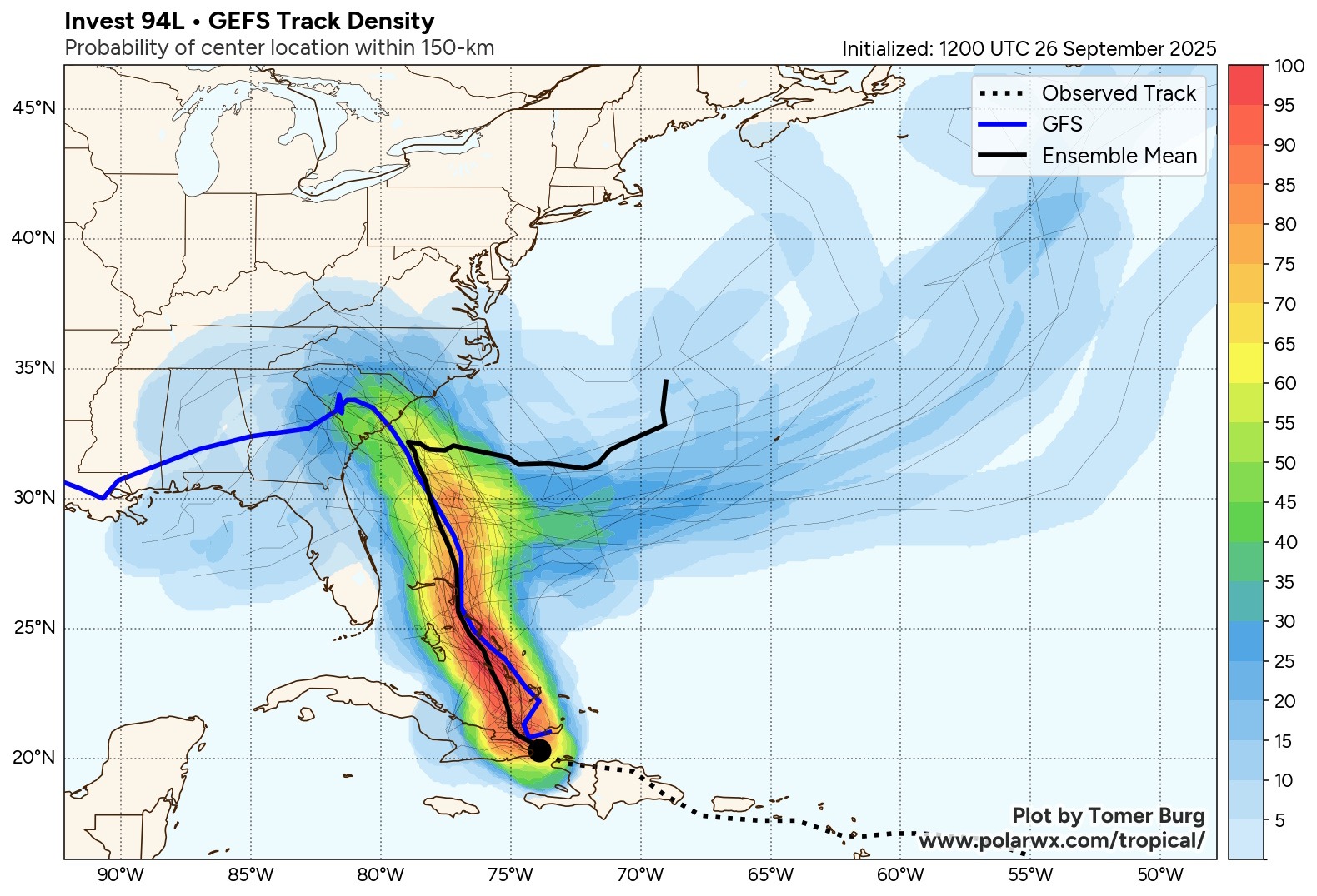
TROPICS: There is *STILL* a lot of uncertainty with regards to the future-Imelda (just going to go ahead and call her Imelda from here on out).
Two scenarios continue to be in place.
Scenario 1: Imelda moves north-northwestward and makes landfall somewhere along the South Carolina coast, maybe Brunswick County NC? The NHC cone of uncertainty is absolutely HUGE which represents the high uncertainty here. Anyway… the first scenario is that of a land-falling tropical cyclone and all the fun that comes with that. More on that in a minute.
Scenario 2: Shown by a handful of models, including the Canadian and assorted AI models… Imelda creeps very slowly north-northwestward, but moves so slowly that she loses the “chance” to be pulled toward land… and instead is yanked eastward by the larger circulation with Hurricane Humberto. Scenario #2 means no landfall, less rain/wind/flooding, etc.
Soooo which one? I’m going with 60/40 odds leaning toward scenario 1. The National Hurricane Center’s outlook brings Imelda north-northwestward and then slows down and … kind of wobbles just offshore. From there, who knows? The large cone of uncertainty takes into account the other possibility that Imelda takes a hard-right turn and moves out to sea. The NHC also suggests a MASSIVE pumping of the brakes… with Imelda still lingering just offshore by WEDNESDAY.
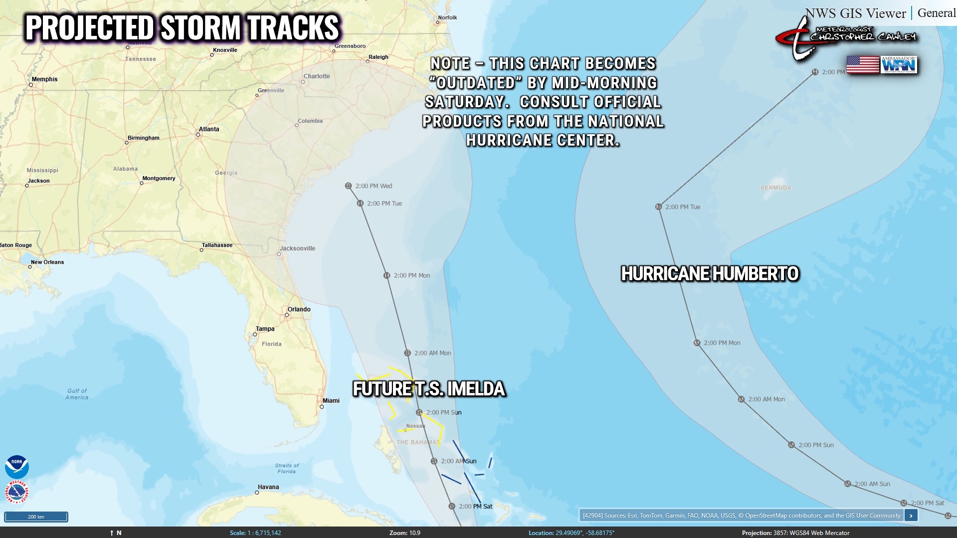
This is an extraordinarily difficult forecast. Check out this image from Friday evening and see if YOU could make a decision.
Factors influencing Imelda’s trajectory include a) the upper level low centered over the deep south; b) a shortwave trough extending from a high pressure ridge over the Great Lakes; c) the remnant frontal boundary offshore; d) Hurricane Humberto.
Much more detail will be ascertained as we move through the day today and as Imelda officially comes to life. Hurricane hunter aircraft will be investigating the storm on a near-continual basis, which will help feed much more data into the global and regional computer modeling.
I would err on the side of safety and say plan on a land-falling high-end tropical storm or possibly low-end cat-1 hurricane … probably on Tuesday… but could be as soon as Monday afternoon or even Wednesday or Thursday, like mentioned above.
Should that be the case, here are some of the impacts we could expect for Columbus County.
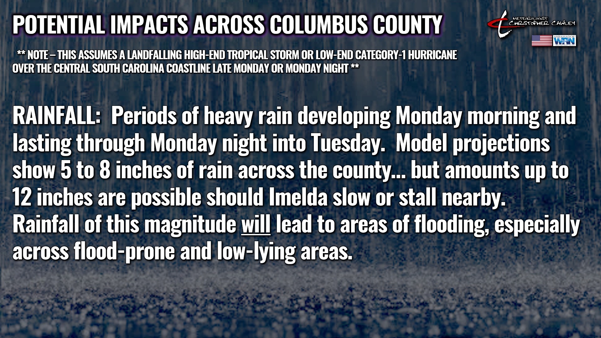
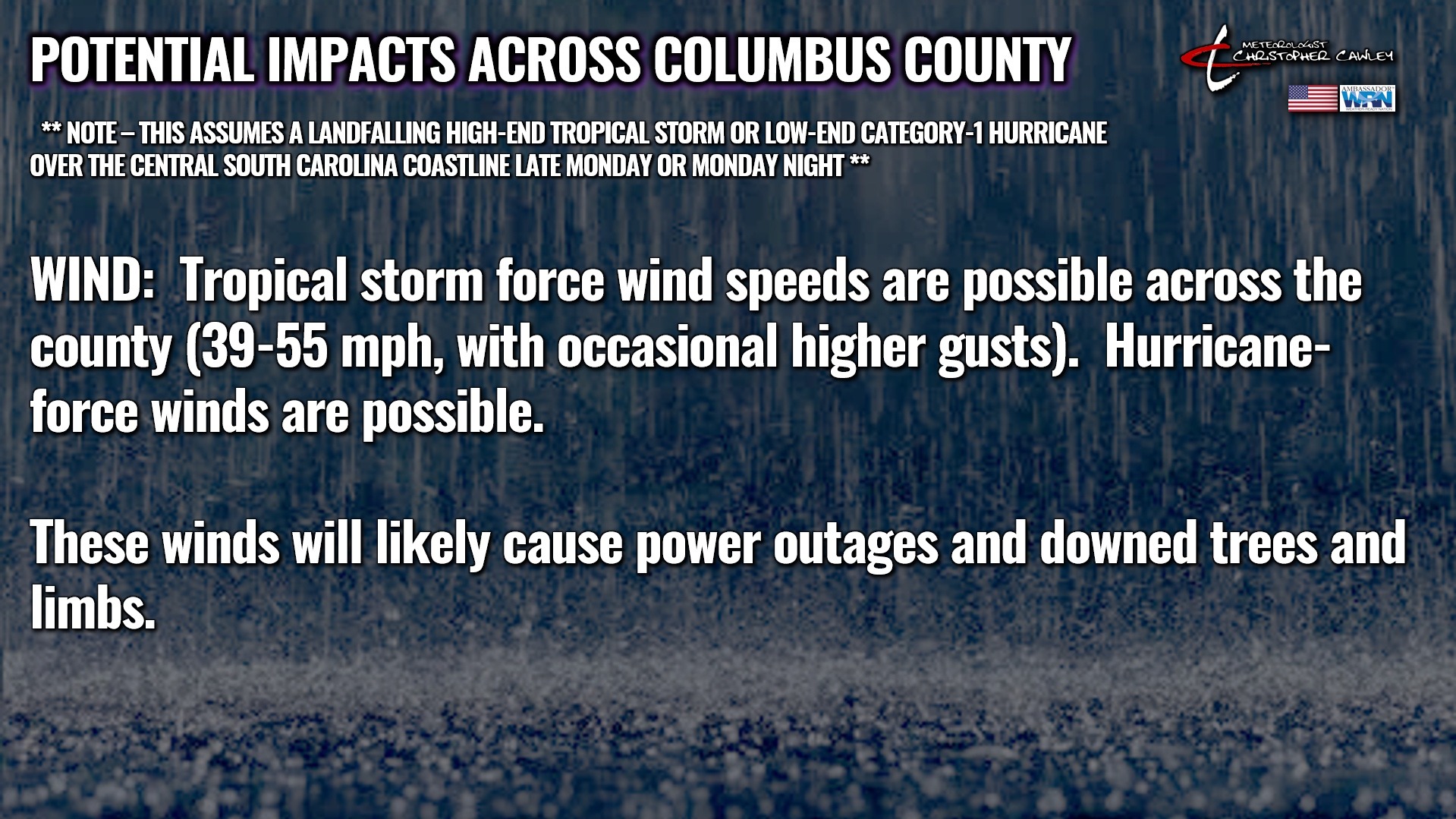
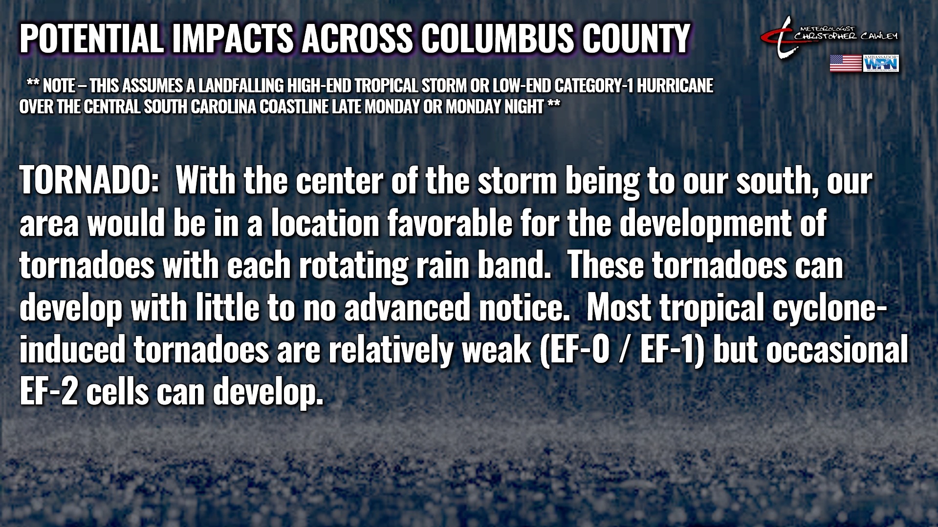
PLEASE NOTE — The IMPACTS graphics above are assuming a landfall late Monday or Monday night, which is earlier than current NHC projections.
I know it’s frustrating with this lack of certainty or lack of clarity in the forecasting. This is one of the most difficult and challenging forecast scenarios I’ve ever encountered. And I’m not even going to pretend to put myself on a level with those experts who are employed by the NWS and the National Hurricane Center. Nor do I envy them.
That is why you should be relying on OFFICIAL SOURCES — degreed meteorologists — not people on Facebook calling themselves authorities or experts. Honestly I would even lean away from outlets like The Weather Channel and Accuweather, as they are not LOCAL meteorologists.
And you already know my stance about phone weather apps. 😉 For entertainment purposes only.
Take a deep breath, friends. This isn’t Helene, or Florence, or Matthew. Don’t compare storms, that’s foolish and a waste of time. Going into a panic is also foolish and nonproductive.
Get prepared for the POSSIBILITY of heavy rain and wind the first half of next week. Get prepared for potential power outages and downed trees. Get prepared for flooding (especially in Whiteville).
But also be aware that the Monday through Wednesday period next week may be mostly sunny and dry.
I will keep you up to date as much as possible on my social media page, and I will post a special Sunday “weather update” here on Columbus County News.
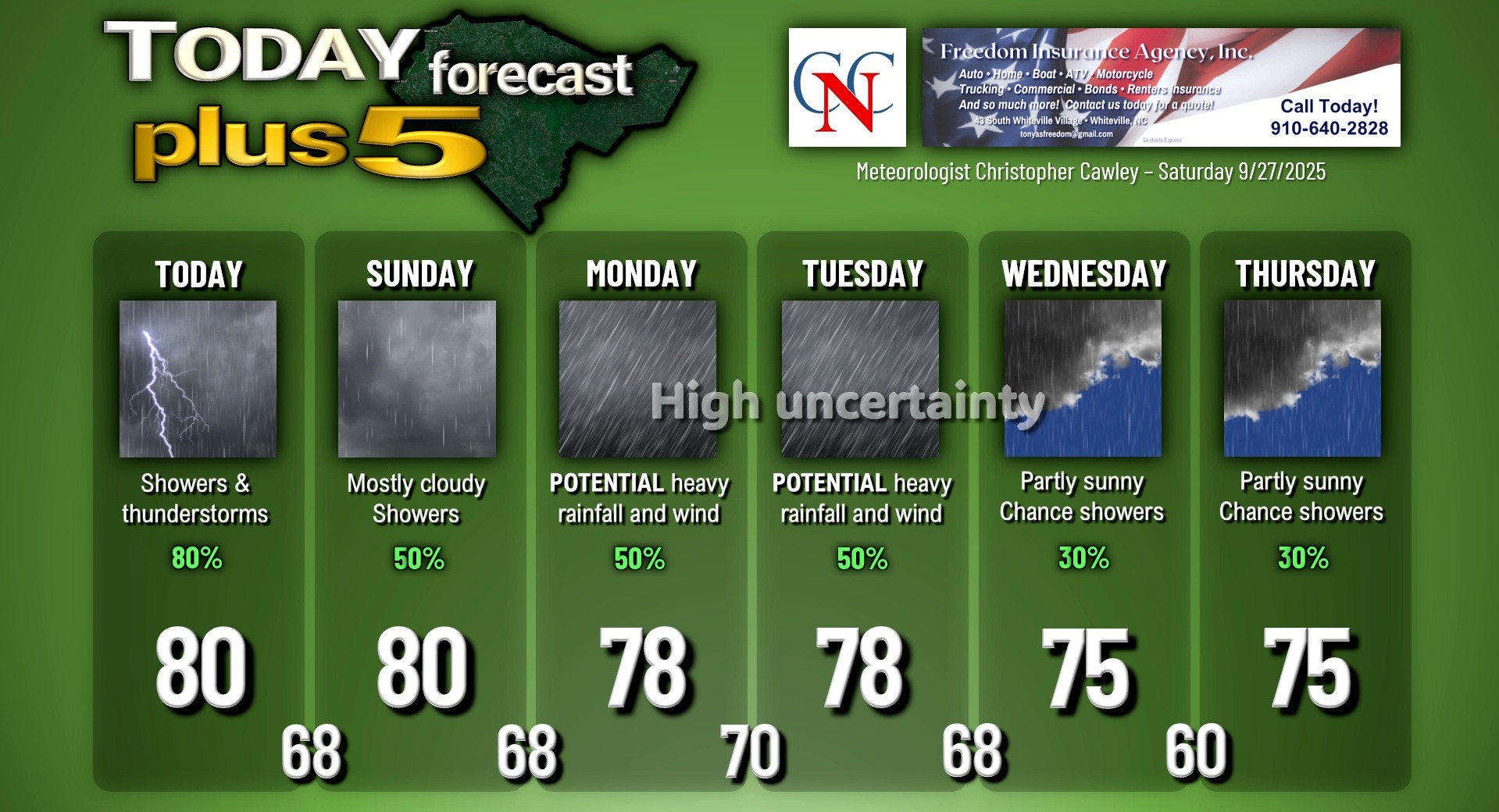
Here is your Freedom Insurance Today-plus-Five Forecast:
–Meteorologist Christopher Cawley