

CCN Weather Update for Tuesday October 14, 2025.
This weather update is sponsored by Freedom Insurance of Whiteville. No weather worries with Freedom Insurance. For home, car, boat, or whatever you need, Freedom can provide customized coverage to keep you and your family safe. Contact Freedom today at 910-640-2828!
Here’s today’s Bottom Line
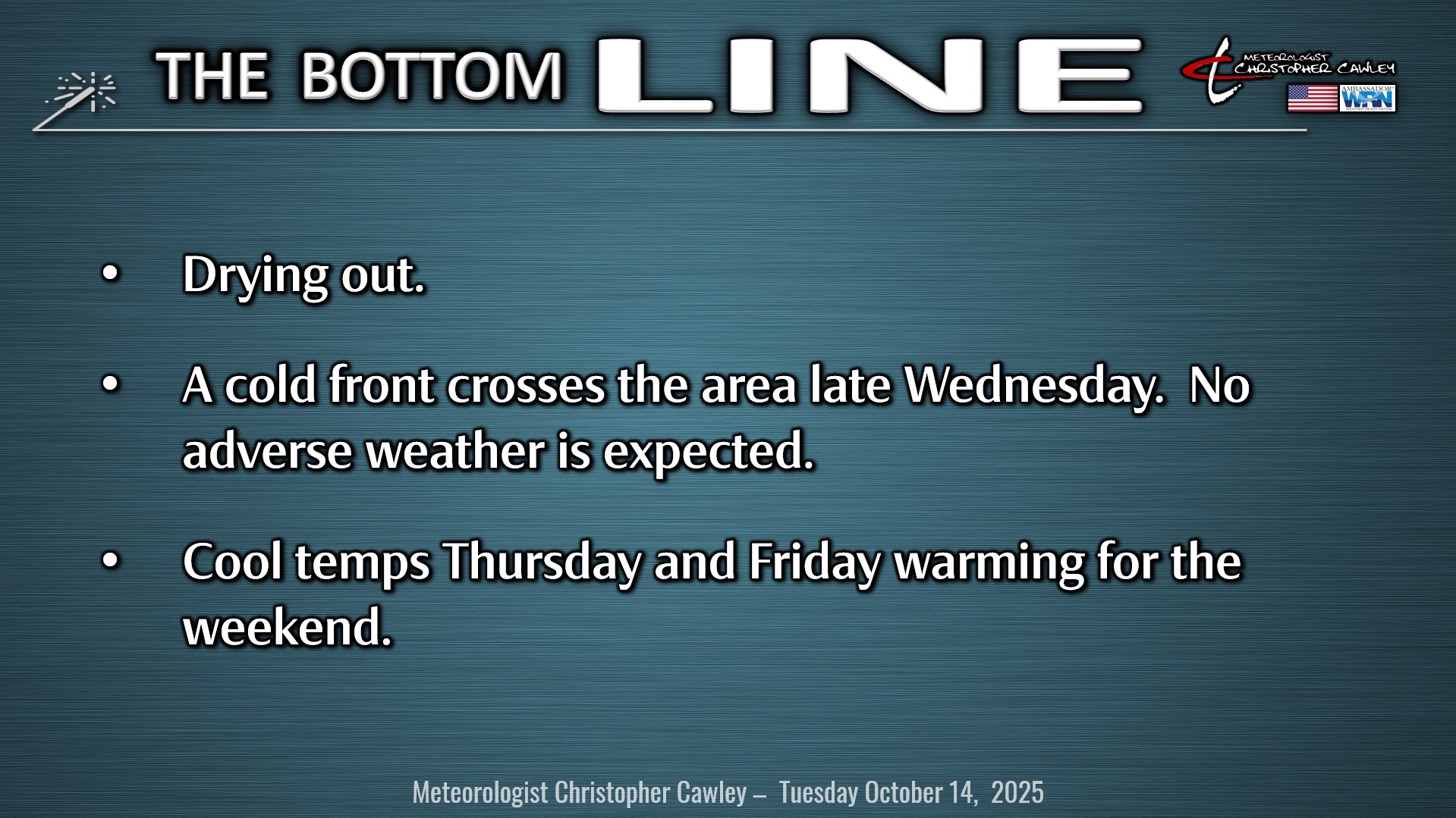
Drying out. That’s the forecast for today. Drying out. High pressure will slide eastward across the Gulf Coast states allowing for sunny, dry weather through today into Wednesday.
A cold front pushes across the area late Wednesday with little fanfare, but it will drop our temps for Thursday and Friday; high pressure of Canadian origin pushes southeastward from Ontario to central Virginia by Friday. The high continues to drop southward off the NC coast by Saturday allowing a return flow of warmer and more moist air from the south. Yet another cold front then appears to push through the area by the end of the weekend. Only slight shower chances with this front.
TROPICS: We have tropical storm Lorenzo over the tropical Atlantic ocean. He is rather poorly organized but does have a closed circulation center and TS force winds. This system will lift to the north over the central Atlantic before veering to the right as we move into the weekend… and some of the spaghetti plots illustrate a bit of a loop-de-loop and then heading west (see graphic). Whether or not he survives that journey is the ultimate question… I’m hedging my bets that he doesn’t.
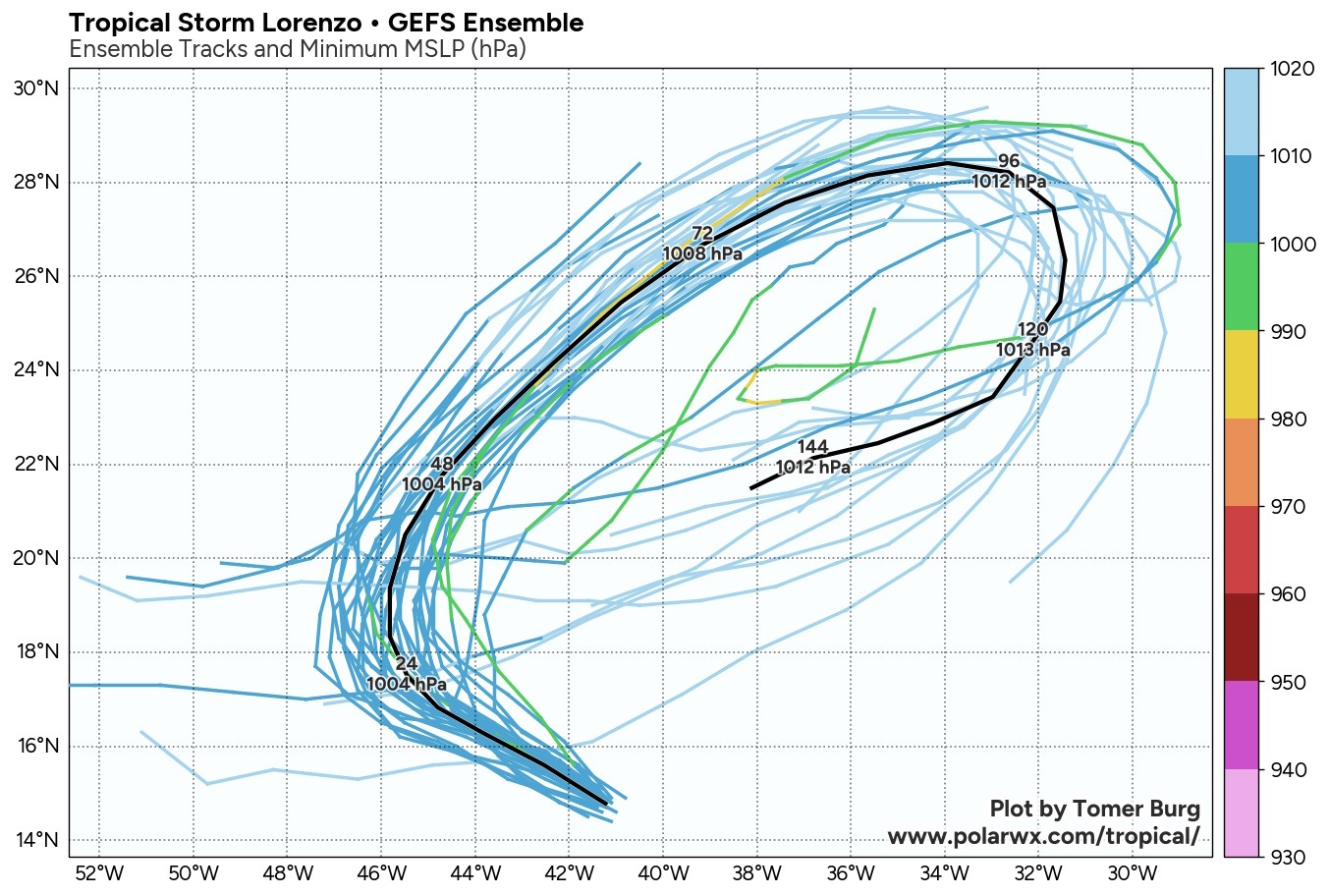
Aside from this, there are no other areas of interest right now. Modeling is hinting, though, that things could start looking interesting in the central Caribbean toward the latter part of the month.
There are no tropical threats to the Carolinas for the foreseeable future.
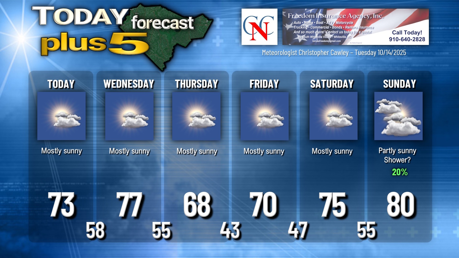
Here is your Freedom Insurance Today-plus-Five Forecast:
It has now been a full year that I have been writing the CCN Weather Update. Thank you for your continued support.
–Meteorologist Christopher Cawley