
CCN Weather Update for Tuesday November 4, 2025, ELECTION DAY!
This weather update is sponsored by Freedom Insurance of Whiteville. Trust Freedom Insurance to give you clear blue skies when it comes to home, car, boat, or whatever insurance you need. Let Freedom provide customized coverage to keep you and your family safe. Contact Freedom today at 910-640-2828!
Here’s today’s Bottom Line
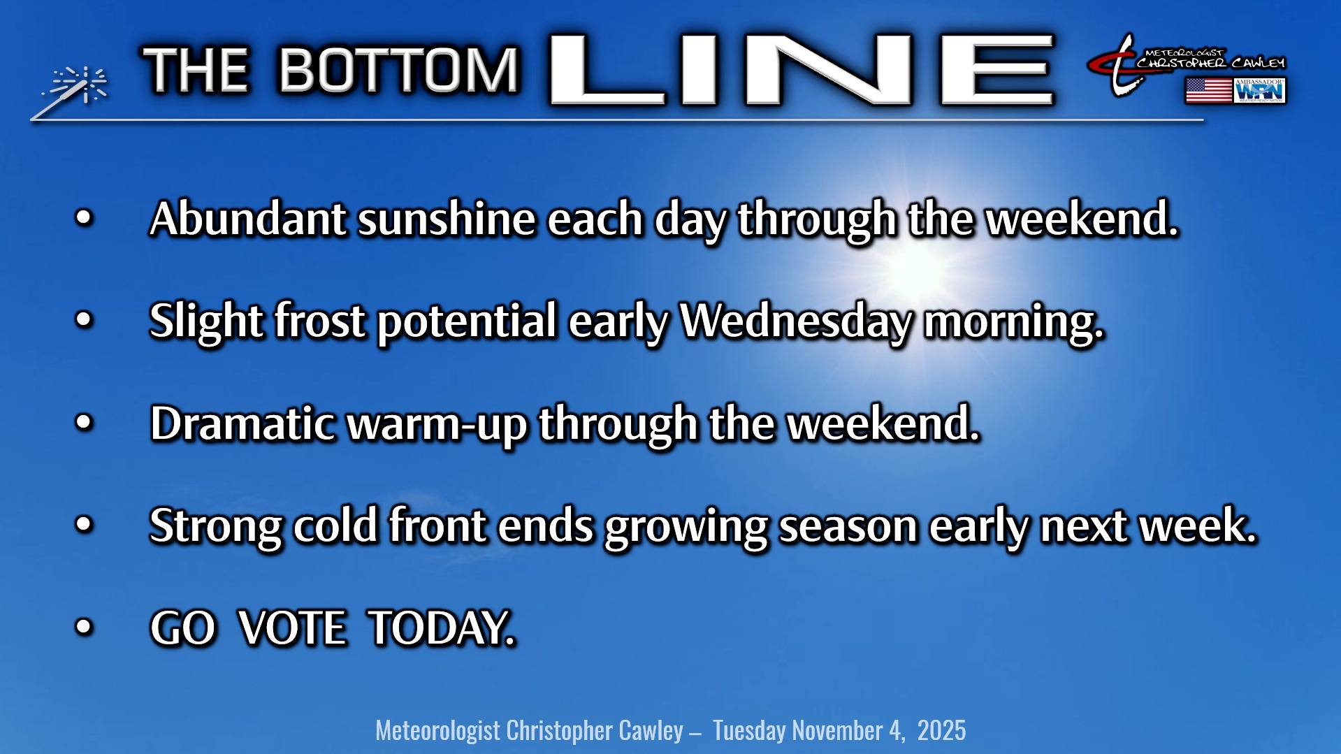
No weather concerns to go vote today.
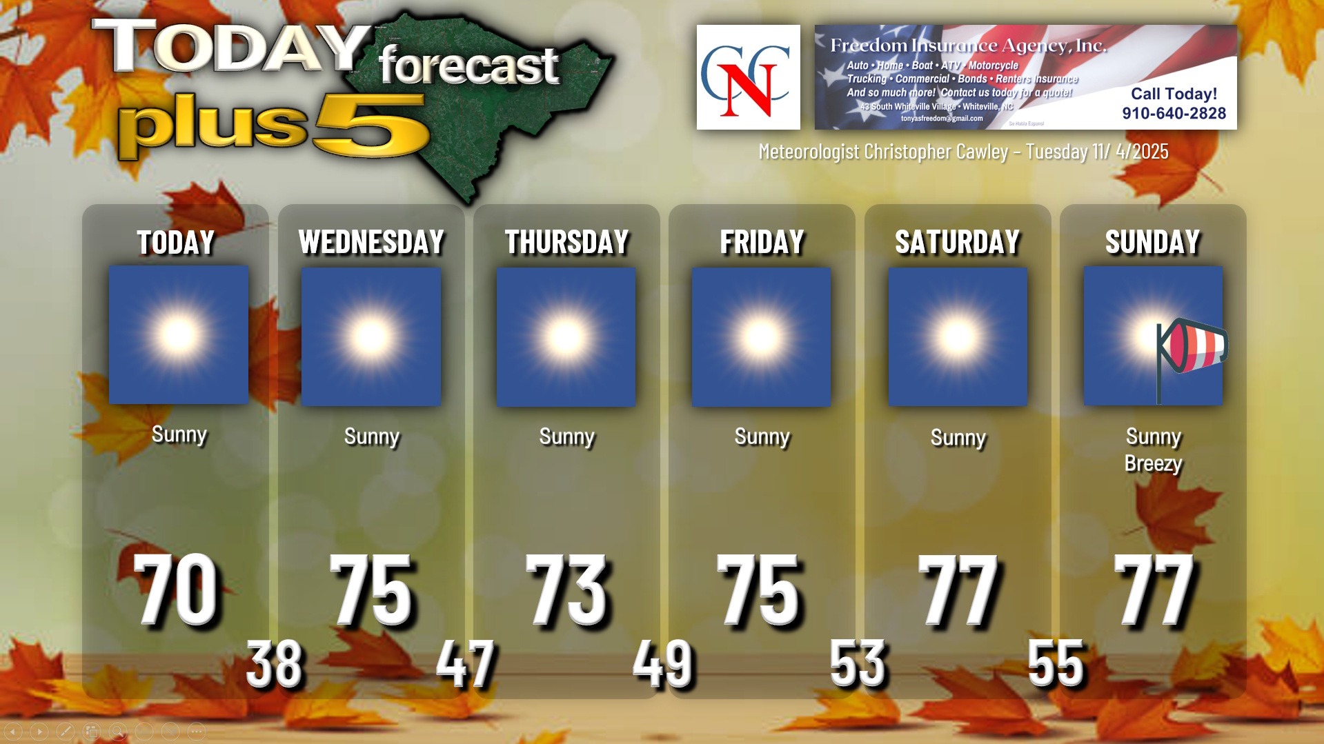
Strong high pressure will remain in control of our weather through the weekend. A “backdoor” cold front may drop south over the area Thursday but that will have little, if any, impact on our area. Rain chances through next Monday are nearly zero.
The development of at least isolated frost is possible in the predawn hours Wednesday as temps drop into the upper 30s with high pressure overhead.
Temperatures warm up fairly dramatically through Sunday… before the arrival of an all-capital-letters COLD FRONT.
On Sunday night.
And this front will mean some serious business… bringing BY FAR the coldest air of the early winter season to Columbus County…
… possibly sub-freezing temperatures.
It’s a bit early to call on the exact numbers, but SOME of the modeling wants to send us into the upper 20s to around 30 next Monday night (the 10th) and early Tuesday (the 11th), with highs on Tuesday the 11th struggling to reach the 50-degree mark, even with full sunshine. There will likely be some moderation with the modeling as we work through time… but right now it’s a pretty safe call to say that the growing season comes to an abrupt conclusion for all areas away from the coast early next week. (Which is actually right on schedule, according to NWS climatological data for Whiteville.)
TROPICS: There are no areas of tropical interest and no tropical formation is expected through the next 7 days.
Here is your Freedom Insurance Today-plus-Five Forecast:
–Meteorologist Christopher Cawley