CCN Weather Update for Friday December 5, 2025.
This weather update is sponsored by Freedom Insurance of Whiteville. You can trust Freedom Insurance to give you clear blue skies when it comes to home, car, boat, or whatever insurance you need. Let Freedom provide customized coverage to keep you and your family safe. Contact Freedom today at 910-640-2828!
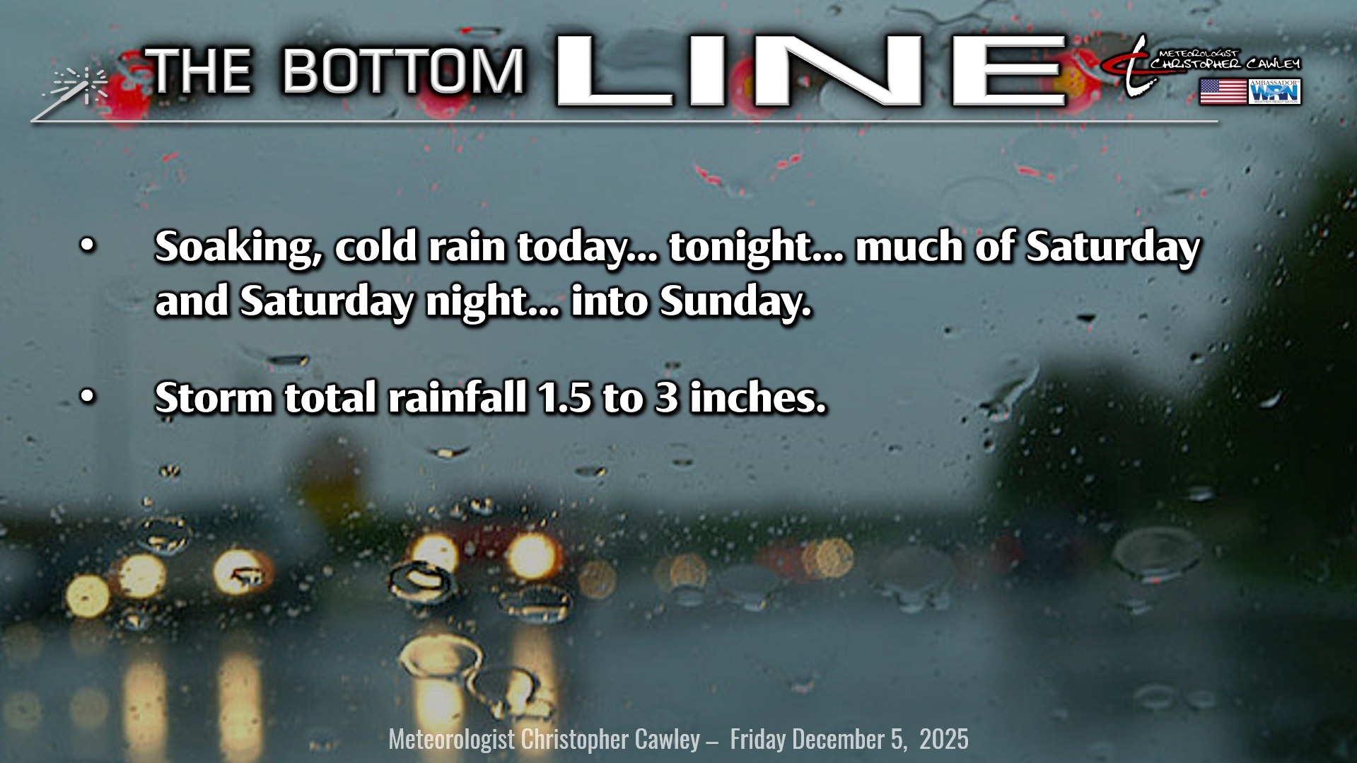
Here’s today’s Bottom Line
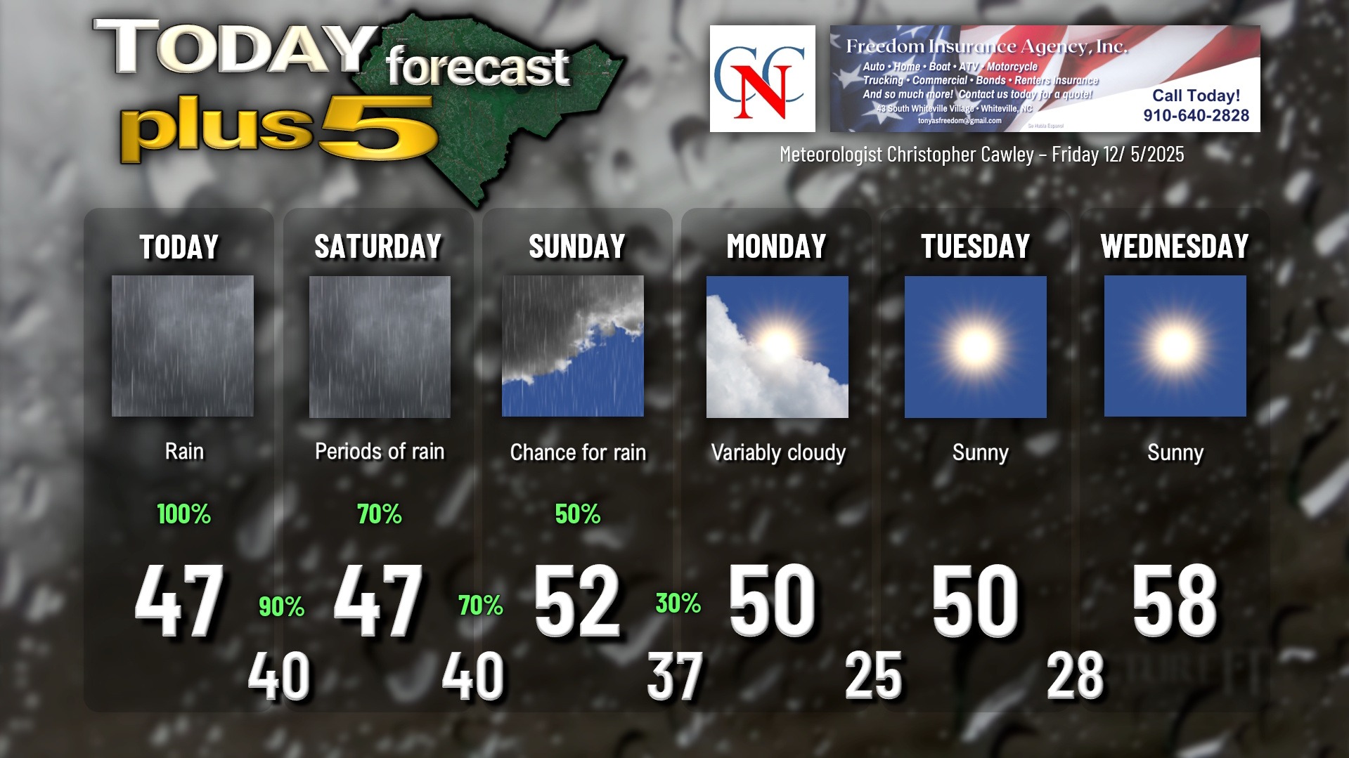
We’ve seen the last of the sun until possibly Sunday afternoon… more likely on Monday.
If you like rainy, cold weather, you’re going to absolutely LOVE the next few days.
A frontal boundary stalled along the coast will be the highway on which several waves of low pressure travel. The first one will move up the coast today bringing the widespread bone-chilling rainfall.
Rain continues into Friday night but should taper off toward daybreak on Saturday.
That’s where certainties come to an end and we trend toward some doubt.
Saturday’s forecast isn’t as straightforward as today. Models show low #2 lifting up the coast, but the rain getting shunted ever-so-slightly south and east. Model soundings (basically profiles of the atmosphere) differ in that they show an entirely saturated atmosphere from cloud to ground surface throughout the day on Saturday. I’m just not ready to jump on board to a south/east displacement of the rain; I think that we’ll see periods of rain Saturday, mainly from late morning into the evening hours, and unfortunately during the parade time (if it’s not postponed).
Sunday now offers the same forecast problem as Saturday… modeling suggests most of the rain will be south/east… but saturation throughout the entire atmosphere suggests good rain chances on Sunday. There may be a break or two of sunshine, but on the whole I think it’s going to remain cloudy, damp, and dreary regardless of how much actual rain falls on Sunday.
Much higher confidence in a drying trend beginning on Monday. A rather robust trough (“atmospheric disturbance”) shoves the stalled coastal front south/east/away and rather chilly high pressure builds overhead. This high eventually pushes offshore by midweek allowing us to return to some milder air.
Storm total rainfall is up to some debate given the uncertainty in the modeling, but the model blends point to between 1.5 and 3 inches of rain for the county from now through Sunday night.
Here is your Freedom Insurance Today-plus-Five Forecast:
–Meteorologist Christopher Cawley