CCN Weather Update for Tuesday December 23, 2025.
This weather update is sponsored by Freedom Insurance of Whiteville. You can trust Freedom Insurance to give you clear blue skies when it comes to home, car, boat, or whatever insurance you need. Let Freedom provide customized coverage to keep you and your family safe. Contact Freedom today at 910-640-2828!
Here’s today’s Bottom Line
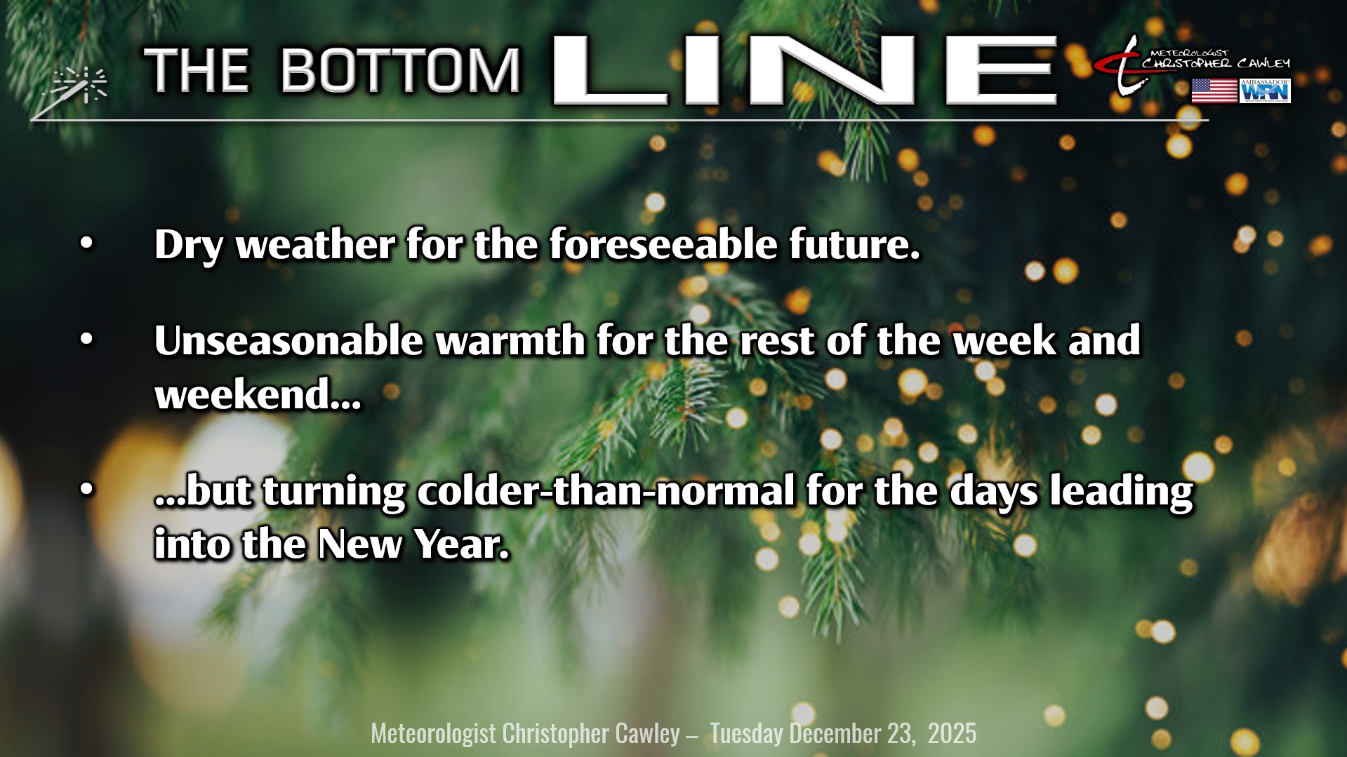
It’s beginning to look a lot like … not Christmastime, that’s for sure!
A warm front is lifting north over the area first thing this morning. We’ll see considerable cloudiness through the morning before the sun starts to shine, and the temps start to rise. We’ll crest in the upper 60s this afternoon.
An unseasonably strong ridge of high pressure will flex its muscle over the southern half of the United States through the rest of the week and into the weekend. Weather systems will rotate off to the north leaving us high-and-dry with abundant sunshine and unseasonably warm temperatures. A little blip will be something of a cold front moving through late Christmas Eve night, but that won’t impact Santa’s rounds.
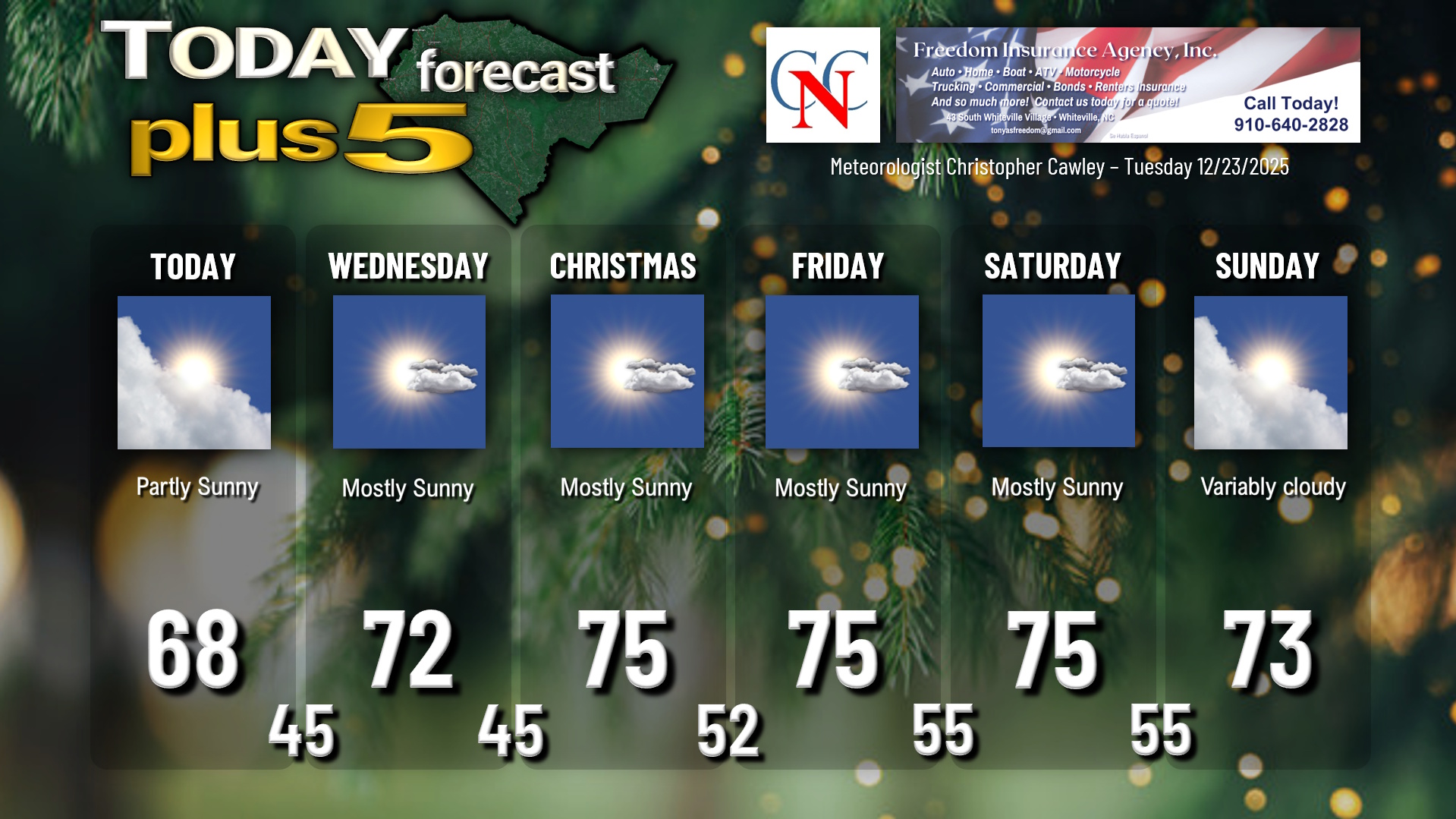
We’ll be solidly in the 70s Wednesday through Sunday. Normal highs are in the upper 50s… which is where we’ll be for LOWS by the end of the week.
PATTERN CHANGE COMING!!
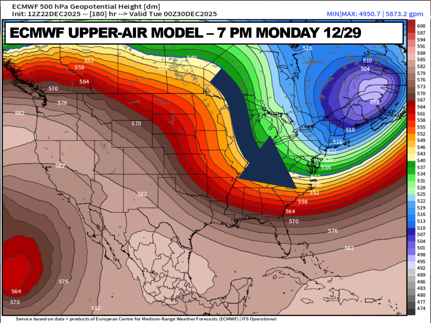
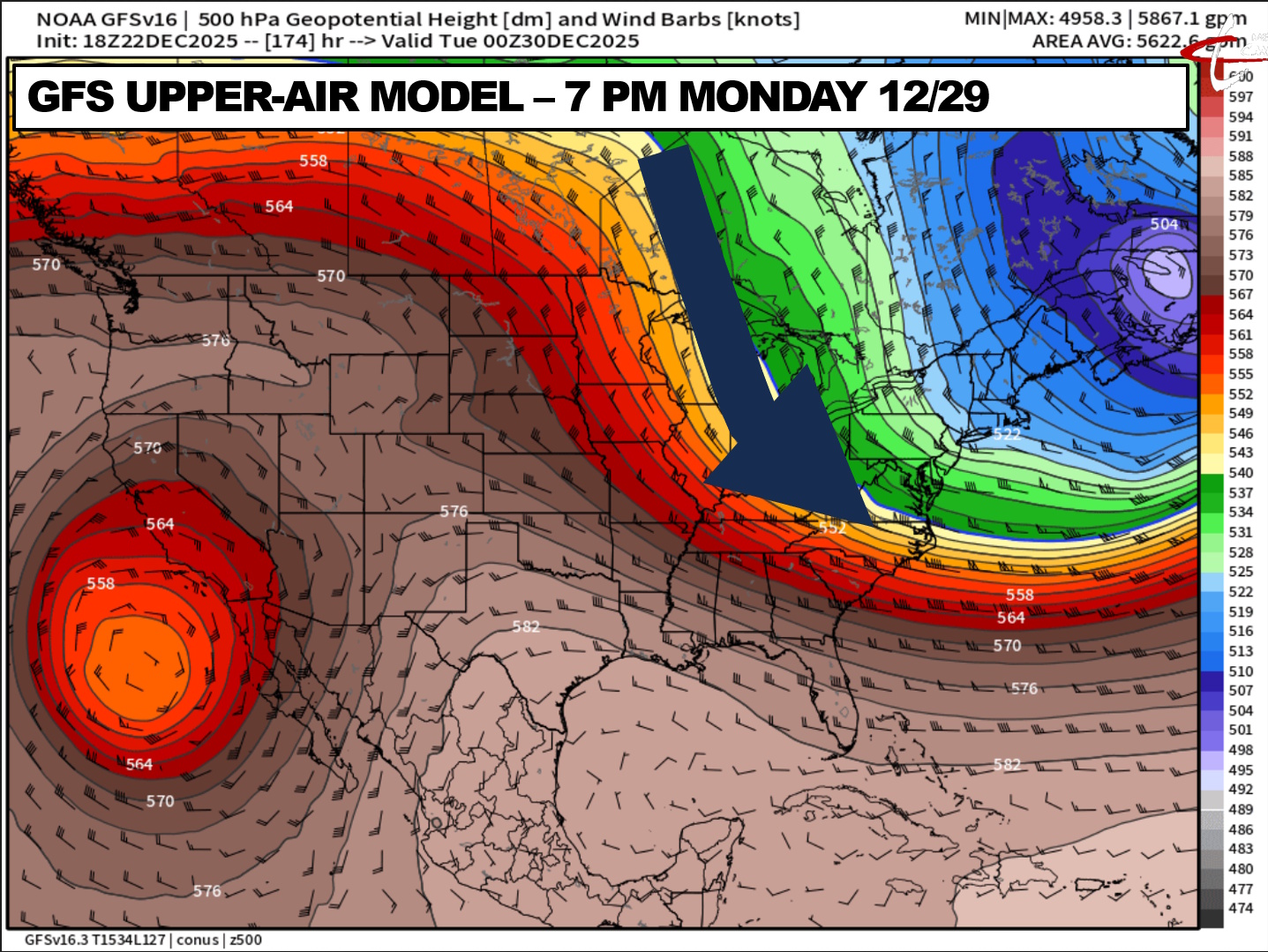
A strong cold front moves across the area late Sunday. This will bring a big-time pattern change and a return to reality for the days closing out the year 2025. A large-scale upper-level pattern change is coming with cold Canadian air pouring into the Carolinas next week, and our highs (not shown on the chart below) will likely average out to around 50 or in the lower 50s with lows in the upper 20s to mid 30s into the New Year. There may be some rain with the frontal passage Sunday night, but outside of that, precipitation chances are essentially zero until things get more active after the New Year.
Here’s your updated Christmas forecast:

Here is your Freedom Insurance Today-plus-Five Forecast:
–Meteorologist Christopher Cawley