CCN Weather Update for Christmas Eve 2025.
This weather update is sponsored by Freedom Insurance of Whiteville. You can trust Freedom Insurance to give you clear blue skies when it comes to home, car, boat, or whatever insurance you need. Let Freedom provide customized coverage to keep you and your family safe. Contact Freedom today at 910-640-2828!
Did you know that Santa also trusts Freedom Insurance for his sleigh? He encounters lots of potentially hazardous flying conditions and knows that Freedom is there for him should something unforeseen happen. Trust Santa? Trust Freedom Insurance!
Here’s today’s Bottom Line
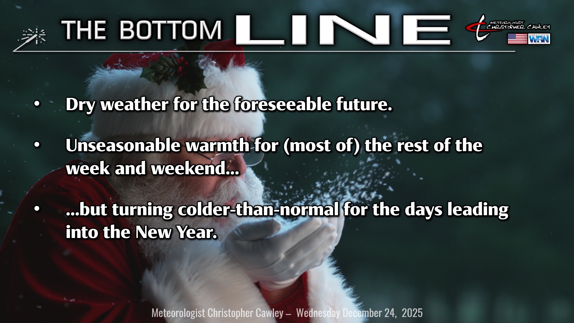
Merry Christmas Eve friends and followers.
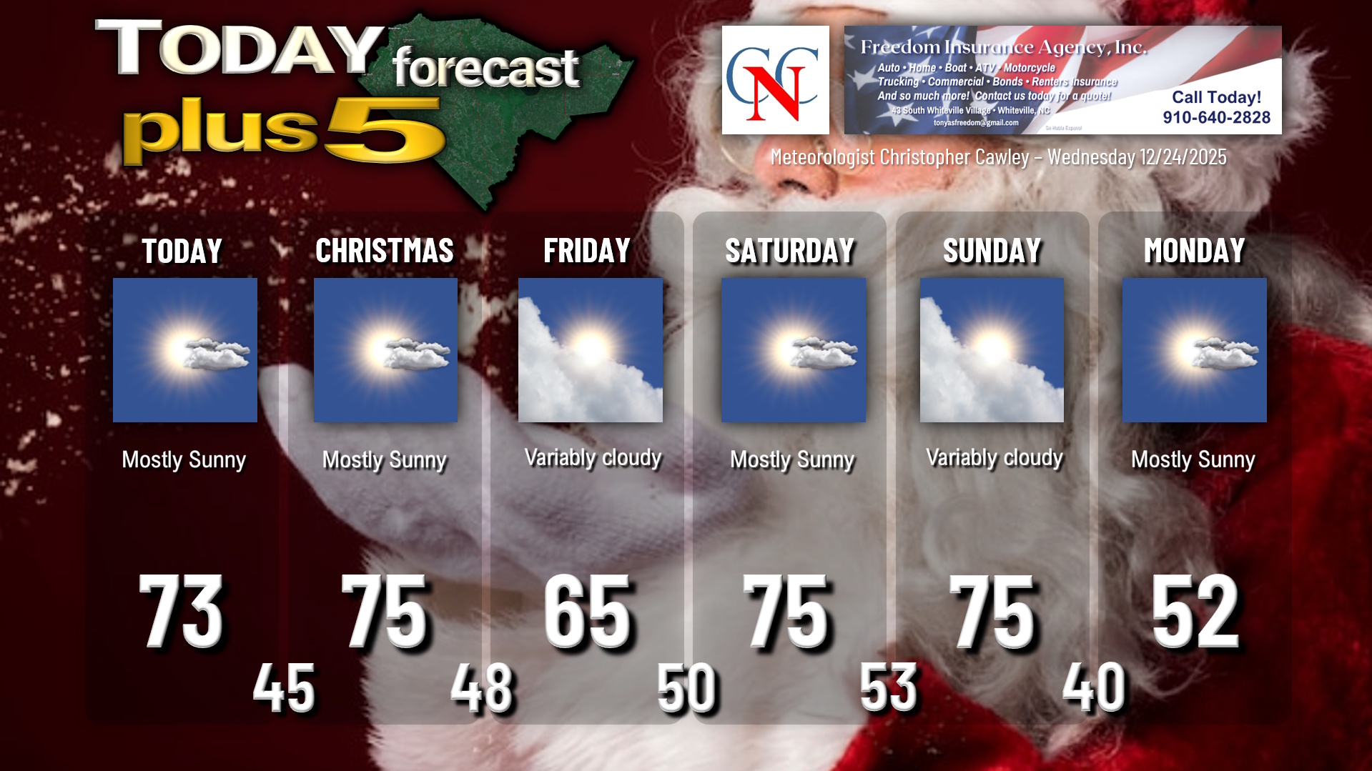
Well, Santa’s sleigh tonight will need some kind of landing gear appropriate for a dry and warm ground… and he may be a bit uncomfortable in that red suit. Temperatures today, with full sunshine thanks to ridging high pressure, will be well into the 70s. We’ll drop to the mid and upper 40s tonight with clear skies… so no visibility issues for Santa and the reindeer. Make sure those kiddos are tucked into bed nice and early! And for goodness’ sake don’t forget the milk and cookies!!
Christmas Day will be … well … either gorgeous if you like sunshine and warmth … or miserable if you’re rooting for cold weather. Near-full sunshine and a southwesterly flow allows our temps to climb into the mid 70s.
A bit of a change from yesterday’s report… I am confident that a “backdoor” cold front will drop down over the area early Friday. It’ll either go completely to our south, or “windshield-wiper” a bit directly overhead. This has huge implications for temperatures. If I’m wrong and the front doesn’t push through, we’ll be back into the 70s on Friday. If I’m right and the front drops south, our highs will “only” be in the mid 60s… still about 8 degrees above normal.
That front then retreats back north pushing more 70-degree weather back into the area for the weekend.
Then…..
PATTERN CHANGE COMING!!
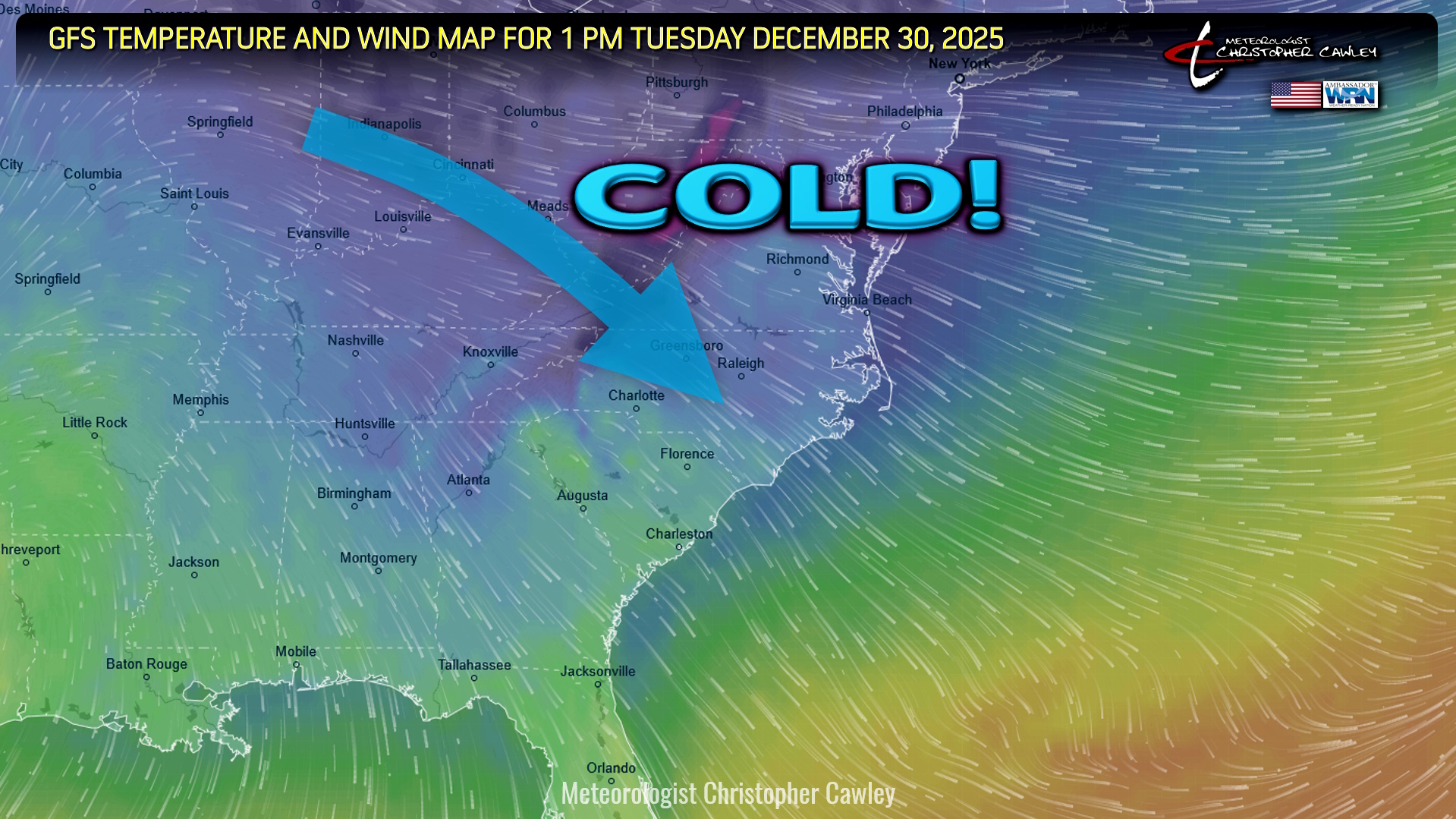
A strong cold front moves across the area late Sunday. This will bring a big-time pattern change and a return to WINTER to close out 2025. Cold Canadian air will cascade into the Carolinas next week, and our highs (not shown on the chart below) will likely be stuck in the 40s by Tuesday through New Years, with lows deep into the 20s to ring in 2026.
While unlikely… 8 out of the 50 members of the European model ensemble are indicating measurable snowfall around/after the first of the year. Again, that’s highly unlikely, but I do think a much more active weather pattern takes shape with the change of the calendar. For comparison purposes, the GFS ensembles show nothing whatsoever through the 3rd of January.
What IS likely though, is an extended-duration cold snap lasting from the 30th through probably the second week of January. Enjoy the 70-degree warmth, because after Sunday, it’s history.
I want to wish everyone a very Merry Christmas. I truly appreciate each and every one of you who takes the time to read this blog every day. THANK YOU for trusting me to provide no-nonsense, no-hype, honest reporting written in plain English. As well, THANK YOU for your continued support of CCN as exciting changes come after the new year.
Here is your Freedom Insurance Today-plus-Five Forecast:
–Meteorologist Christopher Cawley