CCN Weather Update for Monday March 2, 2026.
This weather update is sponsored by Freedom Insurance of Whiteville. You can trust Freedom Insurance to give you clear blue skies when it comes to home, car, boat, or whatever insurance you need. Let Freedom provide customized coverage to keep you and your family safe. Contact Freedom today at 910-640-2828!
Here’s today’s Bottom Line:
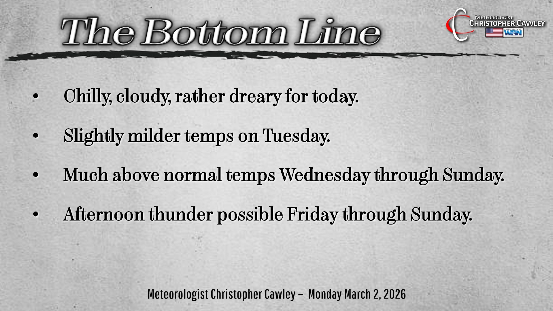
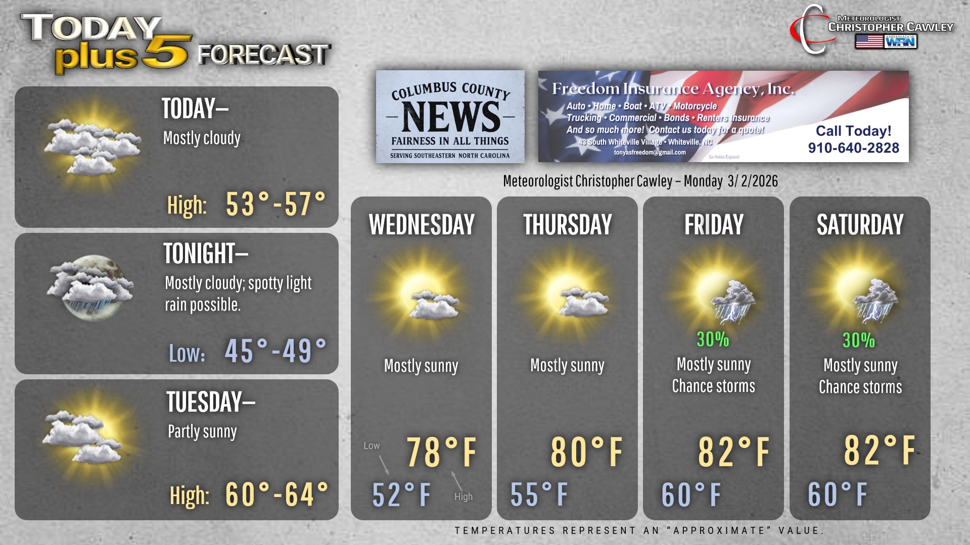
Quite a change in the weather when compared to yesterday. A cold front has dropped south of the area. This has allowed for the formation of a cold-air-damming “wedge.” This will lead to mainly cloudy skies and well-below-normal temps … our highs will be in the lower to middle 50s today (if we’re lucky).
The CAD wedge remains in place for most of Tuesday. I believe the low clouds will linger … though we’ll see more in the way of sunshine. Temps should rise to around 60 or in the lower 60s (which is actually the normal high for this time of year). I’m not really optimistic on these temps though… while I put 60-64 on the graphic below, there’s a good chance we remain in the upper 50s.
That definitely is a memory by Wednesday as Bermuda high pressure takes firm control. A robust south/southwesterly wind flow becomes established around the periphery of the high. Temperatures skyrocket to well-above-normal levels beginning Wednesday and lasting through the weekend.
The sea-breeze becomes a factor in our weather for Friday through Sunday. This means plenty of sunshine, unseasonable humidity, and the potential for afternoon thunderstorms.
A word of caution — this prolonged spring/summer-like trend will cause people to want to get a head start on early planting. I’d hold back on that a bit, though, as I believe we’ll have a period of cooler temps toward the middle of the month. There are no sub-freezing temps on the horizon, but again, I’d hold back on the gardening/planting.
Here’s your Freedom Insurance Today-plus-Five Forecast!
–Meteorologist Christopher Cawley