CCN Weather Update for Monday June 15, 2026
This weather update is sponsored by Freedom Insurance of Whiteville. Trust Freedom Insurance to give you clear blue skies when it comes to home, car, boat, or whatever insurance you need. Let Freedom provide customized coverage to keep you and your family safe. Contact Freedom today at 910-640-2828!
Here’s today’s Bottom Line
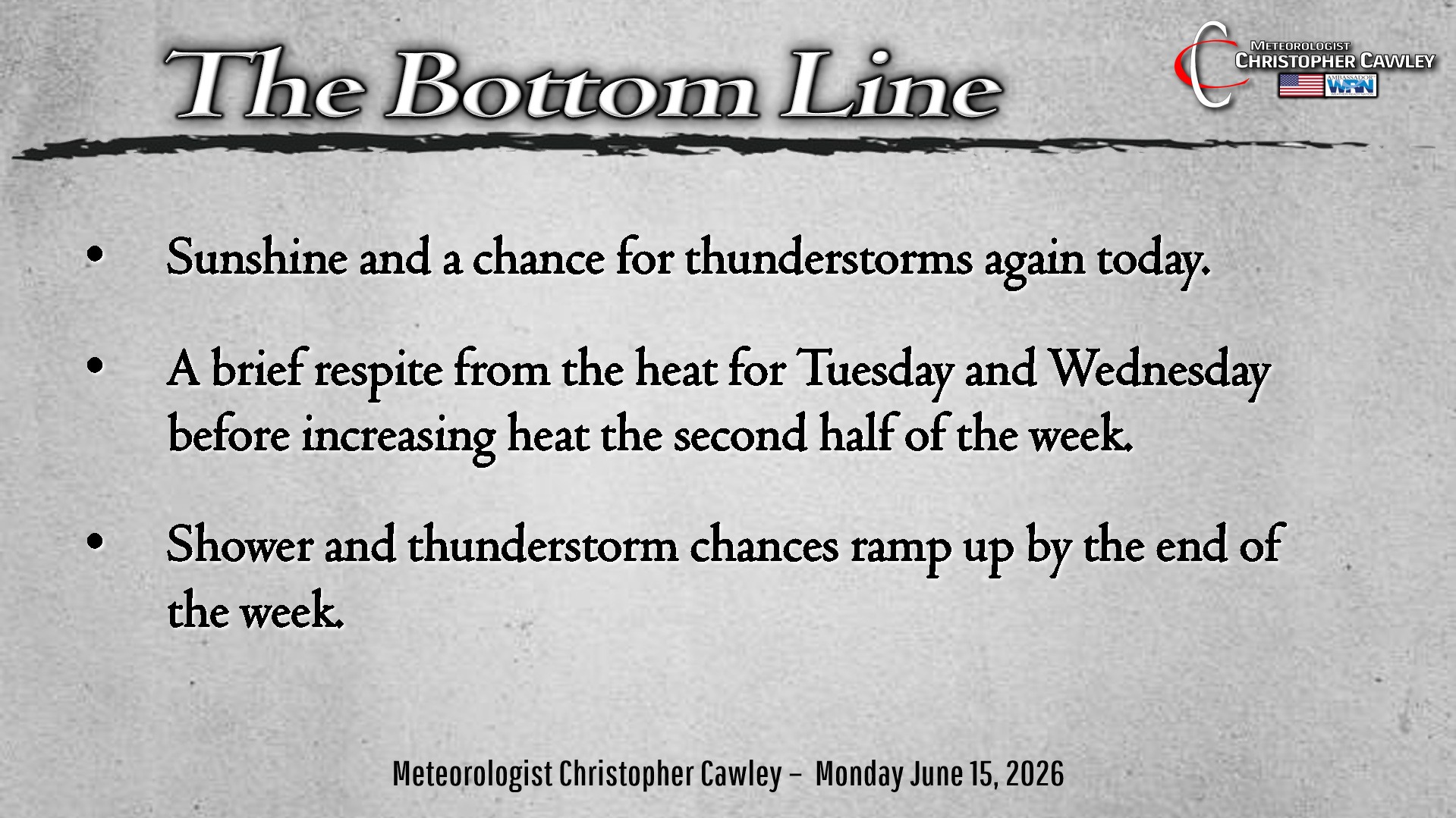
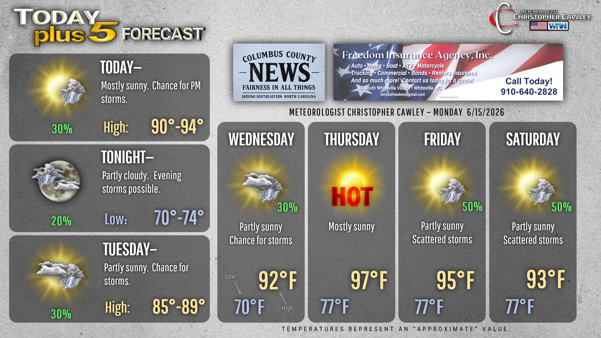
Temps will be a touch cooler today (if you want to call it that) but the presence of a frontal boundary in the area means heat index values should still climb north of 100 this afternoon.
We’ll see a mix of sunshine and clouds with thunderstorm threat similar to what we had over the weekend. They’ll be hit-or-miss, but those who get the “hit” will certainly know it… with monsoon-like rainfall, gusty winds, and frequent lightning.
Slightly cooler temps for your Tuesday with the remains of that dying front in the vicinity. There is still the low threat for a few isolated storms Tuesday. Highs will likely remain in the 80s (!!) on Tuesday.
Heat starts to return on Wednesday and really comes rolling in for Thursday and Friday. Heat index values will probably be 105+ during that stretch. The next front tries to push into the area on Saturday but it remains to be seen just how long it can survive.
Overnight temps will likely stay at or above 80 degrees until the predawn hours Thursday-Saturday making it most uncomfortable for those without air conditioning.
Here is your Freedom Insurance Today-plus-Five Forecast:
–Meteorologist Christopher Cawley