
CCN Weather Update for Thursday June 25, 2026
This weather update is sponsored by Freedom Insurance of Whiteville. Trust Freedom Insurance to give you clear blue skies when it comes to home, car, boat, or whatever insurance you need. Let Freedom provide customized coverage to keep you and your family safe. Contact Freedom today at 910-640-2828!
Here’s today’s Bottom Line
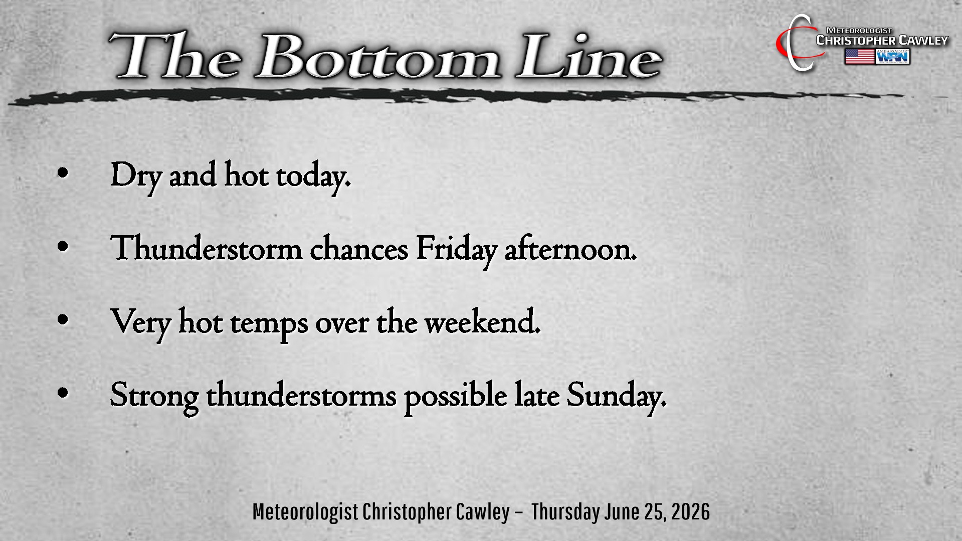
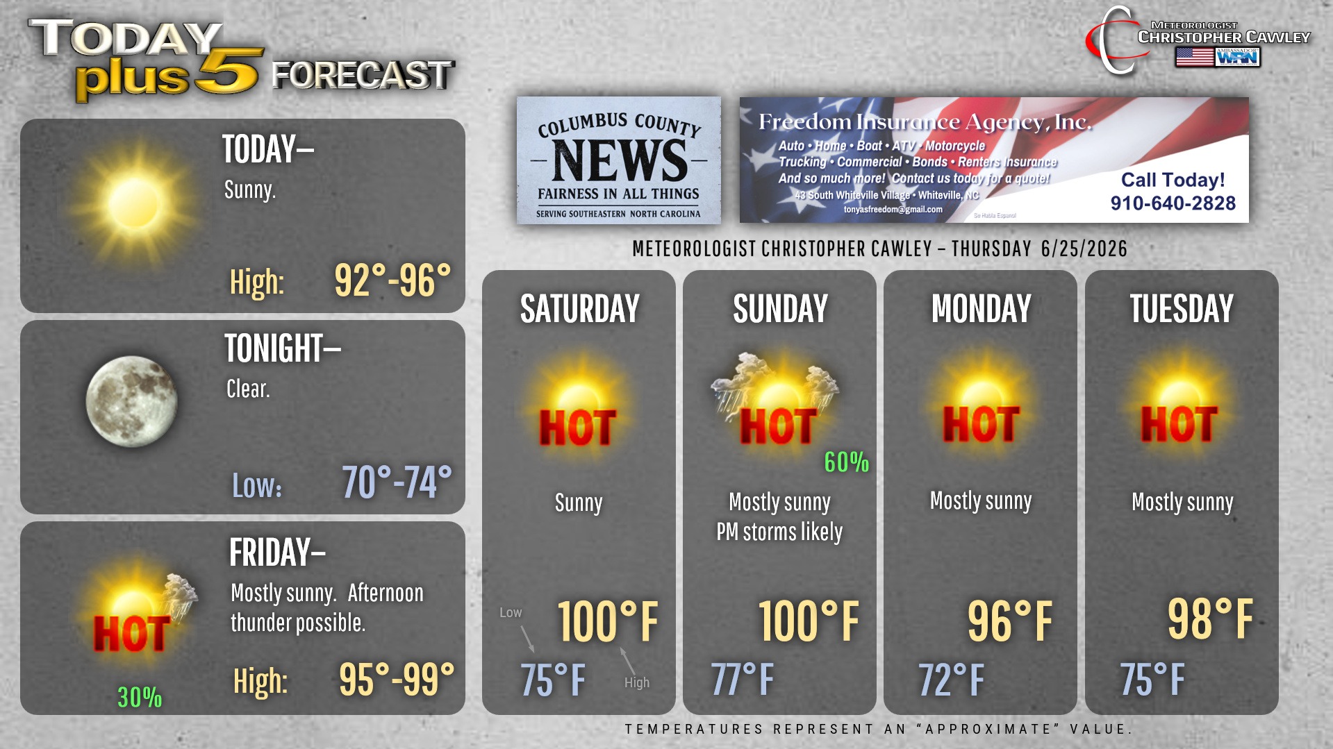
True summer heat will potentially reach extreme levels this weekend and then again as we approach the Fourth of July holiday weekend.
Ridging Bermuda high pressure offshore along with a frontal boundary off to our north and west will tag-team to bring hot temps to the area going into the weekend.
Today should remain dry, but I have introduced low-end thunderstorm chances on Friday afternoon. These storms will likely be sea-breeze-induced but some isolated storms may pop in the unstable atmosphere.
One or two isolated storms are possible on Saturday, but our highs will likely touch the Misery Mark.
That front tries to push into the ridging on Sunday. There’s a much better likelihood of thunderstorms Sunday afternoon and evening, and these storms could be quite powerful. I put a 100 on the graphic but if we get thunderstorms early enough in the afternoon, our temps probably won’t actually break the Misery Mark.
The front pushes off the shore and is vaporized by the high pressure ridge. Dewpoint values will be a little lower on Monday into Tuesday. It’s not on the graphic but there’s a strong likelihood for temps to push back up to triple digits by the end of next week.
Heat index values this weekend will likely be in the 105-110 degree range, which is NWS “heat advisory” criteria.
Heat index values approaching the holiday weekend will possibly reach “extreme heat warning” levels of 110 or higher.
Summertime.
Tropics continue to remain quiet at this time.
Here is your Freedom Insurance Today-plus-Five Forecast:
–Meteorologist Christopher Cawley