CCN Weather Update for Friday June 26, 2026
This weather update is sponsored by Freedom Insurance of Whiteville. Trust Freedom Insurance to give you clear blue skies when it comes to home, car, boat, or whatever insurance you need. Let Freedom provide customized coverage to keep you and your family safe. Contact Freedom today at 910-640-2828!
Here’s today’s Bottom Line
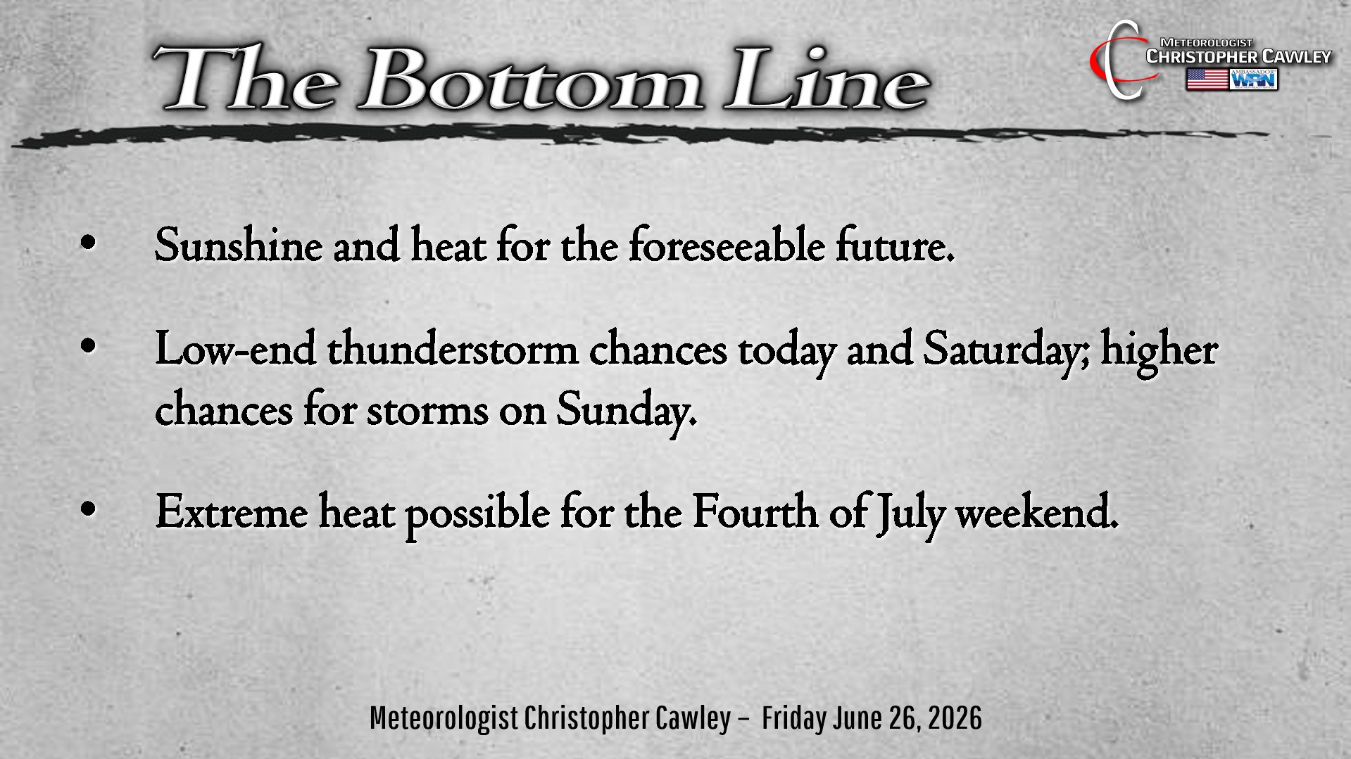
True summer heat potentially will potentially reach extreme levels this weekend and then again as we approach the Fourth of July holiday weekend.
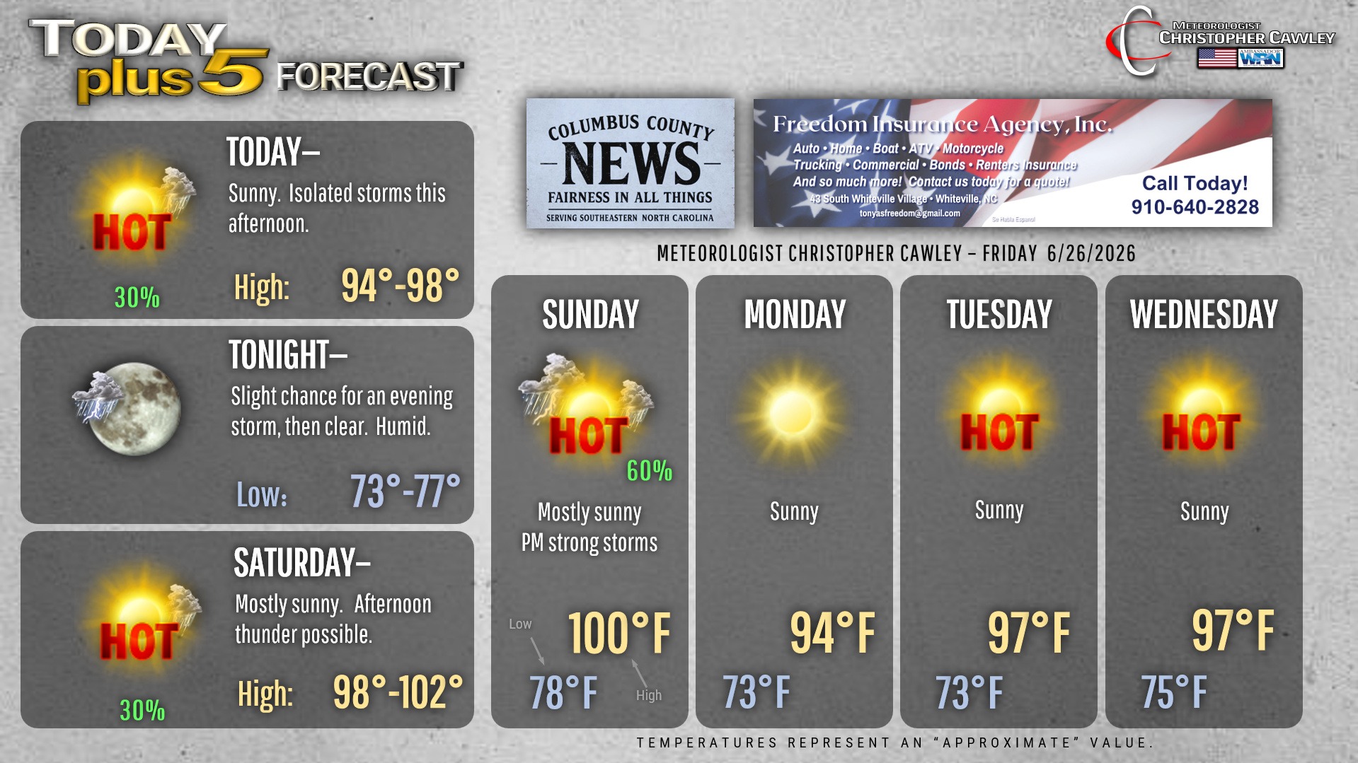
Sunshine and heat will obviously be the dominating factors, but some thunderstorms this afternoon may produce localized areas of intense rainfall including the potential for flash flooding concerns. If you live in Whiteville, you know what that means.
Any storm that forms may pulse to severe limits this afternoon into this evening… but by-and-large the primary threat will be from intense rainfall and frequent cloud-to-ground lightning.
The thunderstorm activity on Saturday will be much less remarkable but still isolated storms may provide temporary relief from the oppressive heat.
Speaking of the heat… this weekend will likely feature advisory criteria heat index values (105-110). Actual air temperatures will be a degree or two either side of 100 on Saturday, upper 90s to around 100 on Sunday.
The threat for strong storms ramps up again on Sunday as a weak cold front tries to break the ridge. The front won’t be too successful, but will be the source of lift required for the development of some robust thunderstorms. These storms could produce locally damaging water-loaded downbursts (intense rainfall with damaging winds) and frequent lightning once again.
This “front” bring briefly “cooler” temps for Monday (with slightly lower humidity). But after that… we fire up the ovens once again.
Southeasterly low-level return flow leads to increasing humidity values. That, combined with a very strong ridge of high pressure to our west, leads to the formation of what is commonly called a “heat dome” over much of the southeast. Heat index values will likely climb above the threshold for heat warning criteria… and we’re looking at several days of extreme heat around the Fourth of July holiday.
Tropics continue to remain quiet at this time.
Here is your Freedom Insurance Today-plus-Five Forecast:
–Meteorologist Christopher Cawley