Tropical Storm Elsa is expected to turn toward Georgia tonight, and make a visit to North Carolina later Thursday afternoon.
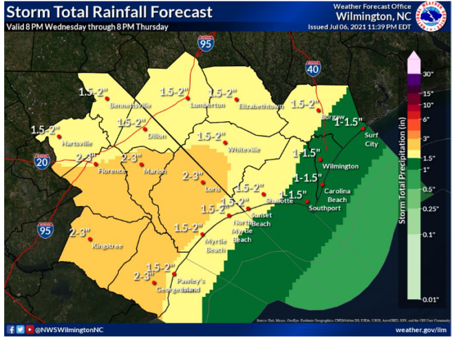
The National Hurricane Center’s 5 p.m. update today (Wednesday) also broadened the impact of rains on North Carolina. As the center of the storm shifts slightly westward, one to three inches are expected from west of Interstate 95 through eastern North Carolina, with isolated totals of eight inches in some areas. Flash flooding in urban and poor drainage areas is likely through Thursday.
While the tornado threat has slightly lessened for southeastern North Carolina for Wednesday, the tornado risk remains moderate for most of Thursday.
Schools and government offices in Columbus are continuing on normal schedules at this time. County and municipal emergency managers are monitoring the storm. Sheriff’s Office spokesperson Michele Tatum said the CCSO high water vehicles have been checked, fueled and are ready to deploy.
Overall dry conditions throughout the area this summer could benefit Columbus County, as most major waterways are several inches below normal. The county’s ongoing drainage improvement projects have also opened a number of waterways that are usually bottlenecks for high water.
Officials will be keeping a close eye on conditions along the Waccamaw and Lumber basins as runoff from upstream flows down through Columbus in the coming days. Conditions along the Cape Fear, especially at Livingston Creek, are favorable to containing large amounts of runoff.
Columbuscountynews.com and WTXY will provide additional updates from the National Weather Service as well as local emergency agencies as conditions warrant.


