
Related story:
Hurricane season officially begins June 1, and federal weather forecasters are calling for the seventh busy season in a row.
There’s a 65 percent chance of an above average tropical season this year, according to the National Oceanographic and Atmospheric Administration (NOAA), the parent agency for the National Weather Service. NOAA’s adjusted forecast was issued at noon today.
The forecast calls for 14 to 21 named storms, with six to ten becoming hurricanes. Three to six of those storms could be major, of Category Three to Five, according to the forecast.
Meteorologists have a 70 percent confidence in the forecast, NOAA officials said in a press release.
Conditions far from the Atlantic seaboard play a major role in hurricane formation.
The ongoing La Nina weather pattern in the Pacific is creating conditions conducive to Atlantic hurricane production. Sea temperatures are also warmer than usual in the Atlantic and Caribbean. Weaker trade winds lead to stronger monsoons in Africa, which in turn produce the strongest, longest-lived tropical waves off the African Atlantic coast.
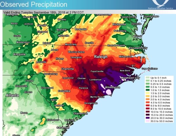
While winds and waves are the best-known hurricane dangers, inland counties like Columbus are often hardest hit by flooding, as evidenced by 2016’s Hurricane Matthew and 2018’s Florence.
The NWS is deploying several new tools for hurricane season this year, including a newly-created Excessive Rainfall Outlook (ERO) program that can predict rainfall amounts up to five days in advance of a storm’s landfall. The new program will estimate the likelihood of heavy rainfall and flooding to within 25 miles, NOAA said.
Local and state officials hope a series of 400 flood gauges, most of which are in Eastern North Carolina, will help provide better warnings of potential flooding. One of those gauges is located at Soles Swamp in downtown Whiteville, as well as the Lumber River at Boardman and Fair Bluff, areas that were devastated by both Matthew and Florence.
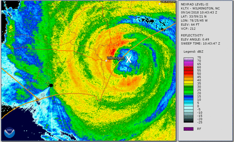
Satellite imagery of Florence making landfall can be found here:
https://www.weather.gov/images/ilm/climate/Florence/SouthwardJogAtLandfall.gif
The Flood Inundation Management Network (FIMAN) is now integrated with the real-time highway app managed by the N.C. Dept. of Transportation (DOT). The DriveNC.gov website provides up-to-the-minute road conditions across the state. The system will allow DOT to monitor flooding moment by moment in all the monitored areas, helping officials determine where to send emergency support.
The FIMAN website also allows users to generate flooding scenarios based on rainfall amounts. Go to https://fiman.nc.gov/# for more.


