Good evening, Meteorologist Christopher Cawley here with an 8 PM Sunday update on Hurricane Milton.
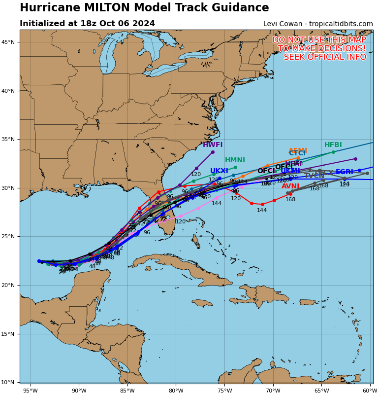
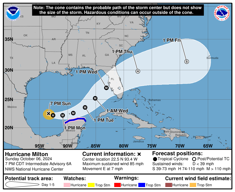
Milton reached hurricane strength on Sunday afternoon … and will quickly achieve cat-3 status on Monday. The Tampa/St. Petersburg, FL, area is directly in the crosshairs of this, with an ETA of Wednesday afternoon. I believe Milton will reach cat-4 before making landfall and ravaging central Florida… but a saving grace may be some dry air that tries to infiltrate the system just before landfall. I’m not sold on it but it is a possibility. Even if dry air wraps in, the storm surge will be at least 9-12 feet and the barrier islands will pick up significant damage. After crossing Florida, Milton will then become somewhat “absorbed” into a frontal boundary that will be draped across northern Florida. This will result in Milton becoming “extratropical” in nature, meaning that it will remain strong but will lose most of its tropical characteristics.
A little science here — hurricanes (tropical cyclones in general) cannot cross a frontal boundary but they can be “absorbed” into the front. At that point, the storm loses most tropical characteristics and becomes a strong low pressure system, or “extratropical.” Milton will still have hurricane-force winds but will be on a weakening trend after crossing Florida.
LOCAL IMPACTS: Little, if any. The Whiteville area will see some breezy conditions and there may possibly be a few rogue rain showers Wednesday night and Thursday along or just south of the state line as Milton passes quickly far to our south. (The National Hurricane Center has the Myrtle Beach area under a 10% risk for 40-mph winds as Milton passes off to the south.) Most impacts, if you want to call it that, will be pinned to the coast. The biggest issue will be strong to potentially deadly rip currents at the beaches, along with some rough surf and maybe some coastal flooding at high tide. Otherwise the Whiteville area can expect mainly dry conditions for the entire work week with seasonable temps.
Next update will be posted Monday evening.