Hello once again folks, Meteorologist Christopher Cawley here with your evening weather update for Tuesday October 15, 2024.
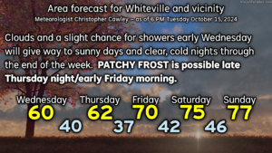
A weak cold front will drop across the area late tonight and early Wednesday, before pushing off the coast by Wednesday afternoon. This will bring some cloudiness and the chance for a few isolated/spotty light rain showers to the area. I’m not optimistic on the rain chances… I think many areas will be dry… but some places may get enough rain to wet the ground a little bit. That clears out and skies become sunny by Wednesday afternoon. It’ll be chilly with highs only topping out around 60.
Skies are clear Wednesday night but the strong ridge of high pressure building in should stay located in an area that precludes frost development. I think we’ll see temps early Thursday around the 40-degree mark… some upper 30s are possible north and west of town.
Thursday will feature full sunshine but temps about 10-12 degrees below normal… highs will struggle to reach the lower 60s.
PATCHY FROST IS POSSIBLE LATE THURSDAY NIGHT AND EARLY FRIDAY. High pressure will be directly overhead, winds go completely calm, and this sets the stage for lows — in town — to reach the upper 30s, with temps 34-36 possible north and west of town with frost development. Make sure you protect those plants.
We’ll rebound to around 70 on Friday… mid to upper 70s for the weekend… with continued sunny skies.

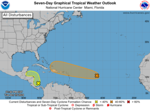
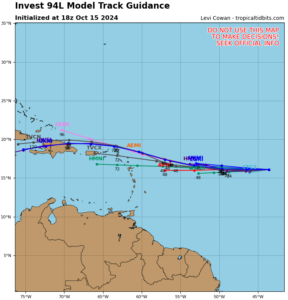
TROPICS: The National Hurricane Center is still watching an area of relatively disorganized showers and thunderstorms in the central tropical Atlantic. This is in an area not very favorable for development, but the system should continue to drift westward over the next several days. The NHC gives this a 50% chance of developing into a tropical system over the next 7 days (which is down from 60% yesterday). Modeling suggests that whatever forms stays well to our south. I have very little concern for a turn up the coast due to strong ridge(s) of high pressure firmly in place, but as always, I’ll be keeping an eye on it.
That’ll do it for this update. Thanks for reading, and, as always, take care.


