It was a busy year for hurricanes, even if Columbus County did largely dodge the spray of tropical bullets from the Atlantic Ocean.
The 2024 Atlantic hurricane season, which officially ends on Nov. 30, saw above-average activity, with a record-breaking increase following a peak-season lull. Hurricane, then Tropical Storm Debby destroyed roads in Brunswick County and caused major flooding there. While more than ten inches of rain fell at Lake Waccamaw, with more in Riegelwood, most of the damage in the county from Debby came from outlying bands after the storm moved north and west.
Most of downtown Whiteville did not flood this time, officials said. Soules Swamp did not overflow, in part due to the efforts of volunteers who used explosives to clear dams on the edge of the city limits.
Columbus County EMS Inc. led a group effort to move 75 patients from Shoreland Healthcare in Whiteville during the height of the storm Wednesday night. The entire facility, including staff and equipment, was evacuated to three other facilities.
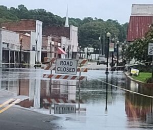
Fair Bluff officials were ready for another major flood, but the Lumber River didn’t rise as much as anticipated. Downtown was inundated, but only a few feet of water — as opposed to seven to nine feet — affected the area. Most of the buildings in the flood zone were already slated for demolition as part of the downtown revitalization project.
The new bridge to Crusoe Island was briefly closed after it was damaged by rising water and debris, but the bridge was reopened in less than 24 hours. Residents noted that had the original system of drain tiles still been in place, flooding in Crusoe and Old Dock could have been significantly worse.

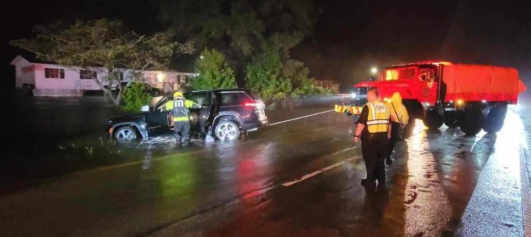
Acme Delco Riegelwood Fire Rescue performed several water rescues at the height of the storm. No injuries were reported. ADR is remaining on alert in case the Cape Fear continues to rise due to runoff from upstream. Kinjy Bowen was honored by county commissioners and the Pine Tree Festival after he rescued two people and their dog from floodwaters on Old Lake Road in Riegelwood.
One person died in Columbus County during Debby after driving around a roadblock and into floodwaters on the Robeson County line.
Brunswick County bore the worst of Debby. Around 70 roads had washouts, debris or roadblocks during the worst of the flooding. Debby was responsible for the death of a Brunswick County man after he drove around barricades and into a flooded area near Leland.
While Southeastern North Carolina saw no direct impacts from Hurricane Helene, the storm caused billions of dollars in damage after it made landfall as a Category-4 storm on the Florida Gulf Coast on Sept. 26.
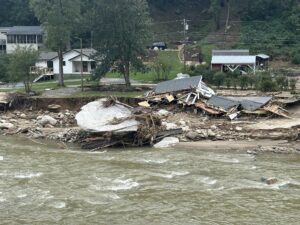
The storm caused catastrophic flooding across the southern Appalachians, widespread wind damage from the Gulf Coast to the North Carolina mountains and storm surge flooding along portions of western Florida.
Preliminary data indicate that Helene was the deadliest hurricane to affect the continental U.S. since Katrina in 2005, with more than 150 direct fatalities, the majority of which occurred in North and South Carolina.

Hurricane Helene marked the first time ever that NOAA’s National Hurricane Center (NHC) forecasted a system to become a major hurricane before it became a tropical depression or tropical storm. NWS was forecasting extreme rainfall totals and rates over western North Carolina more than 48 hours in advance.
The Atlantic basin saw 18 named storms in 2024 (winds of 39 mph or greater). Eleven of those were hurricanes (winds of 74 mph or greater) and five intensified to major hurricanes (winds of 111 mph or greater). Five hurricanes made landfall in the continental U.S., with two storms making landfall as major hurricanes.
The Atlantic seasonal activity fell within the predicted ranges for named storms and hurricanes issued by NOAA’s Climate Prediction Center in the 2024 August Hurricane Season Outlook. An average season produces 14 named storms, seven hurricanes and three major hurricanes.
Twelve named storms formed after the climatological peak of the season in early September. Seven hurricanes formed in the Atlantic since Sept. 25 — the most on record for this period.
“The impactful and deadly 2024 hurricane season started off intensely, then relaxed a bit before roaring back,” said Matthew Rosencrans, lead hurricane forecaster at NOAA’s Climate Prediction Center, a division of NOAA’s National Weather Service. “Several possible factors contributed to the peak season lull in the Atlantic region. The particularly intense winds and rains over Western Africa created an environment that was less hospitable for storm development.”
“As hurricanes and tropical cyclones continue to unleash deadly and destructive forces, it’s clear that NOAA’s critical science and services are needed more than ever by communities, decision makers and emergency planners,” said NOAA Administrator, Rick Spinrad, Ph.D. “I could not be more proud of the contributions of our scientists, forecasters, surveyors, hurricane hunter pilots and their crews for the vital role they play in helping to safeguard lives and property.”
Hurricane Beryl was the earliest Atlantic basin Category-5 hurricane on record. It caused significant storm surge flooding across parts of Texas and Louisiana after making landfall near Matagorda, Texas, as a Category-1 storm.
Hurricane Milton made landfall as a Category-3 near Siesta Key, Fla., on Oct. 9 and resulted in a tornado outbreak that produced 46 tornadoes and caused torrential rainfall and localized flooding with total rainfall amounts of 10-15 inches (and higher). Milton produced a destructive storm surge between Siesta Key and Ft. Myers Beach, Fla., including Charlotte Harbor. Milton’s rate of rapid intensification was among the highest ever observed, with a 90-mile-per-hour increase in wind speed during the 24-hour period from early Oct. 6 to early Oct. 7.
NHC’s first forecast for Hurricane Milton indicated the potential of a major hurricane landfall along the coast of west-central Florida almost two days before it formed into one, and more than four days prior to landfall.
NOAA’s video on the 2024 season can be watched here:


