Hello readers, Meteorologist Christopher Cawley here with your CCN weather update for Sunday December 29, 2024.
Today’s report is going to exclusively focus on our severe weather threat for this afternoon. Today is a “weather action day.”
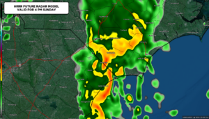
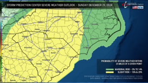
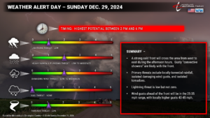
The nitty-gritty: A cold front stampedes across the state late today. Ahead of it, a robust southerly flow will create windy conditions along with a few isolated showers under a partly to mostly sunny sky through about noon. A more organized “convective line” of gusty showers and maybe some thunder is expected to push west to east across the state during the afternoon. These showers may produce isolated damaging wind gusts of 60 mph or higher, and isolated tornadoes (but the best tornado threat is west of I-95).
Modeling is still a little uncertain on the timing, but I don’t really care at this point. Be ready for bumpy weather anytime between roughly 1 PM and 6 PM today.
The severe weather parameters really, on the whole, have not changed an awful lot from yesterday’s blog post here and on my FB page. The very latest HREF instability plots show limited instability across the area. In addition, southerly winds will push cool ocean air onshore during the afternoon, which will really put a lid on severe weather chances as the “cooler” ocean air will sink toward the surface and the warmer, more unstable air is pushed higher up. Shear is decent, but not anything that I would find alarming.
Overall I don’t think we’re going to be looking at anything too terribly significant over the county other than some pretty heavy rainfall for a short while. The primary severe threat to Columbus County remains that of *ISOLATED* damaging wind gusts (60 mph or greater). I highly doubt it. But you never know. There is about a 1% to 2% probability of a tornado.
It will be a windy and warm day ahead of that front. A strong southerly flow will have sustained winds in the 20-25 mph range with gusts 30-40 mph at times. The winds will peak just before the convective line pushes through.
That convective line will mean business as it moves through, and some torrential rainfall is possible.
Periods of rain may linger through Sunday evening as a “cold pool” rotates behind the front, but all of the latest modeling suggests it’s a memory by midnight. The winds will gradually die off overnight.
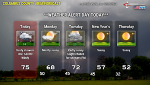
Quickly — Monday looks dry. Our next front moves through New Years Eve with a few showers possible in the afternoon/evening, dry for the midnight hour. New Year’s Day through Saturday will be quiet and calm … but turning sharply colder into the weekend.
That’ll conclude today’s post. I will be posting updates on FB later this afternoon as things heat up. Thanks for reading, and as always, take care!

