Happy Saturday friends, welcome to the CCN Daily Weather update.
*Important note – Please come down to Murf’s Pawn in Whiteville to pick up a hot plate of delicious chicken bog for only $10, as we raise funds in memory of our dear friend and CCN colleague, Misty Cribb, who was involved in a fatal motor vehicle accident a few weeks ago. Her daughter, Kyla, and her step-son, Maddox, have long roads to recovery and need all the assistance (and prayers) they can get. I’ve been putting Misty’s initials at the bottom of my 6-day graphic and will continue to do so.
Our Daily Weather Update is brought to you by Freedom Insurance. The fine folks at Freedom, located across from Lowe’s in Whiteville, can help you with all of your insurance needs. Give them a call at 910-640-2828; professional customer service is their number-one priority.
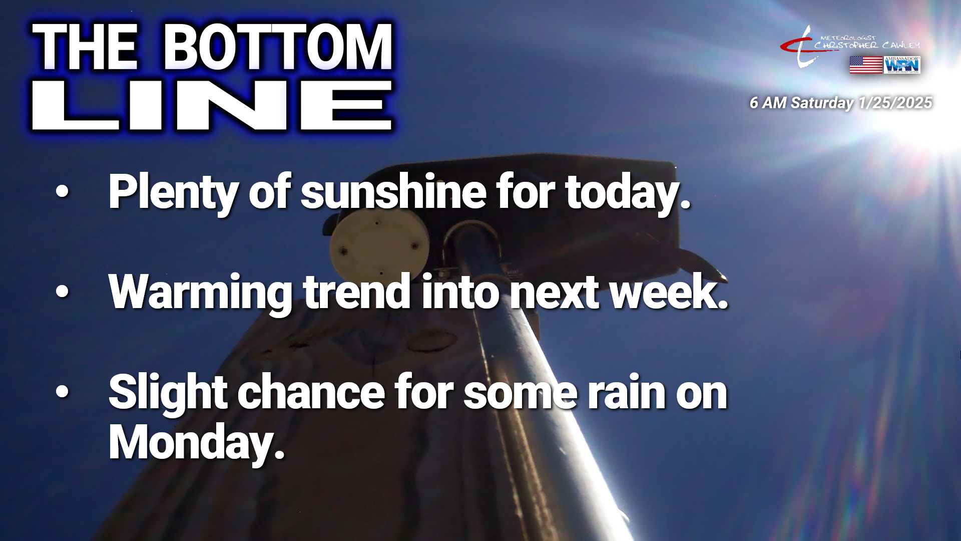
Here’s your Bottom Line for today…
Looking at statistics for Friday – the high temperature on my weather station on College Street was 42.7 at 2:21 PM, and the low was 24.6 at 6:04 AM. You can view real-time data from my weather station at this link — https://www.wunderground.com/dashboard/pws/KNCWHITE8.
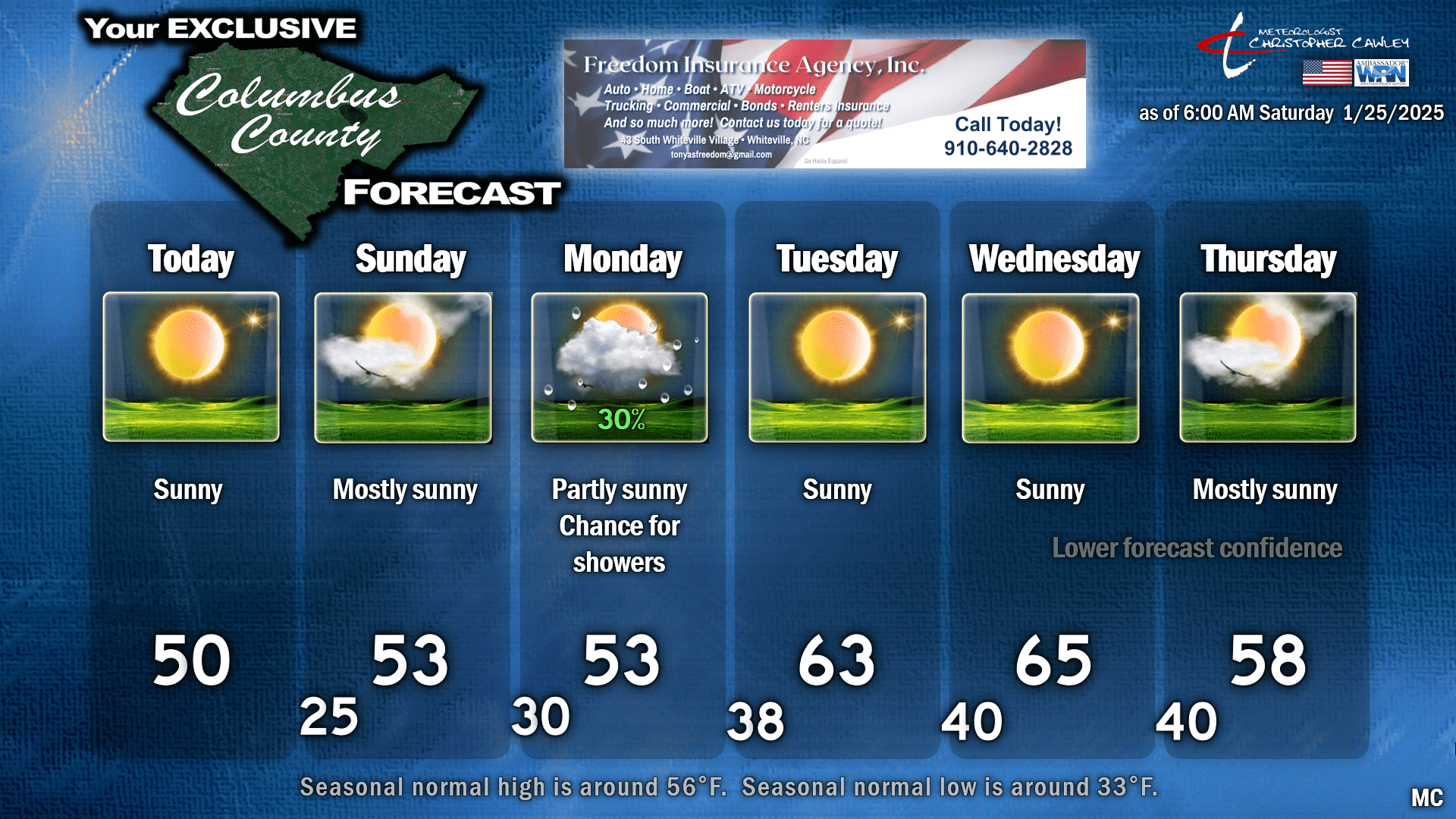
Quiet weather today as high pressure is firmly in control. Highs will be a degree or two either side of 50; however, some areas with deeper remaining snowpack may be stuck in the mid 40s. The high moves overhead tonight and then slips offshore by Sunday. We’ll be back down in the 20s tonight for the last time for a little while, and our Sunday highs go into the lower and possibly mid 50s. I think we’ll see more in the way of cloudiness on Sunday, especially in the afternoon hours (though I’m going with “mostly sunny” on the graphic for now). There will be some moisture in the mid- and upper levels of the atmosphere streaming overhead, so the sunshine will take on a rather “milky” appearance in the afternoon. This might, however, lead to a rather dazzling sunset on Sunday evening.
With increasing cloud cover Sunday night, expect our minimum temperatures to bottom out around 30… a few spotty upper 20s in the typically colder spots.
A weak cold front wants to drop down from the north as we go into Monday. Guidance suggests the front, oriented west-to-east, will drop southward to a position from Atlanta to Charleston by Monday morning, with a weak wave of low pressure forming on the front. This will introduce some light rain shower chances for your Monday. There isn’t much moisture to work with in this system, so if we get anything at all, it’ll be enough to wet the ground and perhaps run the windshield wipers a time or two, and that’ll be about it. Otherwise, a mix of sunshine and clouds can be expected on Monday with temps in the lower 50s. Whatever snow is still left over will be a memory by Monday evening.
Behind this little wave of low pressure it becomes quite mild indeed for Tuesday into Wednesday as, for a welcome change of pace, there’s no cold air behind this system. High pressure will be to our south and highs jump well into the 60s!
Forecast confidence falls like Humpty-Dumpty later Wednesday into Thursday. The latest guidance shows a pattern that suggests middle-level “troughing” deeper into our area toward the end of the week. Something known as a “closed low,” which is essentially cut off from the surrounding jet stream and upper level wind flows, forms over the desert southwest of the U.S. What does that have to do with our weather? Closed lows eventually wander to the east, but are notoriously difficult to forecast (almost more so than our snowstorm was) and the longer-range modeling doesn’t help much.
Again, closed lows eventually DO get moving thanks to the laws of physics and such, so it’s just a matter of when. I’m going with a dry forecast for now for Thursday with mild temps, but if the low does pull out of the southwest and “phase” (connect) with the troughiness over the east, then a complete 180 could occur and Thursday could feature a rather chilly, soaking rainfall.
The latest charts from the NWS Weather Prediction Center suggest a slower progression of this low eastward, keeping rain chances at bay until at least NEXT weekend. The latest Euro ensemble modeling and the model blends carries only light rainfall totals here through the coming week (mainly on Monday); EPS really jacks things up here the following week in terms of rainfall, with some of the ensemble members pushing upwards of 3-4 inches of rain during the February 2-6 time frame. Interestingly, 2 out of the 50 Euro ensembles also paint a little bit of snow here (1 inch or less) but I’m discounting that insanity for now.
Attached is your 6-day outlook. I hope to see yall later this morning at Murf’s Pawn to get some vittles, and I hope you otherwise have a fantastic day. As always, take care.
~Meteorologist Christopher Cawley


