Greetings readers, welcome to the Sunday edition of the CCN Weather Update.
Our Daily Weather Update is brought to you by my friends at Freedom Insurance. From auto to boat to ATV to renters insurance, and so much more, the fine folks at Freedom can help you with all of your insurance needs. Give them a call at 910-640-2828 or drop in at 43 South Whiteville Village, across from Lowe’s, in Whiteville.
Looking at statistics for Saturday – the high temperature on my weather station on College Street was 53.2 at 3:14 PM, and the low was 20.8 at 7:30 AM. You can view real-time data from my weather station at this link — https://www.wunderground.com/dashboard/pws/KNCWHITE8.
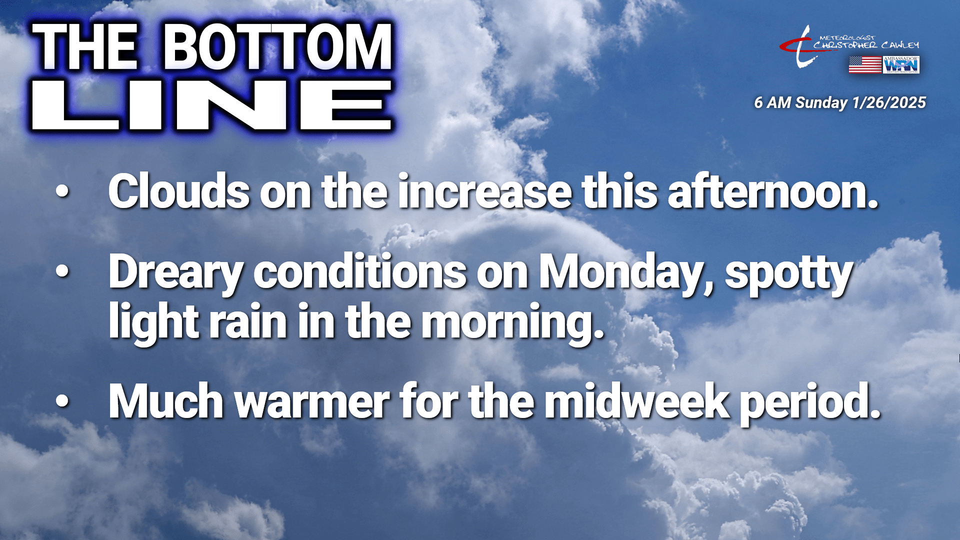
Here’s your Bottom Line for today:
The strong high pressure that brought us the bright blue sunny skies on Saturday will slide just a tad eastward toward the coast today. Our gradual warming trend continues today, and our highs should actually reach seasonal normal values in the mid to upper 50s.
Clouds should start building in this afternoon as our next weather system approaches. Some light rain is now becoming likely late tonight through about lunchtime on Monday. The rain is being caused by a frontal boundary that will sag southward over the area late tonight or early Monday.
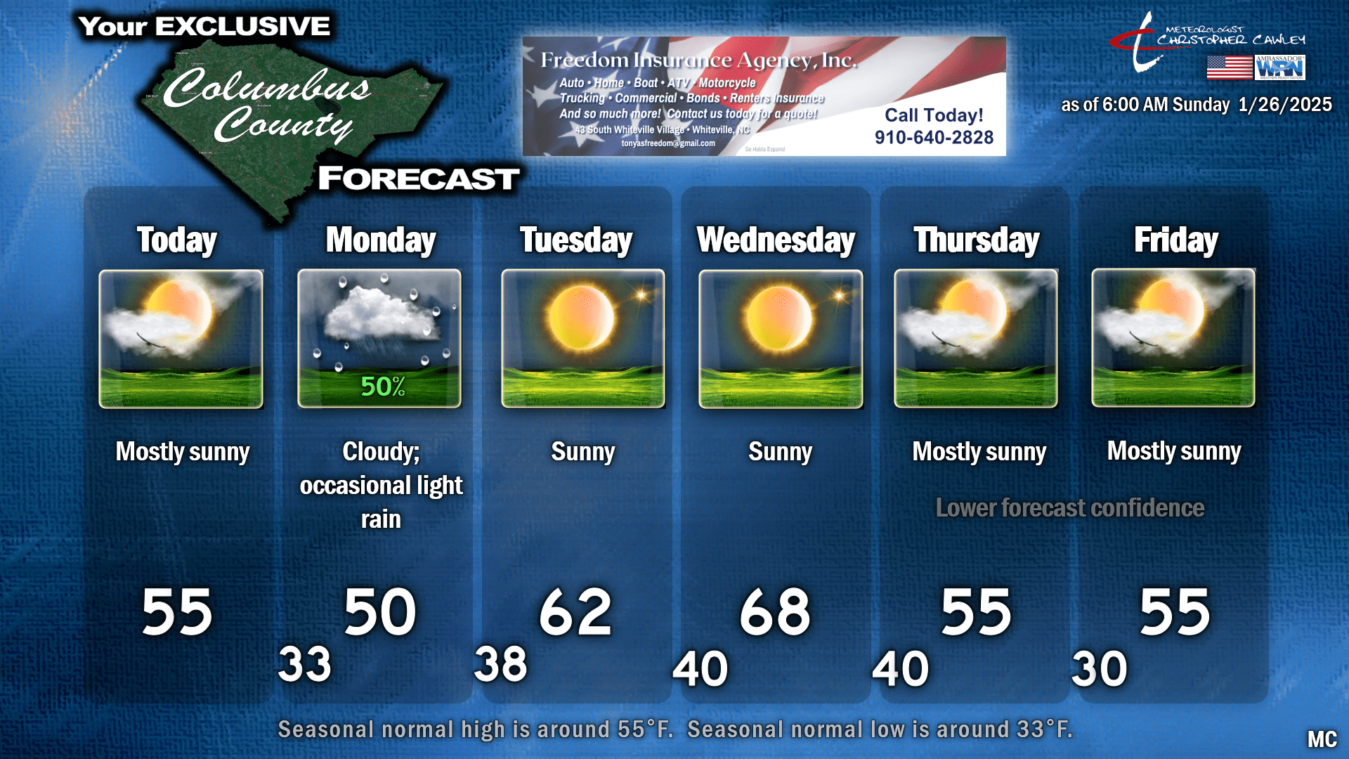
Rainfall amounts should be light. Nearly all of the guidance suggests a quarter of an inch or less… actually the 90th percentile is about a tenth of an inch. The National Blend of Models points to just a shade over a tenth of an inch across the county, so that’s what we’re going with. That’s not much at all. Despite the overall minimal amounts of rainfall, Monday is now looking like it will be mainly cloudy and fairly dreary. Because of this, my temperature forecast is down just a touch from what the MOS guidance suggests. I put 50 on the chart, but honestly we might be stuck in the upper 40s.
Putting the truck in reverse here for just a minute, there’s a timing issue between our low temperatures Sunday night and the onset of light rain. I believe our lows will be in the lower to middle 30s, but temperatures will start to rise after midnight just ahead of the onset of rain. All precipitation will stay in the form of rain.
After this clears out, a “zonal flow” sets up. This means that wind flows at all levels of the atmosphere will be generally from west to east. That keeps cold air pinned much farther to the north through the mid-week period, and allows our temps to warm up dramatically on Tuesday and Wednesday. Spoiler alert: Wednesday is going to be fantastic and springlike. A dry cold front should move through the area Wednesday night, knocking our temps back to reality.
My forecast confidence for Thursday into Saturday remains low. There’s a closed low that will be established over the desert southwest. As I mentioned in yesterday’s report, a closed low is one that is partially or completely detached from the main westerly wind currents, and can move extremely slowly. They are about as much fun to forecast as having dental surgery without anesthetic.
Forecast questions surround the ejection of this closed low; systems approaching the Pacific Northwest, diving southward through California and Nevada, are expected to “kick” this closed low out of its nice comfortable enclave. The available guidance has a very wide range of solutions with regards to this by the end of next week and into next weekend. There are three different directions that this could go, ranging from across the midsection of the country to the Great Lakes, along the Gulf coast and out to sea, or somewhere in the middle. There’s simply no way of knowing those solutions at this time. If the closed low ejects in our direction, there’s the potential for quite a bit of rainfall.
The ensemble range for temperatures in the Thursday through Saturday period is absurd. The 10th to 90th percentile highs range from the mid 30s to the lower 60s on Friday, and from the mid 30s to around 70 on Saturday. So… yeah… I have more confidence in my ability to win the Mega Millions than I do predicting what’s coming by the end of the week. I’m going with dry conditions and seasonable temperatures Thursday and Friday, but this could have remarkable changes as we get into the work week. Your phone apps might have wildly different information for the end of the week — remember that phone apps are just deterministic model data without any quality assurance.
Here’s your 6-day chart.
That’s all folks, for today’s weather update. As always, I thank you for your time in reading, and for your support. I have received quite a few comments in my DMs since the snowstorm, and I truly appreciate them.
Thank you for supporting Columbus County News, and our sponsors. I hope yall have a fantastic day, and take care.
~Meteorologist Christopher Cawley.


