CCN Weather Update for Tuesday July 1, 2025.
This weather update is sponsored by Freedom Insurance of Whiteville. When severe weather strikes, with Freedom Insurance you will always be prepared. For home, car, boat, or whatever you need, Freedom can provide customized coverage to keep you and your family safe. Contact Freedom today at 910-640-2828!
Here’s today’s Bottom Line
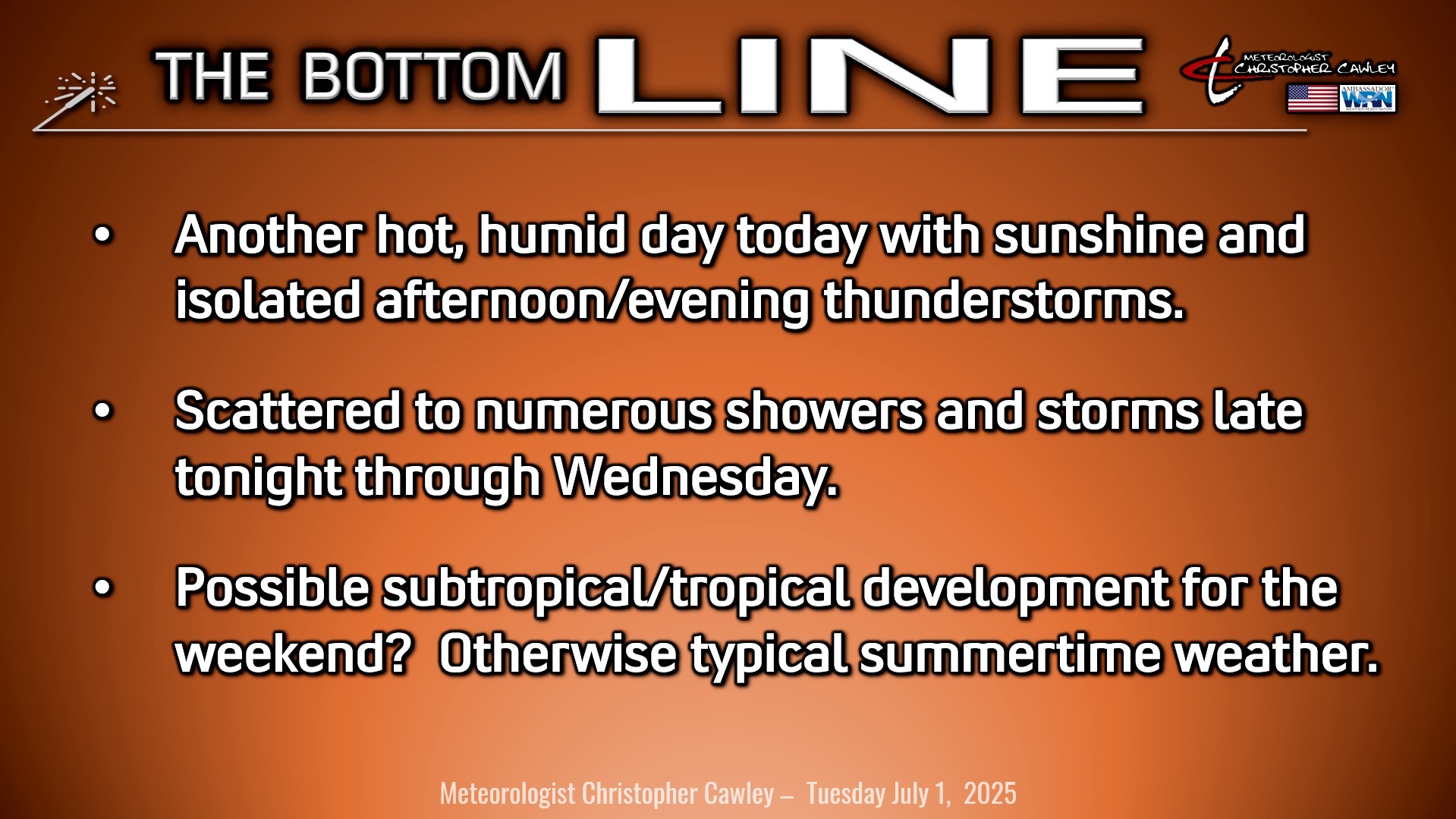
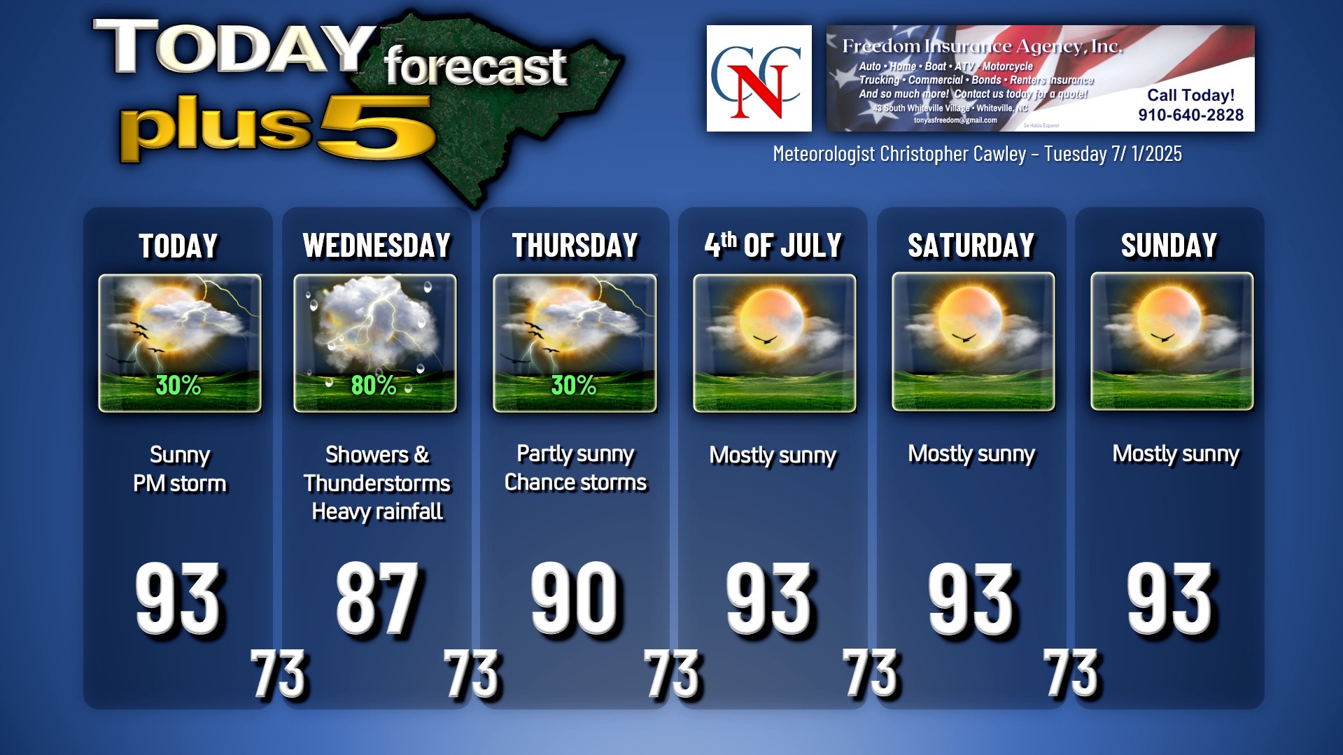
One final day (for now) of typical summertime weather conditions of heat and sunshine, along with isolated thunderstorms this afternoon. I think there’s a bit better chance for storms given an increase in moisture and instability thanks to a frontal boundary that is on approach from the northwest.
The frontal boundary slowly pushes across the area on Wednesday. This will result in scattered to numerous showers and thunderstorms throughout the day, with some copious rainfall possible. There is a low-level severe weather threat primarily west of I-95, so, as of now anyway, ColCo is in the clear in that regard.
Deep moisture and weak wind fields will lead to an enhanced risk for heavy rainfall and localized flash flooding on Wednesday. Storms won’t have a lot of overall organization, but will be slow-moving and, again, will produce copious rainfall.
The weakening front clears the coast Thursday. I think we will still have the potential Thursday for a few showers or thunderstorms, but nowhere near the coverage that I expect on Wednesday. The main question-mark is whether a tropical or subtropical system develops on the front (see tropical outlook below).
Even if a storm does develop, the way the front lies and with the steering winds, I don’t think we’ll see much in the way of impact here. I’m going to return to the “typical mid-summer weather forecast” for Columbus County for Friday through the weekend: Sunshine, heat, and an afternoon storm.
TROPICAL OUTLOOK: Still watching an area in the northern Gulf extending to the southwest Atlantic off the GA/SC coast for possible tropical development by this weekend.
The frontal boundary mentioned above will lie in a remnant state, draped off the coast, extending from the offshore Carolinas southwestward through northern Florida into the northern Gulf. Modeling continues to indicate that an area of low pressure will likely form on this boundary, with the ECMWF control and ensembles pointing at the northern Gulf off the west coast of Florida.
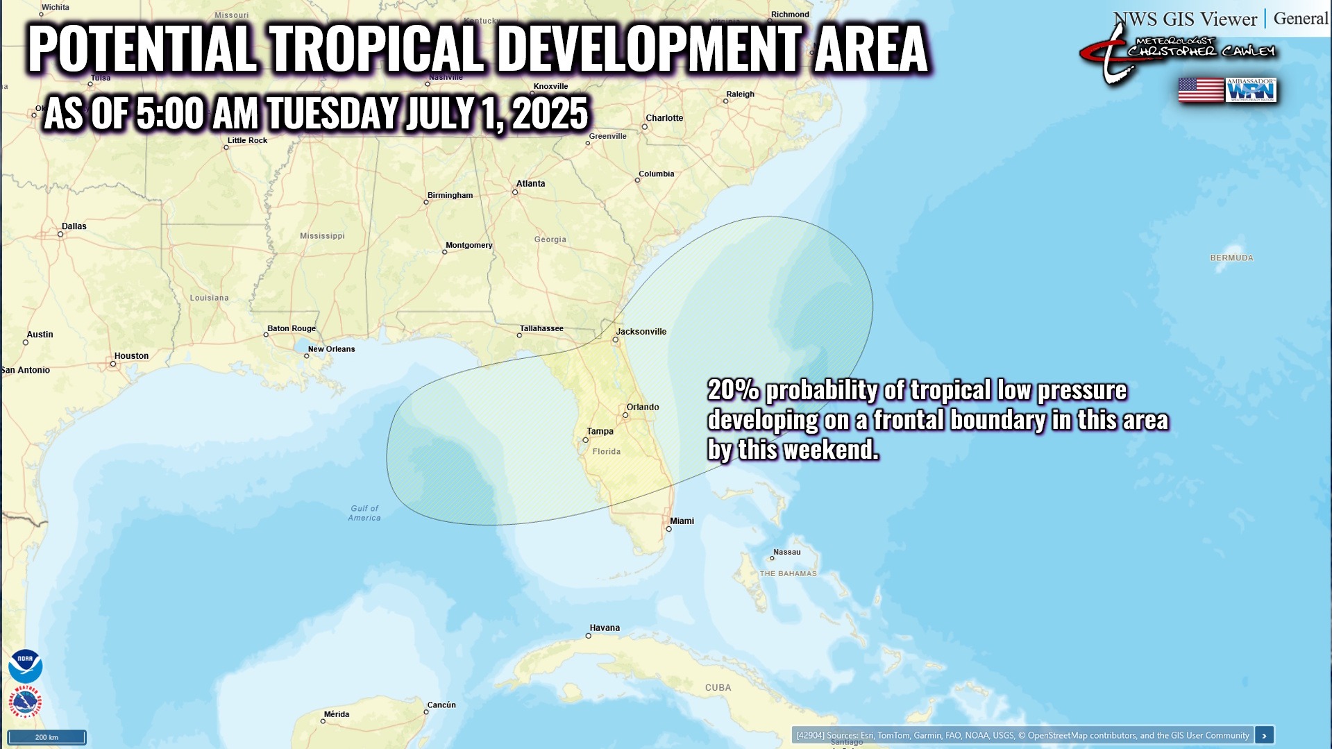
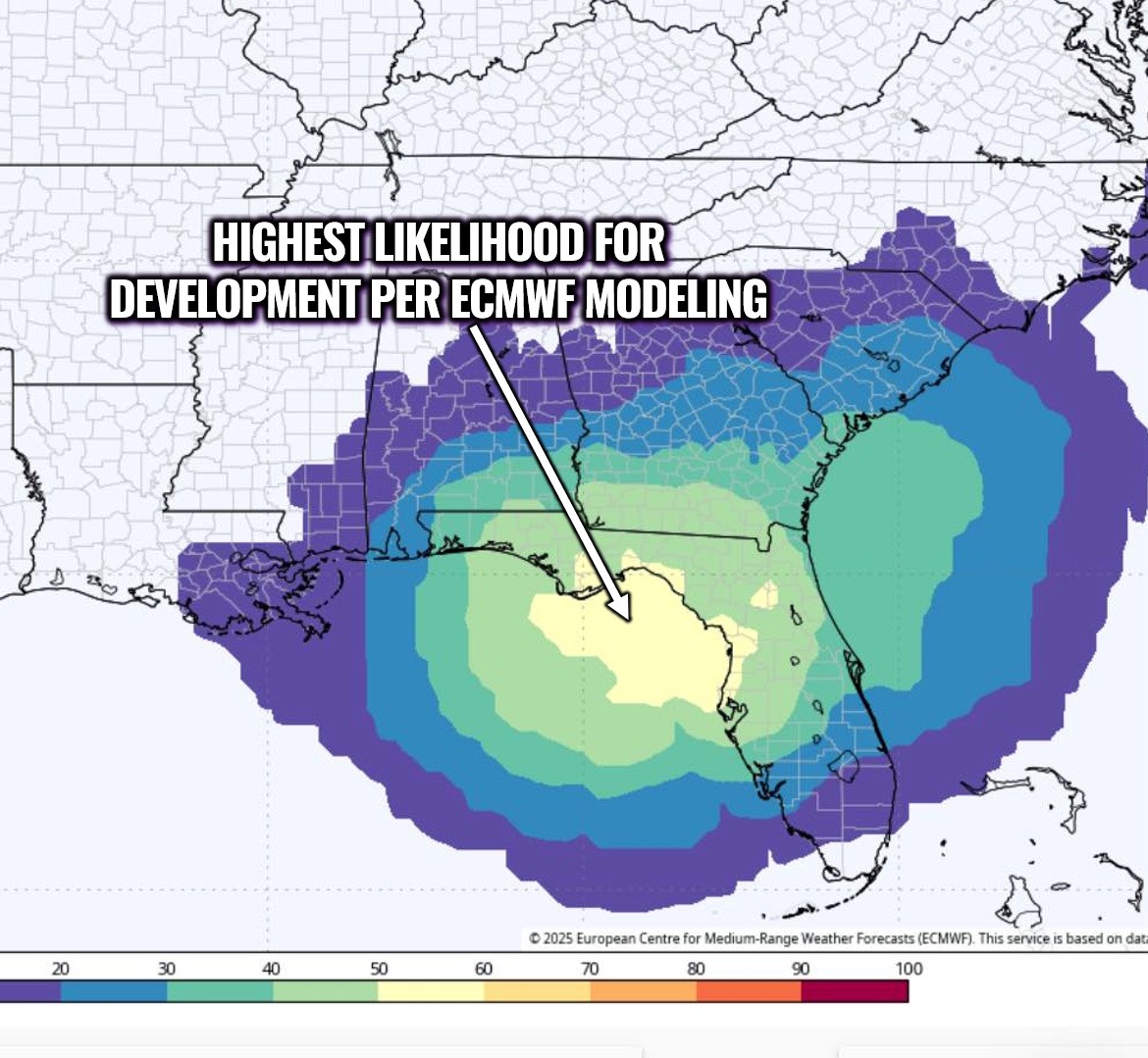
It needs to be stressed that at this point it’s too early to know
a) if a low forms at all,
b) where the low will develop,
c) how strong it will be, or
d) where it’s going to go from there.
I will continue to monitor this area.
Here is your Freedom Insurance Today-plus-Five Forecast:
–Meteorologist Christopher Cawley