CCN Weather Update for Wednesday April 29, 2026
This weather update is sponsored by Freedom Insurance of Whiteville. Trust Freedom Insurance to give you clear blue skies when it comes to home, car, boat, or whatever insurance you need. Let Freedom provide customized coverage to keep you and your family safe. Contact Freedom today at 910-640-2828!
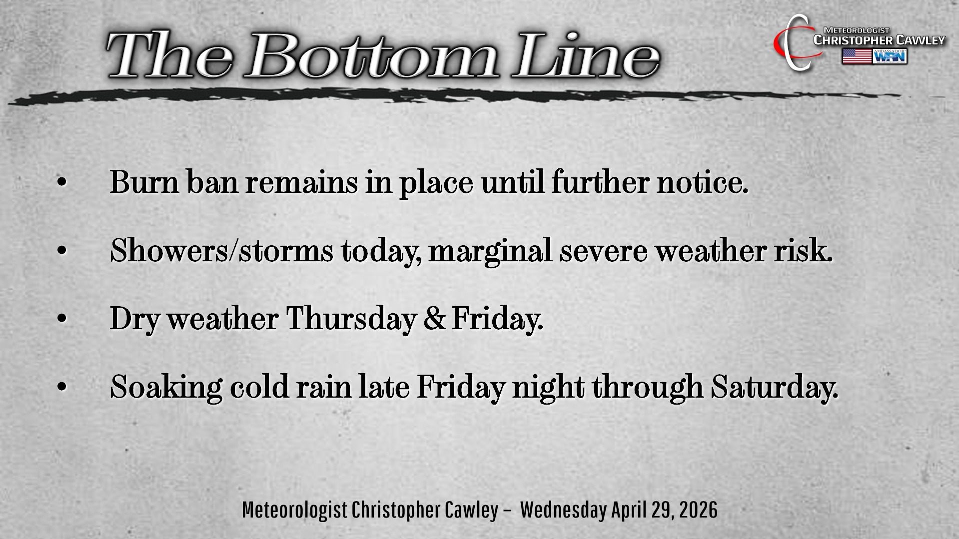
Here’s today’s Bottom Line
Happy Wednesday! Thanks for checking in with the CCN Daily Weather Blog.
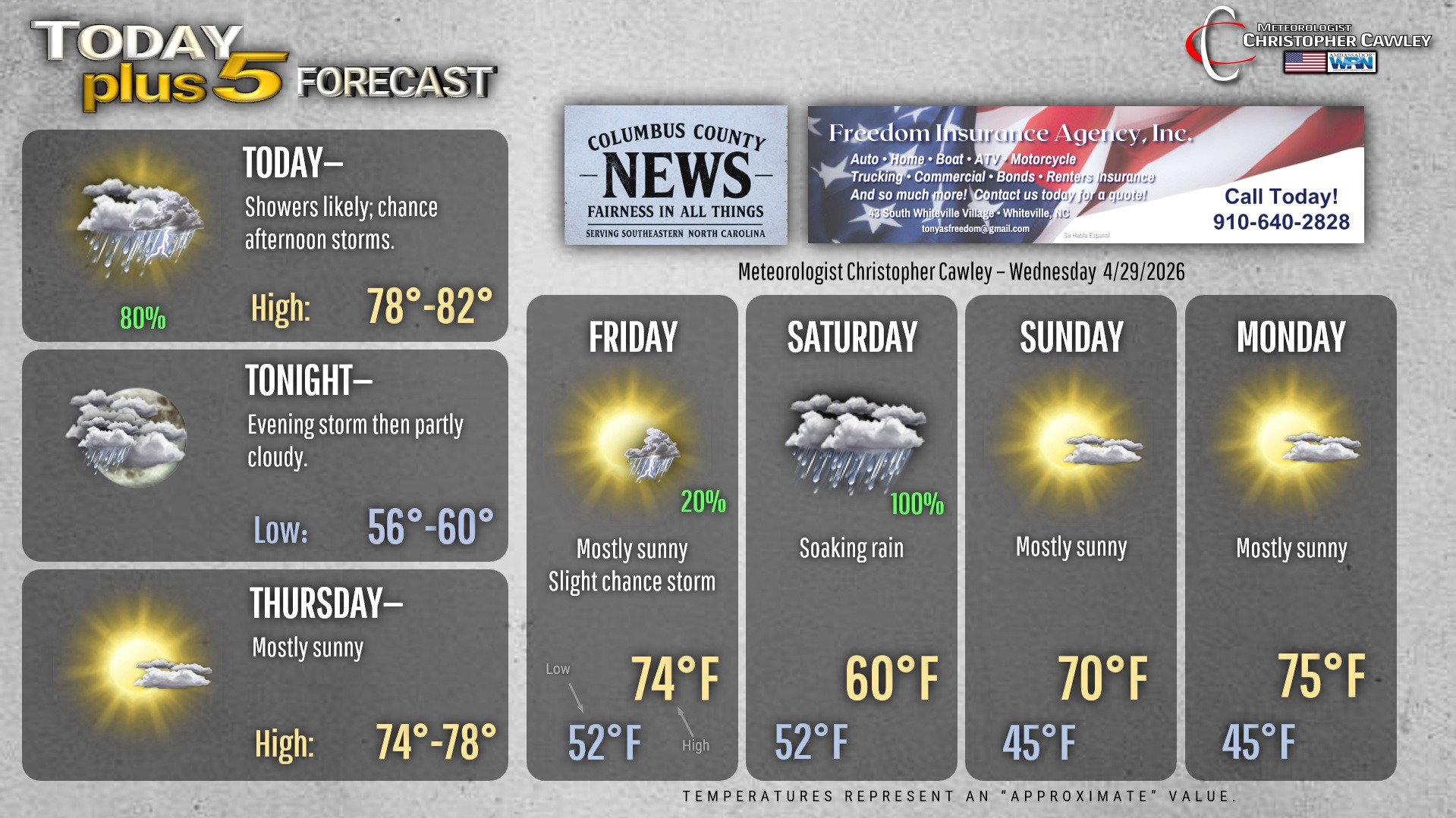
Scattered showers and thunderstorms for today thanks to a low pressure and frontal system moving through. There’s a marginal risk for severe thunderstorms this afternoon; there may be just enough atmospheric destabilization (but I doubt it). Rainfall today should be around a quarter to a third of an inch.
Then our attention focuses on the system that will impact our weather Friday night through Saturday.
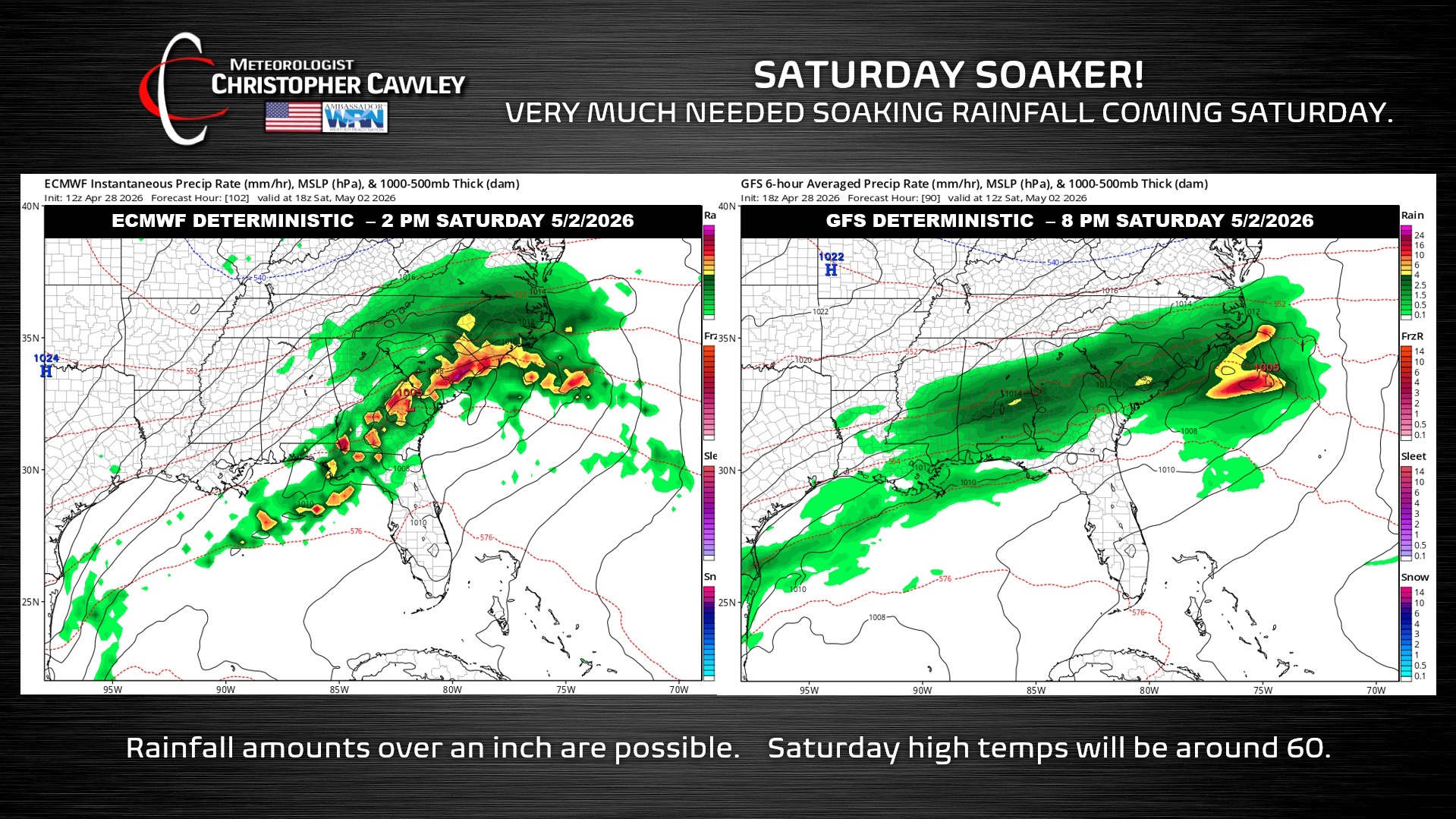
A broad area of low pressure will form near the Georgia/Florida coast late Friday, and push northeast into the Atlantic. The storm is likely to strengthen through Saturday, while an upper-level disturbance pinwheels across the Carolinas. The increased southwesterly flow combined with the surface low and energy up above means … soaking cold rain.
Unfortunately this comes at the expense of the Strawberry Festival.
This is the best chance for significant rainfall that we’ve seen in months. We could experience upwards of an inch of rain from this system. This won’t get rid of the drought but it will put a good dent in the fender.
There doesn’t appear to be any “convective elements” with this system, so it’ll be a slug of cold, soaking rain.
Highs on Saturday will struggle to reach the 60-degree mark.
After that system exits early Sunday, dry weather will return into the first full week of May.
Here is your Freedom Insurance Today-plus-Five Forecast:
–Meteorologist Christopher Cawley