CCN Weather Update for Saturday June 27, 2026
This weather update is sponsored by Freedom Insurance of Whiteville. Trust Freedom Insurance to give you clear blue skies when it comes to home, car, boat, or whatever insurance you need. Let Freedom provide customized coverage to keep you and your family safe. Contact Freedom today at 910-640-2828!
Here’s today’s Bottom Line
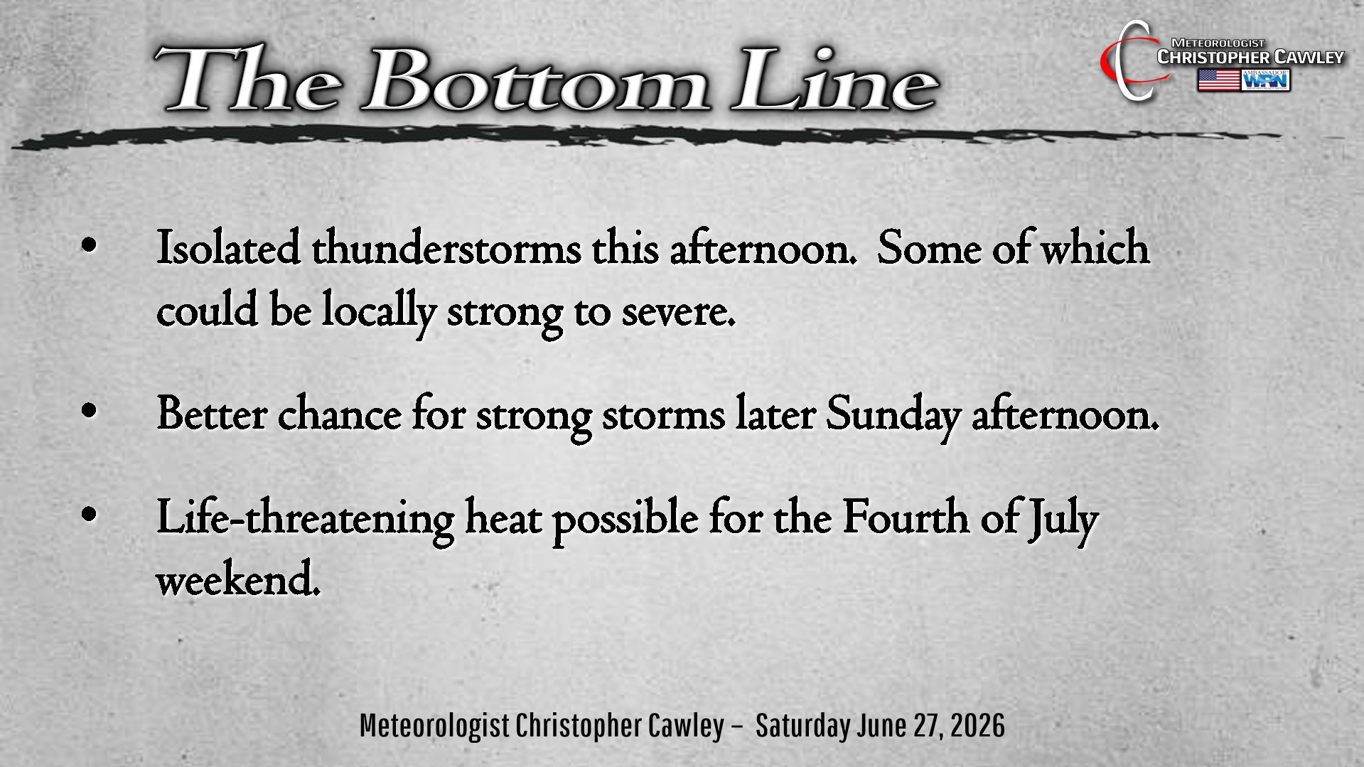
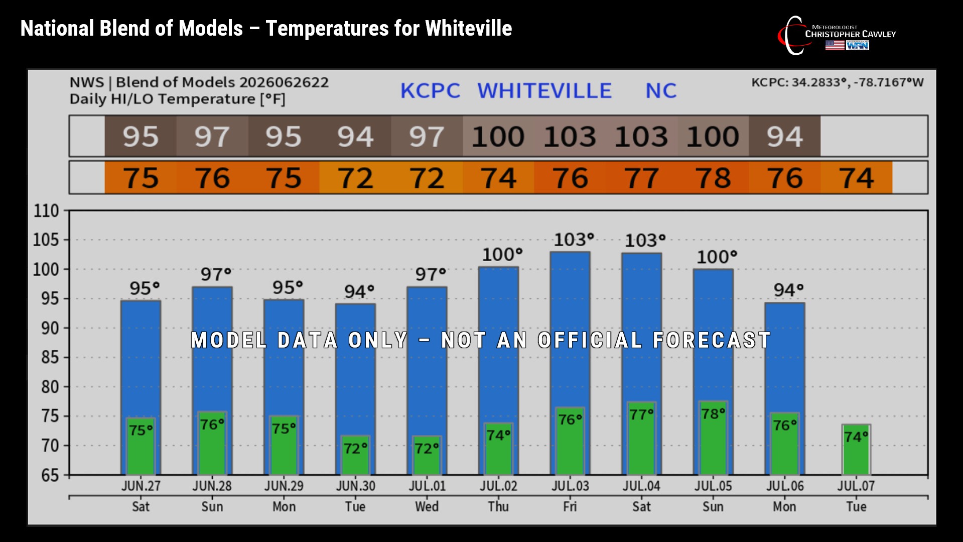
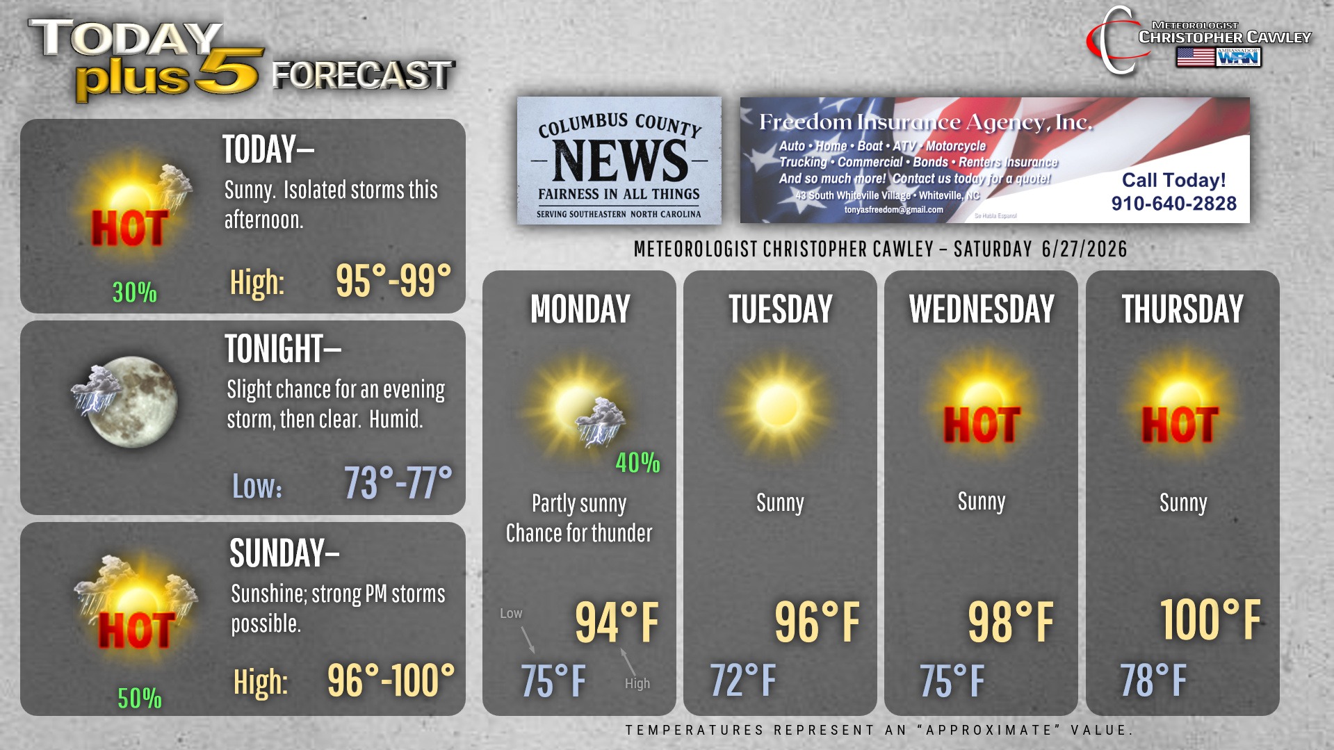
A hot weekend is on tap for the area… but heat index values should fall just short of advisory criteria today. Heat advisory is likely to be posted on Sunday as heat index values rise to between 105 and 110.
Actual highs today and tomorrow will be in the mid to upper 90s, with some areas probably touching 100 on Sunday.
If you have outdoor activities planned, stay well hydrated and use that sunscreen.
We’ll see isolated to widely scattered thunderstorms this afternoon, primarily after 2 PM. Any storm that forms will likely produce intense rainfall, an immense amount of lightning, and possible damaging downburst winds. Again, coverage this afternoon should be isolated to widely scattered.
A “cold front” will drop across the area later Sunday afternoon. More widespread thunderstorm coverage is expected with the boundary. As for severe parameters, the shear (change in wind speed and direction with height) looks to be rather weak, but strong instability with tons of moisture available means the potential for “wet microbursts” — water-loaded downbursts that could produce wind damage and flash flooding. Copious lightning will also be a feature of storms on Sunday.
Behind the front on Monday we’ll see slightly “cooler” temps only in the mid 90s for Monday and Tuesday. Then a southeasterly flow becomes established… and becomes connected with a very strong mid-level high pressure ridge. This is a perfect setup to bring prolonged, dangerous heat to the area, culminating in what could be several consecutive days with highs (actual highs) above the Misery Mark and lows not dropping much below 80. It is highly likely that “extreme heat warnings” will be posted for heat index values of 110 or higher. Thunderstorm chances going into the holiday weekend are nearly zero.
Tropics continue to remain quiet at this time.
Here is your Freedom Insurance Today-plus-Five Forecast:
–Meteorologist Christopher Cawley