Greetings everyone, it’s Thursday and time for the CCN Daily Weather Update! This update is brought to you exclusively by Freedom Insurance of Whiteville. Contact Freedom Insurance today at 910-640-2828, and their professional experts will set up the perfect policy for your needs! Call or stop in today!
STATISTICS FOR WHITEVILLE – Wednesday February 5, 2025.
High: 69.4°F at 2:14 PM (normal is 56)
Low: 47.3°F at 6:06 AM (normal is 32)
Precip: 0.00 in
View live, real-time weather data for Whiteville on my College Street Weather Station.
Here’s your Bottom Line for today…
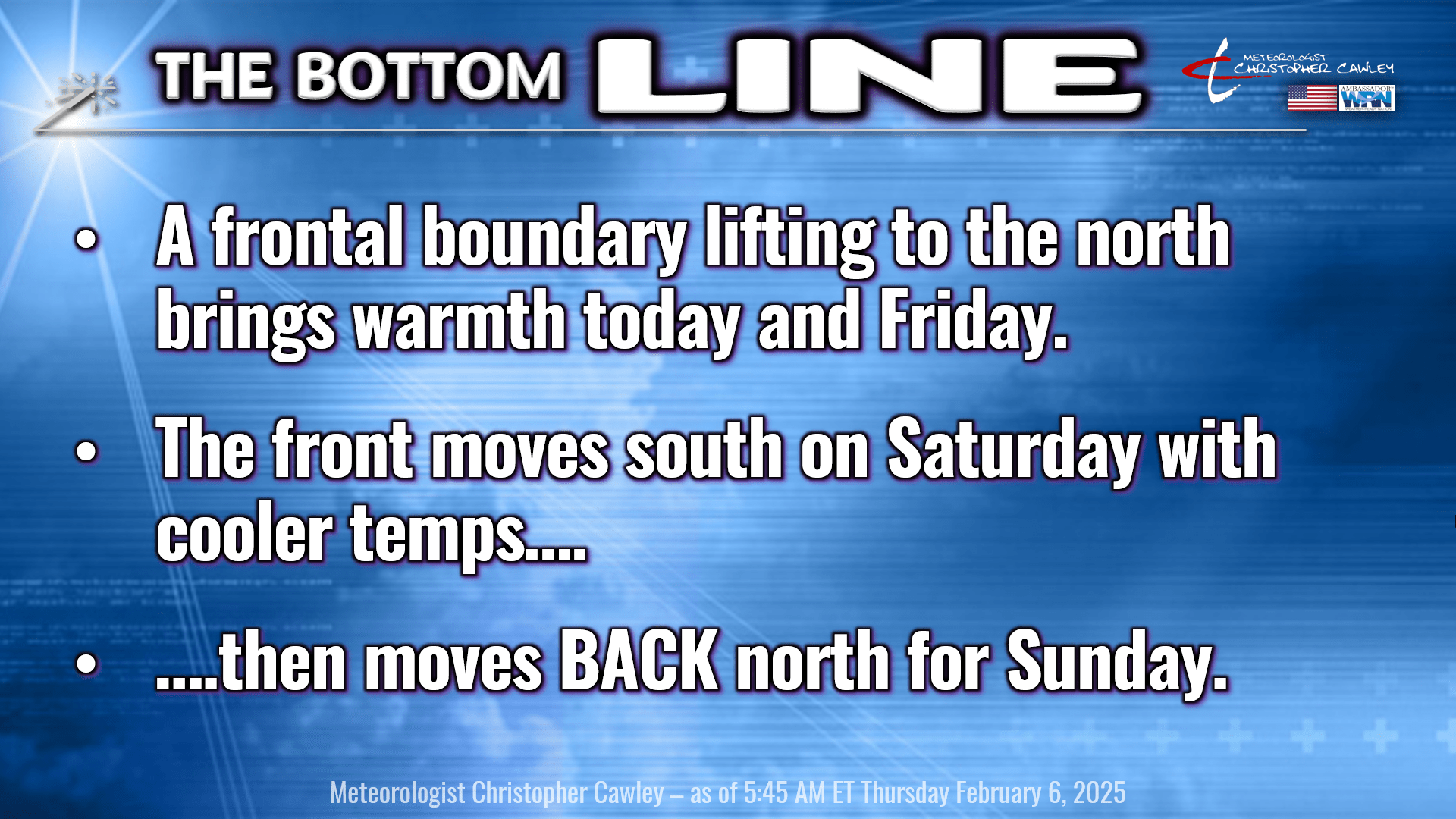
The frontal boundary that has been wreaking havoc with my forecast the past few days has lifted to the north as of this writing. There was some thunder reported to our north during the overnight hours. No, it’s not going to snow in 10 days.
Whatever clouds are leftover this morning will quickly be gone and we’ll have a good deal of sunshine for today. It’s going to be warm as we’ll be in a southerly wind flow… and it’s going to feel just a touch on the humid side this afternoon.
We’re quiet and unseasonably warm tonight. Our LOWS will be higher than the normal highs… I’m going with upper 50s.
Remember that frontal boundary? Well it returns for a short visit Friday night into Saturday bringing considerable cloudiness and some shower chances. I believe the modeling is overdone on this with regards to moisture, since the front has been pretty dry during it’s life span over the area. So whatever showers we get should be scattered in nature, and probably won’t amount to much.
Temperature forecast for Saturday is really challenging as there is a real possibility that front kind of stalls out right over the county. Areas north of the front will have highs in the 50s and 60s… while areas south of the front may reach 80. I’m going with 65 for Saturday, but this could swing as much as 10 degrees either way. Just putting that out there. Even the Euro ensembles have a wide temperature swing for Saturday, ranging from about 60 to as high as 85.
The front lifts back north… far to the north on Sunday as a multitude of low pressure centers take aim on the northeast US. A strong cold front will approach from the west. Ahead of this front we’re locked in the warm sector with a robust flow of warm and humid air from the Gulf. Highs easily cruise past the 80-degree mark on Sunday afternoon. The high end on the Euro ensemble chart is 88. I don’t think it’ll be quite that warm… that would be breaking all-time February record highs. I’m going with 83, and that’ll probably be the high end on that.
FYI – the all-time highest official temperature in February for the Whiteville area is 86°F, recorded in 1997. Note, data is missing for years 2020 and 2022. Available records date back to 1956.
The front crosses the area Sunday night. Some of the guidance wants to paint a line of showers/thunderstorms with the frontal passage. I tend to doubt it as there are some features in the modeling that just do not make a lot of sense. (This is why one can’t just simply rely on model data to make a forecast.) Anyway, Sunday night becomes cloudy and cooler.
The front then gets hung up along the coast by Monday… and a series of low pressure waves begin to develop on the front, lifting north/east across the Carolinas into Virginia and then off the Del-Mar-Va coast. This brings a) cooler weather essentially all of next week, and b) significant rain chances next week.
The latest NBM rainfall projection from now through Sunday February 16 ranges from 2-4 inches. We need every drop of it. Both GFS and Euro ensembles show zero frozen precip… all 82 members. So in spite of what some people are sharing on social media, no, it’s not going to snow.
Here’s your Freedom Insurance Today-Plus-5 forecast for Columbus County.

With that, our report has come to a conclusion for today. Get outside and enjoy the warmth while we have it. Thank you for your support, and as always, take care!
~Meteorologist Christopher Cawley