Hello friends and followers, welcome to the Tuesday edition of the CCN Daily Weather Update.
Today’s weather update is brought to you by our friends at Freedom Insurance in Whiteville. When accidents happen, and they will, our friends at Freedom Insurance can make sure you are fully covered for whatever life throws at you. Give them a call today at 910-640-2828 and the experts at Freedom will make sure everything is perfect for you.
STATISTICS FOR WHITEVILLE – Monday March 10, 2025.
High: 55.6°F at 5:45 PM (normal is 64)
Low: 48.0°F at 10:06 AM (normal is 39)
Precip: 0.62 in
View live, real-time weather data for Whiteville on my College Street Weather Station.
Here’s your Bottom Line for today…

Just over half an inch of rainfall for Whiteville on Monday. Rainfall amounts across the county ranged from 0.25 to just under 2 inches depending on location.
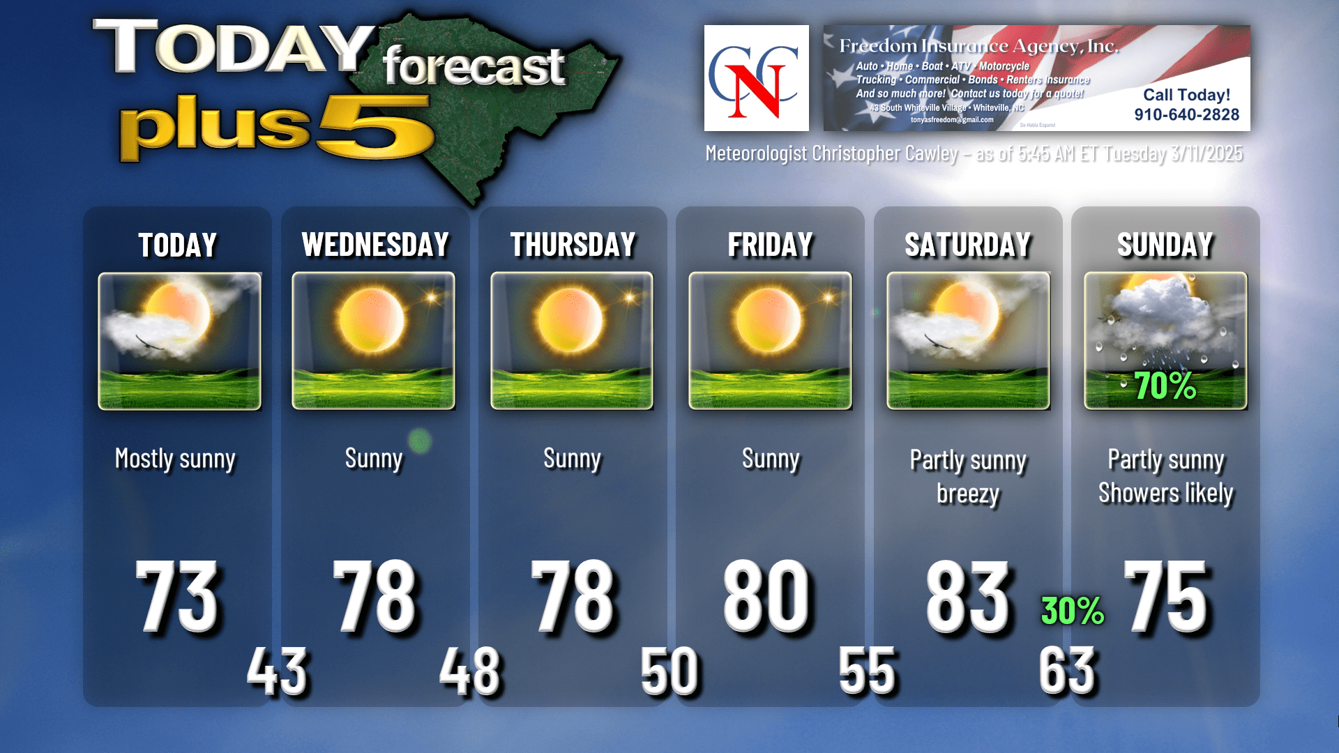
No further rain is expected until Saturday night.
Sprawling high pressure will bring a prolonged period of dry weather and warm daytime temps for the county. Highs will run in the 70s to around 80 through Friday… with highs rising into the lower 80s on Saturday.
Our next weather system arrives late Saturday into Sunday. This is going to be part of a very powerful system that will impact nearly the entirety of the eastern United States. The storm will have two partners… a northern stream and southern stream. The northern stream section will push northeastward over the Great Lakes into Canada. The southern stream section will push through the mid-Atlantic, and this will include a strong cold front. There is a little bit of question with regards to timing… and the whole construct of the system. The northern section has the potential to occlude itself, leaving a weaker trough to push the front. Regardless, a line of showers and possible thunder will push across the area Sunday (although some of the guidance suggests this might be Sunday night or even Monday). As of right now, the severe chances seem rather slim with this. Warm temperatures are likely to continue behind this front into NEXT week.
TOTAL LUNAR ECLIPSE Thursday night. The full moon will be fully enveloped in Earth’s shadow during about a one-hour period of totality during the overnight hours. The eclipse officially begins at 11:57 PM Thursday. Totality begins at 2:26 AM and ends at 3:31 AM. The penumbral phase will end at 6 AM Friday.
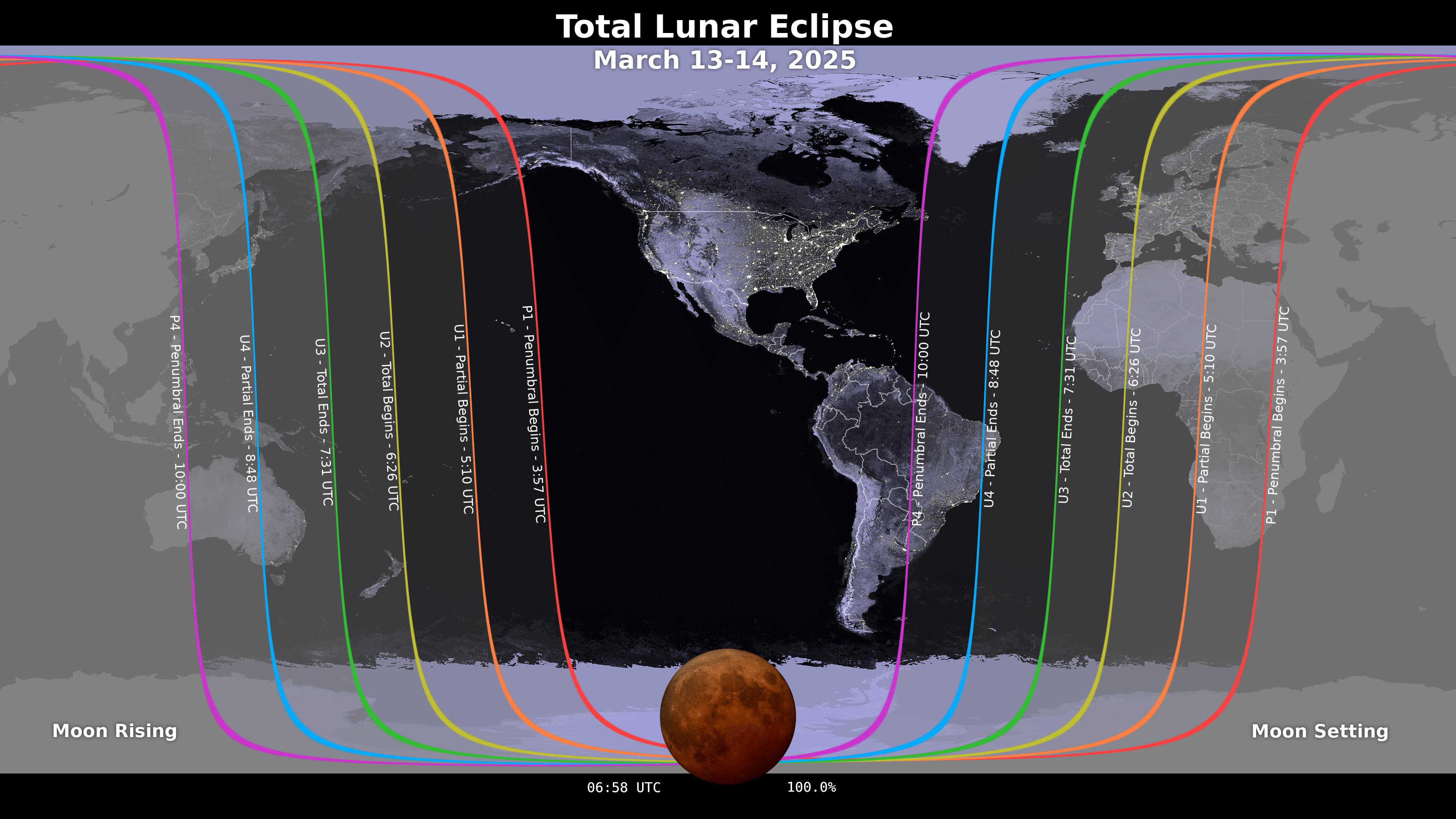
During totality, the moon doesn’t “disappear.” It’s in the Earth’s shadow and will appear a deep blood red during totality.
Here’s your Freedom Insurance Today-Plus-5 forecast for Columbus County.
That’ll do it for today. I hope you all have a wonderful day, and as always, take care.
~Meteorologist Christopher Cawley