CCN Weather Update for Tuesday August 26, 2025.
This weather update is sponsored by Freedom Insurance of Whiteville. No weather worries with Freedom Insurance. For home, car, boat, or whatever you need, Freedom can provide customized coverage to keep you and your family safe. Contact Freedom today at 910-640-2828!
Here’s today’s Bottom Line
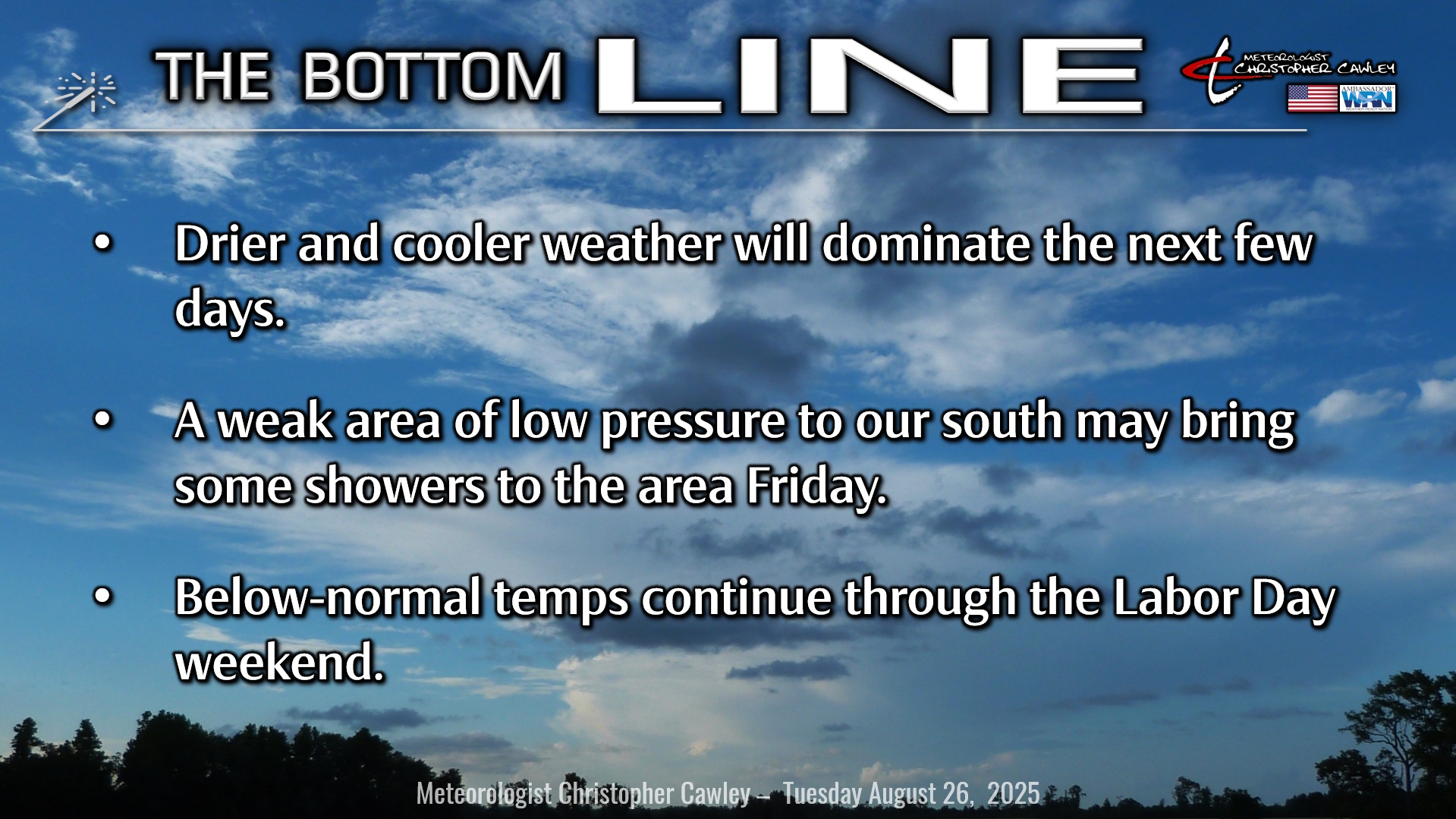
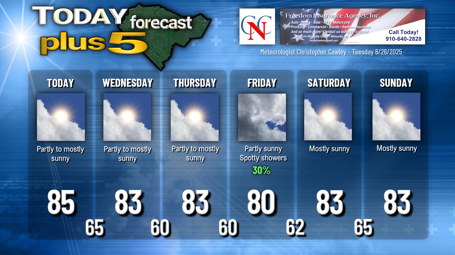
COOLER WEATHER!! Yes it’s finally here. A northerly wind flow in the wake of a cold front means the END of 90-degree heat for the foreseeable future. Lower humidity values and dry weather will dominate today, tomorrow, and Thursday. A few scattered clouds from time to time will dim the sunlight but otherwise it’s going to be really nice with temps in the mid 80s today and in the lower 80s Wednesday and Thursday. Morning lows will dip deep into the 60s… possibly some upper 50s here and there Thursday morning and Friday morning… so open up those windows and enjoy the first taste of cooler weather.
On Friday, a weak area of low pressure to our south will interact with high pressure to the northwest, as well as with a frontal boundary. This will bring more cloudiness and perhaps a few spotty showers from time to time with highs around 80.
That’s all gone by the Labor Day weekend. I’m going with a dry forecast but some of the modeling wants to paint some showers in here later Sunday into Labor Day on a southwesterly flow. I’m not sold on it yet so, for now anyway, it’s a dry forecast for the holiday weekend… but that could change.
Longer-range modeling shows temps warming back up into the upper 80s as we go into the 2nd week of September, so enjoy the cooler weather while we have it. Remember, we have “false fall” here and, well, here it is.
TROPICS: For once we don’t have much to talk about in the tropics! Sure, we have Tropical Storm Fernand, but that storm is moving north over the central Atlantic and is no threat to anything other than shipping.
The system that was located near the Leeward Islands really hit a brick wall of shear and fell apart quite spectacularly during the day on Monday. The NHC is no longer highlighting this area, and the scattered remnant thunderstorms mean very little at this point.
There are no other tropical areas of concern, and absolutely no threats to the Carolinas.
Here is your Freedom Insurance Today-plus-Five Forecast:
–Meteorologist Christopher Cawley