
CCN Weather Update for Monday September 29, 2025.
This weather update is sponsored by Freedom Insurance of Whiteville. No weather worries with Freedom Insurance. For home, car, boat, or whatever you need, Freedom can provide customized coverage to keep you and your family safe. Contact Freedom today at 910-640-2828!
Here’s today’s Bottom Line
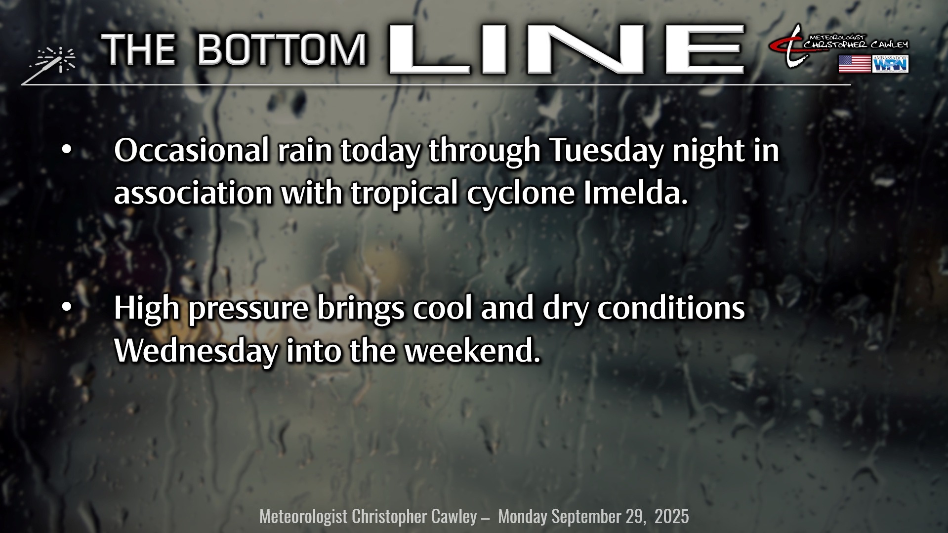
We’re wrapping up September today and tomorrow with active weather. Atlantic moisture from Imelda will interact with the old frontal boundary still lingering off the coast to bring periods of rain to the area today. I expect a rather expansive ‘shield’ of rain to lift northward and over our area. I believe that for the most part the rain will be light to occasionally moderate, but some heavier bursts of rainfall are possible later this afternoon through the evening hours.
Here is the future radar model for 5 PM today… what the radar “could” look like.
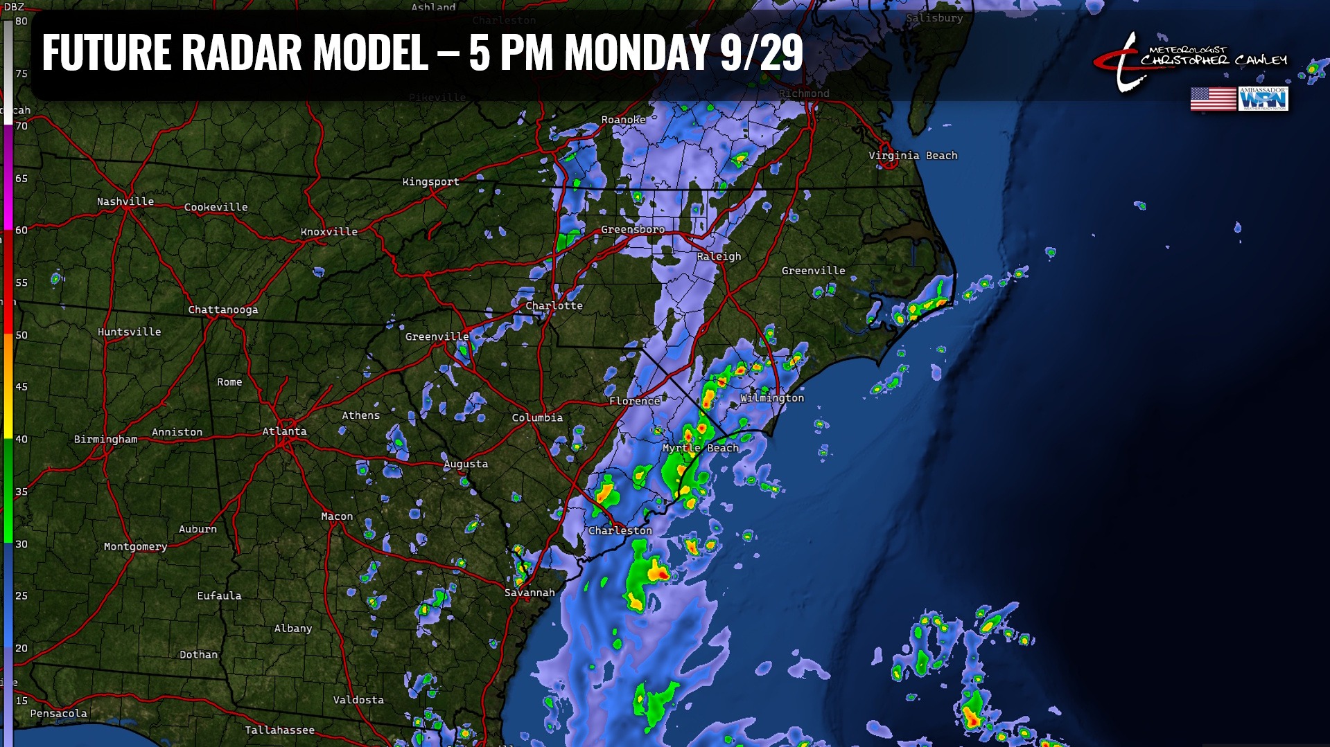
It’s all but certain now that we won’t have any direct impacts from Imelda. However, the deep subtropical plume of moisture (which would have been in place anyway) will be present and quite active. The old frontal boundary will tend to wash out along or just off the coast, which will be the catalyst for some pretty decent rainfall tonight… but should taper off throughout the day on Tuesday. We may see some breaks of sunshine Tuesday as well.
Storm total rainfall models show generally 1-3 inches across the area.
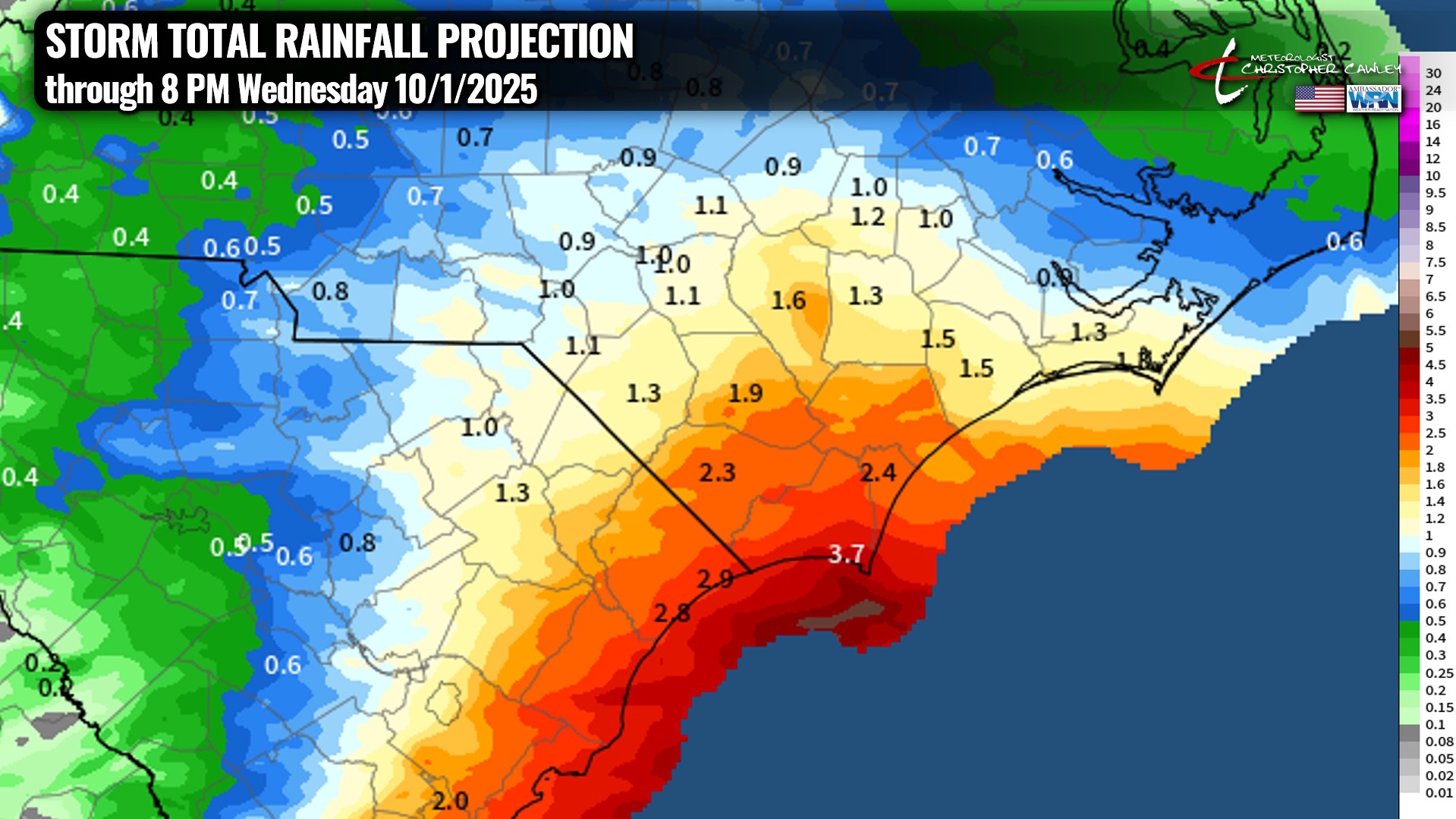
Keep in mind this is a computer-generated chart based on all of the available modeling. There could be some variability in the numbers from neighborhood to neighborhood, but ON AVERAGE this is a fairly decent representation of what I think we’ll see.
As for flooding potential, there may be some flooding of poor drainage or low-lying areas this afternoon through tonight. Roadside ditches, culverts, fields may develop quite a bit of standing water. Rivers, swamps, creeks are running pretty low thanks to the dry overall conditions this month, so they should handle the runoff quite nicely.
As of this writing, the NWS has *NOT* issued any flood watch or statement.
Looking at the rest of the work week, things will quiet down considerably. A rather elongated area of high pressure will extend from the northeast all the way down to the Gulf Coast Wednesday through Saturday bringing dry weather and temps just a touch below seasonable normal values.
TROPICS: Humberto and Imelda will pose no direct risks to the Carolinas. They will, however, combine to create very hazardous beach conditions for much of this week with dangerous rip currents, waves, and some beach erosion.
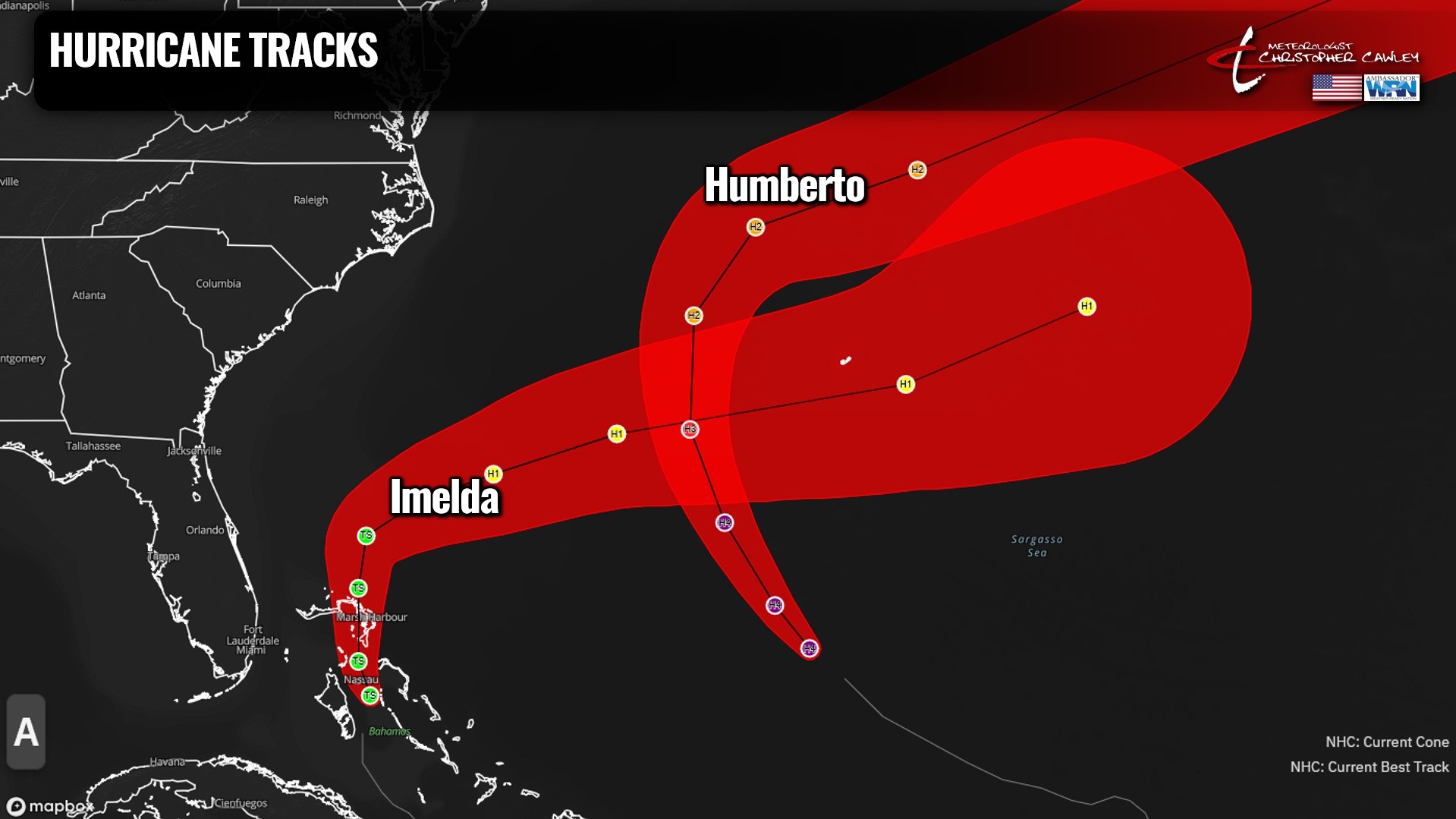
There are no other areas in the tropical Atlantic that are being watched.
Again… a deep sigh of relief. We dodged a big one, folks.
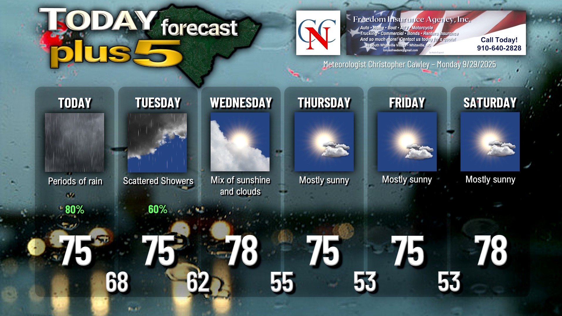
Here is your Freedom Insurance Today-plus-Five Forecast:
–Meteorologist Christopher Cawley