CCN Weather Update for Friday May 22, 2026
This weather update is sponsored by Freedom Insurance of Whiteville. Trust Freedom Insurance to give you clear blue skies when it comes to home, car, boat, or whatever insurance you need. Let Freedom provide customized coverage to keep you and your family safe. Contact Freedom today at 910-640-2828!
Here’s today’s Bottom Line
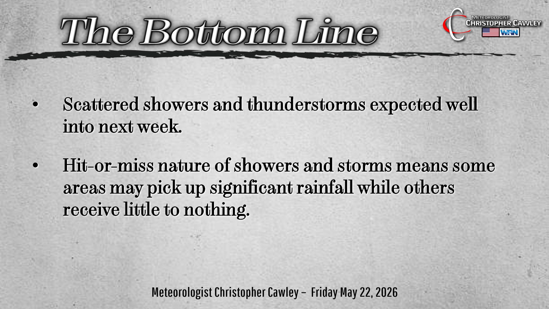
The key word in the “Bottom Line” graphic is SCATTERED.
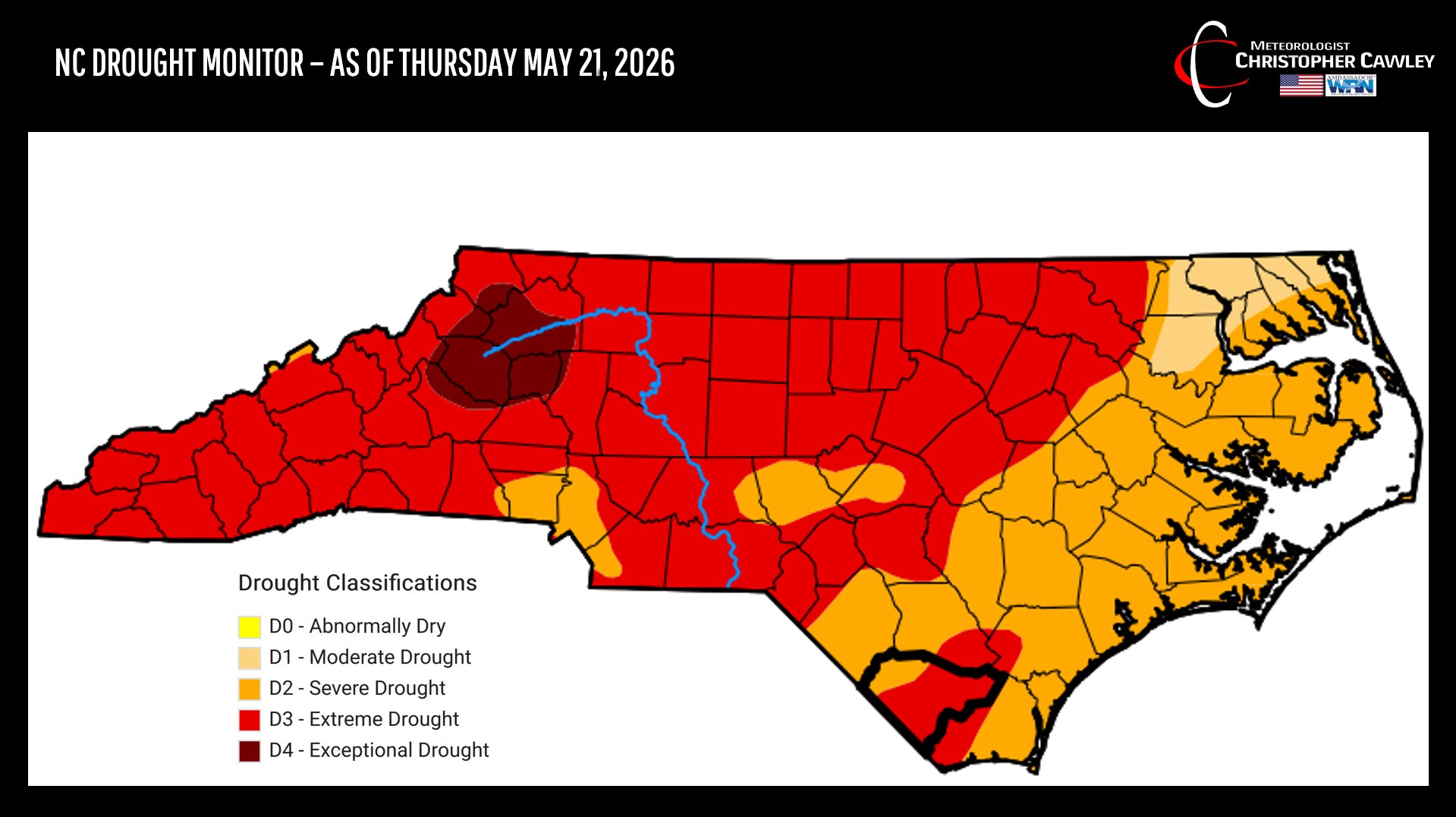
But let’s talk about the ongoing drought. As you can see by the latest Drought Monitor updated on Thursday, Columbus County remains largely in “extreme” drought.
Unsettled weather conditions well into next week MIGHT help put a dent in that, but the SCATTERED nature of the showers and storms means it’s going to be “boom or bust.”
So about the scattered showers and storms over multiple days.
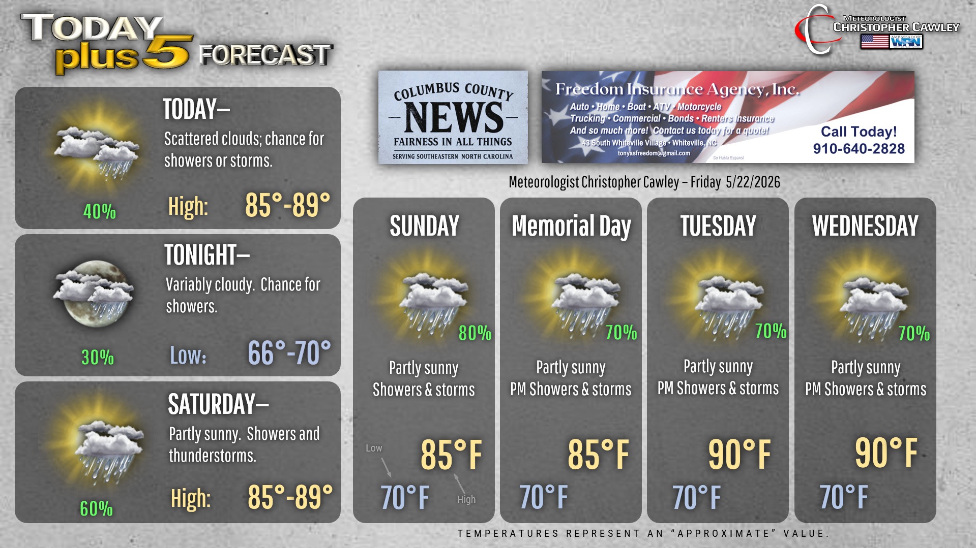
The cold front that pushed through last night (which was remarkably unremarkable, to be honest), will dissipate throughout the day today. The sea-breeze boundary will help trigger SCATTERED showers and thunderstorms this afternoon. Most areas probably won’t see much in the way of rainfall, but one or two spots could get a downpour this afternoon. Again… scattered. It’s impossible to determine where/when, but the best chances are this afternoon into early evening.
Then a lull tonight thanks to a lack of any significant energy. A stray shower or storm can’t be ruled out but by-and-large it’ll be quiet.
More moisture starts to get pushed into the area on Saturday with soupy dewpoints combined with subtle areas of lift enough to trigger SCATTERED showers and thunderstorms. Again, I’m painting 60% with a broad brush… there are plenty of areas that probably won’t get any rain at all, and others could receive significant amounts of rain. Once again it’s impossible to predict exactly who gets what and when.
The old frontal boundary completely fades into oblivion on Sunday, but plenty of tropical moisture will be in place Sunday… Memorial Day… Tuesday… Wednesday… and likely beyond. The sea-breeze and Piedmont trough will be the main sources of lift, along with old storm outflow boundaries.
Painting broad strokes once again with rain and storm chances, going with 70% by day (mainly in the afternoon and evening timeframe) dropping to 30% overnight. Oppressively humid air is likely to be in place with dewpoints well into the 70s. This will lead to highs in the upper 80s to around 90 with lows around 70 or into the lower 70s…. welcome to summertime in Columbus County.
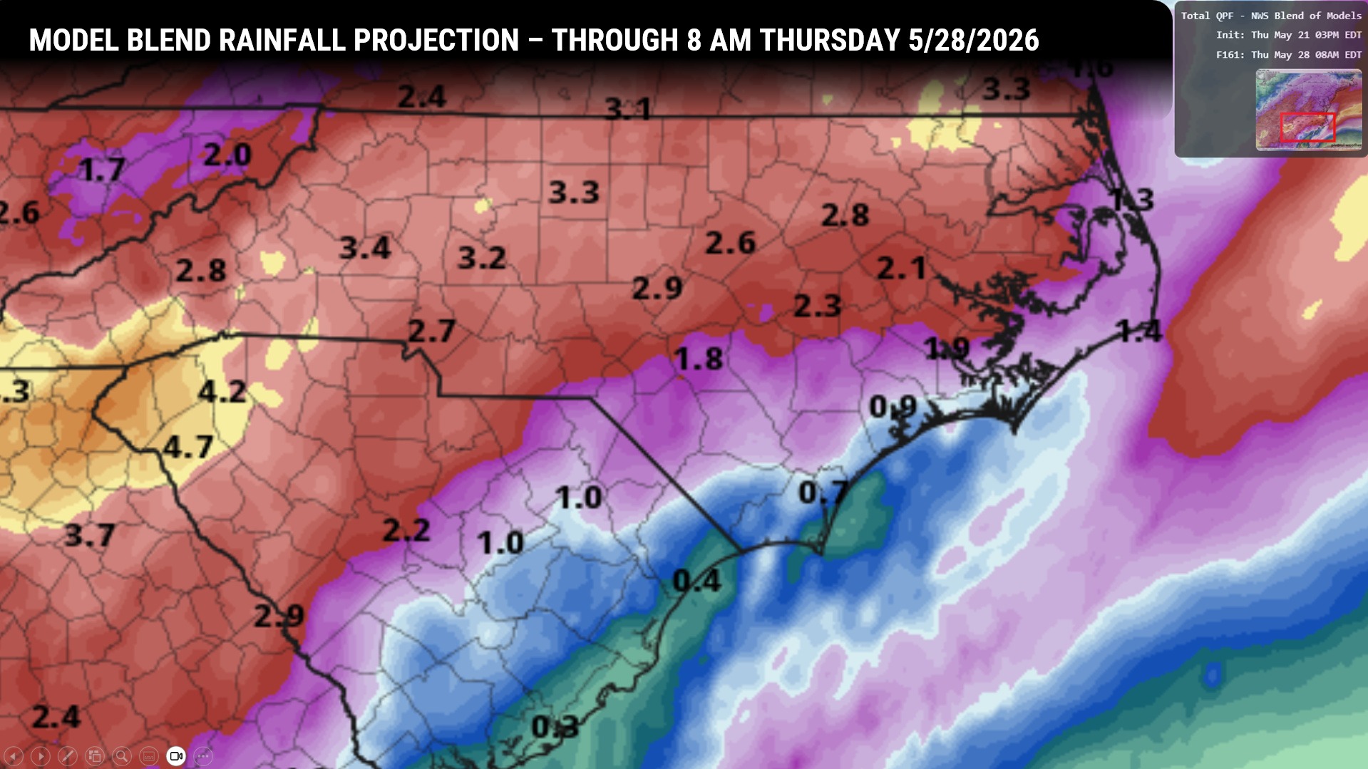
Rainfall COULD add up to some drought-denting levels, but again, it’s going to be boom or bust. The National Blend of Models suggests that most of the heavier rainfall totals will be north and west of Columbus County… but take this with a grain of salt because all it takes is for one pulse-up thunderstorm to drop 2-3 inches of rain over an isolated 5-square-mile area.
Here is your Freedom Insurance Today-plus-Five Forecast:
–Meteorologist Christopher Cawley