CCN Weather Update for Monday December 29, 2025.
This weather update is sponsored by Freedom Insurance of Whiteville. You can trust Freedom Insurance to give you clear blue skies when it comes to home, car, boat, or whatever insurance you need. Let Freedom provide customized coverage to keep you and your family safe. Contact Freedom today at 910-640-2828!
Here’s today’s Bottom Line:

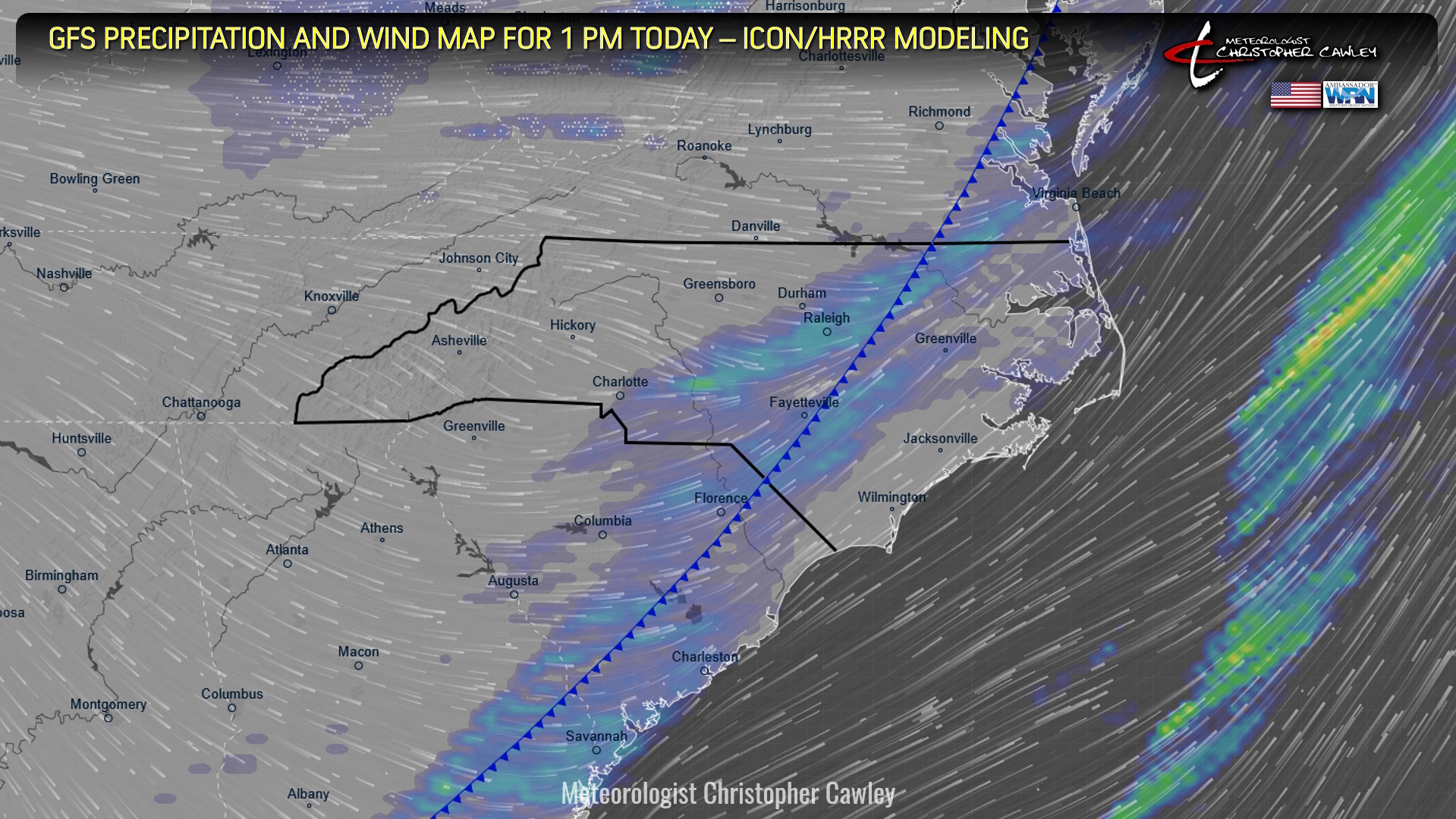
Ok folks, today’s the day. A king-size cold front, connected to an absolutely massive “bomb cyclone” in the Great Lakes, will blast through the area today, likely pushing through Columbus County this afternoon.
Ahead of the front, breezy southwest winds will develop and push our temps well into the 70s with a mix of clouds and sunshine. Some of the high-res modeling is suggesting a little bit of rain with the front itself, but that’s probably not very likely. I’m not going to put it in my graphic below but don’t be surprised if you see some rain drops on the windshield this afternoon.
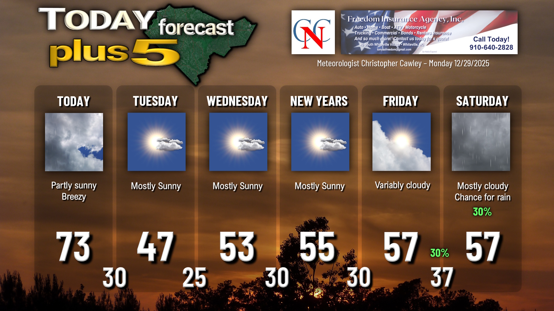
Skies rapidly clear this evening and temps fall to around 30 by Tuesday morning. Winds will stay rather elevated before dying off by tomorrow morning.
Tuesday will feature full sunshine, but a deep, cold northwesterly flow will keep our temps in the mid to upper 40s. Radiational cooling sets in for Tuesday night and we’ll drop to the mid 20s, although some of the typically colder spots will drop to the lower 20s.
High pressure will then bring dry conditions Wednesday, New Year’s Day, and Friday with temps warming up to essentially seasonal normal values (mid 50s). The next frontal boundary moves through late Friday night or early Saturday with a chance for showers. Slightly colder air will move in behind this front but all-in-all temps will be “near normal” through the first week in January.
Here is your Freedom Insurance Today-plus-Five Forecast:
–Meteorologist Christopher Cawley