CCN Weather Update for Tuesday February 17, 2026.
This weather update is sponsored by Freedom Insurance of Whiteville. You can trust Freedom Insurance to give you clear blue skies when it comes to home, car, boat, or whatever insurance you need. Let Freedom provide customized coverage to keep you and your family safe. Contact Freedom today at 910-640-2828!
Here’s today’s Bottom Line:
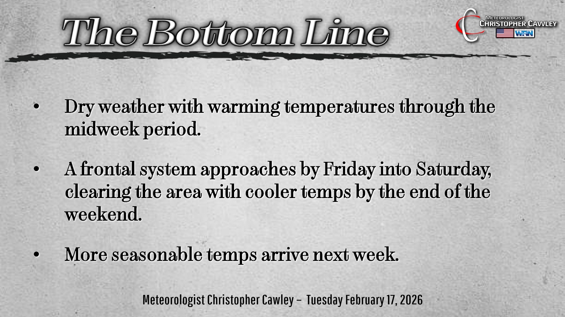
Dry weather with unseasonably warm temps will persist into Thursday thanks to high pressure just off the coast.
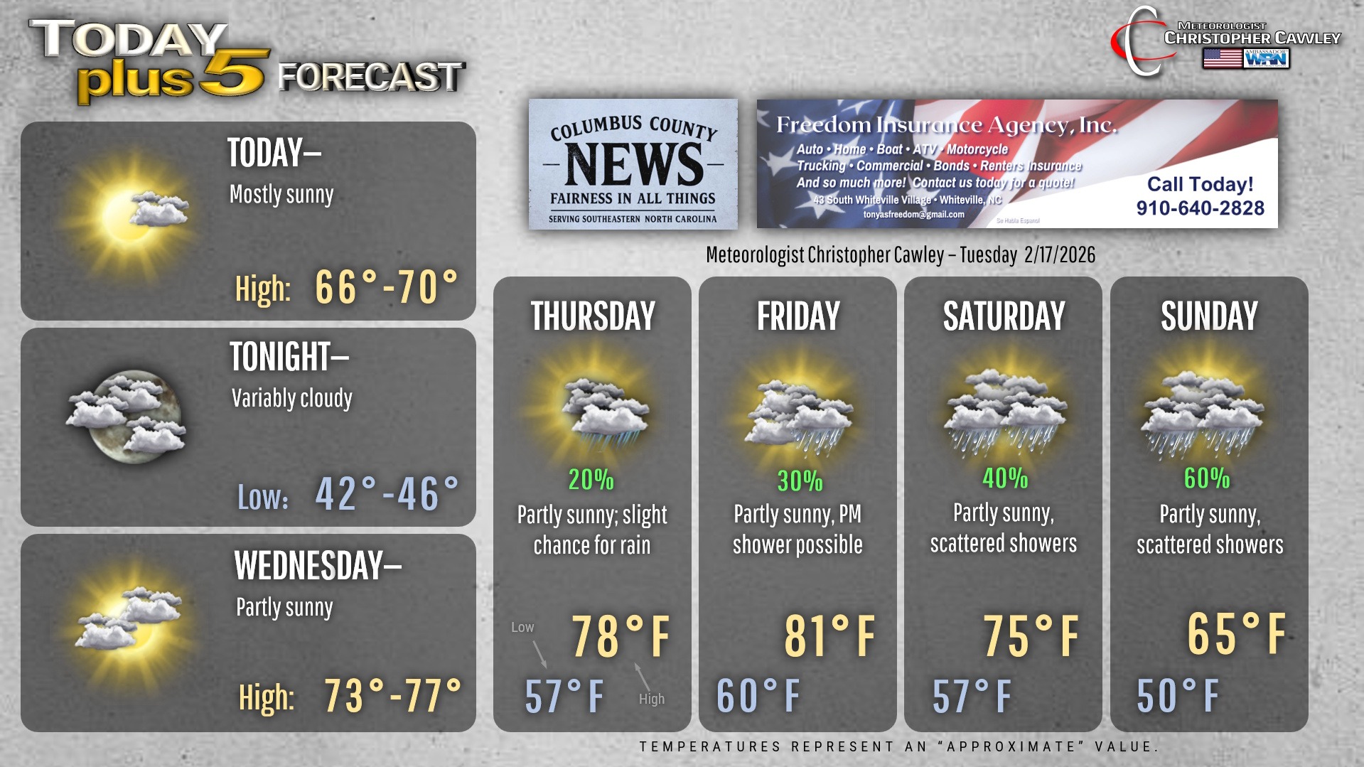
A more humid, southerly flow takes shape Thursday. This will lead to a bit more cloudiness and the slight chance for some spotty light rain, but temps will still flirt with record territory — highs in the upper 70s to near 80.
Friday will be the warmest day of this “false spring.” Depending on the amount of sunshine we receive (I’m expecting a decent amount of cloudiness and some showers), we may pop into the lower 80s, which would be record numbers. The record high for Whiteville for Friday is 79 degrees, recorded back in 2000, so given a decent amount of sunshine, that record will fall.
Overnight lows Wednesday night, Thursday night, and Friday night will run well above our normal HIGH temps. Lows Thursday night probably won’t drop below 60 degrees.
A frontal system will approach for the weekend. Timing / strength / dynamics still remain to be seen. I believe most of those issues will go off to our north; however, scattered showers can be expected on Saturday and Sunday. I’m expecting the cold front to cross the area on Sunday morning.
Much cooler temperature are likely early next week as a cold northwesterly flow becomes established… but this will likely be short-lived.
There is no wintry precipitation anywhere in sight for the next 10+ days.
Here’s your Freedom Insurance Today-plus-Five Forecast!
–Meteorologist Christopher Cawley