Good evening, Meteorologist Christopher Cawley here with an update on Category 5 Hurricane Milton.
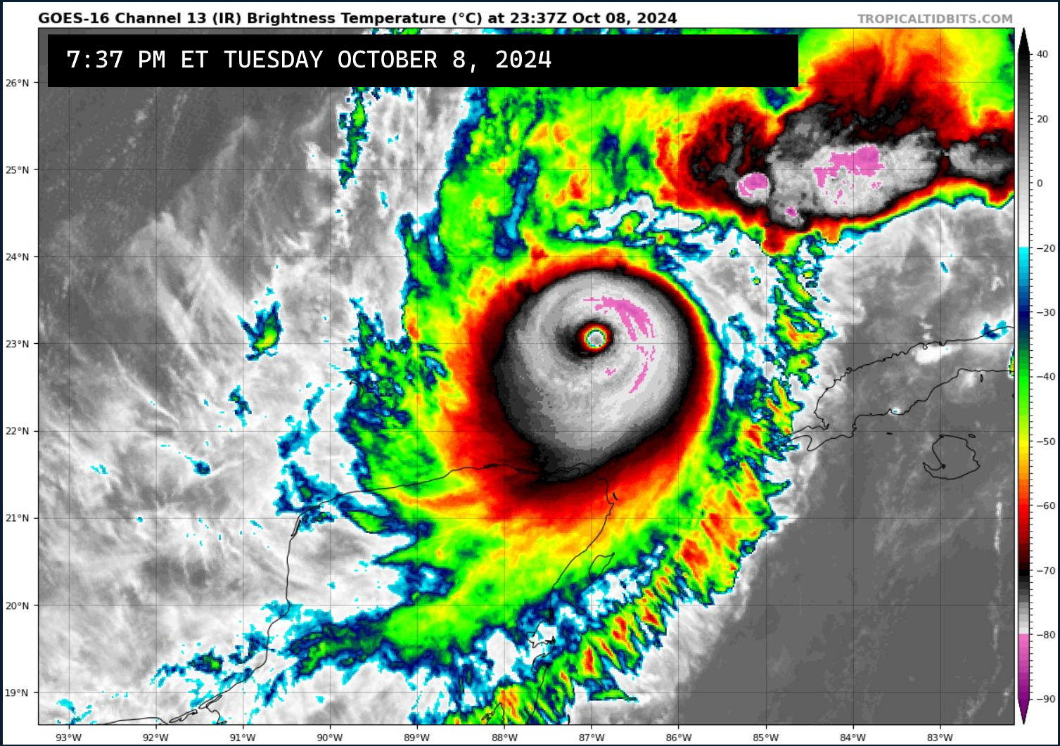
Milton underwent an eyewall replacement cycle on Tuesday and briefly weakened to a cat-4 … but has regained his strength and his tiny eye (which also indicates an extremely intense hurricane) as of this writing.
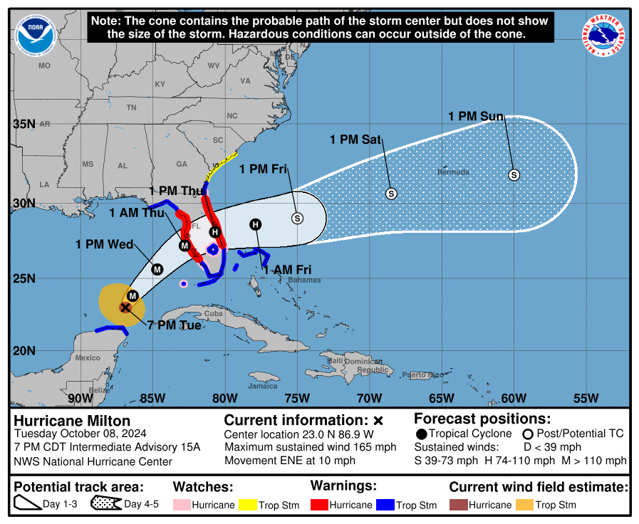
The National Hurricane Center has shifted the track centerline just a tad south, now projecting the center to make landfall a little bit south of Tampa, FL. The differences “on the ground” will be negligible as Milton is increasing in spatial size as well as strength. A storm surge “tsunami” of 10-15 feet is still likely along and just south of the eye wall.
Local impacts remain little to none for the Whiteville area. I think we’ll see some breezy conditions on Wednesday night through Thursday but outside of that, just some increased cloudiness Wednesday night. Tropical storm warnings have been posted for the coastal waters as winds will be much stronger along the coast… with deadly rip current risks… especially for the Brunswick County coast. Some light rain showers may creep as far north as Georgetown or Myrtle Beach, but I think even that is a stretch.
Our weather locally remains high-and-dry through the holiday weekend thanks to strong high pressure in control. Temperatures will be in the lower to middle 70s Thursday and Friday… rising to around 80 for the weekend… before the next dry cold front moves through early next week. Cloudiness Wednesday and Wednesday night will give way to clearing skies for Thursday, and we enjoy full sunshine through at least Monday.