Hey folks, welcome to the Sunday edition of the CCN Weather Update!
We are brought to you today once again by Freedom Insurance of Whiteville. The professionals at Freedom Insurance have your back covered in the event of any situation. Give them a call and they’ll work with you to develop the best policy for your needs. Contact them at 910-640-2828 or stop by and visit today!
STATISTICS FOR WHITEVILLE – Saturday February 8, 2025.
High: 62.6°F at 12:23 AM (normal is 57)
Low: 52.6°F at 9:49 AM (normal is 33)
Precip: 0.12 in
View live, real-time weather data for Whiteville on my College Street Weather Station.
Here’s your Bottom Line for today…
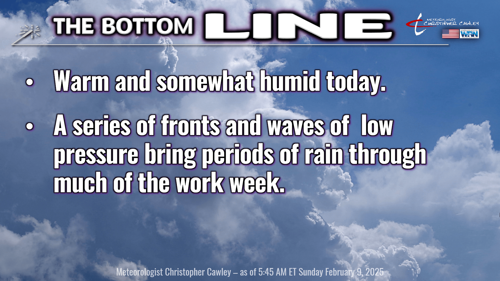
The warm front we’ve talked about has finally moved north of the area, and temperatures have been slowly rising overnight.
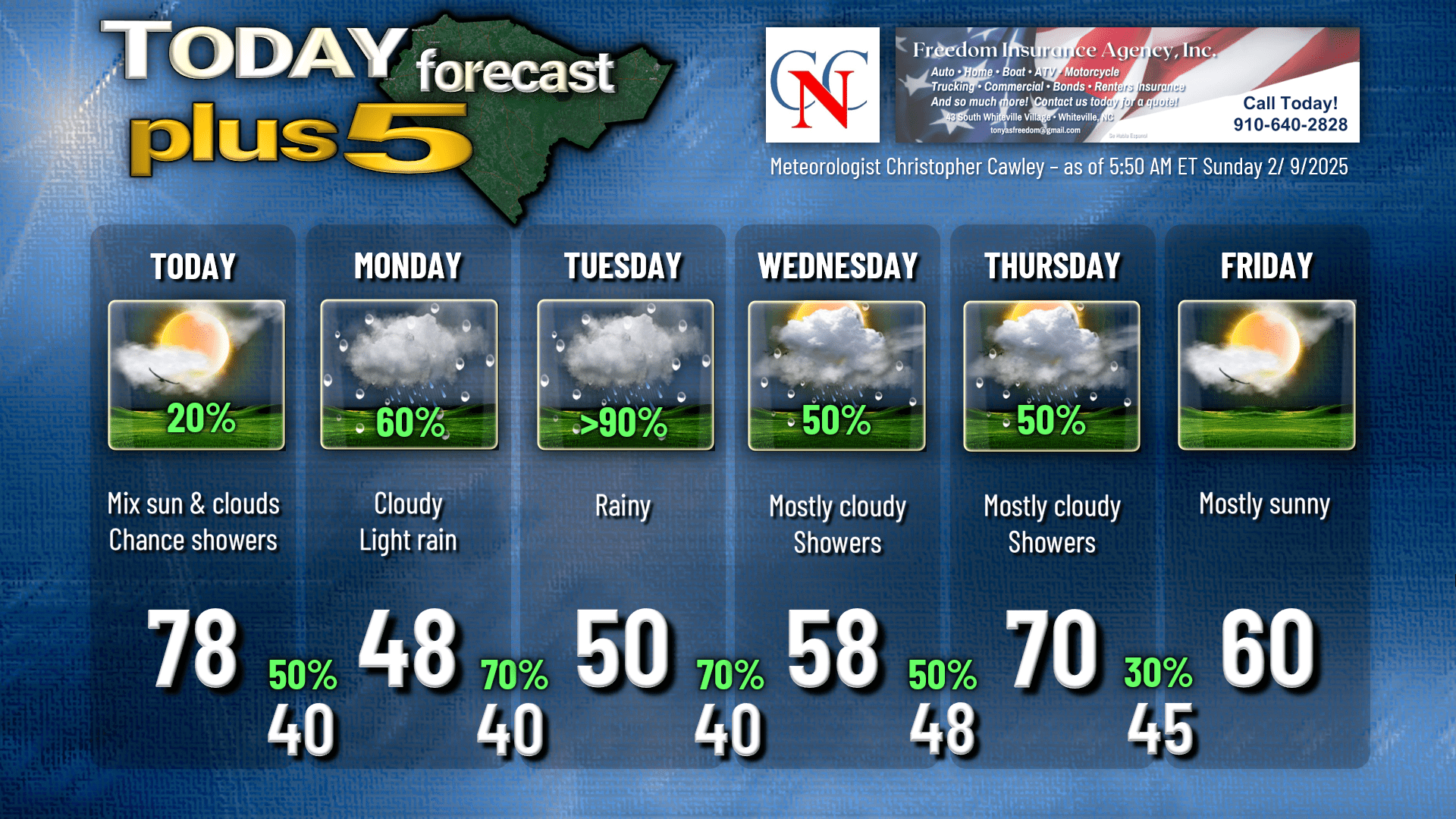
We’ll be quite warm today ahead of a strong cold front, which will push through the area late this afternoon. There may be some showers with the frontal boundary, but overall rainfall should be generally light.
Much cooler and cloudy weather will begin our work week… along with widespread generally light rain.
Cold front settles generally across the area on Monday. Guidance shows that there will be limited “forcing” with this, which means there’s not much spark to fire up the engine (rainfall). I think the rainfall we receive on Monday will be more of a “drizzly rain,” or very light rain. It’s going to be cold, though… just a dreary day on Monday.
As well as Tuesday. A wave of low pressure forms on the front, which should be draped along the coast early Tuesday, which brings more widespread rain of light-moderate intensity.
As we go through the rest of the work week, expect unsettled weather to continue. Support from the southern jet stream appears active. Periods of rain continue Tuesday night through Wednesday. Wednesday will feature temperatures right at seasonable normal values. Frontal boundary lifts BACK to the north as a warm front going into Thursday, and I think we’ll see some breaks of sunshine finally on Thursday along with dramatically warmer temperatures.
Don’t get too used to it though, as the roller-coaster temperature ride begins again through the end of the week. Friday should be completely dry… but that doesn’t last long as our NEXT rain system moves in by next weekend.
Here’s your Freedom Insurance Today-Plus-5 forecast for Columbus County.
Well that will conclude another CCN Daily Weather Update! Thank you for reading and I hope you have an amazing Sunday. Take care!
~Meteorologist Christopher Cawley