Greetings folks, welcome to your CCN Daily Weather Update for Saturday February 1, 2025.
This weather update is sponsored by Freedom Insurance of Whiteville. Contact Freedom today for all of your insurance needs. Their professionals are 100% committed on providing outstanding customer service and working with you to establish the best policy to meet your needs.
STATISTICS FOR WHITEVILLE – Tuesday March 11, 2025.
High: 74.4°F at 4:18 PM (normal is 64)
Low: 50.0°F at 8:10 AM (normal is 39)
Precip: 0.11 in
View live, real-time weather data for Whiteville on my College Street Weather Station.
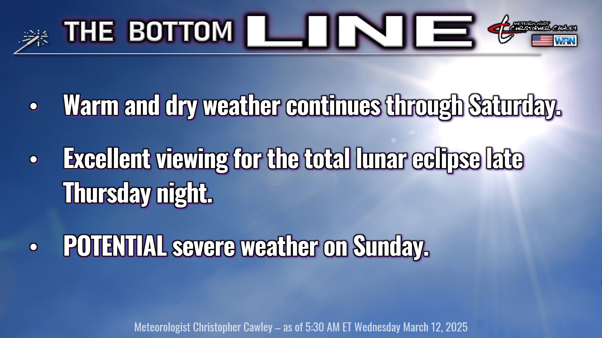
Here’s today’s Bottom Line
Let me preface this by repeating from what was noted in the climate stats section, the normal high is 64, normal low is 39.
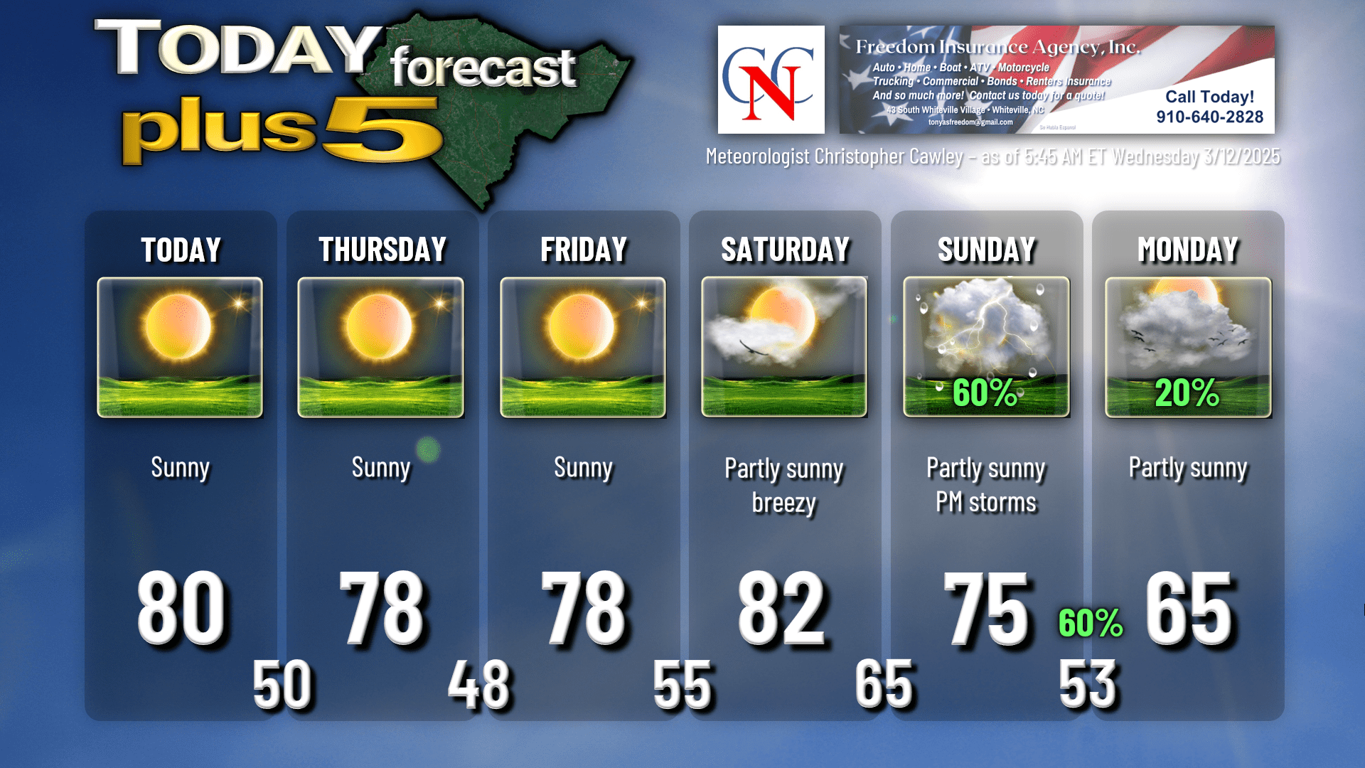
We’re going to be high-and-dry through Saturday as strong high pressure keeps control of our weather. A weak, dry “cold front” (if you want to call it that), will knock our temps down a couple of degrees for Thursday and Friday, but we’re still going to be running a good 12-15 degrees above normal.
At this time Saturday and Saturday night should be dry, but breezy conditions should start to develop Saturday afternoon. A dynamic storm system will be impacting much of the eastern half of the country going into the weekend; a widespread tornado outbreak is looking possible in portions of the southern and southeastern US. As the main center of low pressure lifts into Canada, it is so strong that it will occlude itself and become somewhat detached from the cold front. While this front appears that it will be in a somewhat weaker state when it arrives Sunday, it’s still going to have some pop with it.
A convective line is probable at some point Sunday, likely during the afternoon or evening hours. Given the differences in timing shown by our model guidance, I’m going with 60% chances for both Sunday and Sunday night; this will become more refined as we get closer to the event.
Severe weather is a possibility with this front. The Storm Prediction Center has placed our area in a 15% risk area for Sunday. According to the SPC, “a moist airmass and strong deep-layer flow continuing to support a line of convection producing damaging winds into the Carolinas and mid-Atlantic vicinity.” There’s still time to see how this will unfold.
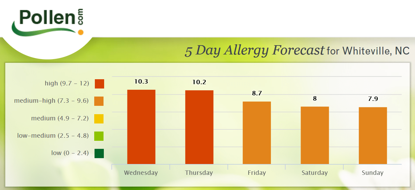
POLLEN: You might have noticed a hint of yellow starting to form on vehicles… welcome to the pollen season. The current top allergens are Juniper, Birch, and Oak. Here is the pollen count forecast for Whiteville, from pollen.com.
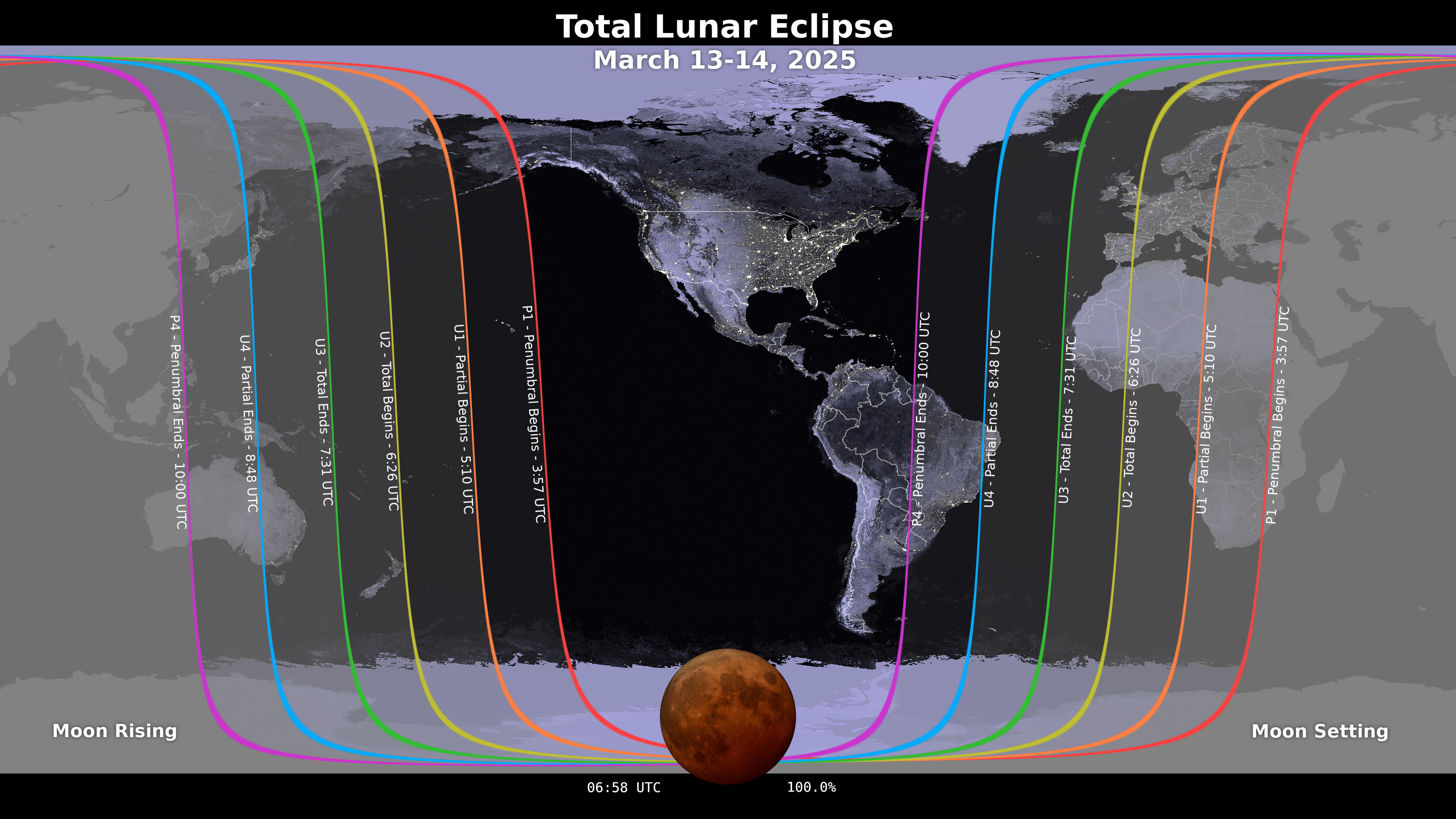
TOTAL LUNAR ECLIPSE Thursday night. The full moon will be fully enveloped in Earth’s shadow during about a one-hour period of totality during the overnight hours. The eclipse officially begins at 11:57 PM Thursday. Totality begins at 2:26 AM and ends at 3:31 AM. The penumbral phase will end at 6 AM Friday. Viewing conditions should be pretty good across the county, with just a few passing clouds from time to time.
Without further ado, here is your Freedom Insurance Today-plus-Five forecast for Columbus County.
That will conclude today’s report, my friends. Thank you for your time, thank you for supporting CCN, and thank you to Freedom Insurance for sponsoring our daily reports. I hope you have a wonderful day, and as always, take care.
~Meteorologist Christopher Cawley