

CCN Weather Update for Friday October 10, 2025.
This weather update is sponsored by Freedom Insurance of Whiteville. No weather worries with Freedom Insurance. For home, car, boat, or whatever you need, Freedom can provide customized coverage to keep you and your family safe. Contact Freedom today at 910-640-2828!
Here’s today’s Bottom Line
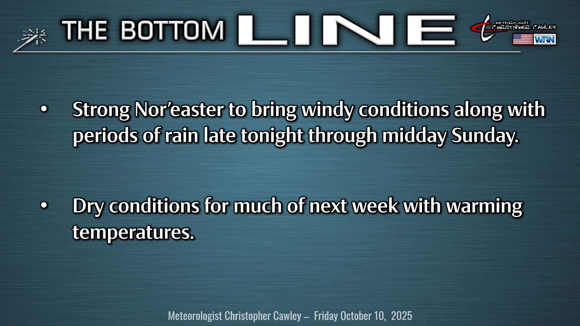
The big story is the coastal storm that is likely to impact our area this weekend with windy conditions and at least some much-needed rainfall.
The cold front that moved through late Wednesday night is hanging around well offshore, extending southward through central Florida, and then into the Gulf. A shortwave diving southward and off the FL/GA coast will spin up an area of low pressure. The low will then rapidly strengthen off the coast.
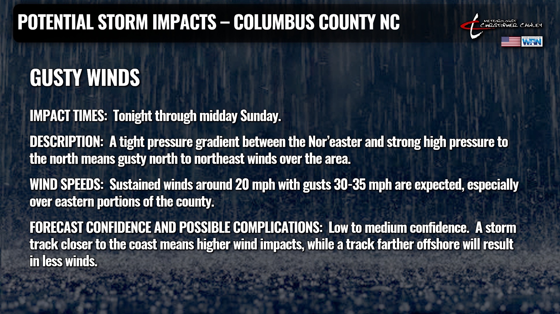
That’s about where the certainties come to an end. Modeling is still relatively spread out on exactly where this storm system will go as it lifts northward. A very strong area of high pressure currently sits off the coast of Cape Cod, and that will act as both a barrier to the low, and act as a “pinch” to the atmosphere as the low lifts northward. This will result in increasingly gusty winds across the area late this afternoon through the weekend.
The low is expected to lift north along the coast. As mentioned, the storm track is still a bit uncertain; here is the Icon deterministic model position for Saturday afternoon. This model is closest to the coast of the big three globals (with the GFS farthest off the coast).
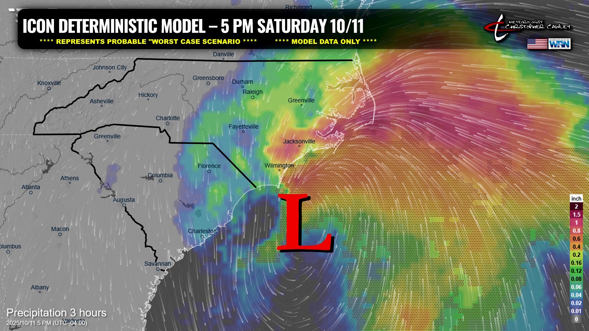
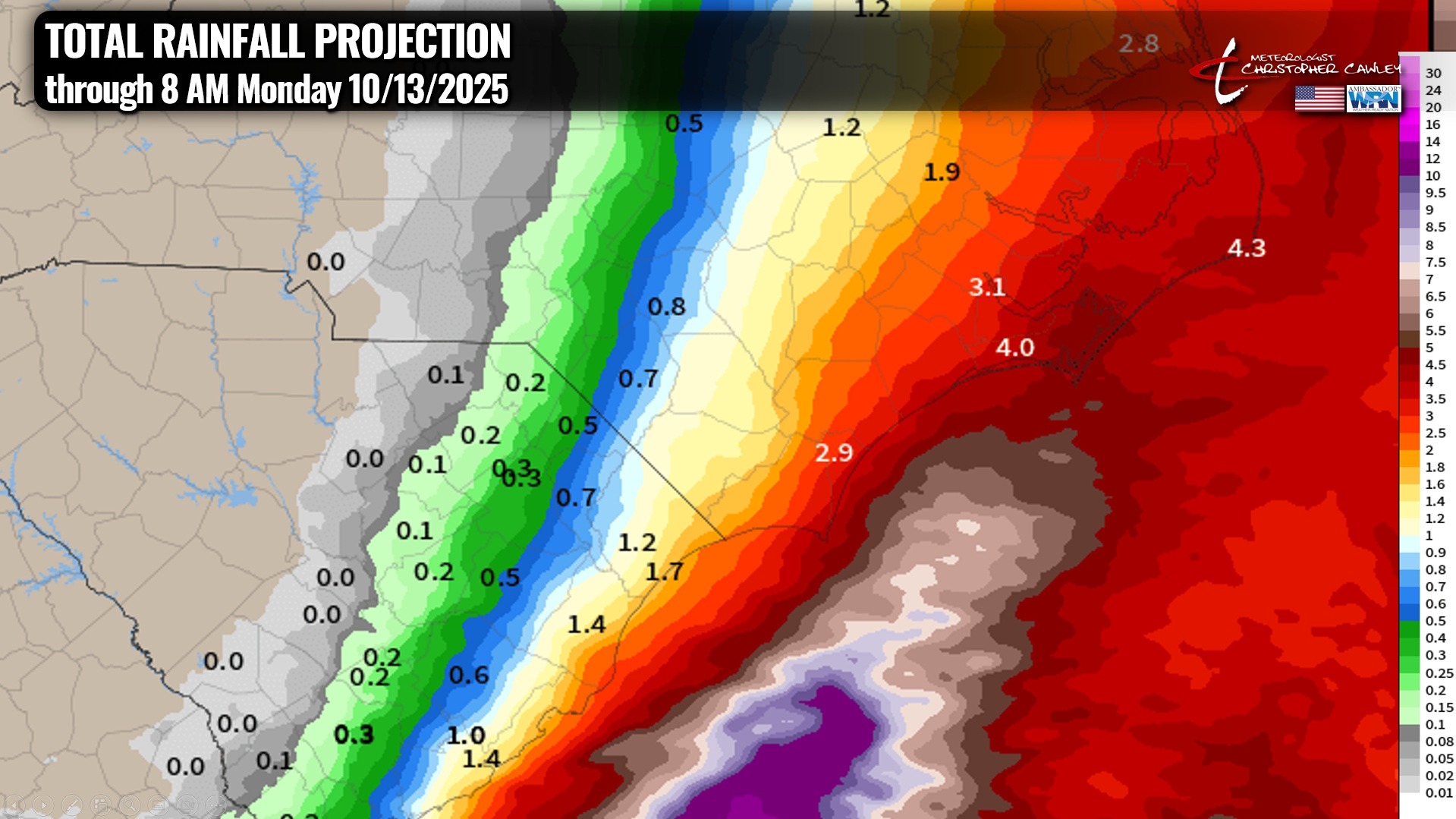
Storm impacts across the county will be in the form of rainfall and wind. The impacts will be highly dependent on the actual storm track.
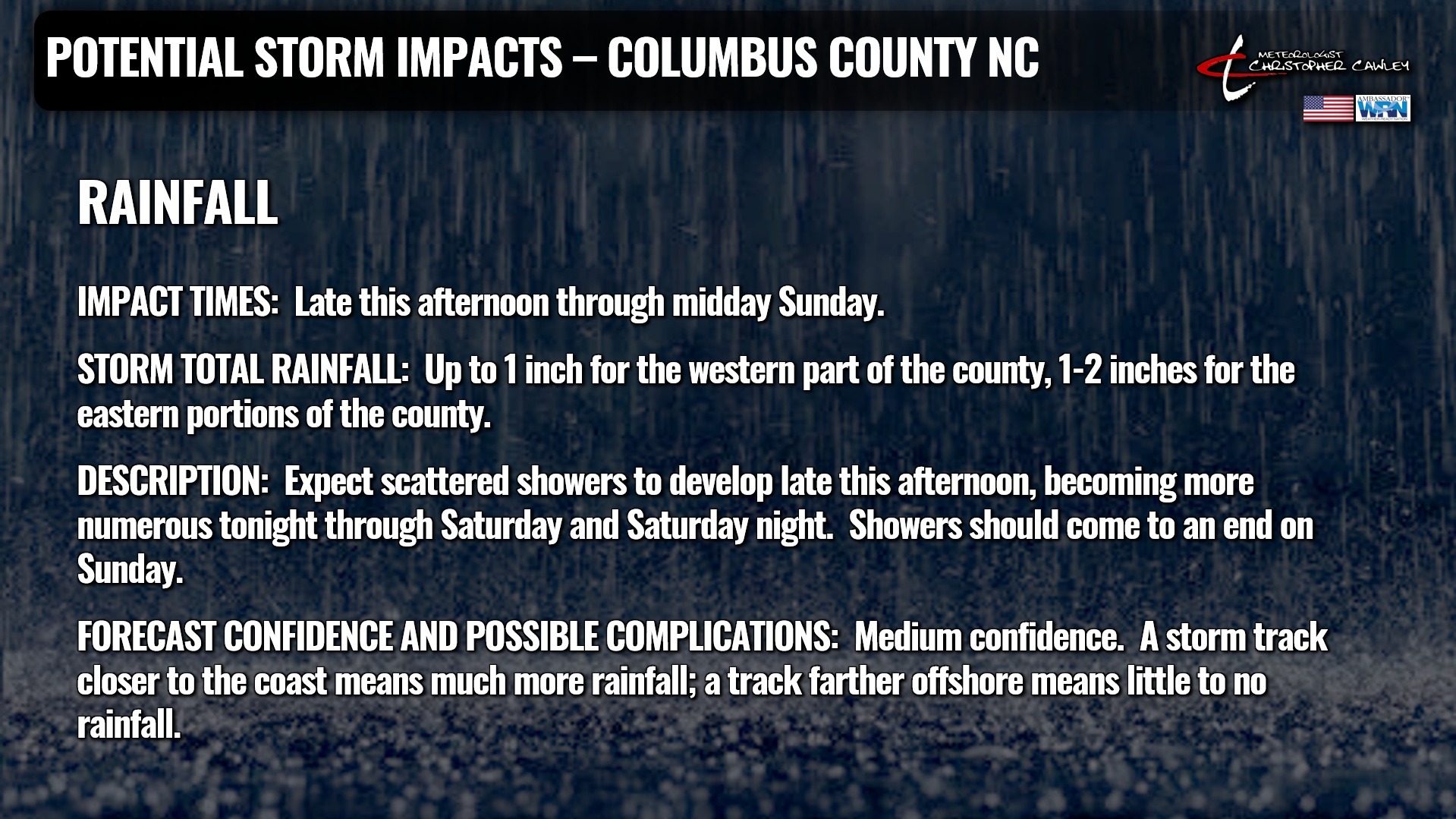
Here is the rainfall projection. This is the NWS blend of models, which is exactly what it says it is — a blend of all of the latest modeling.
After the storm pulls away on Sunday, high pressure builds into the area for much of next week with dry conditions and temperatures warming back up to seasonal normal values.
TROPICS: Not to be forgotten in all this Nor’easter talk is Tropical Storm Jerry, which is expected to become a hurricane by Saturday afternoon. The storm will take a northerly track before making a hard-right-turn (easterly turn) just south of Bermuda. The storm should miss Bermuda entirely and stay over the open Atlantic Ocean into next week.
Much farther to the north, an area of showers and thunderstorms are showing some signs of organizing into a low-pressure center with gale-force winds. This entity may briefly peak into a subtropical depression or subtropical storm (the next name up is Karen). The system is expected to move over fairly cold waters by this weekend, and that’ll be the end of that.
There are no tropical threats to the Carolinas for the foreseeable future.
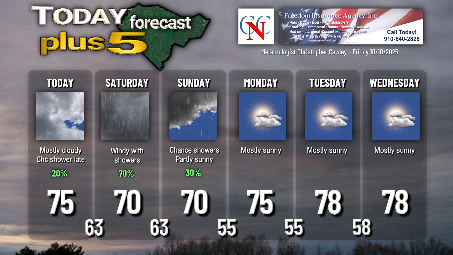
Here is your Freedom Insurance Today-plus-Five Forecast:
–Meteorologist Christopher Cawley