

Columbus County NEWS Weather Update for Sunday July 19, 2026.
This weather update is sponsored by Freedom Insurance of Whiteville. Trust Freedom Insurance to give you clear blue skies when it comes to home, car, boat, or whatever insurance you need. Let Freedom provide customized coverage to keep you and your family safe. Contact Freedom today at 910-640-2828!
Here’s today’s Bottom Line
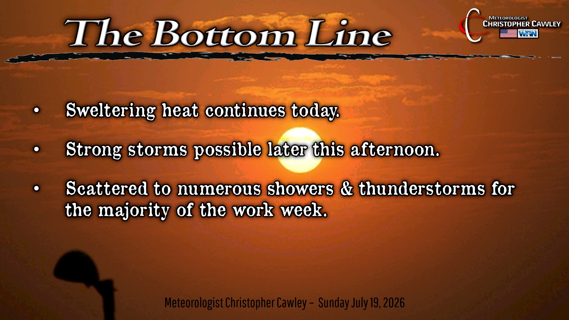
The unrelenting heat continues today. Our actual highs will “only” be in the mid 90s but more and more moisture will push into the area, leading to heat index values 105-110. Again.
We’ll see some changes in the weather patterns this week… the end of the week will be rather un-July-like with the potential for some decent rainfall.
Thunderstorms are possible this afternoon… any storm that develops will have the potential to produce wet downbursts and gusty winds. Intense rainfall and excessive cloud-to-ground lightning. Be watchful for rather rapid changes in weather conditions later this afternoon.
Better chances for storms will be in place tonight with a weak frontal boundary in place. Heavy rainfall is possible with these storms.
A mix of sunshine, heat, and thunderstorms is on tap for Monday and Tuesday. Storms could be rather strong once again.
Then…. change.
An upper-level low pressure center over New York will drive an unusually strong (for this time of year) cold front over the area on Wednesday. This could lead to an organized severe weather outbreak … “stay tuned,” The front is likely to hang up along the coast or perhaps just inland through the end of the week. An area of low pressure is likely to spin up along the front (non-tropical low) and push additional moisture into the area for Wednesday night and Thursday into Friday. There’s the potential for some significant rainfall to the area.
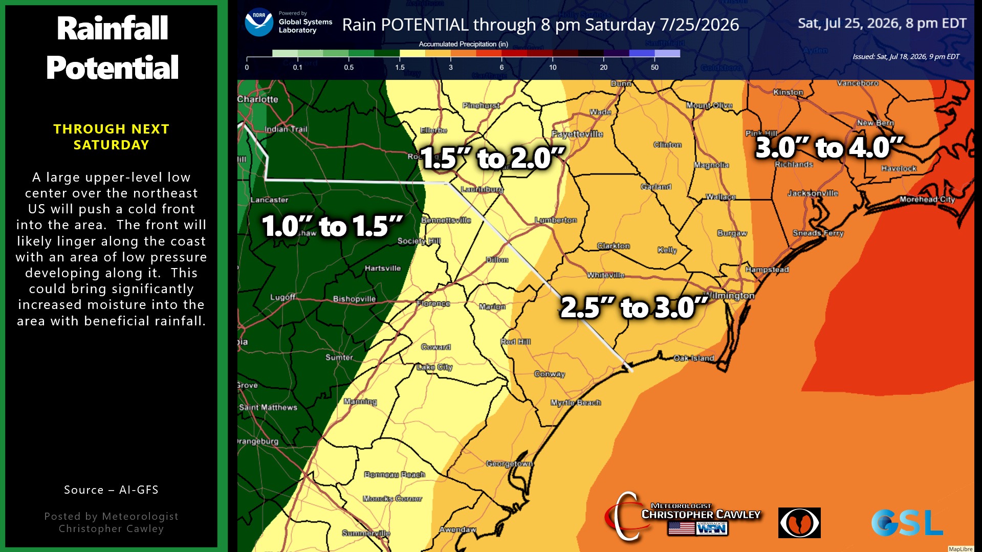
With this rain will come COOLER TEMPERATURES as our highs will only be in the mid 80s for the end of the week (about 7 degrees below normal). I’ll take it.
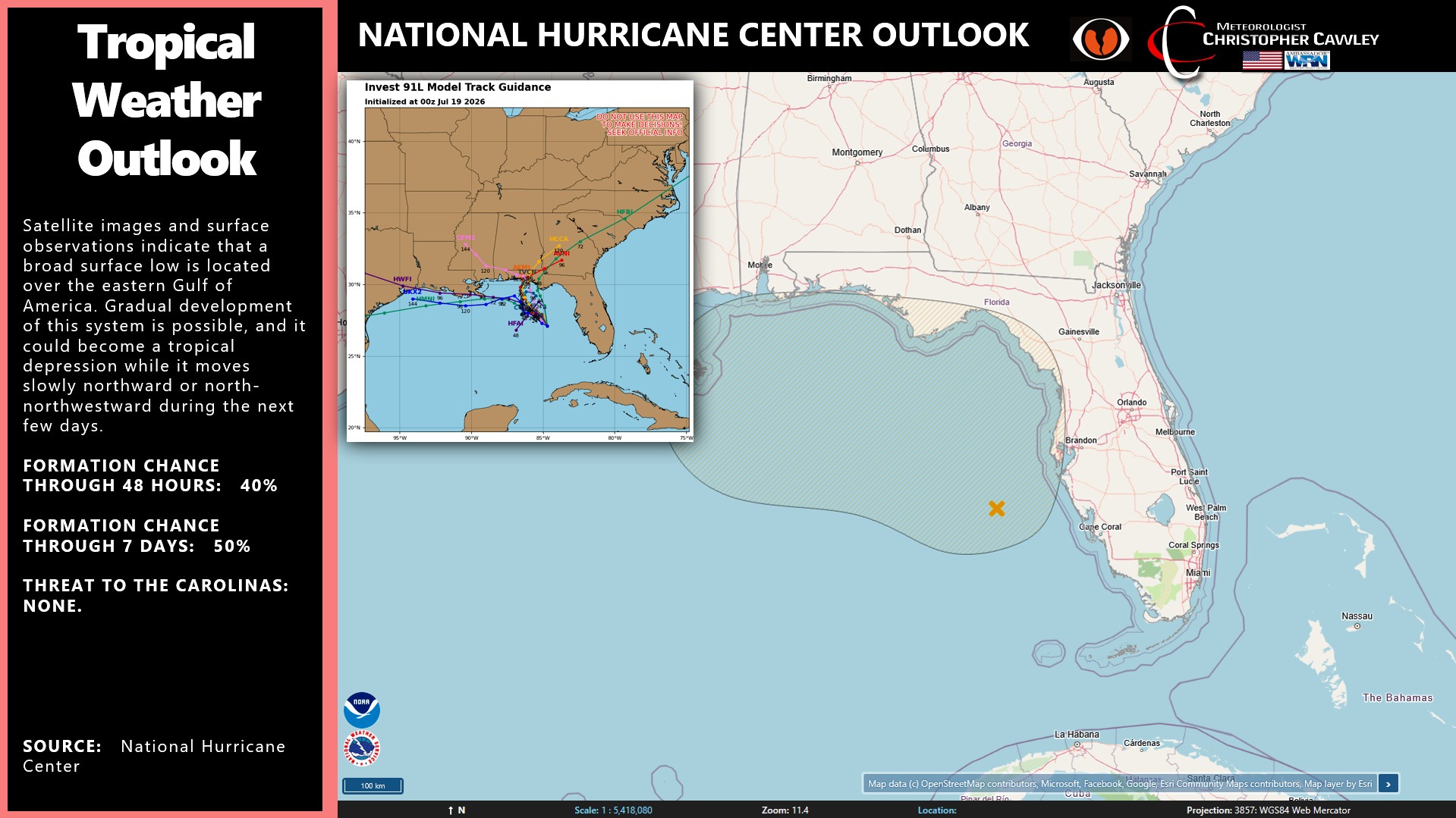
TROPICS: It’s becoming more probable that a system will form along the northern Gulf coast. I don’t think it will be a long-lived system as it lifts north into Florida or Alabama. The presence of the frontal boundary pressing southward will suppress this system. The chance of it being a threat to the Carolinas is quite low; however, one of the spaghetti plots has the remnant low pushing along the old frontal boundary across the Carolinas. If that occurs, we’ll get more very beneficial rainfall.
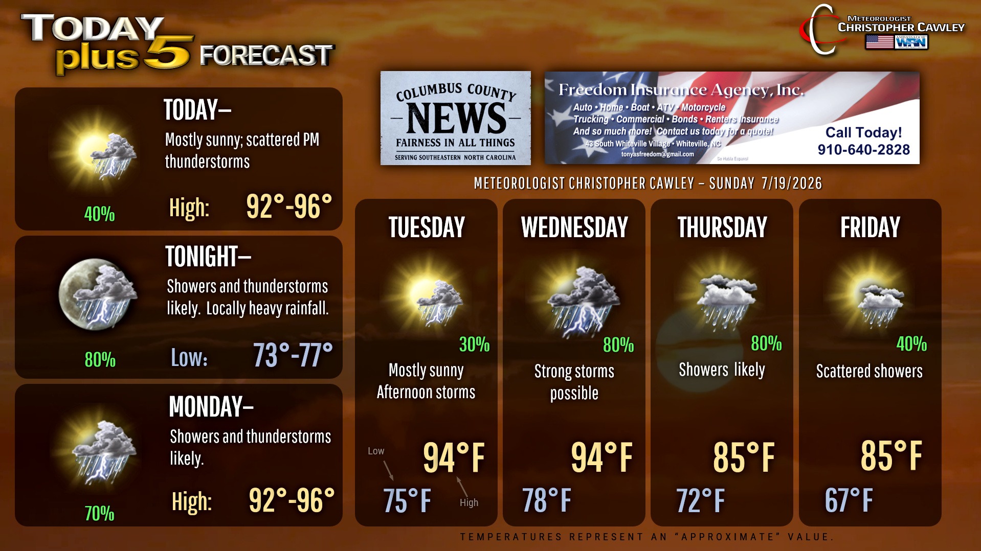
Here is your Freedom Insurance Today-plus-Five Forecast:
–Meteorologist Christopher Cawley