Happy Thursday everyone, welcome to the CCN Daily Weather Update.
Today’s weather update is brought to you by our friends at Freedom Insurance in Whiteville. No matter what your insurance needs happen to be, the professionals at Freedom can get you set up with the perfect policy for you. Dedicated service and friendly faces at Freedom Insurance. Call today 910-640-2828, or stop into their office near the south-end Hills in Whiteville.
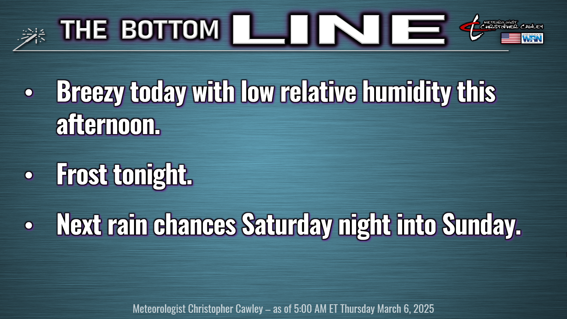
Here’s your Bottom Line for today…
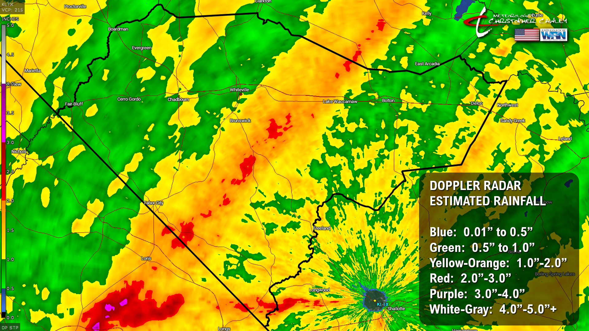
We picked up 0.66 inch of rainfall on my weather station in uptown Whiteville yesterday. But there was an area of Columbus County that extended just east of route 701 from Tabor to Brunswick, and then through Hallsboro to just west of Lake Waccamaw, that picked up between 1 and 3 inches of much needed liquid gold.
The image here is the estimated rainfall per the Doppler radar. This is usually pretty accurate. Easily seen is this axis of heavier rainfall that occurred across the center of the county on Wednesday. Good stuff.
As for the severe weather that didn’t materialize, remember the discussions from the past few days. It was highly dependent on the instability, and the marine air layer. The instability remained extremely low, and another parameter called “convective inhibition,” which is essentially “anti-instability,” was fairly significant across the county. The stable marine layer won the battle vs severe weather chances. Even the times when the layer was pretty thin, the strongest winds were kept higher in altitude. For as good as the models are, they still struggle mightily when there is cool ocean air present. Even as far inland as Columbus County.
The rainfall we received was hugely beneficial to the area, but it was NOT a drought-busting event. This certainly will help with the wildfire situation, but it’s not a solution. We’ll experience low relative humidity values returning this afternoon and especially on Friday and into Saturday. Once that ground vegetation dries out again, we’re right back into the fire danger.
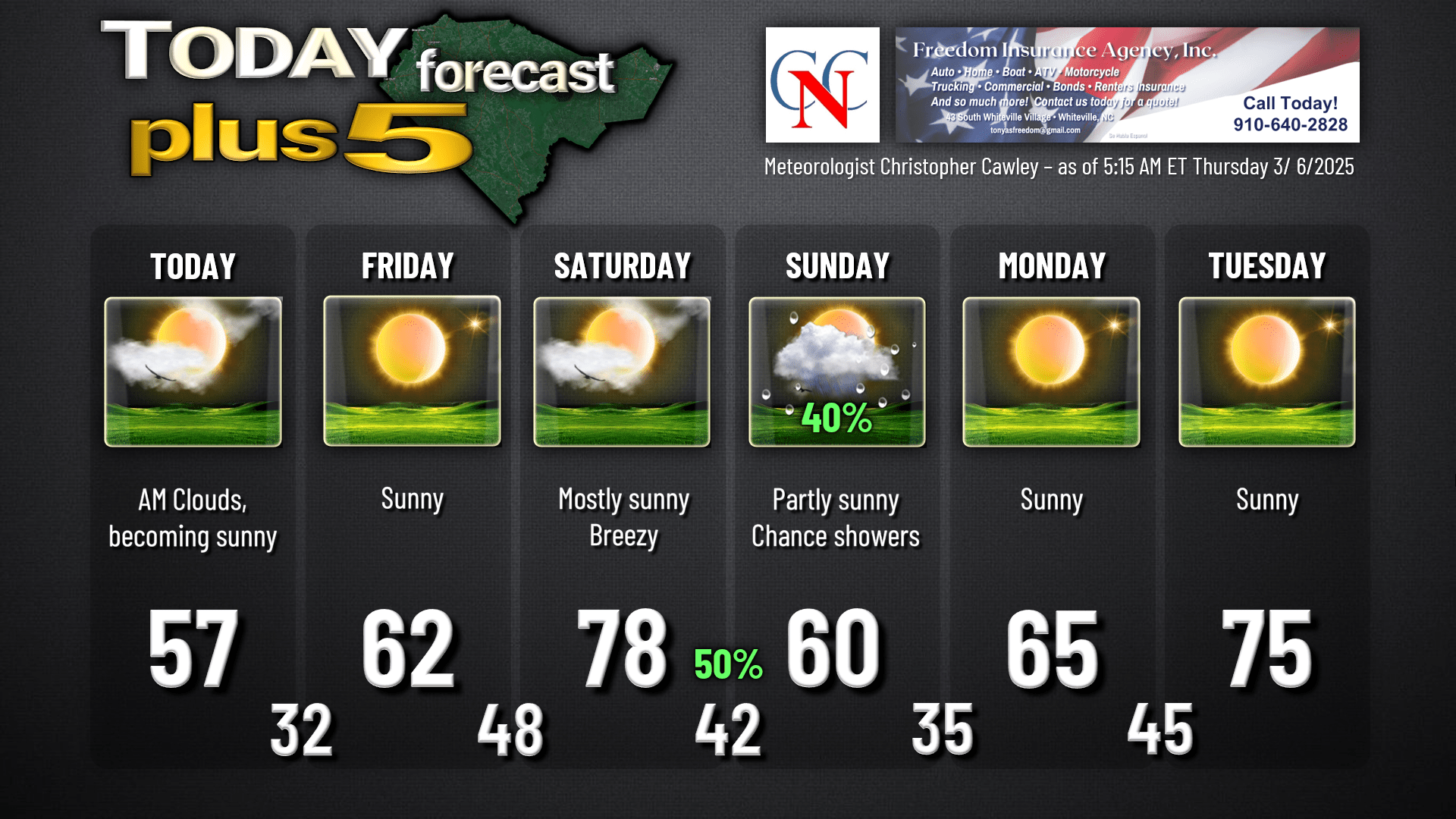
Dry high pressure will build into the area today. It’s still going to be breezy, with winds gusting to around 30 mph at times. Slightly cooler-than-normal temperatures today with highs in the upper 50s… normal highs are in the lower 60s.
Tonight, our winds die off allowing our temps to fall to around the freezing mark. I’m not sure there will be an awful lot of frost present given dry air in place and possibly some light winds remaining, but I put in the “Bottom Line” slide the potential for frost early Friday morning.
Turning our attention to the weekend now, a robust southerly wind flow becomes established once again for your Saturday. This will jack our temperatures into the upper 70s across the county. A cold front then sweeps across the area Saturday night. The moisture profiles aren’t exciting right now, so I put on the graphic a 50/50 chance for showers Saturday night and 40% chance for Sunday. I think that’s being generous, but we’ll go with that for now and I can fine-tune it later. It will turn briefly cooler once again after this frontal passage. No significant weather is expected with the front outside of occasional/scattered showers.
Big-time warmup coming next week. Model blends point to an extended run of days with highs deep into the 70s, possibly into the lower 80s, with lows above normal as well. Climate Prediction Center charts show generally above normal temperatures being expected possibly straight through the end of the month. I’m not going to say that we’re out of the woods for frost/freeze conditions, but all of the available tools I have to examine shows above-normal temps.
Here’s your Freedom Insurance Today-Plus-5 forecast for Columbus County.
That’ll do it for today. I hope you all have a wonderful day, and as always, take care.
~Meteorologist Christopher Cawley