Greetings folks, welcome to your CCN Daily Weather Update for Wednesday March 19, 2025.
This weather update is sponsored by Freedom Insurance of Whiteville. Contact Freedom today for all of your insurance needs. Their professionals are 100% committed on providing outstanding customer service and working with you to establish the best policy to meet your needs. Call 910-640-2828 today!
STATISTICS FOR WHITEVILLE – Tuesday March 18, 2025.
High: 72.1°F at 4:40 PM (normal is 66)
Low: 40.7°F at 7:18 AM (normal is 41)
Precip: 0.00 in
View live, real-time weather data for Whiteville on my College Street Weather Station.
Here’s today’s Bottom Line
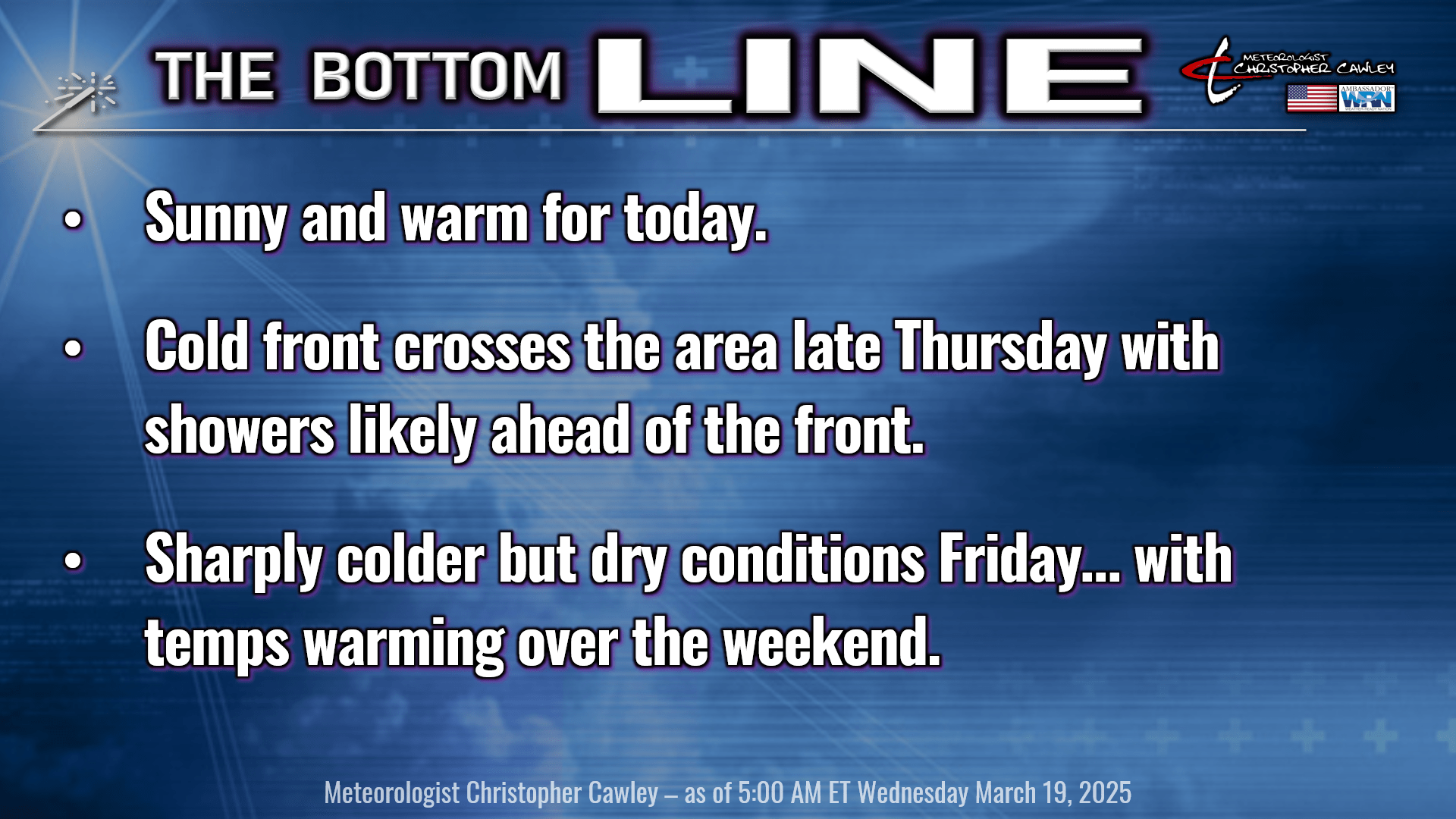
Warm temperatures today with bright blue sunny skies across the County. Relative humidity values will drop to between 20% and 30% this afternoon, and while the winds should remain light and variable, please, please, please don’t do any burning.
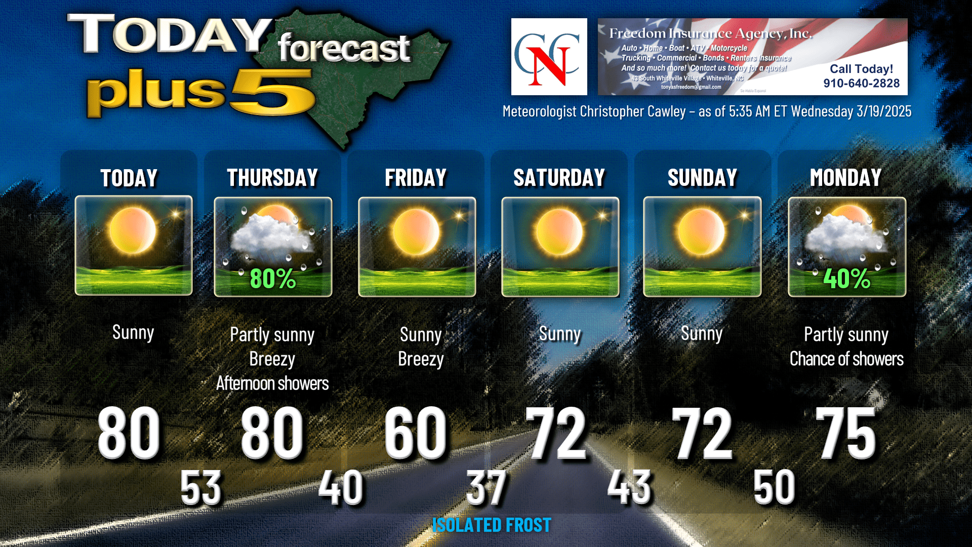
Clouds will start to increase for tonight, as will a southerly breeze, ahead of a frontal system that will move through late Thursday. Lows tonight will be in the lower 50s.
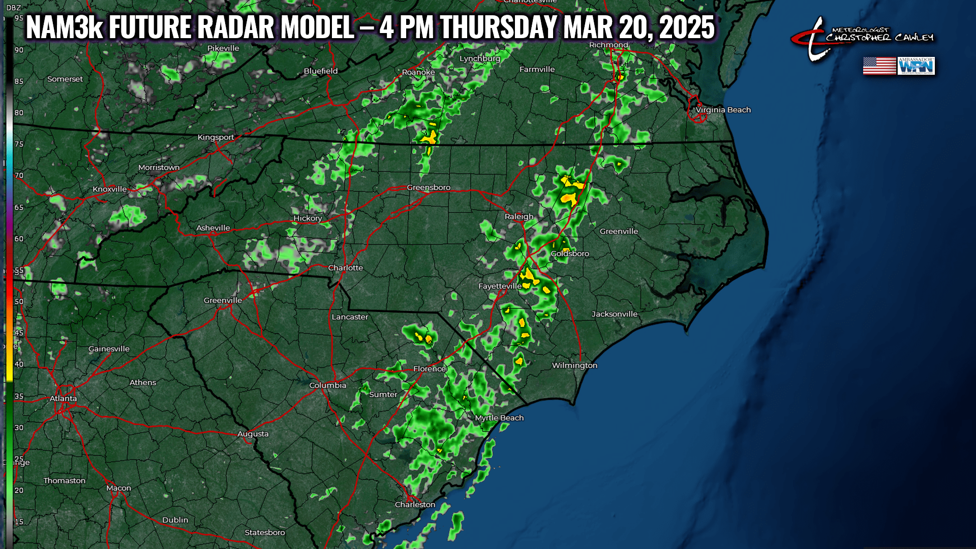
We’ll see considerable sunshine throughout Thursday morning, but a broken line of convection is likely to cross the area during the afternoon hours. This will consist of showers, but there may be enough instability that we get some rumbles of thunder as well. No hazards are expected; the Storm Prediction Center has “general thunderstorms” on their maps… but that area doesn’t even include Columbus County.
Anyway, the line will be moving fairly quickly and should be out of here by early evening. The rain should be light to moderate, but with the line moving quickly, we won’t see much more than a few hundredths of an inch, at most.
Here’s the NAM3k “future radar” model for 4 PM Thursday. Note, the NAM3k is oftentimes fairly “aggressive” when it comes to these kinds of events, so one could consider this to be the “worst case scenario.”
It’s going to be breezy to rather windy at times ahead of the front, thanks to a strong low-level jet. Winds at the surface should stay below advisory criteria, but gusts of 25-35 mph are a good possibility.
That all clears out and we turn quite a bit colder Thursday night. The winds are going to stay elevated, and I think the clouds are going to be slow to pull away, so I’m going with 40 for the low early Friday morning. The National Blend of Models has 41 for Whiteville; the coldest of the ensembles is a 33 by one of the European members. I don’t think we’re getting quite that cold though.
Friday will be sunny, breezy, and rather cool with highs around 60. Friday night / early Saturday is going to be rather cold. The model blend chart says “42” but with crystal-clear skies and winds becoming light, I think we’re going to dip into the upper 30s, especially in the colder spots, and there could be some very isolated areas of frost. I may be undercutting the lows by as much as 5 degrees, but I’d rather have yall prepare for colder temps and then be pleasantly surprised, as opposed to the other way around.
We’ll be high-and-dry over the weekend… even though a weak, dry frontal boundary will float through on Saturday. Our next real front moves through the area Monday afternoon, very similar to what we’ll get on Thursday. Guidance suggests a few showers or thunderstorms, but no real significant risk for severe weather.
Long-range modeling shows us the potential for chilly and rainy weather through the middle part of NEXT week, followed by a frost potential going into the weekend of March 29-31. Way too soon to hammer down any details, but something that will be watched.
Here’s your Freedom Insurance Today-plus-Five forecast:
That will conclude today’s report. Thanks for reading, enjoy the nice weather, and as always, take care.
~Meteorologist Christopher Cawley