Hello friends and followers, it is now time for the CCN Daily Weather Update for Saturday April 5, 2025.
This weather update is sponsored by Freedom Insurance of Whiteville. Protect what matters with Freedom Insurance. Life is full of surprises, but with Freedom Insurance, you’ll always be prepared. Whether it’s your home, car, business, or health, we provide customized coverage to keep you and your loved ones secure. Contact Freedom today at 910-640-2828!
STATISTICS FOR WHITEVILLE – Friday April 4, 2025.
High: 89.9°F at 3:54 PM (normal is 71)
Low: 69.5°F at 7:37 AM (normal is 45)
Precip: 0.00 in
View live, real-time weather data for Whiteville on my College Street Weather Station.
Here’s today’s Bottom Line
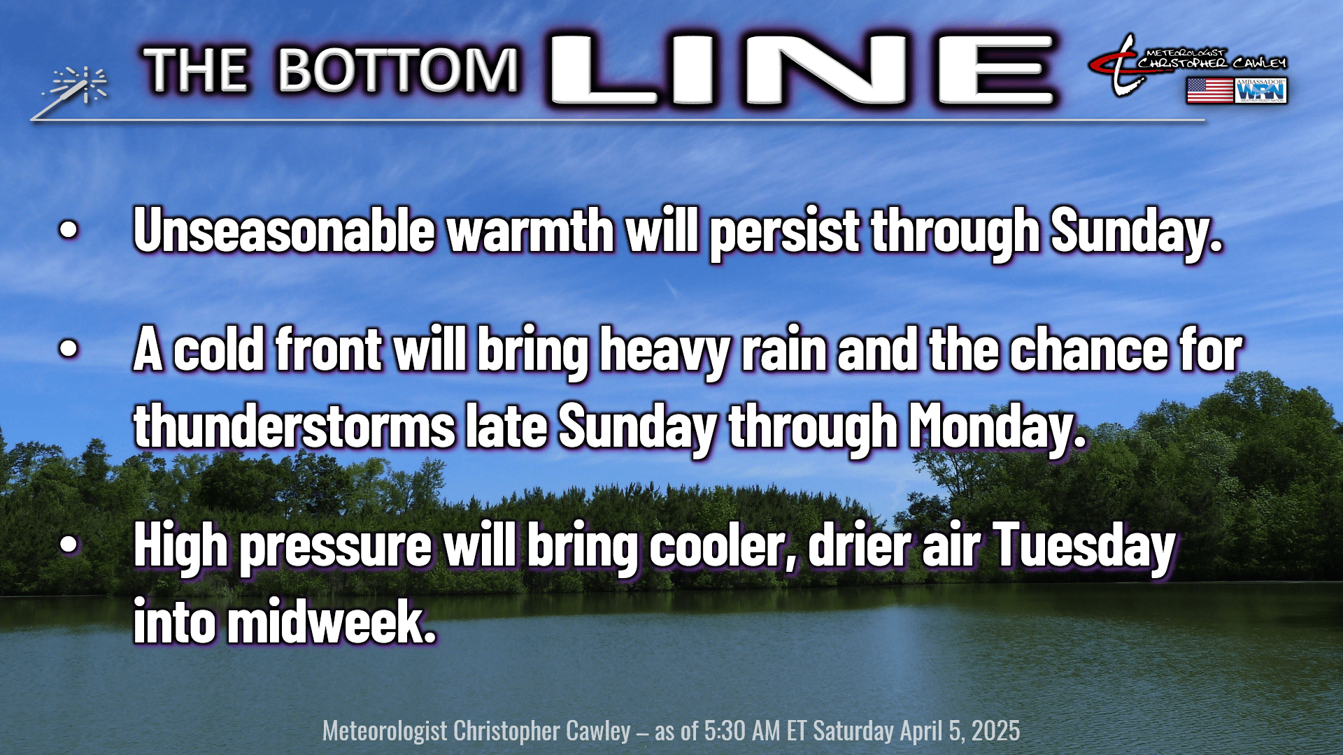
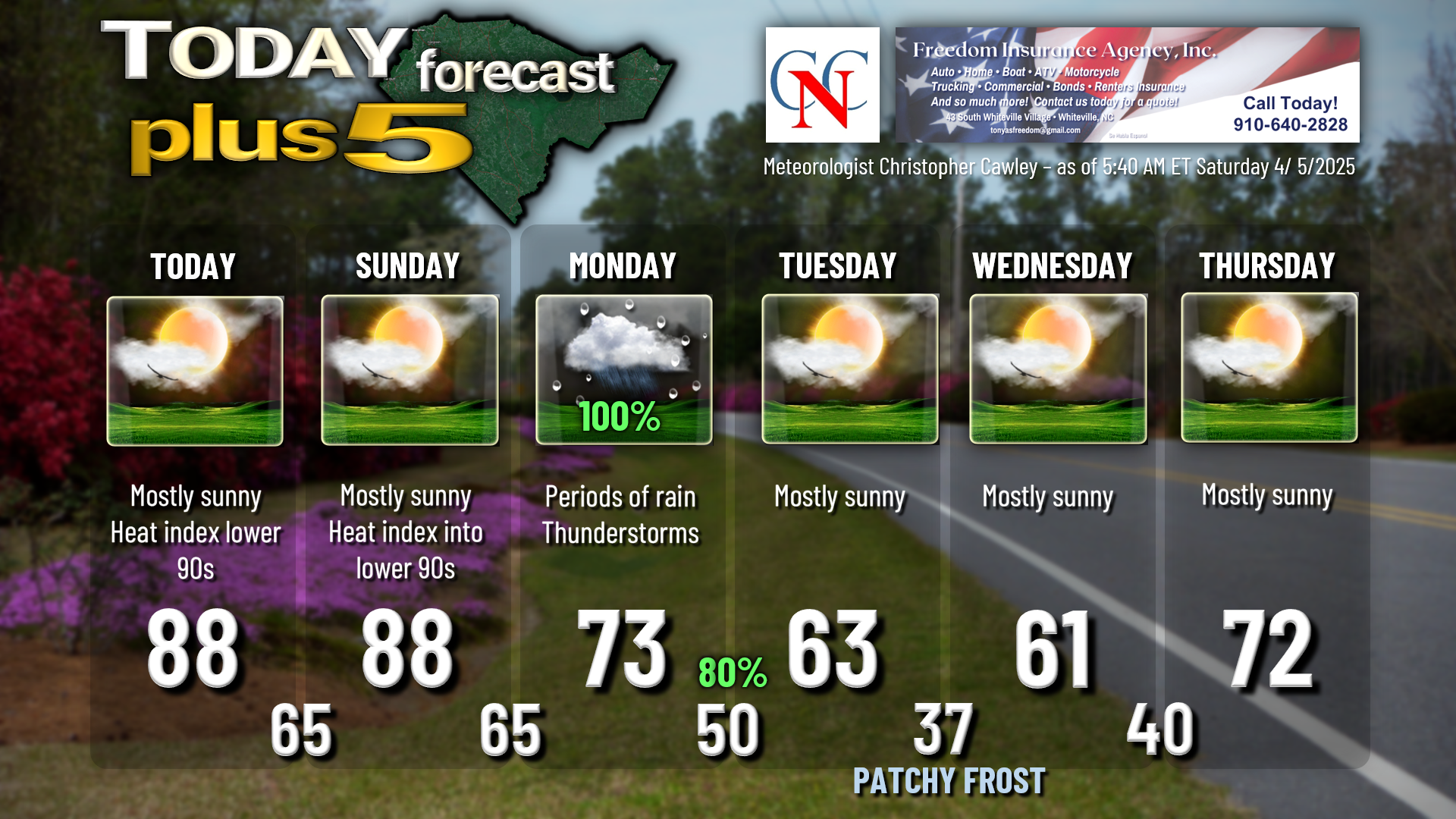
A couple more days of warm and dry weather today and tomorrow thanks to that huge ridge of high pressure just off the coast. The high will continue to push eastward and away, and with that a large, complex storm system will bring copious rainfall to the area Sunday night through Monday. This will be followed by a secondary cold front that will usher in very chilly air — and a frost potential — for the midweek period.
The storm system that will impact our area is a slow-moving, large, sprawling system. The main “part” impacting our area will be a cold front that will push through late Sunday night or early Monday, depending on whichever guidance you wish to choose. That part is irrelevant, though, because a wave of low pressure will lift north along the front, setting the table for us to receive some very much needed significant rainfall Monday into Monday evening. Significant rainfall on the order of 1-2 inches.
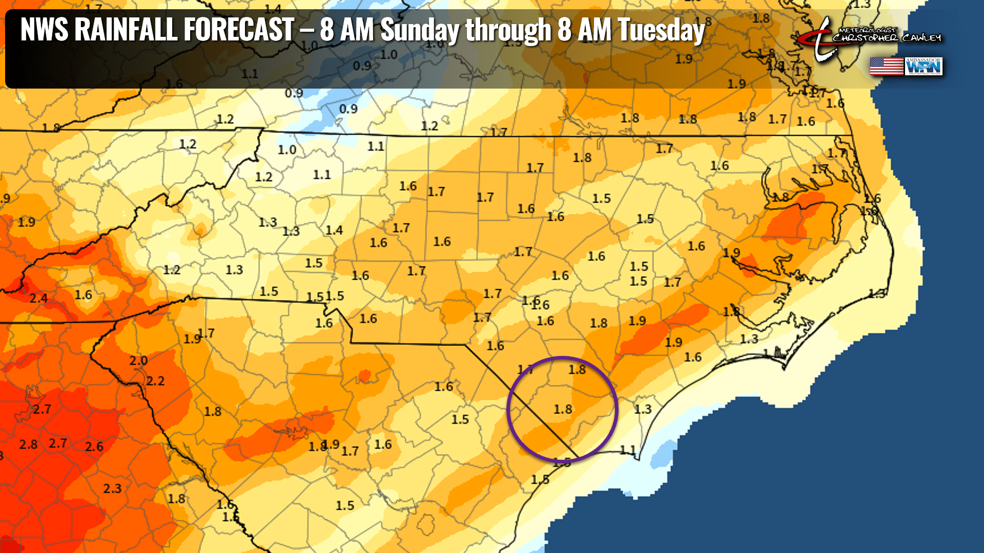
This is just what the doctor ordered in terms of our drought conditions, but guess what? This will not be a drought-busting rainfall. We would need two or three of these kinds of events to truly break the drought. But every little bit helps.
After the initial storm moves through, a secondary cold front quickly drops through early Tuesday. This “shoves” the storm system away and ushers in a period of unseasonably chilly temps to the area. Highs Tuesday will reach the mid 60s, maybe, if we’re lucky, and on Wednesday we might not even break the 60-degree mark.
FROST POTENTIAL: Tuesday night is the night I’m watching for frost potential. Guidance has come up slightly with temps but I think that, since our Canadian high pressure center will be just to our north, winds will go calm and the radiational cooling setup is near-perfect. So I’m going with 37 on the graphic for Whiteville… outlying areas may drop to 34-37 by time the kids are at the bus stop Wednesday morning. At least patchy frost is likely to develop, but the extent of that is questionable given exceedingly dry air that will be in place.
Temperatures warm back up to seasonal levels by the end of the week; our next weather system looks to arrive by Friday or into Saturday with shower chances.
Here’s your Freedom Insurance Today-plus-Five forecast:
That will conclude today’s report. Thanks for your time, and as always, take care!
~Meteorologist Christopher Cawley